- Shire of Kalamunda
Infobox Australian Place | type = lga
name = Shire of Kalamunda
state = wa

imagesize= 180
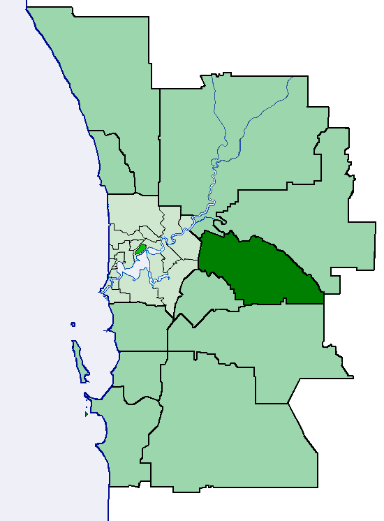
caption = Location of Shire of Kalamunda within outer Perth metropolitan area.
pop = 49,534 (2006 census)
density =
area = 324.2
est = 1897
seat = Kalamunda
mayor = Don McKechnie
region =Darling Scarp

logosize = 140
url = http://www.kalamunda.wa.gov.au
stategov = Darling Range, Forrestfield, Kalamunda
fedgov = Hasluck, Pearce
near-nw = Swan
near-n = Mundaring
near-ne = Mundaring
near-e = York
near-w = Belmont
Canning
near-sw = Gosnells
near-s = Armadale
near-se = BeverleyThe Shire of Kalamunda is a Local Government Area in the eastern suburbs of the
Western Australia n capital city of Perth, located about convert|25|km|mi|1 east of Perth'scentral business district . The Shire covers an area of convert|324.2|km2|sqmi|1, much of which is state forest rising into theDarling Scarp to the east. It has a population of 49,534 (2006), making it the most populous shire (as opposed to cities or towns) in Western Australia. [ [http://www.abs.gov.au/AUSSTATS/abs@.nsf/DetailsPage/3218.02006-07?OpenDocument 3218.0 - Regional Population Growth, Australia, 2006-07] — 3218.0 Population Estimates by Statistical Local Area, 2001 to 2007. Australian Bureau of Statistics.]History
The Darling Range Road Board was gazetted in 1897. On 1 July 1961, it became the Kalamunda Shire Council after changes to the Local Government Act. [WA Electoral Commission, "Municipality Boundary Amendments Register" (release 2.0), 31 May 2003.]
Wards
The shire has been divided into 5 wards.
* East Ward (1 councillor)
* North Ward (3 councillors)
* North West Ward (2 councillors)
* South Ward (3 councillors)
* South West Ward (3 councillors)uburbs
* Bickley
* Canning Mills
* Carmel
* Forrestfield
* Gooseberry Hill
* Hacketts Gully
* High Wycombe
* Kalamunda
* Lesmurdie
* Maida Vale
* Paulls Valley
* Pickering Brook
* Piesse Brook
* Reservoir
* Walliston
* Wattle GroveReferences
External links
* [http://www.kalamunda.wa.gov.au/ Shire of Kalamunda Website]
Wikimedia Foundation. 2010.
