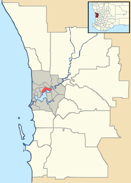
Maida Vale, Western Australia

Maida Vale, Western Australia
Maida Vale
PerthWestern Australia
Maida Vale is located in Perth
{{{alt}}}
Maida Vale
Population: 4297 (2006 census)[1]
Postcode: 6057
Location: 22 km (14 mi) from Perth, Western Australia
LGA: Shire of Kalamunda
State District: Forrestfield
Federal Division: Hasluck
Suburbs around Maida Vale:
High Wycombe Hazelmere Gooseberry Hill
High Wycombe Maida Vale Gooseberry Hill
Forrestfield Forrestfield Kalamunda

Coordinates: 31°57′11″S 116°01′23″E / 31.953°S 116.023°E / -31.953; 116.023

Maida Vale is a suburb of Perth, Western Australia, located within the Shire of Kalamunda. Kalamunda Road runs through the suburb.

Within the suburb there is a primary school (Maida Vale Primary School), a golf course, numerous parks/ovals (including a Seventh Day Adventist Church Ground and Caravan Park), small shops including a BP Petrol station and a heated swimming pool. The suburb still retains areas of natural bushland and is not completely built up with housing, although there are plans to increase housing with expansion on the Crystal Brook housing estate. Maida Vale contains a rare Flower named The Maida Vale Bell.

References


Wikimedia Foundation. 2010.

Игры ⚽ Поможем решить контрольную работу

Look at other dictionaries:

  • Maida Vale (disambiguation) — Maida Vale may refer to: Maida Vale, an area of London, United Kingdom Maida Vale Studios, a complex of seven BBC studios Maida Vale tube station Maida Vale, an abandoned railway station Maida Vale, Western Australia, a suburb of Perth Maida Vale …   Wikipedia

  • High Wycombe, Western Australia — Infobox Australian Place | type = suburb name = High Wycombe state = wa city = Perth caption = pop = 9,043 (2001 Census) postcode = 6057 lga = Shire of Kalamunda area = 14.2 est = 1978 propval = $380,000 (Q1 2007)cite… …   Wikipedia

  • Gooseberry Hill, Western Australia — Gooseberry Hill Perth, Western Australia Gooseberry Hill viewed from the Kalamunda Zig Zag …   Wikipedia

  • Perth Airport, Western Australia — Infobox Australian Place | type = suburb name = Perth Airport city = Perth state = wa caption = lga = City of Belmont lga2 = City of Swan lga3 = Shire of Kalamunda area = postcode = 6105 dist1 = 12 |location1 = Perth est = 1997 fedgov = Swan… …   Wikipedia

  • List of major roads in Perth, Western Australia — This page details the major roads in the greater Perth conurbation, in Western Australia.A list of the routes (most involving multiple roads) is available at List of road routes in Perth, Western Australia.Freeways in Perth (by road route… …   Wikipedia

  • Forrestfield, Western Australia — Infobox Australian Place | type = suburb name=Forrestfield city=Perth state=wa thumb|350px caption=Roundabout at entrance to Hartfield Park lga=Shire of Kalamunda area= postcode=6058 pop=11,314 [Census 2001 AUS|id=SSC51476|name=Forrestfield(State …   Wikipedia

  • Kalamunda, Western Australia — Infobox Australian Place | type = suburb name = Kalamunda city = Perth state = wa caption = Kalamunda Road, Kalamunda lga = Shire of Kalamunda area = 9.9 postcode = 6076 pop = 6835 (2006 census)Census 2006 AUS|id=SSC51711|name=Kalamunda (State… …   Wikipedia

  • Westminster Presbyterian Church of Australia — Infobox Christian denomination name = Westminster Presbyterian Church of Australia caption = main classification = Protestant orientation = Calvinism founded date = 1970 founded place = Perth separated from = separations = congregations = 13… …   Wikipedia

  • MV — can stand for: Contents 1 Business 2 Science and technology 3 Places 4 …   Wikipedia

  • List of Perth bus routes — For detailed travel information, do not rely solely on this page; please refer to the [http://www.transperth.wa.gov.au Transperth] website. This is a list of the numerous bus routes in Perth, Western Australia. They are organized by route number …   Wikipedia

Share the article and excerpts

Direct link
Do a right-click on the link above
and select “Copy Link”