- Shire of Northam
Infobox Australian Place | type = lga
name =Shire of Northam
state =wa
region =Wheatbelt
imagesize= 180
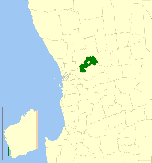
caption = Location inWestern Australia
area =1431.5
est =1871
seat =Northam
pop =9,803 (2006 census)
logo =Northam shire logo.png
mayor =Steven Pollard
fedgov =Pearce
stategov =Central Wheatbelt
near-nw =Toodyay
near-n =Goomalling
near-ne =Cunderdin
near-w =Swan
near-e =Cunderdin
near-sw =Mundaring
near-s =York
near-se =QuairadingThe Shire of Northam is a Local Government Area in the Wheatbelt region of
Western Australia , beyond the northeastern fringe of the Perth metropolitan area centred on the town of Northam itself. The Shire covers an area of convert|1431|km2|sqmi|0. In 2007, it merged with theTown of Northam , almost tripling its population in the process from a previous size of 3,794 (ABS 2006).History
In 1871, the Northam Road Board was gazetted. On 1 July 1961, it became the Shire Council following changes to the Local Government Act. [WA Electoral Commission, "Municipality Boundary Amendments Register" (release 2.0), 31 May 2003.]
In September 2006, the Shire received a report into the possibility of merging with the
Town of Northam , [cite web|url=http://www.northamshire.wa.gov.au/Shire%20of%20Northam_Town%20of%20Northam_Final_Merger%20Study%20Report_Sept%202006%20doc.pdf|title=Shire and Town of Northam Merger Study Report|author=Kelly LG Services|date=September 2006|accessdate=2006-11-04 - commissioned by Department of Local Government and Regional Development.] and on 31 October 2006, the Local Government Advisory Board received a proposal to that effect from both councils. Public meetings in December 2006 announced that the new council would be known as the Shire of Northam, and would come into existence on 1 July 2007, initially operated by a board of commissioners (two from each entity plus an independent chair). [cite web|url=http://www.dlgrd.wa.gov.au/LocalGovt/Docs%5CNorthamAmalgamationInformationPaper.pdf|title=Proposal to Amalgamate the Shire of Northam and the Town of Northam - Information Paper|author=Local Government Advisory Board|date=November 2006|accessdate=2006-11-15] .In January 2007, the Local Government Advisory Board officially recommended to the Minister for Local Government that the amalgamation proceed. [cite web|url=http://www.dlgrd.wa.gov.au/LocalGovt/AdvisoryBoard/CurrentInquiries.asp#Northam|title=Proposal to Amalgamate the Shire of Northam and the Town of Northam|author=Local Government Advisory Board|date=March 2007|accessdate=2007-04-21] The Shire electors successfully petitioned for a referendum within their area, which was held on 28 April 2007. Prior to the election, the Shire of Northam itself took the unusual step of asking its electors not to vote, in order to deny the referendum the 50% of voters needed to constitute a valid poll under Clause 10 of Schedule 2.1 of the
Local Government Act 1995 . [cite web|url=http://www.northamshire.wa.gov.au/Merger-abstain%20from%20vote.pdf|title=Please Abstain From Voting|last=Llewellyn|first=Cr A W|date=18 April 2007|accessdate=2007-05-01] With a participation rate of 23.59%, a majority of 93% voted against the proposal. [cite news|url=http://www.waec.wa.gov.au/local/wards.asp?agencyid=81&electionid=244|title=Northam Shire of - Voting In Person Referendum|date=28 April 2007|author=Western Australian Electoral Commission|accessdate=2007-05-01] This 23.59% voter participation equates to 596 voters; less than the number that petitioned for the referendum in the first place.The amalgamation proceeded as planned and the first elections for seats in the new council were held in October 2007.
Wards
The shire has been divided into 4 wards.
* Town Ward (5 councillors)
* Central Ward (2 councillors)
* West Ward (2 councillors)
* East Ward (1 councillors)Towns/Localities
* Bakers Hill
* Buckland
* Burlong
* Clackline
* Copley
* Grass Valley
* Irishtown
* Jennapullin
* Meenaar
* Mokine
* Muresk
* Northam
* Southern Brook
* Spencers Brook
* Throssell
* Woottating
* Wundowieee also
*
Northam, Western Australia
*Town of Northam References
External links
* [http://www.northam.wa.gov.au/ Shire of Northam]
* [http://www.northamshire.wa.gov.au/ Former website]
Wikimedia Foundation. 2010.