- Shire of Morawa
Infobox Australian Place | type = lga
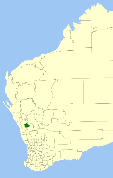
name =Shire of Morawa
state =wa
region =Mid West
area =3515.8
seat =Morawa
pop =824 (2006 census)
density =
imagesize = 180
caption = Location inWestern Australia
logo =
logosize =
url =http://www.morawa.wa.gov.au
mayor = J F (Jim) Cook
fedgov =O'Connor
stategov =Moore
near-nw = Mullewa
near-n = Mullewa
near-ne = Yalgoo
near-w = Mingenew
near-e = Perenjori
near-sw = Three Springs
near-s = Perenjori
near-se = PerenjoriThe Shire of Morawa is a Local Government Area in the Mid West region of
Western Australia , about convert|170|km|mi|0 east-southeast of the city of Geraldton and about convert|390|km|mi|0 north of the state capital, Perth. The Shire covers an area of convert|3516|km2|sqmi|0, and its seat of government is the town of Morawa.History
Morawa was gazetted as a Road Board in 1928. On 1 July 1961, it became a Shire Council following changes to the Local Government Act. [WA Electoral Commission, "Municipality Boundary Amendments Register" (release 2.0), 31 May 2003.]
Wards
The shire is no longer divided into wards and the 7 councillors sit at large. Prior to the 1997 election, the shire was divided into wards:
* Town Ward (3 councillors)
* Central Ward (2 councillors)
* North Ward (2 councillors)
* South Ward (2 councillors)
* Pintharuka Ward (2 councillors)Towns/Localities
* Morawa
* Canna
* Gutha
* Koolanooka
* Merkanooka
* PintharukaReferences
External links
* [http://www.morawa.wa.gov.au/ Shire of Morawa]
Wikimedia Foundation. 2010.