- Shire of Augusta-Margaret River
Infobox Australian Place | type = lga
name = Shire of Augusta-Margaret River
state = wa
imagesize= 180
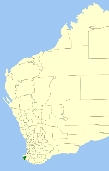
caption = Location inWestern Australia
pop = 10,353 (2006 census)
area = 2242.6
est = 1891
seat = Margaret River
mayor = Stephen Harrison
region = South West
logosize = 143
url = http://www.amrsc.wa.gov.au
stategov = Vasse, Blackwood-Stirling
fedgov = Forrest
near-nw =
near-n = Busselton
near-ne = Donnybrook-
Balingup
near-e = Nannup
near-w = "Indian Ocean "
near-sw =
near-s = "Southern Ocean "
near-se =The Shire of Augusta-Margaret River is a Local Government Area in the south-west corner of the South West region of
Western Australia , approximately convert|270|km|mi|0 south of Perth. The Shire covers an area of convert|2243|km2|sqmi|0 and has a population of about 11,000, about half of whom live in the towns of Margaret River and Augusta.Nearly half of Augusta-Margaret River's land area is state forest or
national park . National parks includeScott National Park andLeeuwin-Naturaliste National Park . Other land uses includeagriculture , especiallydairy andbeef cattle ;viticulture ; andtourism .History
In 1891, the Augusta Road Board was gazetted, and was renamed to Augusta-Margaret River Road Board in 1926. On 1 July 1961, it became the Shire Council following changes to the Local Government Act. [WA Electoral Commission, "Municipality Boundary Amendments Register" (release 2.0), 31 May 2003.]
Wards
As of 2001, the shire has been divided into 4 wards.
* Margaret River Town (2 councillors)
* Chapman Ward (2 councillors)
* Leeuwin Ward (2 councillors)
* Cowaramup Ward (1 councillor)uburbs and localities
* Augusta
* Margaret River
* Boranup
* Cowaramup
* Gnarabup
* Gracetown
* Karridale
* Prevelly
* Rosa Brook
* WitchcliffeMap
* Western Australia. Dept. of Land Administration. Cartographic Services Branch. (2004) "South West Corner/Western Australia" Perth, W.A.. Scale 1:150 000 ; (E 114°58'--E 115°40'/S 033°27'--S 034°25') "Also known as StreetSmart Touring Map - with localities Augusta, Busselton, Dunsborough and Margaret River on title" ISBN 0-7309-2907-8
References
External links
* [http://www.amrsc.wa.gov.au Shire of Augusta-Margaret River website]
Wikimedia Foundation. 2010.