- Shire of Irwin
Infobox Australian Place | type = lga
name =Shire of Irwin
state =wa
region =Mid West
area =2374.4
seat =Dongara
pop =3,052 (2006 census)
density =
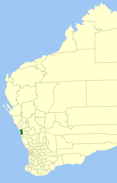
imagesize = 180
caption = Location inWestern Australia
logo =
logosize =
url =http://www.irwin.wa.gov.au
mayor =Robyn Parsons
fedgov =O'Connor
stategov =Moore
near-nw = "Indian Ocean "
near-n = Geraldton- Greenough
near-ne = Mullewa
near-e = Mingenew
near-se = Three Springs
near-s = Carnamah
near-sw = "Indian Ocean "
near-w = "Indian Ocean "The Shire of Irwin is a Local Government Area in the Mid West region of
Western Australia , about convert|50|km|mi|0 south of Geraldton and about convert|360|km|mi|0 north of the state capital, Perth. The Shire covers an area of convert|2374|km2|sqmi|0, and its seat of government is the town of Dongara.History
The Irwin Road Board was gazetted in 1871, and in 1916 received a large land area from the Upper Irwin Road Board shortly before that entity's dissolution. In the 1920s, the Carnamah and Three Springs districts were split away from Irwin. On 1 July 1961, it became a Shire Council following changes to the Local Government Act. [WA Electoral Commission, "Municipality Boundary Amendments Register" (release 2.0), 31 May 2003.]
Wards
The shire is divided into 4 wards:
* Denison Ward (4 councillors)
* North Ward (2 councillors)
* South East Ward (2 councillors)
* Town Ward (2 Councillors)Towns/Localities
* Dongara
* Allanooka
* Bookara
* Arrowsmith
* Port Denison
* Springfield
* YardarinoReferences
External links
* [http://www.irwin.wa.gov.au/ Shire of Irwin]
Wikimedia Foundation. 2010.