- Wollongong
-
This article is about the metropolitan area in Australia. For the local government area, see City of Wollongong.
Wollongong
New South Wales
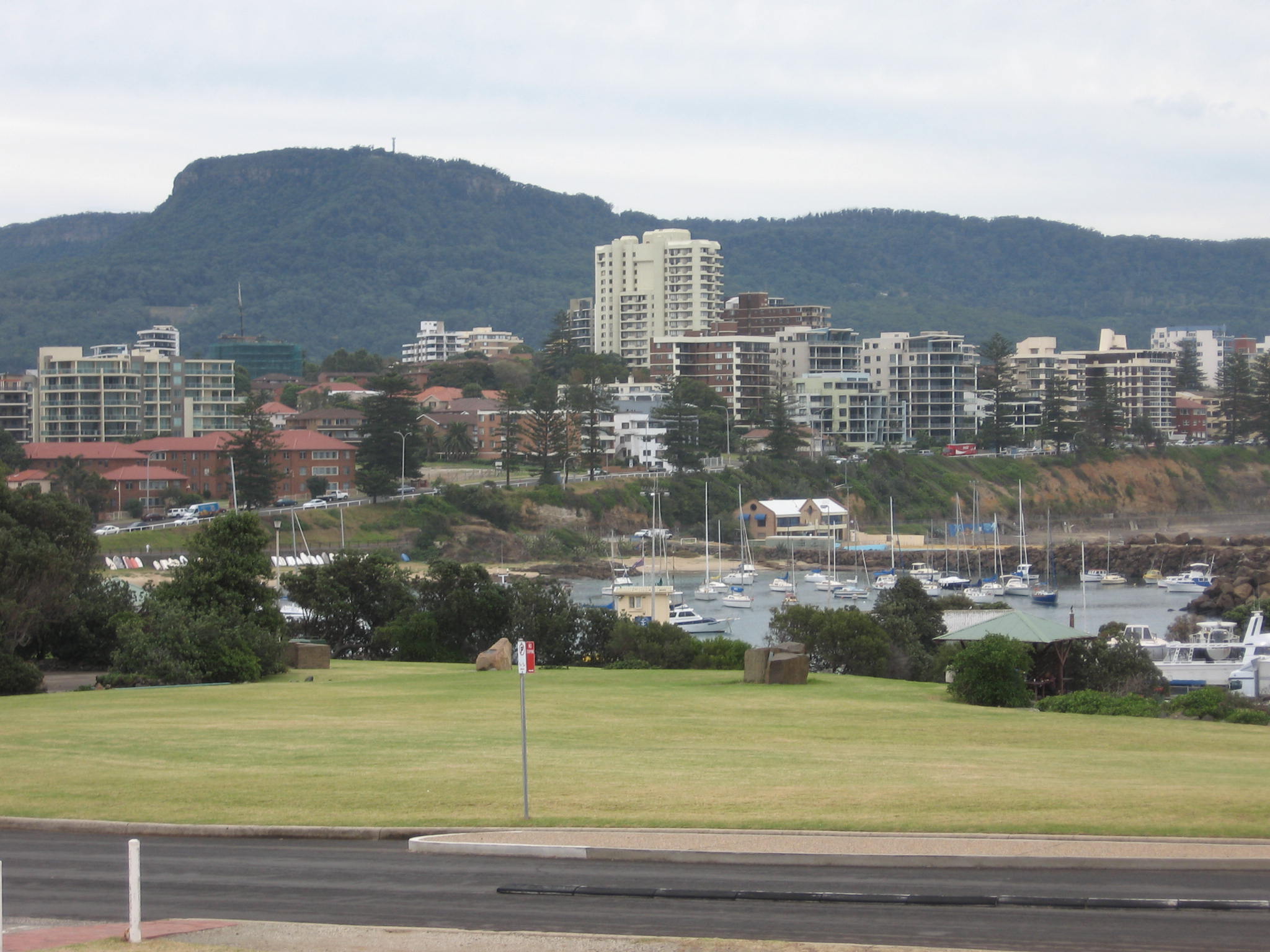
Overlooking Wollongong Harbour to the CBD and beyond toward Mount Keira and the Illawarra Escarpment.
 Wollongong
Population: 292,190[1] (9th) Postcode: 2500 Coordinates: 34°25′59″S 150°52′59″E / 34.43306°S 150.88306°ECoordinates: 34°25′59″S 150°52′59″E / 34.43306°S 150.88306°E Elevation: 5 m (16 ft) Time zone: • Summer (DST)
AEST (UTC+10) AEDT (UTC+11)
Location: 84 km (52 mi) S of Sydney LGA: Region: Illawarra Federal Division: Mean max temp Mean min temp Annual rainfall 21.8 °C
71 °F13.3 °C
56 °F1,320.9 mm
52 inWollongong (
 /ˈwʊləŋɡɒŋ/ wuul-ləng-gong) is a seaside city located in the Illawarra region of New South Wales, Australia. It lies on the narrow coastal strip between the Illawarra Escarpment and the Pacific Ocean, 82 kilometres (51 mi) south of Sydney. Wollongong has a population of 292,190,[1] making it the third largest city in New South Wales after Sydney and Newcastle, and the ninth largest city in Australia.
The metropolitan area extends from Helensburgh in the north to Gerroa in the south, and is administered by the Wollongong, Shellharbour and Kiama councils.[2] Geologically, the city is located in the south-eastern part of the Sydney basin, which extends from Newcastle to Nowra.[3]
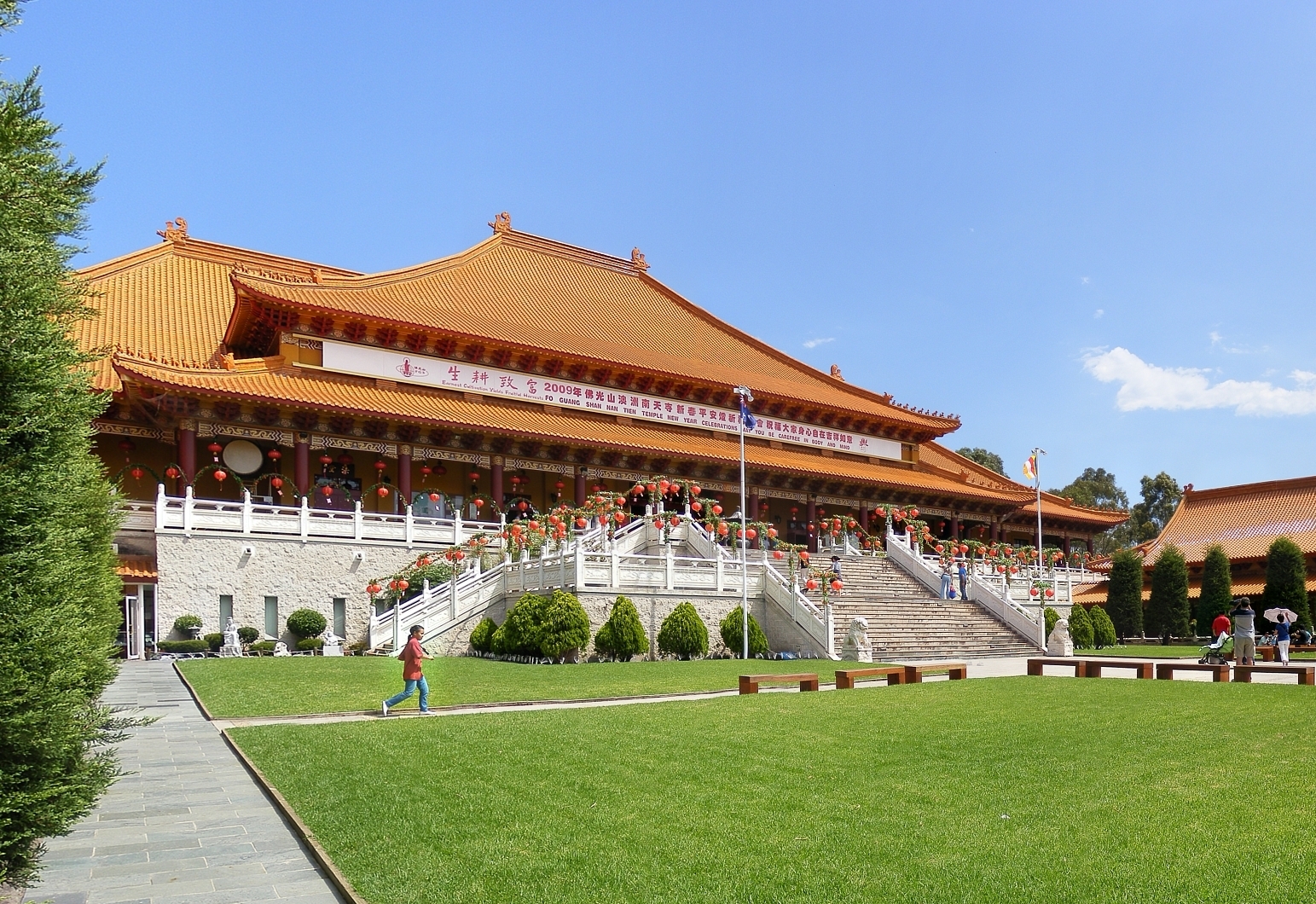
Wollongong is noted for its numerous surfing beaches, scenic lookouts and botanic gardens. It has two regional cathedrals, churches of many denominations and the Nan Tien Temple, one of the largest Buddhist temples in the southern hemisphere.[4] Wollongong is a city with a long history of mining and industry, with coal mines, a steelworks and an industrial port. The city attracts numerous tourists each year,[5] and is a regional centre for the South Coast fishing industry. The local University of Wollongong has around 22,000 students[6] and is internationally recognised.[7]
The name Wollongong is believed to mean "sound of the sea" in the local Aboriginal language, although other explanations have been offered, such as "great feast of fish", "hard ground near water", "song of the sea", "sound of the waves", "many snakes" and "five islands".[8][9][10][11][12][13]
Contents
Geography
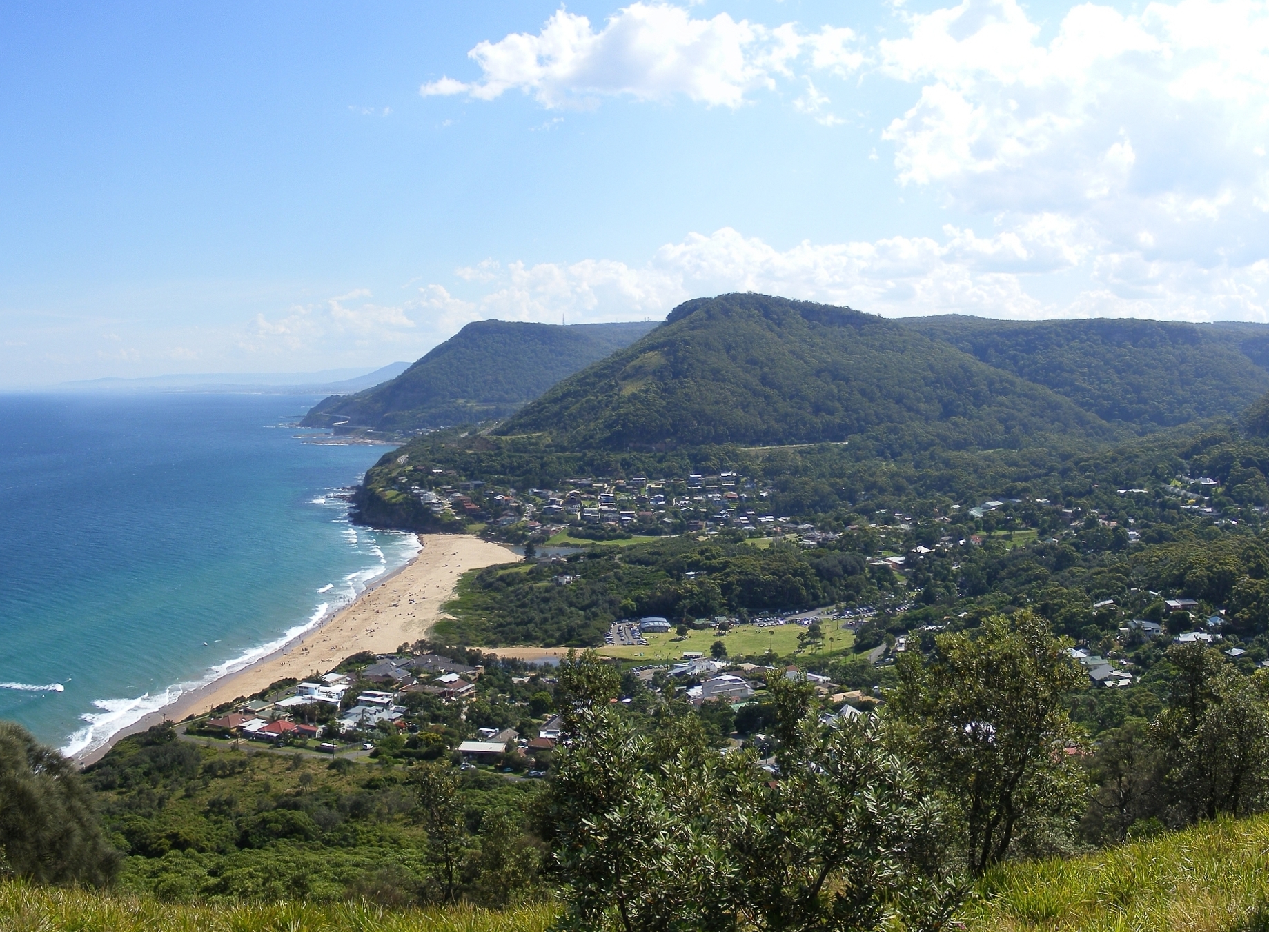
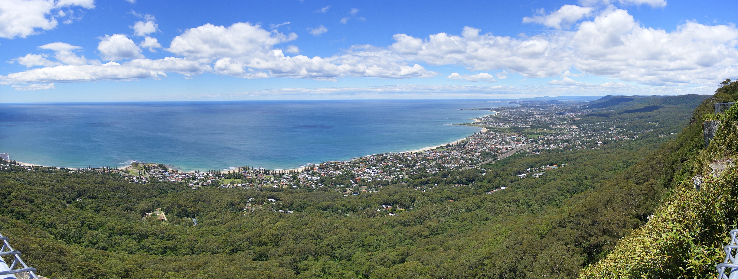
Main article: Geography of Wollongong Scenic view of Wollongong's northern coastline from Bald Hill, overlooking Stanwell Park
The city of Wollongong has a distinct geography. It lies on a narrow coastal plain flanked by the Pacific Ocean (or Tasman Sea) to the east and a steep sandstone precipice known as the Illawarra Escarpment to the west. The coastal plain is widest in the south and narrowest in the north, with the city centre located about midway.
The escarpment ranges between 150 and 750 metres (490–2,460 ft) above sea level, with locally famous mountains such as Mount Keira (464m), Mount Kembla (534m), Broker's Nose (440m) and Mount Murray (768m) to the south. It contains strata of coal measures, and the adit entrances to many coal mines have been established along the slopes of the escarpment throughout Wollongong. Suburbia encroaches on the escarpment’s lower slopes in some areas, but the majority remains in a relatively natural state forested with dry sclerophyll and pockets of temperate rainforest. The escarpment is largely protected by a State Conservation Area and local council zoning, and provides a scenic backdrop to the city.
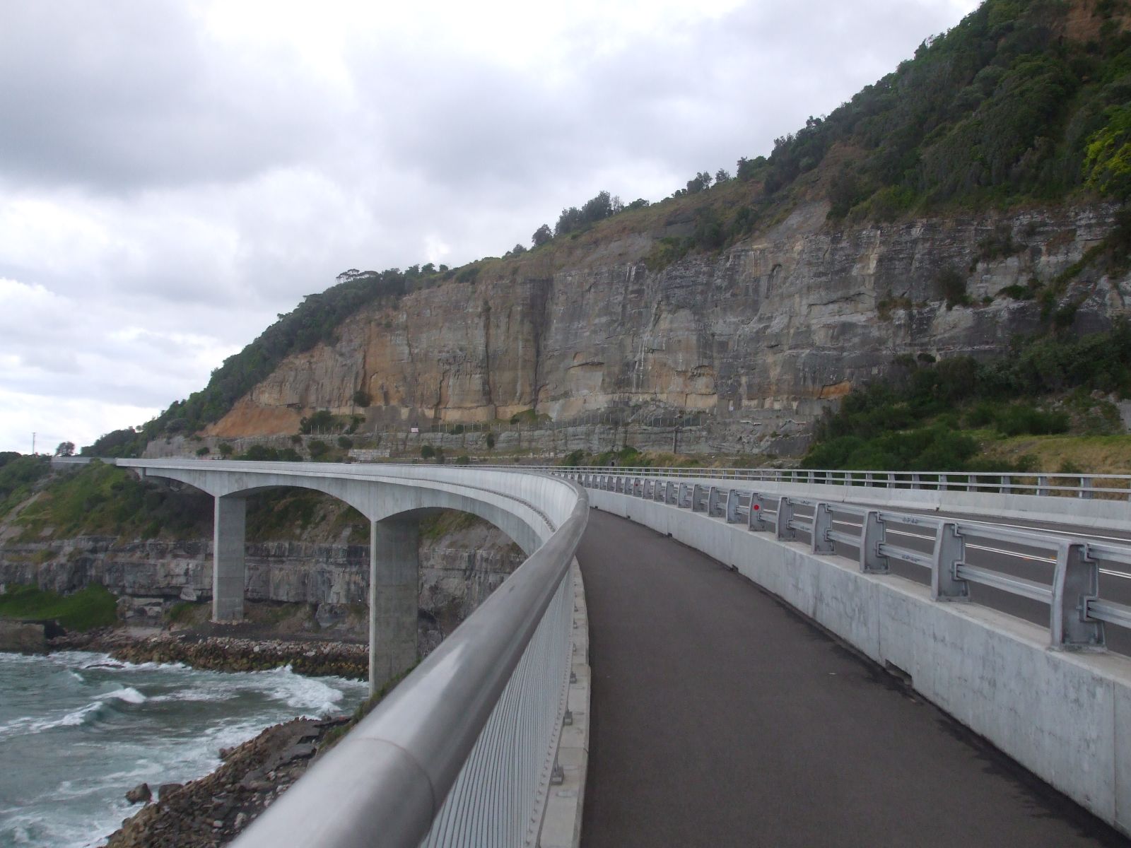
In the north the coastal plain becomes so narrow that the coastal road Lawrence Hargrave Drive once precariously hugged the cliffline until rock falls forced its closure. It was replaced in 2005 by the Sea Cliff Bridge. The bridge carries both vehicular and pedestrian traffic just off the coast, crossing the submerged rock shelf. The South Coast railway line must go through several tunnels to reach the Sydney metropolitan area. The Southern Freeway and Old Princes Highway provide alternative inland routes, descending the escarpment further south at Bulli Pass or at Mount Ousley, entering just north of Wollongong's city centre.
To the south the plain reaches its maximum extent around Albion Park where it incorporates a large coastal saltwater lagoon called Lake Illawarra, separated from the Pacific Ocean by a long sandy spit.
 Lookout from the Illawarra Escarpment above Wombarra over the northern Illawarra plain viewing Austinmer, Thirroul, Bulli, Wollongong up to Port Kembla in the far distance.
The coastal strip consists of highly fertile alluvium, which made Wollongong so attractive to agriculturists in the nineteenth century. It contains many hills including the foothills of the escarpment’s lower slopes, and while these generally do not exceed one hundred metres in height they give much of the city an undulating character. The coastal strip is traversed by several short but flood-prone and fast-flowing streams and creeks such as Para Creek, Allans Creek, Nostaw Ravine, Jimbob Creek, Mullet Creek and Macquarie Rivulet.
The coastline consists of many beaches characterised by fine pale gold-coloured sands; however, these beaches are sometimes interrupted by prominent and rocky headlands, such as Tego Rock, jutting into the sea. In places these headlands have been excavated or extended to create artificial harbours at Wollongong, Port Kembla, Shellharbour and Kiama. Just off the coast south of Wollongong centre, near Port Kembla, lies a group of five islands known collectively as The Five Islands. The islands are a wildlife refuge.
Inner City
The inner city area includes the suburbs of Wollongong and North Wollongong, extending from Para Creek in the north, west to include the Wollongong Hospital, and south to the Greenhouse Park.
The CBD is a major commercial hub containing many department stores and speciality shops, offices and entertainment venues. It is centred around the Crown Street Mall, and approximates the area bounded by Market Street, Corrimal Street, Burelli Street and the railway line. Surrounding the CBD lies a mixture of parks, reserves, light commercial property, houses and multi-story residential units. Multi-story housing is evident particularly on Smith’s Hill north-east of the CBD, reflecting the popularity of combining inner-city living, coastal views and a beachside lifestyle.
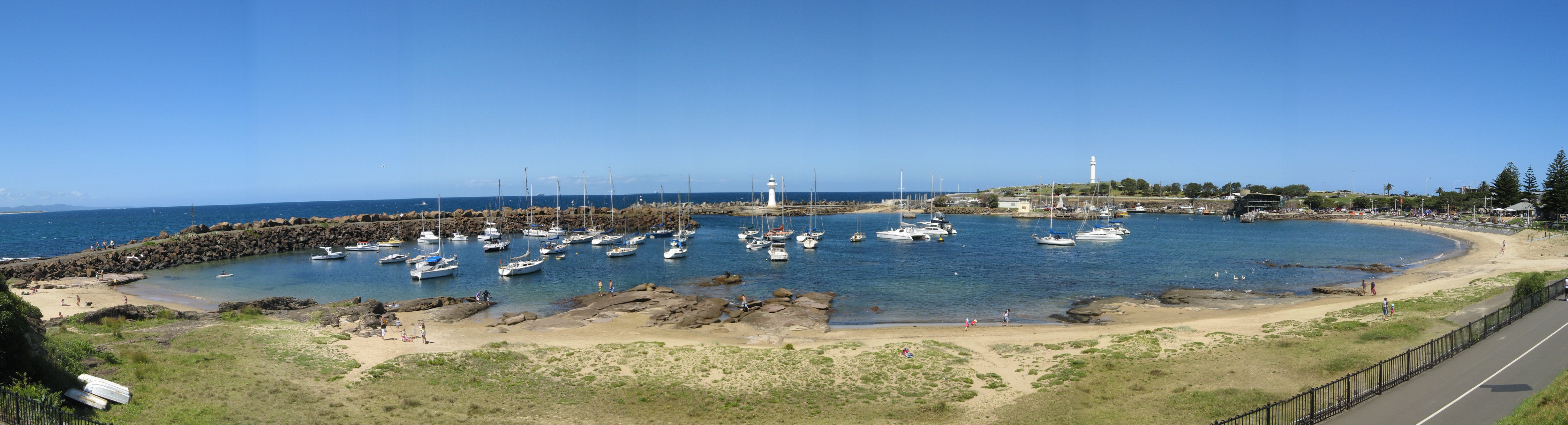
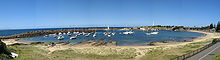 Wollongong Harbour including Belmore Basin, Brighton Beach, the Breakwater Lighthouse and the Head Lighthouse.
To the east of the city lies Flagstaff Point, a rocky headland with eroded low cliffs topped by a grassy hill. The northern side of the point was excavated by convict labour to form Belmore Basin, and later extended with the northern breakwater to create Wollongong Harbour. The area is the site of a historic fort, several restored cannons and two lighthouses, a feature peculiar to the east coast of Australia. The older Wollongong Breakwater Lighthouse located at the harbour entrance was made of wrought iron plates in 1871 and has become an icon of the city. The newer Wollongong Head Lighthouse was constructed in 1936 atop the Flagstaff Hill and is still in use today. Belmore Basin houses the commercial fishing fleet and Fisherman’s Co-op, while the main harbour shelters private vessels.
The main beaches of central Wollongong are North Wollongong (or simply North) Beach extending from the harbour up to the Para Creek lagoon and Puckeys Estate Reserve, and Wollongong City Beach extending south from Flagstaff Point and into Coniston Beach.
Climate
Wollongong experiences an oceanic climate (Köppen climate classification Cfb), with average maximum temperatures varying from 17 °C in winter to 26 °C in summer tempered by sea breezes. The highest recorded temperature is 44.1 °C in January, and the lowest 0.8 °C in July.[14]
Hot summer evenings are sometimes relieved by a front of rapidly moving cool air known as a southerly buster.
Rainfall is fairly evenly distributed throughout the seasons, with a bias to the first half of the year. It is often associated with orographic lift caused by the escarpment. Short high intensity rainfall events may happen at any time of the year and can lead to local flooding. A significant flood event occurred on 17 August 1998 when Wollongong recorded 316 mm of rainfall (the nearby suburb of Mt Ousley recorded in excess of 445 mm), mostly falling in a 3 hour period.[15][16] Wollongong also experiences thunderstorms during the warmer months bringing lightning, heavy rain and occasionally hail.
Yearly rainfall is influenced by the El Niño-Southern Oscillation.
July and August are known as the windy months, with westerly gales that can gust at over 100 km/h.[14]
Climate data for Wollongong Month Jan Feb Mar Apr May Jun Jul Aug Sep Oct Nov Dec Year Record high °C (°F) 44.1
(111.4)41.7
(107.1)40.2
(104.4)35.4
(95.7)28.5
(83.3)24.7
(76.5)25.7
(78.3)30.3
(86.5)34.2
(93.6)38.8
(101.8)40.6
(105.1)41.5
(106.7)44.1
(111.4)Average high °C (°F) 25.6
(78.1)25.6
(78.1)24.5
(76.1)22.5
(72.5)20.0
(68.0)17.6
(63.7)17.0
(62.6)18.3
(64.9)20.3
(68.5)22.1
(71.8)22.9
(73.2)25.0
(77.0)21.8 Average low °C (°F) 17.9
(64.2)18.2
(64.8)16.7
(62.1)14.2
(57.6)11.8
(53.2)9.4
(48.9)8.3
(46.9)8.8
(47.8)10.6
(51.1)12.6
(54.7)14.4
(57.9)16.5
(61.7)13.3 Record low °C (°F) 9.6
(49.3)10.3
(50.5)9.1
(48.4)5.1
(41.2)3.1
(37.6)2.0
(35.6)0.8
(33.4)2.0
(35.6)3.3
(37.9)4.7
(40.5)5.4
(41.7)8.3
(46.9)0.8
(33.4)Precipitation mm (inches) 130.3
(5.13)156.4
(6.157)160.4
(6.315)129.3
(5.091)106.4
(4.189)112.4
(4.425)63.4
(2.496)83.3
(3.28)67.4
(2.654)100.5
(3.957)115.6
(4.551)94.6
(3.724)1,320.9
(52.004)Source: [14] History
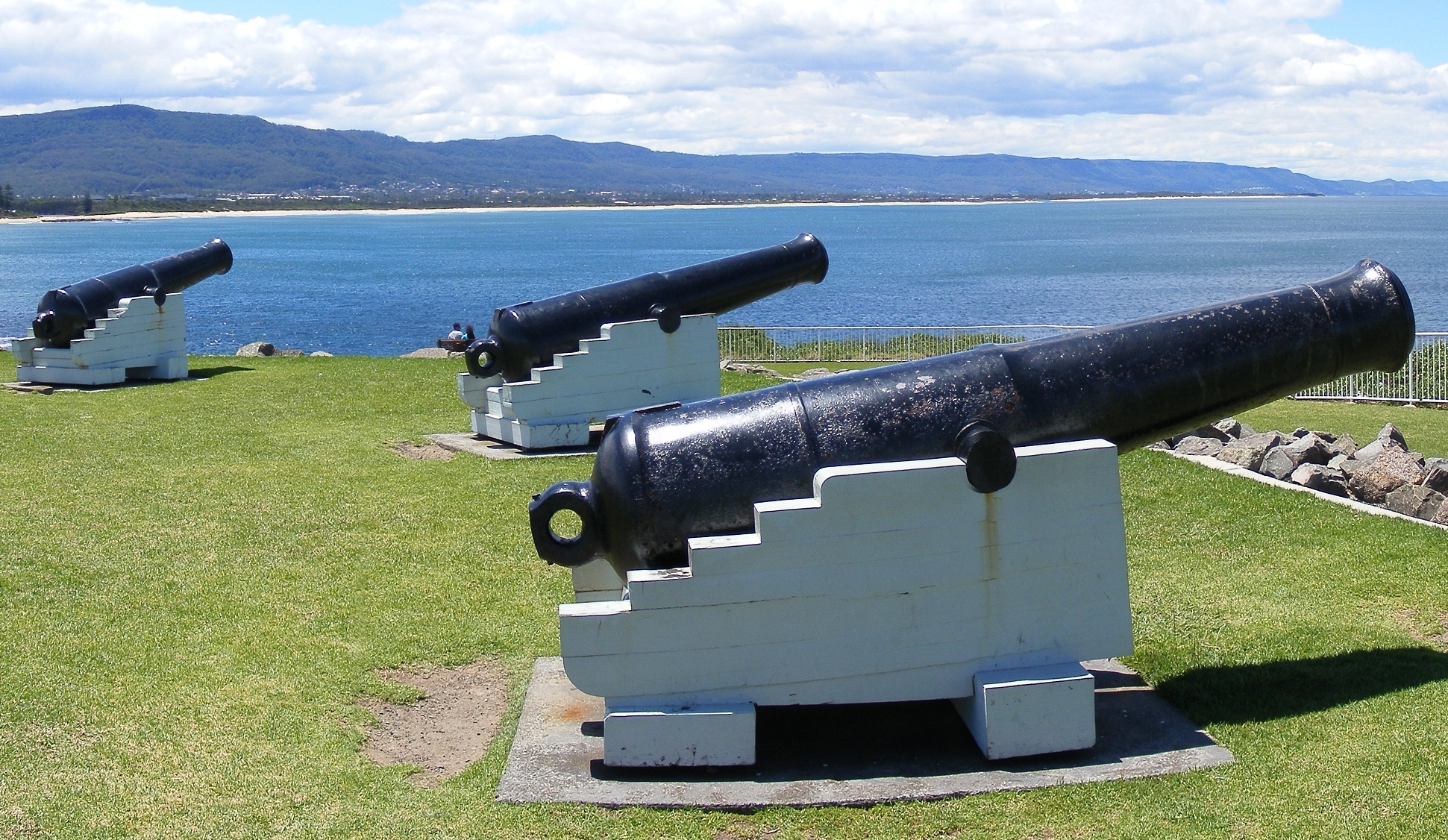
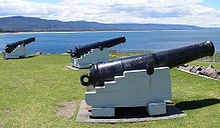 Cannons at Flagstaff Hill Fort
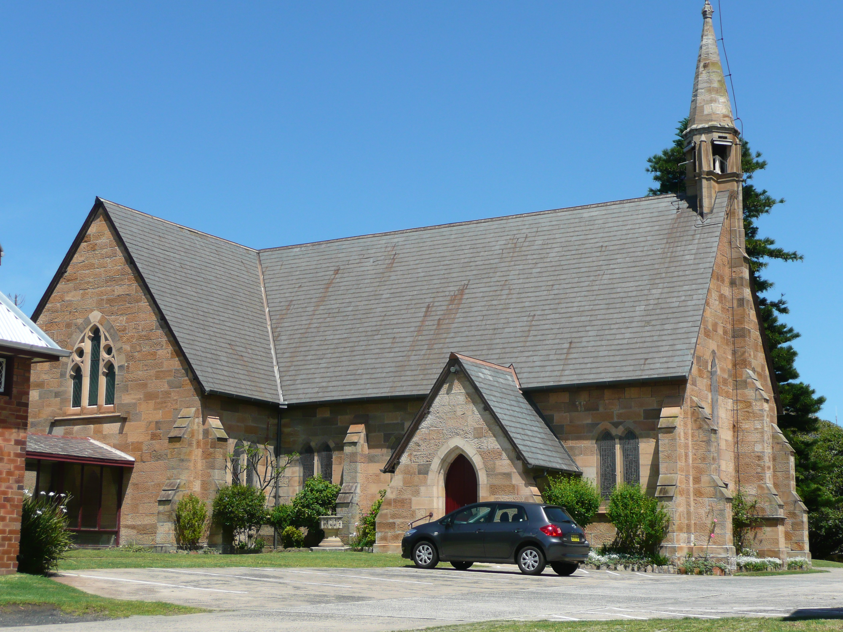
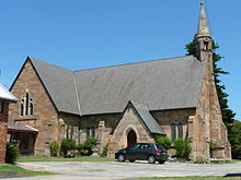 St Michael's Cathedral, Church Street
The area was originally inhabited by the Dharwal (or Turuwal) Indigenous Australians. The first Europeans to visit the area were the navigators George Bass and Matthew Flinders, who landed at Lake Illawarra in 1796. The first settlers in the region were cedar cutters in the early nineteenth century, followed by graziers in 1812. Charles Throsby established a stockman's hut in the area in 1815. The first land grants were made in 1816. In 1830, a military barracks was constructed near the harbour. Further settlers arrived and in 1834 a town was planned. On 26 November 1834, the town was first gazetted and George Brown erected the first court house. The main road down the Escarpment through Bulli Pass was built by convict labour in 1835-6, although other passes were built during the 1800s as well, such as O'Briens Road and Rixons Pass. By 1856 Wollongong had a population of 864.
In 1858, a court house was built. In 1861, a horse-drawn tramway from Mount Keira to the harbour was completed. In 1862 a telegraph line was opened between Wollongong and Bellambi. In 1865, the first gas supply in Wollongong was provided from a gas plant in Corrimal Street. In 1868 the extensions to the harbour were opened by Lady Belmore and named Belmore Basin. Patrick Lahiff established a coke works at Wollongong Harbour in the 1870s. He erected two beehive coke ovens between the north eastern end of the basin and Pulpit Rock. The ovens were demolished in 1892. The remains of the coke ovens were uncovered and recovered and are now preserved beneath the hill, with a plaque explaining their history.
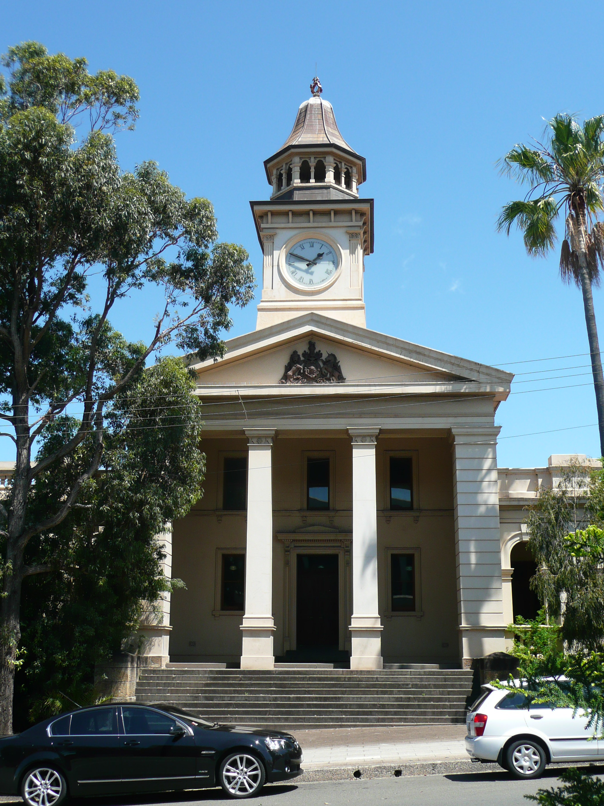
In 1871, the old lighthouse was completed. In 1880, steam locomotives were introduced to haul coal loads from Mount Keira mine to the harbour. Gas street lighting was introduced in 1883. In 1885, a new court house was erected in Market Street. Like many Australian court houses, it was designed in a Classical Revival style considered appropriate for public buildings. It is now listed on the Register of the National Estate.[17] In 1886 the first town hall was erected. The Illawarra Railway to Wollongong was completed in 1887, and now continues as far south as the town of Bomaderry on the Shoalhaven River. The navigator George Bass first documented the Illawarra coal deposits in 1797. There have been many coalmines in the district. Australia's worst coal mining disaster occurred in 1902, at the Mount Kembla mine when an explosion killed 94 men and boys, the youngest aged 14, the oldest 69. Two other men died attempting to rescue survivors. In 1908 the Wollongong District Hospital was established on Garden Hill. In 1916 the Wollongong High School was opened.
 Heritage-listed court house, Market Street
Heavy industry was attracted to the region by the ready availability of coal. In 1928 Hoskins, later Australian Iron & Steel, started a steelworks at Port Kembla, a few kilometres south of Wollongong. The former Broken Hill Proprietary Company (now BHP Billiton after merging with Billiton plc) acquired AI&S in 1935, but has since spun-out their steel division as a separate company, now known as BlueScope Steel. The steelworks has grown to become a world-class flat rolled steel producer, operating as a fully integrated steel plant with a production of around 5 million tonnes per year. Other industries to have set up in the massive Port Kembla industrial complex—the largest single concentration of heavy industry in Australia—include a fertiliser plant, an electrolytic copper smelter (featuring the tallest chimney in Australia), a locomotive workshop, a coal export shipping terminal, a grain export shipping terminal and an industrial gases manufacturing plant.
In 1937 the new Wollongong Lighthouse was finished on Flagstaff Point. In 1942 Wollongong was proclaimed a City. In 1947 City of Greater Wollongong was formed. In 1954 the population of Wollongong was 90,852. In 1956 new Wollongong City Council Chambers were opened. In 1961 the Wollongong University College was established. In 1963 the Wollongong Teachers College was established. In 1965 the Westfield shopping centre at Figtree opened.
In 1985 the railway line was electrified to Wollongong, and in 1993 to Dapto. In 1986 the Wollongong Mall was completed. For a short while trams (trackless trains) were used in the mall, though this ceased due to dangers involved. The mall was re-opened to traffic after the initial test but re-zoned a pedestrian area after and has remained one since.
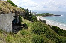 The Illowra Battery, or Hill 60, was intended to defend Port Kembla in the event of a seaborne attack during World War II
In 1987 the council chambers and library building were completed, replacing the old council building at the present art gallery site. The Crown Gateway Shopping Centre was completed. Wollongong Mall was opened. In 1988 the current council administration building was completed, as well as the performing arts centre across Burelli Street. A sculpture recognising Lawrence Hargrave was placed via a helicopter on the eastern foothills of Mount Keira. In 1998 the 6000 seat Wollongong Entertainment Centre was opened.
In 1999 the Gateway and Crown Central mall buildings were unified as Wollongong Central and a pedestrian walkway/cafe was built connecting the buildings in an above ground bridge. In 2000, as part of the Sydney Olympics, the Olympic torch was carried through Wollongong as part of its journey. In 2001 the population of Wollongong reached 181,612 people. In 2004 the Wollongong City Gallery celebrated its 25th anniversary. In 2005 Qantas established a daily air service from Wollongong to Melbourne that lasted till 2008.
In 2006/2007 the library was renovated, including new facilities, as part of the tenth anniversary of the library's current site. Also at this time the beachfront was renovated with a new lookout and walkway upgrade. In June 2007 erosion was caused via storms to the beaches, the worst in 30 years.
Despite the decline of traditional manufacturing and blue-collar industries due to the abandonment of protectionist economic policies in the 1980s, many of these industrial installations still exist. The city's economy is, however, on the rebound, thanks to diversification of economic activity including higher education, the fine arts, tourism, residential construction and eco-friendly electricity generation; however, the city's economy still relies primarily on heavy industry, and will continue to in the near future.
Demographics
The Wollongong metropolitan area includes the suburbs, outlying towns and rural localities stretching from Helensburgh in the north to Gerroa in the south.[2] With an estimated population of 292,190 as at 30 June 2010[1] it is the 3rd largest city in New South Wales and the 9th largest in Australia. Around 89% of the population reside in the built-up urban area extending from Clifton to Shell Cove.[18][19][20]
The following table includes selected 2006 census figures for these areas, together with those for the central suburb of Wollongong.
Selected 2006 Census Statistics Metropolitan Area[18] Urban Area[19] Inner City[21] Area Helensburgh to Kiama[2] Clifton to Shell Cove[20] Wollongong Suburb[22] Population 263,535 234,482 14,363 Indigenous persons 4,744 1.8% 4,415 1.9% 183 1.3% Age Groups 0–4 years 16,478 6.3% 14,780 6.3% 540 3.8% 5–14 36,435 13.8% 32,020 13.7% 887 6.2% 15–24 36,329 13.8% 32,590 13.9% 3,055 21.3% 25–54 106,038 40.2% 94,564 40.3% 6,100 42.5% 55–64 28,447 10.8% 25,167 10.7% 1,427 9.9% 65+ 39,806 15.1% 35,361 15.1% 2,355 16.4% People born overseas 53,102 20.1% 49,501 21.1% 4,151 28.9% Country of birth 1  Australia
194,197 73.7% Australia170,058 72.5% Australia8,579 59.7% 2  England
12,964 4.9% England11,503 4.9% England437 3.0% 3  Macedonia
4,276 1.6% Macedonia4,261 1.8%  China
China409 2.8% 4  Italy
Italy3,746 1.4% Italy3,613 1.5% Macedonia329 2.3% 5  Scotland
2,681 1.0% Scotland2,452 1.0%  Croatia
220 1.5% 6  New Zealand
2,358 0.9% New Zealand2,051 0.9% Italy195 1.4% Language Spoken At Home 1  English only
215,079 81.6% English only187,944 80.2% English only9,308 64.8% 2 Macedonian6,857 2.6% Macedonian6,814 2.9% Macedonian522 3.6% 3 Italian5,275 2.0% Italian5,097 2.2% Mandarin389 2.7% 4  Spanish
2,456 0.9% Spanish2,390 1.0%  Serbian
371 2.6% 5  Greek
Greek2,353 0.9% Greek2,272 1.0% Italian320 2.2% 6 Serbian1,782 0.7% Serbian1,738 0.7% Greek311 2.2% Religious Affiliation 1 Catholic 76,875 29.2% Catholic 68,751 29.3% Catholic 3,453 24.0% 2 Anglican 62,640 23.8% Anglican 54,694 23.3% No Religion 2,462 17.1% 3 No Religion 38,901 14.8% No Religion 34,070 14.5% Anglican 2,236 15.6% 4 Eastern Orthodox 14,199 5.4% Eastern Orthodox 13,910 5.9% Eastern Orthodox 1,459 10.2% 5 Uniting Church 14,060 5.3% Uniting Church 12,073 5.1% Uniting Church 516 3.6% Total labour force 119,542 105,316 7,110 Wollongong is continuing to grow with a population growth of 2.9% for the period 2001 to 2006, although the supply of new residential land is limited by the geography particularly in the northern suburbs. The west Dapto area is a major centre of future growth with plans for 19,000 new dwellings and 50,000 people within 40 years.[23][24] New residential areas are also being developed further south around the Albion Park, Shell Cove and Kiama areas.
Wollongong Population Growth 1947–2006 Year Population Increase Growth 1947 70,135 1954 100,725 30,590 43.6% 1961 150,387 49,662 49.3% 1966 177,432 27,045 18.0% 1971 202,800 25,368 14.3% 1976 222,250 19,450 9.6% 1981 231,400 9,150 4.1% 1986 232,240 840 0.4% 1991 244,930 12,690 5.5% 1996 255,740 10,810 4.4% 2001 256,095 355 0.1% 2006 263,535 7,440 2.9% Source: 1947–1996[25] 2001[26] 2006[18]  The Great Mercy Shrine at the Fo Guang Shan Nan Tien Temple complex.
Wollongong has a distinctly multicultural population. Many migrants were attracted to the area by the job opportunities at the Port Kembla steelworks in the post-war period, and settled in surrounding suburbs such as Cringila, Warrawong and Coniston. By 1966 about 60% of the wage earners at the Australian Iron and Steel steelworks were born overseas coming from over 70 countries.[25] These included British, Macedonians, Hungarians, Portuguese Greeks, Bosnians, Croatians, Serbians, Germans, Turks, and Chileans.[25] With the end of the White Australia policy these were followed by Indo-Chinese refugees in the 1970s, Indians, Filipinos, Chinese, Malays and Pacific Islanders in the 1980s and 1990s.[25] The university continues to attract students and staff from all over the world, with around 5,000 overseas student enrolments.[6]
In religion Wollongong is predominantly Christian. The major denominations are Catholic (29.2%) and Anglican (23.8%), while 14.8% of the population profess no religion.[18]
Major sources of employment include education, steel and food service.[18] Around 20,000 people commute daily to jobs in Sydney by road and rail, making it one of the busiest commuter corridors in Australia.[27]
Education
Wollongong has one university, the University of Wollongong, which was formerly part of the University of New South Wales, and the Illawarra Institute of Technology, part of the State's system of TAFE colleges. The university was awarded the "Australian University of the Year" in two consecutive years (1999–2000, 2000–2001) by the Good Universities Guide.[7]
Wollongong has a number of primary and high schools, including public, denominational and independent. Specialist high schools include the selective Smith's Hill High School, the Illawarra Sports High School, The Illawarra Grammar School and Wollongong High School of the Performing Arts.
Further information: List of schools in Illawarra and the South East and Category:Schools in WollongongMedia
Wollongong and the Illawarra region is serviced by three commercial television networks – WIN Television, Prime7 and Southern Cross Ten. The Australian Broadcasting Corporation (ABC) and the Special Broadcasting Service (SBS) also broadcast television services to Wollongong. In addition to these channels, ten new channels broadcasting in digital transmission format only are also available in Wollongong and the greater Illawarra region. These channels include ABC2, ABC3, ABC News 24, 7TWO, 7mate, GO!, GEM HD, One HD, Eleven and SBS Two. In some areas it is also possible to pick up Sydney channels including community station Television Sydney. Subscription Television service Austar is also available via satellite.
Of the three main commerical TV networks, WIN (whose network base is located in Wollongong) produces a 30-minute local news bulletin for its local broadcast area and a late night statewide bulletin for southern New South Wales and the ACT each weeknight. Prime and Southern Cross Ten also air short local news updates throughout the day.
The region receives four ABC radio services – ABC Classic FM 95.7, ABC Illawarra 97.3, Triple J 98.9, and Radio National 1431 AM. There are two commercial radio stations i98 FM 98.1 and WAVE FM 96.5, and two community radio stations Vox FM 106.9 and Christian broadcaster 94.1 FM.[28] Nowra's Power FM 94.9 also reaches the city, as do most Sydney commercial radio stations.
Wollongong is home to one daily newspaper The Illawarra Mercury issued Monday to Saturday, in addition to several free community newspapers including the Wollongong Advertiser and Local Citizen.
Transport
 The Sea Cliff Bridge on Lawrence Hargrave Drive bypasses a dangerous section of the Illawarra Escarpment.
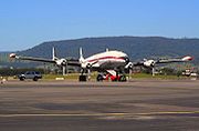 Lockheed Super Constellation (Connie), part of the HARS fleet housed at the Illawarra Regional Airport.
Road
Main article: Southern FreewayThe main road connecting Wollongong is the Waterfall-Yallah Southern Freeway (formerly the F6). The freeway, part of National Route 1, descends the escarpment via Mount Ousley Road to enter the city near the University of Wollongong and exits at its southern fringe. A second freeway, Memorial Drive (formerly the Northern Distributor), continues northward from the university to connect Wollongong's northern suburbs, Bulli Pass and the scenic Lawrence Hargrave Drive. The Illawarra Highway connects Wollongong's southern suburbs to the Southern Highlands via Macquarie Pass.
Rail
Main article: South Coast railway line, New South WalesWollongong is served by the South Coast railway line. Passenger rail services on this line connect the centres of Nowra and Kiama to the south and Sydney to the north. A branch line connects suburbs between the CBD and Port Kembla. A passenger rail service connecting Wollongong to the Southern Highlands has since been replaced with a coach service. Freight services connect Sydney markets with Port Kembla and the Manildra factory at Bomaderry. The Southern Highlands line is used primarily for freight, providing an important bypass for Sydney's congested rail network.
Bus
Main article: Illawarra bus routes, New South WalesBus services in Wollongong are provided by Premier Illawarra, Dions Bus Service, Greens Northern Coaches and other bus companies. Wollongong railway station serves as the network's hub. Services connect Wollongong suburbs to Shellharbour, Lake Illawarra and the Royal National Park. There is also a Free Shuttle Bus service that connects the CBD, University and the suburbs of North Wollongong, Fairy Meadow and Gwynneville.
Air
Main article: Illawarra Regional AirportWollongong is serviced by Illawarra Regional Airport, also known as the Wollongong Airport and the base for the Historical Aircraft Restoration Society (HARS). The Airport is located at Albion Park Rail, in the Shellharbour City LGA. There are multiple air charter businesses including NSW Air, EliteJet and Touchdown Helicopters.
Culture
Arts
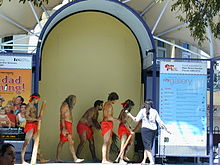 Indigenous Australians performing at Crown Street Mall
Wollongong maintains an active arts scene. In the area of music the city is home to the Wollongong Symphony Orchestra, BlueScope Steel Youth Orchestra, a jazz club and various groups and ensembles. The Wollongong Conservatorium of Music provides musical tuition for instruments and voice in classical, jazz and contemporary styles. It is one of the largest regional conservatorium in Australia and located in the historic Gleniffer Brae Manor House, part of the Wollongong Botanic Gardens.
Local theatre groups include the Arcadians, Roo Theatre, Merrigong and Wollongong Workshop Theatre.
The annual Wollongong Eisteddfod showcases local talent in music, theatre and dance.
The Wollongong City Gallery houses a significant collection of the art of the Illawarra, contemporary Australian, Aboriginal and Asian art. In addition there are a number of private galleries, particularly in Wollongong's northern seaside suburbs.[29]
The popular 1990s stoner rock band Tumbleweed were formed and based in Wollongong.
Entertainment and Nightlife
Entertainment venues include the Crown Street Mall, many restaurants and cafes, the town cinemas and the Illawarra Performing Arts Centre. Adjacent to WIN Stadium, the home ground of the NRL team St. George Illawarra Dragons, is the WIN Entertainment Centre: a multipurpose venue which hosts concerts and sporting events (including Southern Stars, basketball and motocross stunt shows). There are numerous city nightclubs, pubs & Registered Clubs, including HostageX, The Illawarra Master Builders Club, The Grand Hotel (back to its original name, after being called Cooney's for a few years), The Glasshouse Tavern, One Five One (Formerly Bourbon St and originally Cousins), Castros (Formerly Rusty's), The Illawarra Hotel, The Harp Hotel, and The North Wollongong Hotel. The iconic Oxford Hotel closed in 2010, which meant the demise of a well-known live music venue, home in years past to acts such as Tumbleweed in their formative days. Most suburbs also have their own hotels, each with individual character. The Headlands Hotel at Austinmer is heritage-listed.
Recreation

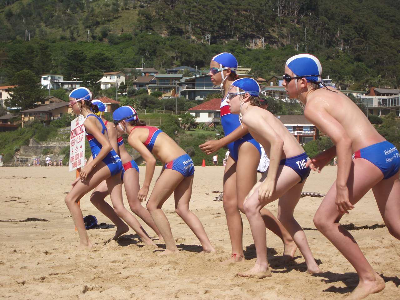
Wollongong has 17 seasonally-patrolled local beaches: Stanwell Park, Coalcliff, Austinmer, Thirroul, Sandon Point, Bulli, Woonona, Bellambi, Corrimal, Towradgi, Fairy Meadow, North Wollongong, Wollongong City, Port Kembla and Windang. Surfing, rock fishing, swimming, skimboarding are common activities. The Wollongong to Thirroul Bike Track, a thirteen kilometre Heart Foundation walking/biking pathway which runs northwards adjacent to the Illawarra coastline starting at Wollongong Beach, is frequented by walkers, joggers, skaters and bicycle riders. Bushwalking on nearby Mount Keira and Mount Kembla, and motorbike riding at the Motocross Track on the escarpment west of Wollongong, are also popular activities.
Wollongong has many parks. In the city centre is MacCabe Park, featuring a playground, the local youth centre, a war memorial, community hall, a sculpture called "Nike" and a brick amphitheatre. Lang Park, adjacent to the city beach, has a number of shelters built in the 1950s. These were subject for demolition but were saved by a community vote. Stuart Park, to the coastal north of the city but south of Fairy Lagoon and Puckeys Estate Reserve, is well known as a landing spot for skydivers as well as a place for outdoor recreation and social gatherings. Stuart Park is also distinctive for its Norfolk Island Pines, planted during the North Wollongong tourism boom in the 1920s. J.J.Kelly Park to the south is used by circuses, as well as a protected area of creek leading to the Greenhouse Park north of the Port Kembla Steelworks, containing a revegetated area of once waste and a lookout, as well as the small remnants of Tom Thumb Lagoon, which once stretched north to Swan Street. Beaton Park in Gwynneville is home to Tennis Wollongong and the Leisure Centre with an athletics complex, indoor heated swimming pool, gymnasium and multipurpose sports hall.
Sport
The St George Illawarra Dragons represent the city in the National Rugby League (NRL) competition. The club was formed in a merger between the St. George Dragons and the Illawarra Steelers in 1999, and continues to play some home games at WIN Stadium. They won the 2010 NRL Grand Final against the Sydney Roosters. Prior to the merger the Illawarra Steelers had represented the area in the New South Wales Rugby League premiership and NRL between 1982 and 1998. Rugby league has been played in Wollongong since 1911, and the area has produced at least 41 international players.[30] At the local level league continues to have a strong following with a number of teams playing in the Illawarra Rugby League and Group 7 Rugby League competitions.
Trent Johnston, captain of Ireland at the 2007 Cricket World Cup, is a native of Wollongong. He grew up in Dapto and left Australia in 2004. He played his 100th game for Ireland against England in August 2009.
The Illawarriors are a rugby union club based in the Illawarra, who contest the Shute Shield NSW club competition. The club play some of their home games at WIN Stadium.
The Wollongong Hawks basketball team play in the National Basketball League and are the only NBL club (as of 2009/10) to have competed in every season since the league's inception in 1979. Home games are played at the WIN Entertainment Centre, known as "The Sandpit" in the NBL[31]
Wollongong F.C. is the region's football (soccer) club who compete in the New South Wales Premier League. Scott Chipperfield, a Wollongong native who became a professional football player in Europe, along with Tim Cahill, has recently expressed an interest in being involved in a Wollongong football club in the A-League, as well as the Sydney club playing some promotional games in Wollongong. Great South Football is a consortium preparing the Illawarra's South Coast A-League bid. In late 2008, the club folded due to debt incurred over the past season. It is proposed that a new community-based entity will take on the Football NSW licence previously held by Wollongong FC.[32]
The Illawarra Cycling Club holds road cycle races almost every week of the year. During the summer, velodrome racing is also promoted at the Unanderra Velodrome on the Princes Highway. A recent focus within the club has seen a shift to encompass a stronger emphasis on youth development programs alongside its already strong commitment to competitive under 19's, 23's and adult road racing. The club is represented at a state and national level regularly and has had several riders compete at international levels.
The Wollongong Lions Australian Football Club play in the Sydney AFL competition. The club was established in 1971 as the Swans and in 1989 joined the Sydney AFL as the Lions. The club also has junior teams playing in the AFL Illawarra Juniors competition.
The Gong Scorpions are the local Floorball team from the Wollongong area. The Club plays socially at the Wollongong University and has recently been re-established in order to compete in the NSW Elite Series.[citation needed]
Baseball has been played in the region with structured competitions conducted since 1938. The Illawarra District Baseball Association was the governing body from this year until 1991 when the Illawarra Baseball League was created. The Illawarra Junior Baseball League was inaugurated in 1984 to accommodate a growing number of juniors that peaked at around 950 players in 1995. Eight regional clubs from four Local Government Areas play in the I B L. A regional club, the Illawarra Flame Baseball Club, fielded teams in four grades in the New South Wales Baseball League Sydney Major League from 1994 to 2007. The first grade team made the Grand Final in their inaugural season. The Club won a total of four premierships while participating. The IFBC played their inaugural games against the All Kawasaki Baseball Club in August 1994 the games being the first sporting exchange between the Sister Cities, Wollongong and Kawasaki.
Other popular sports in the Illawarra include rock climbing, surfing, cup stacking, triathlon and mountain biking.
Reference in popular culture
- Wollongong has received its share of attention from novelists, songwriters and filmmakers over the years. English author D. H. Lawrence penned the novel Kangaroo while staying in the northern suburb of Thirroul.
- Wollongong is the home of a professional Quidditch team, the Woollongong Warriors, that operates within the Harry Potter universe.[33]
- The original (Australian) version of the song "I've Been Everywhere" mentions Wollongong and its suburb Unanderra in its list of places visited.
- The city was famously lampooned in the 1970s ABC-TV comedy series The Aunty Jack Show. The show's characters included a gormless local TV reporter Norman Gunston, described as a Wollongong media non-personality, who presented a segment "What's On In Wollongong" and subsequently went on to have his own spin-off series and 'career'. Another spin-off from the show was the album Aunty Jack Sings Wollongong, a mixture of sketches and songs loosely based around a visit to Wollongong.
- In the episode Unnatural Love from the New Zealand/American television series Flight of the Conchords, Bret pretends to be Jemaine's Australian girlfriend in a message on their answering machine, saying that she has moved back to Wollongong. Jemaine corrects Bret, telling him she is actually from Woolloomooloo.
Attractions
In addition to numerous swimming and surfing beaches, major visitor attractions to the Wollongong region are:
- Wollongong Botanic Gardens
- Cockatoo Run scenic train ride from Wollongong to Robertson
- Cycling to Sandon Point from North Wollongong
- Wollongong Harbour (Belmore Basin), Wollongong Breakwater Lighthouse, Wollongong Head Lighthouse and surrounding foreshores
- Historical Aircraft Restoration Society located at the Illawarra Regional Airport
- Illawarra Light Railway Museum, with light and miniature train rides
- Illawarra Museum
- Jamberoo Action Park
- Kiama Blowhole
- Lookouts at Bald Hill, Bulli Tops (Sublime Point and Cliffhanger Restaurant), Mount Keira, Port Kembla (Illowra Battery), Illawarra Fly Tree Top Walk, Saddleback Mountain
- Minnamurra Rainforest Centre and Minnamurra Falls
- Motorlife Museum
- Nan Tien Temple
- Port Kembla steelworks and Australia’s Industry World tours
- Science Centre and Planetarium
- Sea Cliff Bridge
- Skydiving at North Wollongong Beach
- Five Islands Brewery
- Symbio Wildlife Park
Sister city and Friendship city relationships
Wollongong has sister city and friendship city arrangements with:[34]
 Kawasaki, Japan, formally established 1988
- Ohrid, Republic of Macedonia, established 1981, lapsed, formally re-established 1999
- Longyan, People's Republic of China (friendship city), formally established 2001
See also
- The Aunty Jack Show, Norman Gunston and Aunty Jack Sings Wollongong
- Church Street
- Crown Street
- Greenhouse Park
- HMAS Wollongong
- Illawarra Escarpment
- The Illawarra Region
- Mount Keira
- Mount Kembla
- Nan Tien temple
- Port Kembla
- Puckeys Estate Reserve
- List of songs about the Illawarra
- List of Wollongong suburbs
- South Coast Railway Line
- University of Wollongong
- Wollongong Botanic Garden
- Wollongong Central
References
- ^ a b c "3218.0 – Regional Population Growth, Australia, 2009–10". Australian Bureau of Statistics. http://www.abs.gov.au/ausstats/abs@.nsf/Products/3218.0~2009-10~Main+Features~New+South+Wales?OpenDocument#PARALINK23.
- ^ a b c "Wollongong Statistical District Map". Australian Bureau of Statistics. http://www.censusdata.abs.gov.au/ABSNavigation/ImageServer?id=map,Census,2006,1006. Retrieved 2 January 2009.
- ^ http://www.dpi.nsw.gov.au/__data/assets/image/0007/96847/20758.gif
- ^ "Nan Tien Temple Home Page". Nan Tien Temple. http://www.nantien.org.au/en/index.asp. Retrieved 31 August 2008.
- ^ "Illawarra Facts & Figures". Tourism NSW. http://corporate.tourism.nsw.gov.au/Illawarra_p914.aspx. Retrieved 2 January 2009.
- ^ a b "Key Statistics". University of Wollongong. http://www.uow.edu.au/about/keystatistics/index.html. Retrieved 2 January 2009.
- ^ a b "Awards and Achievements". University of Wollongong. http://www.uow.edu.au/about/awards/index.html. Retrieved 2 January 2009.
- ^ "Place Names of Wollongong". Wollongong City Library. http://www.wollongong.nsw.gov.au/library/localinfo/place.html#W.
- ^ McCarthy, F. D., The Australian Museum: New South Wales Aboriginal Place Names and Euphonious Words, with their Meanings, 3rd ed., Australian Museum, Sydney, 1959.
- ^ Illawarra Historical Society Bulletin, Illawarra Historical Society, Wollongong, 1945–
- ^ Cousins, Arthur, The Garden of New South Wales, Producers' Co-op. Distributing Society Ltd, Sydney, 1948.
- ^ Shaw, Hilde J., 200 Facts About Historic Illawarra, Illawarra Historical Society, Wollongong, 1970
- ^ McDonald, W. G., Earliest Illawarra: By its Explorers and Pioneers, Illawarra Historical Society, [Wollongong], 1966.
- ^ a b c "Bureau of Meteorology – Summary statistics WOLLONGONG UNIVERSITY". Australian Bureau of Meteorology. http://www.bom.gov.au/climate/averages/tables/cw_068188_All.shtml. Retrieved 9 August 2008.
- ^ "SIGNIFICANT WEATHER – AUGUST 1998". Australian Bureau of Meteorology. http://www.bom.gov.au/inside/services_policy/public/sigwxsum/sigw0898.shtml#rain. Retrieved 24 February 2008.
- ^ "Geography Stimulus Booklet – Wollongong Floods". http://www.wollongong.nsw.gov.au/Documents/Student_broadsheet.pdf. Retrieved 24 February 2008.
- ^ Heritage of Australia, Macmillan Publishers, 1981, p.2/173
- ^ a b c d e Australian Bureau of Statistics (25 October 2007). "Wollongong (NSW) (Statistical District)". 2006 Census QuickStats. http://www.censusdata.abs.gov.au/ABSNavigation/prenav/LocationSearch?collection=Census&period=2006&areacode=1006&producttype=QuickStats&breadcrumb=PL&action=401. Retrieved 7 September 2008.
- ^ a b Australian Bureau of Statistics (25 October 2007). "Wollongong (Urban Centre/Locality)". 2006 Census QuickStats. http://www.censusdata.abs.gov.au/ABSNavigation/prenav/LocationSearch?collection=Census&period=2006&areacode=UCL184800&producttype=QuickStats&breadcrumb=PL&action=401. Retrieved 7 September 2007.
- ^ a b "Wollongong Urban Centre/Locatity Map". Australian Bureau of Statistics. http://www.censusdata.abs.gov.au/ABSNavigation/ImageServer?id=map,Census,2006,UCL184800. Retrieved 7 September 2008.
- ^ Australian Bureau of Statistics (25 October 2007). "Wollongong (State Suburb)". 2006 Census QuickStats. http://www.censusdata.abs.gov.au/ABSNavigation/prenav/LocationSearch?collection=Census&period=2006&areacode=SSC15281&producttype=QuickStats&breadcrumb=PL&action=401. Retrieved 7 September 2007.
- ^ "Wollongong State Suburb Map". Australian Bureau of Statistics. http://www.censusdata.abs.gov.au/ABSNavigation/ImageServer?id=map,Census,2006,SSC15281. Retrieved 7 September 2008.
- ^ "West Dapto". Wollongong City Council. Archived from the original on 22 July 2008. http://web.archive.org/web/20080722053531/http://www.wollongong.nsw.gov.au/planning/westdapto.asp. Retrieved 16 January 2009.
- ^ "West Dapto Implementation". Wollongong City Council. Archived from the original on 23 July 2008. http://web.archive.org/web/20080723023527/http://www.wollongong.nsw.gov.au/planning/3483.asp. Retrieved 16 January 2009.
- ^ a b c d Hagan, Jim, ed (1997). "14. The Emergence of Multicultural Wollongong". A History of Wollongong. The University of Wollongong Press. ISBN 0864184468.
- ^ Australian Bureau of Statistics (9 March 2006). "Wollongong (NSW) (Statistical District)". 2001 Census QuickStats. http://www.censusdata.abs.gov.au/ABSNavigation/prenav/LocationSearch?collection=Census&period=2001&areacode=1006&producttype=QuickStats&breadcrumb=PL&action=401. Retrieved 17 January 2009.
- ^ "Illawarra transport infrastructure priorities". Illawarra Business Chamber. http://www.nswbusinesschamber.com.au/reference/influence_government/1742_Illawarra_Report.pdf. Retrieved 17 January 2009.
- ^ "All Current Sydney FM Stations". Scanner Australia. Archived from the original on 19 July 2008. http://web.archive.org/web/20080719054144/http://www.scanneraustralia.com/nswfrequencies/fmradiosydney.html. Retrieved 31 August 2008.
- ^ "Wollongong Arts". Wollongong. http://www.wollongongphotography.com. Retrieved 31 August 2008.
- ^ "Illawarra History". St George Illawarra Dragons. http://www.dragons.com.au/default.aspx?s=illawarra. Retrieved 9 November 2010.
- ^ "Venue and Season by Season results". Basketball Australia. http://www.nbl.com.au/hawks/history/season-by-season/. Retrieved 7 November 2010.
- ^ Supporters save Wollongong FC – ABC News (Australian Broadcasting Corporation)
- ^ Whisp, Kennilworthy (2001). Quidditch Through the Ages. WhizzHard Books. pp. 31–46. ISBN 1551924544.
- ^ "Sister cities". Wollongong City Council. 26 July 2010. http://www.wollongong.nsw.gov.au/city/sistercities/pages/default.aspx. Retrieved 7 November 2010.
External links
- Video
- Tourist Guides
- Special Interest
- News
- Councils and Governance
- Facilities
Suburbs and Localities of Wollongong, New South Wales Albion Park · Albion Park Rail · Austinmer · Avon · Avondale · Balarang · Balgownie · Barrack Heights · Barrack Point · Bellambi · Berkeley · Blackbutt · Bombo · Broughton Village · Brownsville · Bulli · Burning Palms · Calderwood · Carrington Falls · Cleveland · Clifton · Coalcliff · Coledale · Coniston · Cordeaux · Cordeaux Heights · Corrimal · Cringila · Croom · Curramore · Dapto · Darkes Forest · Dombarton · Dunmore · East Corrimal · Fairy Meadow · Farmborough Heights · Fernhill · Figtree · Flinders · Foxground · Gerringong · Gerroa · Gwynneville · Haywards Bay · Helensburgh · Horsley · Huntley · Jamberoo · Jerrara · Kanahooka · Keiraville · Kembla Grange · Kembla Heights · Kemblawarra · Kiama · Kiama Downs · Kiama Heights · Knights Hill · Koonawarra · Lake Heights · Lake Illawarra · Lilyvale · Macquarie Pass · Maddens Plains · Mangerton · Marshall Mount · Minnamurra · Mount Keira · Mount Kembla · Mount Ousley · Mount Pleasant · Mount Saint Thomas · Mount Warrigal · North Macquarie · North Wollongong · Oak Flats · Otford · Penrose · Port Kembla · Primbee · Rose Valley · Russell Vale · Saddleback Mountain · Scarborough · Shell Cove · Shellharbour · Shellharbour City Centre · Spring Hill · Stanwell Park · Stanwell Tops · Tarrawanna · Thirroul · Tongarra · Toolijooa · Towradgi · Tullimbar · Unanderra · Upper Kangaroo Valley · Warilla · Warrawong · Werri Beach · West Wollongong · Willow Vale · Windang · Wollongong · Wombarra · Wongawilli · Woonona · Yallah · Yellow Rock
Cities of Australia Australian Capital Territory Canberra (national capital)New South Wales Northern Territory Queensland Brisbane · Bundaberg · Cairns · Caloundra · Gladstone · Gold Coast · Gympie · Hervey Bay · Mackay · Maryborough · Mount Isa · Rockhampton · Sunshine Coast · Toowoomba · TownsvilleSouth Australia Adelaide · Mount Gambier · Murray Bridge · Port Augusta · Port Lincoln · Port Pirie · Victor Harbor · WhyallaTasmania Victoria Western Australia Categories:- Cities in New South Wales
- Wollongong
- Coastal cities in Australia
- Port cities in Australia
- Australian Aboriginal placenames


Wikimedia Foundation. 2010.