- East Corrimal, New South Wales
-
East Corrimal
Wollongong, New South Wales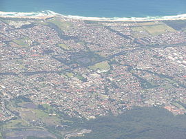
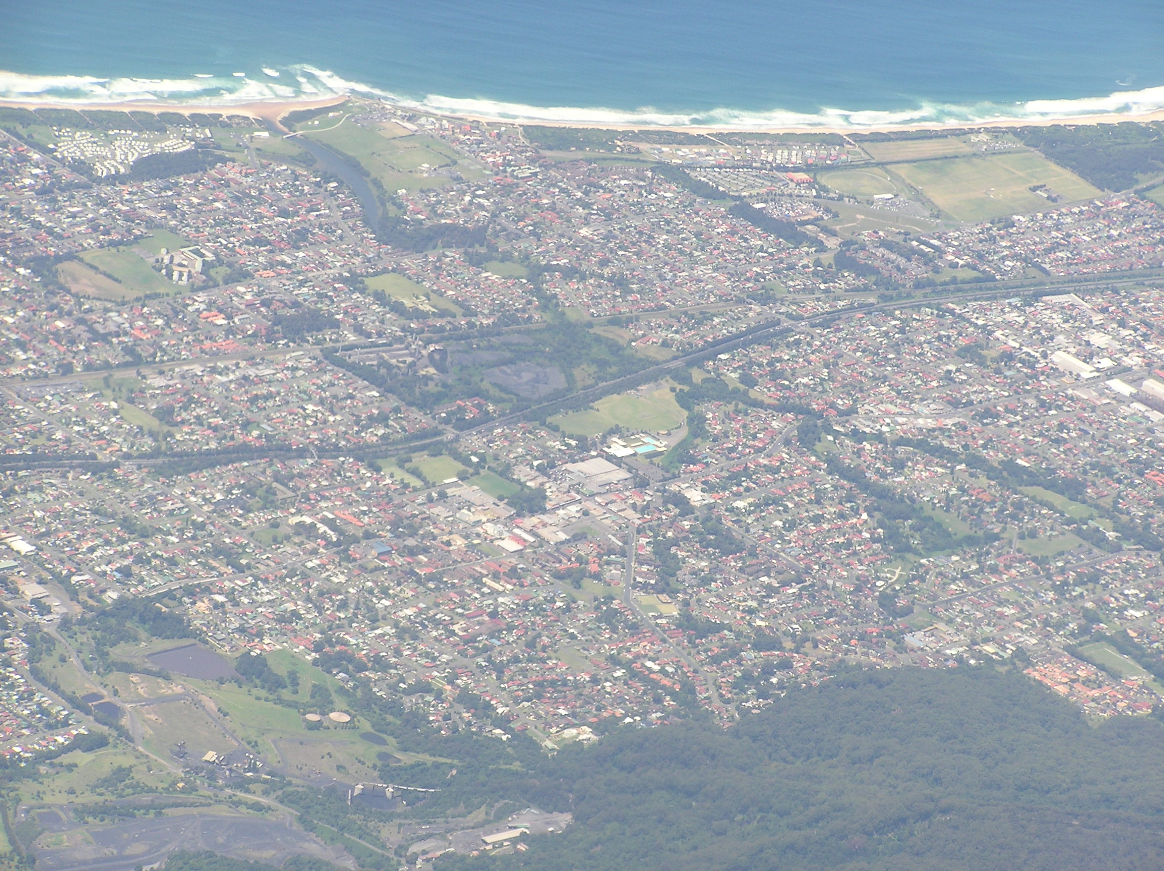
Aerial photo overlooking Corrimal and Tarrawanna to East CorrimalPopulation: 3,056[1] Postcode: 2518 Coordinates: 34°22′35″S 150°54′39″E / 34.37639°S 150.91083°ECoordinates: 34°22′35″S 150°54′39″E / 34.37639°S 150.91083°E LGA: City of Wollongong State District: Keira Federal Division: Cunningham Suburbs around East Corrimal: Russell Vale Bellambi Bellambi Corrimal East Corrimal Pacific Ocean Towradgi Towradgi Pacific Ocean East Corrimal is a northern seaside suburb of Wollongong, New South Wales, Australia. Predominantly residential, the suburb includes Corrimal High School and Corrimal East Public School, as well as Corrimal Beach and tourist park at the eastern end. A park was opened in 1959 to the west of the high school and north of the primary school, named Phil Adams Park, which features tall trees, paths and several seats.
The South Coast railway line forms the western boundary of East Corrimal and separates it from its sister suburb Corrimal. It is served by Corrimal railway station.
The suburb takes its name from a point on the nearby Illawarra escarpment which was known as Mount Corrimal (named after the Aboriginal Dreamtime warrior Kurimul) and now called Broker's Nose.[2]
Schools
Corrimal High School is located in Corrimal. Corrimal East Public School is a local public primary school, established in 1952.[3]
See also
- Broker's Nose
- Corrimal
- Corrimal High School
- Corrimal railway station
References
- ^ Australian Bureau of Statistics (25 October 2007). "East Corrimal (State Suburb)". 2006 Census QuickStats. http://www.censusdata.abs.gov.au/ABSNavigation/prenav/LocationSearch?collection=Census&period=2006&areacode=SSC15091&producttype=QuickStats&breadcrumb=PL&action=401. Retrieved 2009-03-07.
- ^ "Place names of the Wollongong region". Wollongong City Council. http://www.wollongong.nsw.gov.au/library/placenames.asp. Retrieved 2009-03-07.
- ^ "orrimal East Public School". http://www.corrimaleastps.com/ceps/About_us.html. Retrieved 1 July 2010.
Suburbs and Localities of Wollongong, New South Wales Albion Park · Albion Park Rail · Austinmer · Avon · Avondale · Balarang · Balgownie · Barrack Heights · Barrack Point · Bellambi · Berkeley · Blackbutt · Bombo · Broughton Village · Brownsville · Bulli · Burning Palms · Calderwood · Carrington Falls · Cleveland · Clifton · Coalcliff · Coledale · Coniston · Cordeaux · Cordeaux Heights · Corrimal · Cringila · Croom · Curramore · Dapto · Darkes Forest · Dombarton · Dunmore · East Corrimal · Fairy Meadow · Farmborough Heights · Fernhill · Figtree · Flinders · Foxground · Gerringong · Gerroa · Gwynneville · Haywards Bay · Helensburgh · Horsley · Huntley · Jamberoo · Jerrara · Kanahooka · Keiraville · Kembla Grange · Kembla Heights · Kemblawarra · Kiama · Kiama Downs · Kiama Heights · Knights Hill · Koonawarra · Lake Heights · Lake Illawarra · Lilyvale · Macquarie Pass · Maddens Plains · Mangerton · Marshall Mount · Minnamurra · Mount Keira · Mount Kembla · Mount Ousley · Mount Pleasant · Mount Saint Thomas · Mount Warrigal · North Macquarie · North Wollongong · Oak Flats · Otford · Penrose · Port Kembla · Primbee · Rose Valley · Russell Vale · Saddleback Mountain · Scarborough · Shell Cove · Shellharbour · Shellharbour City Centre · Spring Hill · Stanwell Park · Stanwell Tops · Tarrawanna · Thirroul · Tongarra · Toolijooa · Towradgi · Tullimbar · Unanderra · Upper Kangaroo Valley · Warilla · Warrawong · Werri Beach · West Wollongong · Willow Vale · Windang · Wollongong · Wombarra · Wongawilli · Woonona · Yallah · Yellow Rock
Categories:- Suburbs of Wollongong, New South Wales
Wikimedia Foundation. 2010.