- Coniston, New South Wales
-
Coniston
Wollongong, New South Wales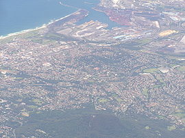
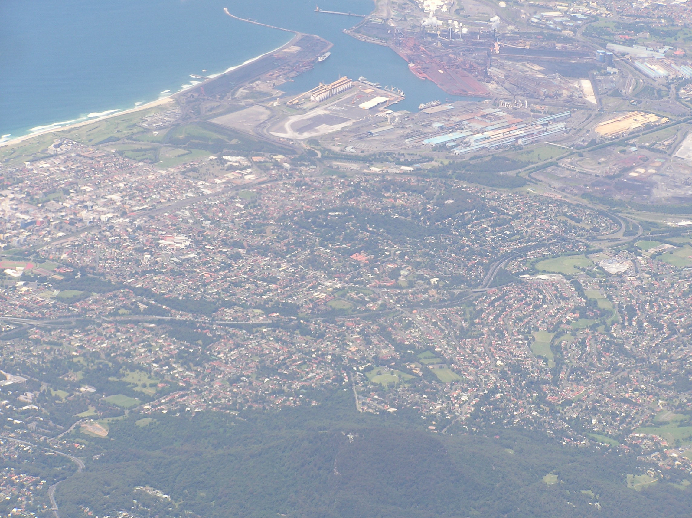
Population: 1,883[1] Postcode: 2500 Coordinates: 34°26′S 150°53′E / 34.433°S 150.883°ECoordinates: 34°26′S 150°53′E / 34.433°S 150.883°E LGA: City of Wollongong State District: Wollongong Federal Division: Cunningham Suburbs around Coniston: Wollongong Mangerton Coniston Wollongong Mount Saint Thomas Spring Hill Port Kembla Coniston is a suburb of Wollongong in New South Wales.
Coniston has one public primary school, east of the railway, and its main street is Gladstone Avenue which is the business center of the suburb. The suburb has a beach, Coniston Beach, to the east of Wollongong Golf Course, and Coniston railway station is in the suburb's business centre. Coniston has a pub, Gilmore's Hotel Coniston which is a drinking establishment. Coniston is also home to the Coniston Juniors Football Club who play at McKinnon Park, north of the commercial district. The commercial area also has several specialty stores, including a tattoo parlour, pet hair salon, computer store, aforementioned pub, and grocery store. Coniston is bordered to the west by the hill suburbs of Mangerton and Mount Saint Thomas, and from these good views of the suburb can be had. To the north is Wollongong City and the south Port Kembla.
Coniston was formerly called Mount Drummond, or South Wollongong. It is still known by some residents of Wollongong as South Wollongong, though this term generally defines all the residential area below MacCabe Park.
A local landmark is the concrete office building on Bridge Street that for many years was Coniston's only one. This large building rises above the surrounding suburb and is well known locally. It formerly housed the head offices of the Illawarra County Council, which has since become Integral Energy. Integral maintains a presence in the building, but the building and surrounding lower buildings are now now privately owned.
Coniston is just north of the Port Kembla Steelworks and includes the Greenhouse Park, a one time waste pile converted into a natural park area with a weather station. The hill, known locally as "The Overseer" has a lookout over the city and Port Kembla.
Coniston has been known as a low class area in the past, but since the early 2000s work has been in progress to revitalise it, including a new office block. Coniston is undergoing a demographic change as the children of the baby-boomers are moving out thus leaving empty nests. The original houses are being knocked down in favour of units as developers slowly encroach into the suburb.
Coniston also has a large population of Australians of Macedonian background - approximately 9 percent of the total population[1].
See also
- Drummond Battery
- Greenhouse Park
References
External links
Suburbs and Localities of Wollongong, New South Wales Albion Park · Albion Park Rail · Austinmer · Avon · Avondale · Balarang · Balgownie · Barrack Heights · Barrack Point · Bellambi · Berkeley · Blackbutt · Bombo · Broughton Village · Brownsville · Bulli · Burning Palms · Calderwood · Carrington Falls · Cleveland · Clifton · Coalcliff · Coledale · Coniston · Cordeaux · Cordeaux Heights · Corrimal · Cringila · Croom · Curramore · Dapto · Darkes Forest · Dombarton · Dunmore · East Corrimal · Fairy Meadow · Farmborough Heights · Fernhill · Figtree · Flinders · Foxground · Gerringong · Gerroa · Gwynneville · Haywards Bay · Helensburgh · Horsley · Huntley · Jamberoo · Jerrara · Kanahooka · Keiraville · Kembla Grange · Kembla Heights · Kemblawarra · Kiama · Kiama Downs · Kiama Heights · Knights Hill · Koonawarra · Lake Heights · Lake Illawarra · Lilyvale · Macquarie Pass · Maddens Plains · Mangerton · Marshall Mount · Minnamurra · Mount Keira · Mount Kembla · Mount Ousley · Mount Pleasant · Mount Saint Thomas · Mount Warrigal · North Macquarie · North Wollongong · Oak Flats · Otford · Penrose · Port Kembla · Primbee · Rose Valley · Russell Vale · Saddleback Mountain · Scarborough · Shell Cove · Shellharbour · Shellharbour City Centre · Spring Hill · Stanwell Park · Stanwell Tops · Tarrawanna · Thirroul · Tongarra · Toolijooa · Towradgi · Tullimbar · Unanderra · Upper Kangaroo Valley · Warilla · Warrawong · Werri Beach · West Wollongong · Willow Vale · Windang · Wollongong · Wombarra · Wongawilli · Woonona · Yallah · Yellow Rock
Categories:- Suburbs of Wollongong, New South Wales
Wikimedia Foundation. 2010.