- Otford, New South Wales
-
This article is about the town in NSW. For the village in England, see Otford.
Otford
Wollongong, New South Wales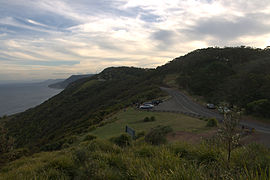
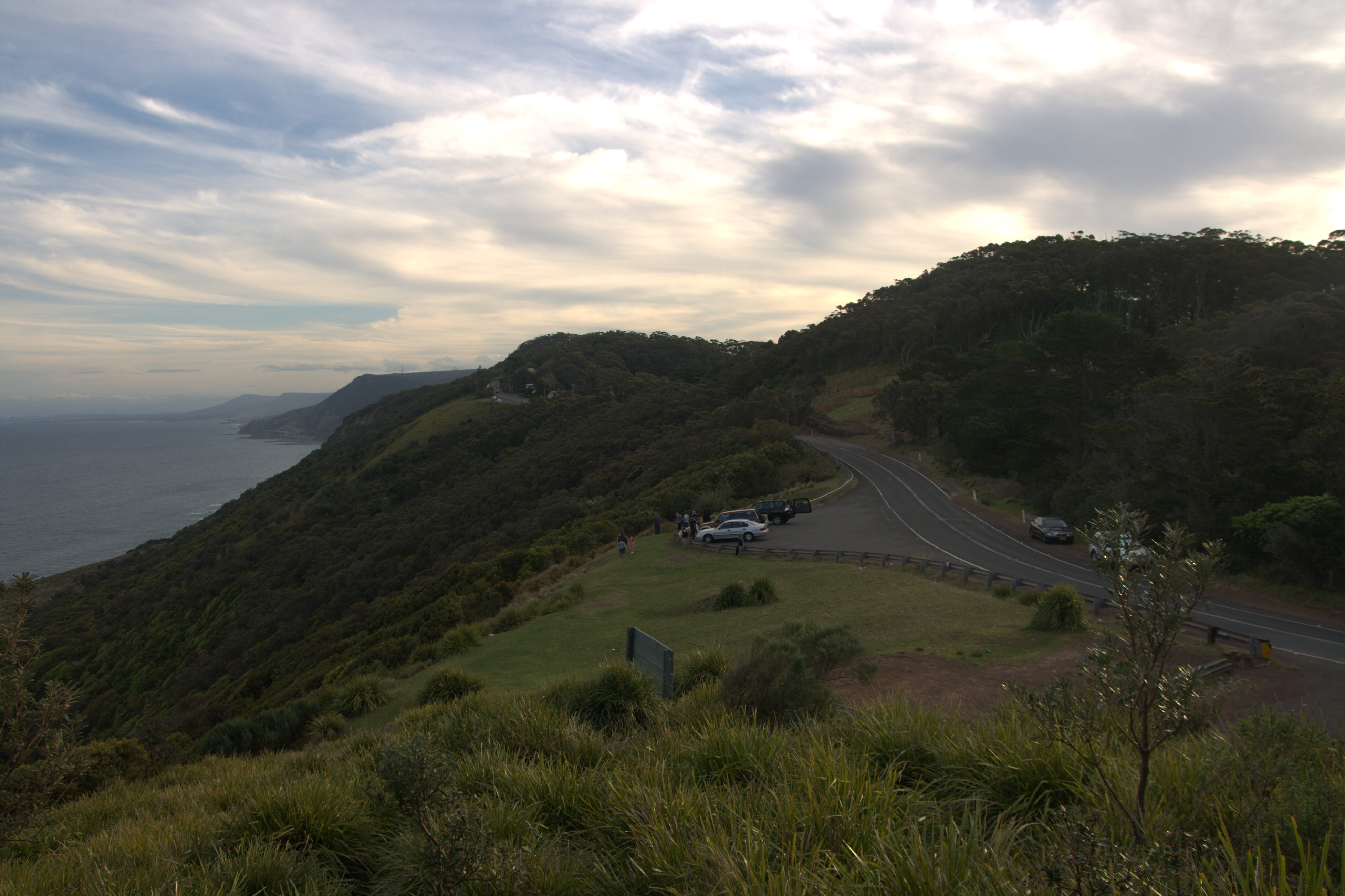
Otford LookoutPopulation: 381[1] Postcode: 2508 Coordinates: 34°13′S 151°00′E / 34.217°S 151°ECoordinates: 34°13′S 151°00′E / 34.217°S 151°E LGA: City of Wollongong State District: Heathcote Federal Division: Cunningham Suburbs around Otford: Helensburgh Lilyvale, Royal National Park Helensburgh Otford Stanwell Tops Otford is a northern suburb of Wollongong in New South Wales, Australia located near the Sydney metropolitan area. It has a railway station on the CityRail South Coast Line. It is an important stop for bushwalkers accessing the Royal National Park. Much of it is situated in the Otford Valley, north of Undola Ridge and Stanwell Park. To the east of the valley is the coastal ridge and small community of Bulgo, also the name of a hill in the area and the former name of Otford. A local attraction is the Otford Valley riding farm. Otford's coastal ridge is home to the Otford Lookout on Lawrence Hargrave Drive which has similar views south over the Illawarra as does its southern neighbour Bald Hill.
The town is on the southern tip of the Royal National Park and features many native plants in its bushland like the Dendrobium Lilly. The trees of the bushland are mostly of the dry eucalypt variety. The railway tunnel between Otford and Stanwell Park was made after annoyances in the old one (still in existence though disused) such as buildup of smoke in the unventilated route and the steep descent.[2][3] The railway achievements of the area are known as engineering feats, and the views are equally well known. The landscape is mostly hillside, and a creek runs through the valley to join the Hacking River to the north. The highest points of Otford reach over 250 metres above sea level, at Bulgo and Otford Hills. The Bulgo Range of coastal hill headland is the northern extension of the Illawarra escarpment as it gradually turns into coastal cliffs.
History
Otford was first known as Bulgo. The name Bulgo was first marked on Robert Dixon's 'Map of the Colony of New South Wales' in 1842 and the name was in use for some time after. When the construction of the Illawarra (now officially South Coast Line) line was taking place a village formed in 1885, with four houses. During that year the village grew and the first school was built, as well as a post office. In 1887 a hotel was present, along with a butchers store, bakers shop, tailor, jeweller and general store. Otford also had a billiard room and skittle alley. After construction of the railway had finished the village went into decline and the school was closed in 1893. Trains on the line stopped at Otford to take in water and a small railway and sawmill centre developed at the entrance to the tunnel. The name was changed to Otford in May 1885. A mill in the Otford valley was established by Thomas James and his three brothers in 1875 in the northern part of the village. James Forster also created a mill in 1899, but to the south. Lilyvale Mushrooms Pty. Ltd began in 1952 in a the small tunnel at Lilyvale and in 1959 two tunnels were in operation.[4]
References
- ^ Australian Bureau of Statistics (25 October 2007). "Otford (State Suburb)". 2006 Census QuickStats. http://www.censusdata.abs.gov.au/ABSNavigation/prenav/LocationSearch?collection=Census&period=2006&areacode=SSC18479&producttype=QuickStats&breadcrumb=PL&action=401. Retrieved 2009-01-14.
- ^ The Notorious Otford Tunnel and the Stanwell Park Deviation Chamberlain, B Australian Railway Historical Society Bulletin June, 1966 pp122-127
- ^ The Notorious Otford Tunnel Revisited Oakes, John Australian Railway Historical Society Bulletin, December, 2002 pp449-460
- ^ Otford - History
External links
Suburbs and Localities of Wollongong, New South Wales Albion Park · Albion Park Rail · Austinmer · Avon · Avondale · Balarang · Balgownie · Barrack Heights · Barrack Point · Bellambi · Berkeley · Blackbutt · Bombo · Broughton Village · Brownsville · Bulli · Burning Palms · Calderwood · Carrington Falls · Cleveland · Clifton · Coalcliff · Coledale · Coniston · Cordeaux · Cordeaux Heights · Corrimal · Cringila · Croom · Curramore · Dapto · Darkes Forest · Dombarton · Dunmore · East Corrimal · Fairy Meadow · Farmborough Heights · Fernhill · Figtree · Flinders · Foxground · Gerringong · Gerroa · Gwynneville · Haywards Bay · Helensburgh · Horsley · Huntley · Jamberoo · Jerrara · Kanahooka · Keiraville · Kembla Grange · Kembla Heights · Kemblawarra · Kiama · Kiama Downs · Kiama Heights · Knights Hill · Koonawarra · Lake Heights · Lake Illawarra · Lilyvale · Macquarie Pass · Maddens Plains · Mangerton · Marshall Mount · Minnamurra · Mount Keira · Mount Kembla · Mount Ousley · Mount Pleasant · Mount Saint Thomas · Mount Warrigal · North Macquarie · North Wollongong · Oak Flats · Otford · Penrose · Port Kembla · Primbee · Rose Valley · Russell Vale · Saddleback Mountain · Scarborough · Shell Cove · Shellharbour · Shellharbour City Centre · Spring Hill · Stanwell Park · Stanwell Tops · Tarrawanna · Thirroul · Tongarra · Toolijooa · Towradgi · Tullimbar · Unanderra · Upper Kangaroo Valley · Warilla · Warrawong · Werri Beach · West Wollongong · Willow Vale · Windang · Wollongong · Wombarra · Wongawilli · Woonona · Yallah · Yellow Rock
Categories:- Suburbs of Wollongong, New South Wales
Wikimedia Foundation. 2010.