- Cordeaux Heights, New South Wales
-
Cordeaux Heights
New South Wales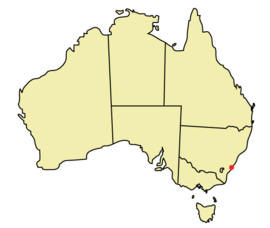
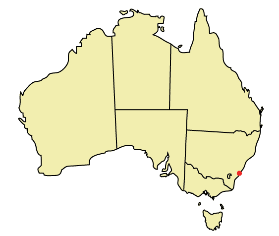
Population: 5,067[1] Postcode: 2526 Coordinates: 34°26.38′S 150°50.06′E / 34.43967°S 150.83433°ECoordinates: 34°26.38′S 150°50.06′E / 34.43967°S 150.83433°E Area: 3.8 km² (1.5 sq mi) Location: 87 km (54 mi) from Sydney LGA: City of Wollongong State District: Keira Federal Division: Cunningham Suburbs around Cordeaux Heights: Mount Kembla Figtree Cordeaux Heights Farmborough Heights Unanderra Cordeaux Heights is a suburb in the city of Wollongong, New South Wales, Australia. It is situated on the eastern foothills of Mount Kembla as is its southern neighbour Farmborough Heights. Its northern boundary of housing is along Cordeaux Road which goes to Mount Kembla Village. Cordeaux Heights has a few shops.
Cordeaux Heights was named after William Cordeaux (1792-1839) an early resident and land commissioner.[2]
Schools
- Illawarra Christian School - Cordeaux Campus
- Unanderra Public School
References
- ^ Australian Bureau of Statistics (25 October 2007). "Cordeaux Heights (State Suburb)". 2006 Census QuickStats. http://www.censusdata.abs.gov.au/ABSNavigation/prenav/LocationSearch?collection=Census&period=2006&areacode=SSC15071&producttype=QuickStats&breadcrumb=PL&action=401. Retrieved 2009-01-18.
- ^ "Place names of Wollongong". Wollongong City Library. Archived from the original on 10 March 2007. http://web.archive.org/web/20070310215404/http://www.wollongong.nsw.gov.au/library/localinfo/place.html. Retrieved 16 April 2007.
Suburbs and Localities of Wollongong, New South Wales Albion Park · Albion Park Rail · Austinmer · Avon · Avondale · Balarang · Balgownie · Barrack Heights · Barrack Point · Bellambi · Berkeley · Blackbutt · Bombo · Broughton Village · Brownsville · Bulli · Burning Palms · Calderwood · Carrington Falls · Cleveland · Clifton · Coalcliff · Coledale · Coniston · Cordeaux · Cordeaux Heights · Corrimal · Cringila · Croom · Curramore · Dapto · Darkes Forest · Dombarton · Dunmore · East Corrimal · Fairy Meadow · Farmborough Heights · Fernhill · Figtree · Flinders · Foxground · Gerringong · Gerroa · Gwynneville · Haywards Bay · Helensburgh · Horsley · Huntley · Jamberoo · Jerrara · Kanahooka · Keiraville · Kembla Grange · Kembla Heights · Kemblawarra · Kiama · Kiama Downs · Kiama Heights · Knights Hill · Koonawarra · Lake Heights · Lake Illawarra · Lilyvale · Macquarie Pass · Maddens Plains · Mangerton · Marshall Mount · Minnamurra · Mount Keira · Mount Kembla · Mount Ousley · Mount Pleasant · Mount Saint Thomas · Mount Warrigal · North Macquarie · North Wollongong · Oak Flats · Otford · Penrose · Port Kembla · Primbee · Rose Valley · Russell Vale · Saddleback Mountain · Scarborough · Shell Cove · Shellharbour · Shellharbour City Centre · Spring Hill · Stanwell Park · Stanwell Tops · Tarrawanna · Thirroul · Tongarra · Toolijooa · Towradgi · Tullimbar · Unanderra · Upper Kangaroo Valley · Warilla · Warrawong · Werri Beach · West Wollongong · Willow Vale · Windang · Wollongong · Wombarra · Wongawilli · Woonona · Yallah · Yellow Rock
Categories:- Suburbs of Wollongong, New South Wales
- Illawarra region geography stubs
Wikimedia Foundation. 2010.