- South Brisbane, Queensland
Infobox Australian Place | type = suburb
name = South Brisbane
city = Brisbane
state = qld
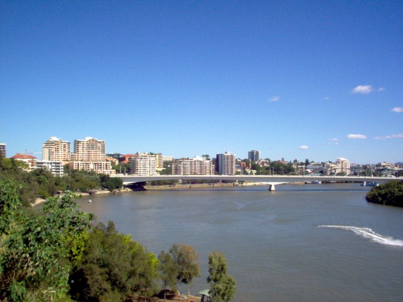
caption = |South Brisbane is dominated by riverside high-rise apartments.
lga =Brisbane City Council , Dutton Park Ward
postcode = 4101
pop = 4,285 (2006) [ [http://www.censusdata.abs.gov.au/ABSNavigation/prenav/ProductSelect?newproducttype=QuickStats&btnSelectProduct=View+QuickStats+%3E&collection=Census&period=2006&areacode=SSC31491&geography=&method=&productlabel=&producttype=&topic=&navmapdisplayed=true&javascript=true&breadcrumb=LP&topholder=0&leftholder=0¤taction=201&action=401&textversion=false 2006 Census QuickStats : South Brisbane (Brisbane City) (State Suburb) ] ]
area = 2.0
stategov = Moggill
fedgov = Griffith
near-nw = Milton
near-n = Brisbane City
near-ne = Brisbane City
near-w = West End
near-e = Brisbane City
near-sw = West End
near-s = Highgate Hill
near-se = WoolloongabbaSouth Brisbane is an inner city suburb of
Brisbane ,Australia located on the southern bank of theBrisbane River , directly connected to the central business district by the Victoria Bridge and the Goodwill Bridge. Modern public transport services include suburban train stations at South Brisbane and South Bank and South East Busway stations at Cultural Centre, South Bank, and Mater Hill.CityCat ferry services link South Brisbane to other riverside suburbs.Its fast growing population was estimated in the 2006 census at 4,285.
Geography
History
Known, along with West End and Highgate Hill as Kurilpa (Water Rat) to the local indigenous people, the area remains important in indigenous life. Musgrave Park has been for many years a place of congregation for the Murri peoples of south-east Queensland. It is the site of a
bora ring that has been buried.South Brisbane was established when a construction boom followed the opening of the railway to the south in 1884 with its terminus in the area. The suburb was previously heavily industrialised, but its regeneration began when it was selected as the location of World Expo '88, which was built on former wharves and industrial land. Following Expo '88, South Bank Parklands was built on the former Expo site.
South Brisbane has emerged as fashionable, high density, modern residential area, given its proximity to the city centre and good public transport links.
Popular Attractions
South Bank Parklands is a major feature of the suburb and popular with tourists and Brisbane residents alike. Some of Brisbane's most popular restaurants are located on Little Stanley Street where crowds gather every Friday night to dance the salsa outdoors. Nearby Grey Street has one of Brisbane's most popular cinemas, several restaurants & coffee shops and two five star hotels.
Arts & Culture
South Brisbane is home to the
Queensland Cultural Centre (with theQueensland Performing Arts Centre ,Queensland Art Gallery , Gallery of Modern Art - GoMA, State Library, andQueensland Museum ), theQueensland Maritime Museum and theBrisbane Convention & Exhibition Centre .Business
The suburb is a focal point for education with the South Bank campus of
Griffith University (which incorporates the Queensland Conservatorium,Queensland College of Art and Griffith Film School), theSouthbank Institute of Technology , theRoyal Brisbane International College ,Brisbane State High School ,St Laurence's College ,Somerville House .Mater Health Services provides a wide range of public and private medical services in the area to the south of the suburb around Mater Hill and close to its border with Woolloongabba.A number of major corporations have recently established offices in new buildings along Grey Street and Melbourne Street.
Gallery
ee also
References
External links
* [http://www.ourbrisbane.com/living/suburbs/south_brisbane/home/ Brisbane City Council website, South Brisbane section]
* [http://littlestanleystreet.net.au/ Little Stanley Street]
Wikimedia Foundation. 2010.