- South Brisbane Cemetery
-
 South Brisbane Cemetery
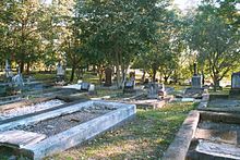
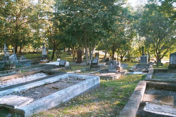
The South Brisbane Cemetery is a heritage-listed cemetery located in South Brisbane, Queensland, Australia, adjacent to the Brisbane River. It is adjacent to Dutton Park and consequently is often (incorrectly) called Dutton Park Cemetery. The cemetery was established in 1866 and remained in active use until the 1960s, after which its use has been limited by lack of space for new graves. [1]
Contents
History
In 1851, the residents of South Brisbane discovered (apparently to their surprise) that the Government of New South Wales (this being prior to the establishment of an independent colony in Queensland) had set aside around 5 acres of land for a general cemetery for South Brisbane.[2] (In 2011 that land is the site of the West End State School.) However, no trustees were ever appointed and no burials occurred.[3] In 1865, the Queensland Government decided to sell that site and use the proceeds towards another burial ground.[4]
In 1866 a grant of 18 acres of land was made for the South Brisbane Cemetery by the Queensland Government.[5] The original trustees were Thomas Blacket Stephens, Albert John Hockings, William Theophilus Blakeney, William Henry Baynes and James Mooney.[6][7] The first person buried in the cemetery was Jane Hockings in July 1870.[1]
In 1881 a Caretakers Cottage was erected. In 1888 entrance gates, a boundary wall and railings and a boundary wall were designed by architect A.B. Wilson and constructed by W. Reid at a cost of £662. In 1891 the wall was extended by R. Wilcock.[1]
The cemetery was enlarged in 1904 by the addition of 7 acres on the south side of Cornwall Street. In 1930 that section of Cornwall Street (now within the cemetery) was closed as a public road.[1]
The Brisbane City Council took over the management of the cemetery in 1928.[1]
Current Use
By the early 1960s, the cemetery was effectively full and the cemetery was closed. However, as with most closed cemeteries, additional burials and interment of ashes in existing family graves continued to occur. Some additional plots were released in the cemetery in the 1990s.[1]
The cemetery has been placed on the Queensland Heritage Register.[1]
Notable burials
- Archibald Meston, Australian politician and explorer
- Digby Denham, politician and Premier of Queensland
- Harold Parker, sculptor
References
- ^ a b c d e f g Queensland Heritage Register: South Brisbane Cemetery, accessed 30 July 2011
- ^ "DOMESTIC INTELLIGENCE.". The Moreton Bay Courier (Brisbane, Qld. : 1846 - 1861) (Brisbane, Qld.: National Library of Australia): p. 2. 30 August 1851. http://nla.gov.au/nla.news-article3713861. Retrieved 30 July 2011.
- ^ "PARLIAMENT.". The Brisbane Courier (Qld. : 1864 - 1933) (Qld.: National Library of Australia): p. 3. 12 September 1865. http://nla.gov.au/nla.news-article1278419. Retrieved 30 July 2011.
- ^ "LEGISLATIVE ASSEMBLY.". The Brisbane Courier (Qld. : 1864 - 1933) (Qld.: National Library of Australia): p. 3. 7 September 1865. http://nla.gov.au/nla.news-article1278158. Retrieved 30 July 2011.
- ^ "WEEKLY EPITOME.". The Brisbane Courier (Qld. : 1864 - 1933) (Qld.: National Library of Australia): p. 5. 17 March 1866. http://nla.gov.au/nla.news-article1264233. Retrieved 30 July 2011.
- ^ "GOVERNMENT NOTIFICATIONS.". The Brisbane Courier (Qld. : 1864 - 1933) (Qld.: National Library of Australia): p. 3. 15 February 1866. http://nla.gov.au/nla.news-article1262516. Retrieved 30 July 2011.
- ^ "Friends of South Brisbane Cemetery: South Brisbane Cemetery People". http://www.southbrisbanecemetery.org/sbc%20people.html. Retrieved 30 July 2011.
External Links
- Brisbane City Council Grave Location Search, includes the burial register for South Brisbane cemetery
- Friends of South Brisbane Cemetery
Categories:- Cemeteries in Queensland
- Brisbane
Wikimedia Foundation. 2010.