- Moree, New South Wales
-
For the town in Ghana, see Moree, Ghana.
Moree
New South Wales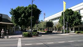
Main street, Moree
 Moree
MoreePopulation: 8,083[1] Established: 1862 Postcode: 2400 Coordinates: 29°27′57″S 149°50′02″E / 29.46583°S 149.83389°ECoordinates: 29°27′57″S 149°50′02″E / 29.46583°S 149.83389°E Elevation: 212 m (696 ft) Location: - 628 km (390 mi) from Sydney
- 480 km (298 mi) from Brisbane
- 380 km (236 mi) from Dubbo
- 272 km (169 mi) from Tamworth
- 129 km (80 mi) from Goondiwindi
LGA: Moree Plains Shire County: Courallie State District: Barwon Federal Division: Parkes Mean max temp Mean min temp Annual rainfall 26.6 °C
80 °F12.2 °C
54 °F578 mm
22.8 in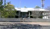 Moree Lands Office, Frome Street
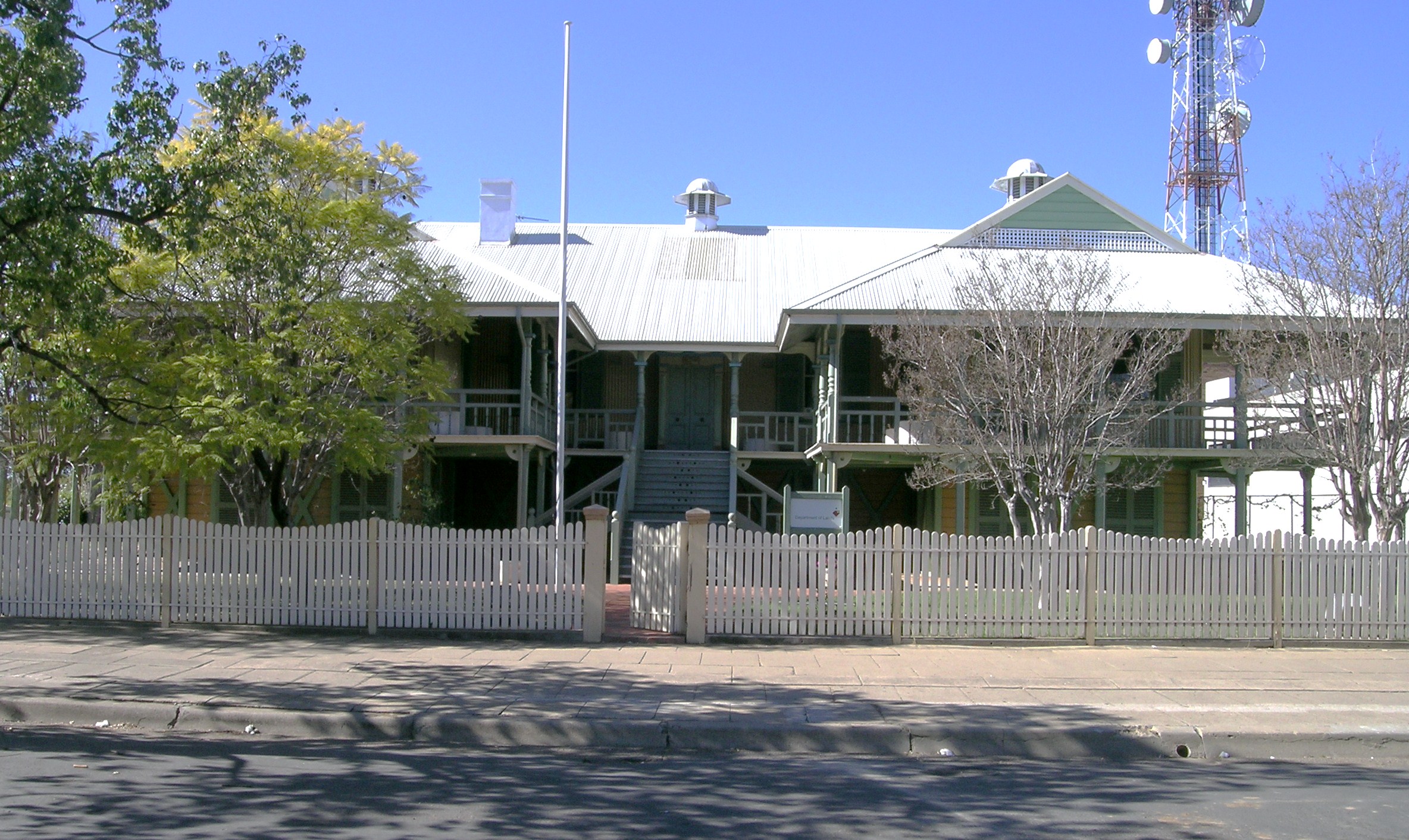
 Moree Court House, Frome Street
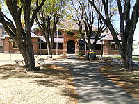
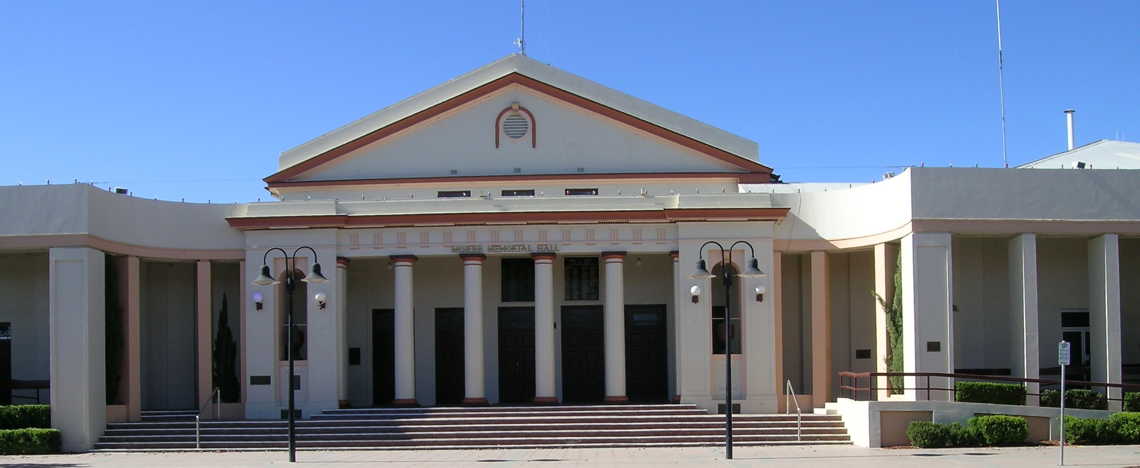
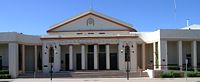 Moree Memorial Hall
Moree is a large town in Moree Plains Shire in northern New South Wales, Australia. It is located on the banks of the Mehi River in the centre of the rich black-soil plains.
Moree is a major agricultural centre, noted for its part in the Australian cotton growing industry which was established there in the early 1960s. The town is located at the junction of the Newell Highway and Gwydir Highway and can be reached by daily train and air services from Sydney. It is situated in the Shire of Moree Plains. Like many towns and cities in Australia, Moree shares its name with a much smaller community in Northern Ireland Moree County Tyrone. At the 2001 census, Moree had a population of 9,247[2] declining to 8,083 in 2006.[1]
Moree is home to artesian hot spring baths which are famous for their reputed healing qualities.[3]
Contents
History
The Kamilaroi people, whose descendants are still in the town, were the early inhabitants of the area. Major Sir Thomas Mitchell went to the district at the request of the acting governor after the recapture of escaped convict George Clarke who told of a great river called the Kindur in 1832. Clarke had been living in the area to the south with the Kamilaroi from 1826-1831. Squatters soon followed in Mitchell's wake establishing pastoral runs, among which was 'Moree' (1844), from a Kamilaroi term believed to mean either 'long waterhole' or 'rising sun'.
In 1851 James and Mary Brand arrived and built a general store on the banks of the river in 1852. A post office was added the following year. The family sold up and moved to the Hunter Valley in 1857 but James died in 1858 leaving Mary with six children so she returned opened another business and in 1861 she opened the town's first inn.[3]
Moree was gazetted as a town in 1862 with land sales proceeding that year. A court of petty sessions was established in 1863 and was followed by a severe flood in 1864. The first constable arrived and a police station was set up in 1865. The first church (Wesleyan) was built in 1867 when the town had a population of 43.[3]
As closer settlement proceeded agriculture emerged as a thriving industry on the fertile flood plains. Banking began in 1876 and the first local newspaper was set up in 1881, at which time the population was 295.
The town became a municipality in 1890. During 1894 construction of the heritage listed Federation-style lands office commenced and ended that years with the completion of the ground floor. The second storey was added in 1903. In 1895 the Great Artesian Basin which sits under Moree was tapped and yields over thirteen million litres of water every day. The bore was sunk to 3,000 ft (900 m) deep in order to provide water for agricultural pursuits but was proved unsuitable for this purpose. The railway line and service from Sydney arrived in 1897.[3]
Wheat cultivation increased after World War II with a flour mill built at Moree in 1951 and the first commercial pecan nut farm was established on the Gwydir Highway east of Moree in 1966. The Trawalla Pecan Nut Farm is the largest pecan nut farm in the southern hemisphere, growing about 75,000 trees. In 1994 the Gwydir Olive Grove Company was established when two Moree families started producing olive oil from olives grown in the area.[4]
Moree was one of the destinations of the famous 1965 Freedom Bus ride, an historic trip through northern NSW led by the late Charles Perkins to bring media attention to discrimination against Indigenous Australians. It brought racial segregation in rural Australia to the attention of urban Australians, in particular at the Moree public swimming pool as well as pubs and theatres, where Aborigines were refused entry. At the Moree swimming pool, after a confrontation with the council and pool management, it was agreed that Indigenous children could swim in the pool outside school hours.[5] [6][7]
In 2007 the Moree Plains Council announced plans for a $14m upgrade to the hot thermal baths.[4]
Heritage listed sites:
- CBC Bank (former)
- Mellor House
- Moree Club
- Moree Courthouse
- Moree Lands Office
- Moree Spa Baths
- Victoria Hotel Moree
Media
Moree is served by The Moree Champion newspaper owned by Rural Press which is published on Tuesdays and Thursdays.
Radio stations 2VM and 98.3 NOW FM also broadcast from Moree. The NOW FM transmitter site is located on Mt Dowe, whilst the 2VM transmitter is located 5 kilometers east of Moree on the Gwydir Highway. Both stations are owned by the Broadcast Operations Group and broadcasts weekday breakfast and afternoon programs.
Prime Television's Tamworth station also had a News Bureau in Moree, but this was closed down in 2000 due to budget deficiencies. Cameron Hammond first indigenous male from Moree , to go to the Commonwealth games in Delhi, 2010.
Transport
The town is served by the daily Countrylink Xplorer train service to Sydney as well as regular Qantas airline services, as well as the recent addition of Brindabella airlines, connecting Moree to Brisbane twice weekly.[8]
-
- QF2180 07:00 09:00 Weekdays & Saturday
- QF2186 09:25 11:25 Sunday
- QF2192 17:50 19:50 Weekdays & Sunday
Railway station
 Moree
Moree
CountryLink North Western Station code MRZ Suburb Moree East Street(s) Distance from Central Station 665km km Station Altitude (above sea level) {{{altitude}}} m Types of stopping trains CountryLink Number of platforms 1 Number of tracks 1 Platform arrangement {{{platform_arr}}} Type of station Ground Transfers available Disabled access Moree railway station is situated on the Mungindi, or North West railway line, 665 kilometres (413 mi) from Sydney.[9] The station opened in 1897 and currently marks the northernmost point of passenger services on the line, a single daily Xplorer diesel railcar to and from Sydney
Preceding station NSW Main lines Following station Camurratowards MungindiMungindi Line Gurleytowards Werris CreekPreceding station CountryLink Following station Terminus CountryLink North Western Bellatatowards SydneyNotable people
The youngest child of English author Charles Dickens, Edward Bulwer Lytton Dickens (1852–1902) emigrated to Australia, living in Moree and became MP for Wilcannia. He is buried in Moree cemetery.[10]
Mary Gaudron was the first female Justice of the High Court of Australia.
Mary Brand was the first European woman to own a shop in Moree. A replica of her shop and house are situated in Mary Brand Park in Moree. She is also buried in the Moree Cemetery.
Peter Taylor, who retired from the Australian Cricket Team, now lives in Moree.[citation needed]
John Williamson has strong roots in Moree, his mother and a large part of his extended family still live there.
Australian rugby union player Van Humphries grew up in Moree.
Climate
Climate data for Moree Month Jan Feb Mar Apr May Jun Jul Aug Sep Oct Nov Dec Year Record high °C (°F) 43.0
(109.4)43.0
(109.4)40.4
(104.7)34.0
(93.2)30.6
(87.1)27.1
(80.8)24.4
(75.9)36.1
(97.0)37.8
(100.0)39.8
(103.6)42.6
(108.7)42.5
(108.5)43.0
(109.4)Average high °C (°F) 33.7
(92.7)32.9
(91.2)30.9
(87.6)27.1
(80.8)22.4
(72.3)18.9
(66.0)18.0
(64.4)20.4
(68.7)24.4
(75.9)27.8
(82.0)30.1
(86.2)32.3
(90.1)26.6 Average low °C (°F) 19.8
(67.6)19.6
(67.3)16.8
(62.2)12.4
(54.3)8.0
(46.4)5.7
(42.3)4.3
(39.7)5.3
(41.5)9.0
(48.2)12.6
(54.7)16.1
(61.0)18.1
(64.6)12.3 Record low °C (°F) 10.8
(51.4)9.9
(49.8)5.9
(42.6)1.2
(34.2)−1.8
(28.8)−3.4
(25.9)−4.3
(24.3)−3.8
(25.2)−1.9
(28.6)2.6
(36.7)5.0
(41.0)7.7
(45.9)−4.3
(24.3)Precipitation mm (inches) 81.4
(3.205)73.6
(2.898)48.2
(1.898)23.6
(0.929)27.8
(1.094)43.2
(1.701)38.4
(1.512)28.0
(1.102)33.9
(1.335)49.3
(1.941)79.3
(3.122)71.4
(2.811)595.2
(23.433)Avg. precipitation days 6.8 6.8 5.6 4.0 5.1 6.2 6.2 5.0 5.4 7.1 8.9 9.0 76.1 Source: [11] See also
References
- ^ a b Australian Bureau of Statistics (25 October 2007). "Moree (Urban Centre/Locality)". 2006 Census QuickStats. http://www.censusdata.abs.gov.au/ABSNavigation/prenav/LocationSearch?collection=Census&period=2006&areacode=UCL154600&producttype=QuickStats&breadcrumb=PL&action=401. Retrieved 2008-07-01.
- ^ Australian Bureau of Statistics (9 March 2006). "Moree (Urban Centre/Locality)". 2001 Census QuickStats. http://www.censusdata.abs.gov.au/ABSNavigation/prenav/LocationSearch?collection=Census&period=2001&areacode=UCL154600&producttype=QuickStats&breadcrumb=PL&action=401. Retrieved 2007-06-30.
- ^ a b c d Readers Digest Guide to Australian Places, Reader’s Digest (Australia) Pty. Limited, Surry Hills N.S.W., 1993, ISBN 0864383991
- ^ a b Tourism Moree, Moree,2007/2008
- ^ Curthoys, Ann (4 September 2002). "The Freedom Ride – Its Significance Today" (pdf). Australian National University. Archived from the original on 2007-08-29. http://web.archive.org/web/20070829153222/http://arts.anu.edu.au/nih/FreedomRide_notes.pdf. Retrieved 2007-09-08.
- ^ "Unknown". The Sydney Morning Herald. 13 February 2005.
- ^ Stone, Gerry (21 February 1965). "Violence explodes in racist rown". The Australian Freedom Rides/Sunday Mirror. http://freedomride.net/. Retrieved 2007-09-08.
- ^ "Flights to Moree". Qantas. http://www.qantas.com.au/regions/dyn/home/qualifier-region-au. Retrieved 2007-09-08.
- ^ Moree Railway Station. NSWrail.net. Accessed 1 April 2008.
- ^ "Grave Photo Link". National Library of Australia. http://nla.gov.au/nla.pic-an11306721-18. Retrieved 2007-09-08.
- ^ "Climate statistics for Moree". Bureau of Meteorology. http://www.bom.gov.au/climate/averages/tables/cw_053115_All.shtml. Retrieved 21 September 2011.
Categories:- Towns in New South Wales


Wikimedia Foundation. 2010.