- Gold Coast City
-
Gold Coast City
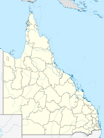
Queensland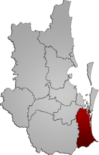
Gold Coast in South East QueenslandPopulation: 527,828(2010)[1] • Density: 366.6/km² (949.5/sq mi) Established: 1948 Area: 1358 km² (524.3 sq mi) Mayor: Ron Clarke Council Seat: Surfers Paradise Region: South East Queensland State District: Albert, Broadwater, Burleigh, Coomera, Currumbin, Gaven, Mermaid Beach, Mudgeeraba, Southport, Surfers Paradise Federal Division: Fadden, Forde, McPherson, Moncrieff 
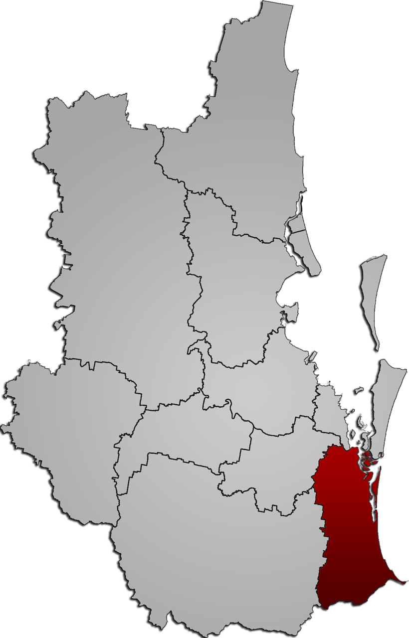
LGAs around Gold Coast City: Logan Redland Redland Scenic Rim Gold Coast City Pacific Ocean Tweed (NSW) Tweed (NSW) Pacific Ocean Gold Coast City is the local government area spanning the Gold Coast, Queensland, and surrounding areas. Based on resident population, it is the second largest local government area in Australia and its council maintains a staff of over 2,500. It was established in 1948, but has existed in its present form since 1995.
Contents
History
Early history
By the late 1870s, the Government of Queensland had become preoccupied with the idea of getting local residents to pay through rates for local services, which had become a massive cost to the colony and were undermaintained in many areas. The McIlwraith government initiated the Divisional Boards Act 1879 which created a system of elected divisional boards covering most of Queensland. It was assented by the Governor on 2 October 1879, and on 11 November 1879, the Governor gazetted a list of 74 divisions which would come into existence. Four of these—Nerang, Coomera, Beenleigh and Waterford—were in the Gold Coast region. Southport was developed as both an administrative centre as well as a holiday destination with hotels and guesthouses to cater for visitors. Town dwellers had different needs to the rural landholders so Southport ratepayers lobbied the colonial government to create a separate Divisional Board so that rates monies raised by Southport landholders could be spent on town improvements. This resulted in the Southport Divisional Board on 14 July 1883.
On 31 March 1903, following the enactment of the Local Authorities Act 1902, the divisions became shires. On 12 June 1914, the Town of Coolangatta was created from part of the Shire of Nerang, and on 12 April 1918, Southport became a Town.
Development and growth
 Gold Coast City (Queensland)
On 9 December 1948, as part of a major reorganisation of local government in South East Queensland, an Order in Council renamed Southport to "Town of the South Coast" and amalgamated Coolangatta and coastal sections of the Shire of Nerang into the town's area, creating a narrow coastal strip. The same Order abolished all of the earlier Shires and amalgamated most of their area into the new Shire of Albert, with the rest becoming part of the Shire of Beaudesert. The Order came into effect on 10 June 1949, when the first elections were held for the new councils.
On 23 October 1958, the Town of the South Coast adopted the name of Gold Coast Town, and on 16 May 1959, the Town was proclaimed as a City by the Governor, having met the requirements for city status. Most of what is now regarded as the Gold Coast urban area was at that time located within the Shire of Albert, which had its administrative offices in Nerang-Southport Road, Nerang.
A regional authority
On 21 November 1991, the Electoral and Administrative Review Commission, created two years earlier, produced its second report, and recommended that local government boundaries in South East Queensland be rationalised with a view to creating stronger local authorities with a single community of interest. After much public debate, Local Government (Albert, Beaudesert and Gold Coast) Regulation 1994 was gazetted on 16 December 1994, resulting in the amalgamation of the Shire of Albert into Gold Coast City at the 1995 local government elections.
In 2007, as part of a report recommending massive amalgamation of local government in Queensland, the Local Government Reform Commission recommended that the Beenleigh-Eagleby region on the Gold Coast's northern border be transferred to Logan City, on the basis that a common community of interest existed and that planning of the South East Queensland urban footprint would be made more efficient by the change. The area to be excised was estimated by the Commission to have an area of 49 km2 (18.9 sq mi) and a population of 40,148. The change took effect at the 15 March 2008 local government elections.
Suburbs and localities
Main article: List of Gold Coast suburbsGold Coast City consists of the following suburbs and localities:
Gold Coast suburbs:
- Arundel
- Ashmore
- Benowa
- Biggera Waters
- Bilinga
- Broadbeach
- Broadbeach Waters
- Bundall
- Burleigh Heads
- Burleigh Waters
- Carrara
- Clear Island Waters
- Coolangatta
- Coombabah
- Currumbin
- Currumbin Waters
- Elanora
- Gaven
- Helensvale
- Highland Park
- Hollywell
- Hope Island
- Labrador
- Main Beach
- Mermaid Beach
- Mermaid Waters
- Merrimac
- Miami
- Molendinar
- Nerang
- Oxenford
- Pacific Pines
- Palm Beach
- Paradise Point
- Parkwood
- Reedy Creek
- Robina
- Runaway Bay
- Southport
- Surfers Paradise
- Tugun
- Varsity Lakes
North of Coomera River:
- Alberton
- Cedar Creek
- Coomera
- Gilberton
- Jacobs Well
- Kingsholme
- Luscombe
- Norwell
- Ormeau
- Ormeau Hills
- Pimpama
- South Stradbroke Island
- Stapylton
- Steiglitz
- Upper Coomera
- Willow Vale
- Wongawallan
- Woongoolba
- Yatala
Western region:
- Advancetown
- Austinville
- Bonogin
- Clagiraba
- Currumbin Valley
- Gilston
- Guanaba
- Lower Beechmont
- Maudsland
- Mount Nathan
- Mudgeeraba
- Natural Bridge
- Numinbah Valley
- Springbrook
- Tallebudgera
- Tallebudgera Valley
- Tallai
- Worongary
Divisions and councillors
Gold Coast City has been divided into 14 divisions, each electing one councillor at elections held every four years. The most recent local government election was on 15 March 2008. Additionally, a mayor is elected by the entire City. The present mayor is Cr Ron Clarke.
Divisional Councillors are:
- Division 1 Cr Donna Gates - Yatala
- Division 2 Cr John Wayne - Coomera
- Division 3 Cr Grant Pforr - Paradise Point
- Division 4 Cr Margaret Grummitt - Biggera Waters
- Division 5 Cr Peter Young - Pacific Pines
- Division 6 Cr Dawn Crichlow - Southport
- Division 7 Cr Susie Douglas - Surfers Paradise
- Division 8 Cr Robert La Castra - Ashmore
- Division 9 Cr Ted Shepherd - Mudgeeraba
- Division 10 Cr Eddy Sarroff - Broadbeach
- Division 11 Cr Jan Grew - Robina
- Division 12 Cr Greg Betts - Burleigh Heads
- Division 13 Cr Daphne McDonald (Deputy Mayor) - Palm Beach
- Division 14 Cr Chris Robbins - Coolangatta
Population
Populations are provided below for the Gold Coast (Southport/Coolangatta, South Coast, Gold Coast) and Albert entities. As Albert included the entire Logan City area prior to 1978, figures are only provided from the 1976 census.
Year Population
(Gold Coast)Annual
growth (%)Population
(Albert)Annual
growth (%)1933 6,046 N/A 1947 13,888 6.12 1954 19,807 5.20 1961 33,716 7.90 1966 49,481 7.97 1971 66,697 6.15 1976 87,510 5.58 18,753 N/A 1981 117,824 6.13 54,870 23.95 1986 130,304 2.03 92,766 11.07 1991 157,857 3.91 143,697 9.15 Year Population Annual
growth (%)1991 301,554 6.21 1996 375,175 4.47 2001 441,736 3.32 2006 507,876 2.83 Council Officer Accommodation
Accommodation for Council officers has been an issue of some controversy since amalgamation of Gold Coast City with Albert Shire in 1996. The largest office is at Nerang but Council itself meets at the Evandale Office. Discussions about where a new combined central office have been ongoing with sites including Southport, Robina, Nerang, Evandale and Beenleigh all being investigated. Growth in staff numbers has meant existing Council owned office space is no longer sufficient and so commercial offices have been rented at Waterside West (Bundall) and at Varsity Lakes. The Robina NRL stadium was touted as a location for a new office tower for Council. Council resolved during October 2008 to construct a new highrise headquarters at Evandale, but the CEO is still promoting options at either Robina or Southport. The mayor has suggested options to secure space in highrises that have stalled due to the credit crisis. In 2009 a new plan emerged to vacate existing office space at Nerang and Surfers Paradise and move to three new green rated buildings at Southport (next to the library) and at Robina and Coomera (next to the stations).
Key projects
- Gold Coast University Hospital- to be completed 12/12/12
- Tugun Desalination Plant
- Raising of Hinze Dam
- Gold Coast Oceanway
- Southport Broadwater Parklands
- Gold Coast Rapid Transit System
- Gold Coast Ferry Service
- Rosser Park Regional Botanic Gardens
- Evandale Cultural Precinct including a greenbridge from Evandale Parklands to Chevron Island
- Mermaid Waters Library
- Gold Coast Bold Future
- Gold Coast Shoreline Management Plan
- Community bike hire [2]
See also
References
- ^ Australian Bureau of Statistics (31 March 2011). "Regional Population Growth, Australia, 2009–10". http://www.abs.gov.au/ausstats/abs@.nsf/Products/3218.0~2009-10~Main+Features~Queensland?OpenDocument. Retrieved 11 June 2011.
- ^ Gold Coast Community Bike Hire
External links
Gold Coast, Queensland Suburbs: Arundel · Ashmore · Benowa · Biggera Waters · Bilinga · Broadbeach · Broadbeach Waters · Bundall · Burleigh Heads · Burleigh Waters · Carrara · Clear Island Waters · Coolangatta · Coombabah · Coomera · Currumbin · Currumbin Waters · Elanora · Gaven · Helensvale · Highland Park · Hollywell · Hope Island · Labrador · Main Beach · Mermaid Beach · Mermaid Waters · Merrimac · Miami · Molendinar · Nerang · Oxenford · Pacific Pines · Palm Beach · Paradise Point · Parkwood · Robina · Runaway Bay · Southport · Surfers Paradise · Tugun · Upper Coomera · Varsity LakesWestern localities: Northern localities: Local Government Areas in South East Queensland Brisbane · Gold Coast · Ipswich · Logan · Lockyer Valley · Moreton Bay · Redland · Scenic Rim · Somerset · Sunshine CoastLocal Government Areas of Queensland South East Brisbane · Gold Coast · Ipswich · Lockyer Valley · Logan · Moreton Bay · Redland · Scenic Rim · Somerset · Sunshine CoastWide Bay-Burnett Darling Downs Central Central Highlands · Gladstone · Isaac · Mackay · Rockhampton · WoorabindaNorth Far North Aurukun · Cairns · Cassowary Coast · Cook · Hopevale · Kowanyama · Lockhart River · Mapoon · Napranum · Northern Peninsula Area · Pormpuraaw · Tablelands · Torres · Torres Strait Islands · Weipa · Wujal Wujal · YarrabahNorth West Central West South West Coordinates: 28°00′04″S 153°25′42″E / 28.00111°S 153.42833°E
Categories:- Populated places established in 1948
- 1948 establishments in Australia
- Gold Coast, Queensland
- Local Government Areas of Queensland

Wikimedia Foundation. 2010.