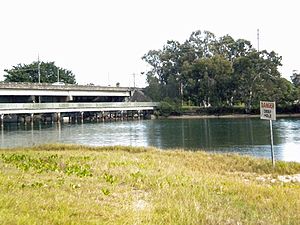
- Currumbin, Queensland
-
"Currumbin" redirects here. For the Queensland electoral division, see Electoral district of Currumbin.
Currumbin
Gold Coast, QueenslandPopulation: 2,647 (2006)[1] Postcode: 4223 LGA: Gold Coast City State District: Currumbin Federal Division: McPherson [2] Suburbs around Currumbin: Elanora Palm Beach Pacific Ocean Currumbin Waters Currumbin Pacific Ocean Currumbin Waters Currumbin Waters Tugun Currumbin is a suburb in the Gold Coast region of Queensland, Australia. At the 2006 Census, Currumbin had a population of 2,647.
Contents
History
Many of the houses at Currumbin date from the period of its earliest subdivision and the area contains a substantial grouping of fibro beach houses. Since then later development has occurred including some high rise backing onto the hillside at Pacific Parade.
Generally the area contains more natural vegetation than other areas of the coast due in part to the difficulty of building on the steep hillsides and in part to the presence of the Currumbin Wildlife Sanctuary - a long standing icon and landmark at the Gold Coast. The Sanctuary comprises a substantial area of land on both sides of the highway adjacent to Flat Rock Creek.
Geography
The Currumbin area is one of a particular character. Stretching from Currumbin Creek in the north to Wyberba Street in the south the area is easily identified because of its headlands that project into the beach. The Pacific Highway skirts to the rear of Currumbin creating something of a quaint backwater. Even the more usual commercial development of the Gold Coast Highway is absent as the highway winds over the headland and past the Currumbin Wildlife Sanctuary.
At the beach front, Elephant Rock and Currumbin Rock enclose a discrete surf beach. Currumbin Alley is a popular surfing site formed on the bar of Currumbin Creek, particularly for longboards. Some properties to the south are only separated from the beach by an undeveloped public road reserve and the elevated land provides opportunities for views unusual at the coast.
The Currumbin Valley Reserve is located west of Currumbin. Of late, developments in the area have started to destroy the natural rainforests and wildlife.
The Gold Coast Oceanway follows a beachfront alignment around Currumbin Alley and along Currumbin Beach. Between Tomewin Street and Flat Rock the current Oceanway pavements swing inland along Temmangum Street. The local community have signed petitions asking for the Oceanway pavements to be realigned to the beachfront public road reserve. Other local residents are concerned about CPTED issues and have signed petitions requesting that the Oceanway remain along its current inland alignment.[citation needed]
The Currumbin Rock Pools are a popular swimming hole in the upper part of Currumbin Creek.[citation needed]
The City Council dredges the entrance of Currumbin Creek each year for flood mitigation, water quality, beach nourishment and navigation.
Events
Each year during September, the Swell Sculpture Festival is held along the Oceanway at Currumbin between Currumbin Creek and Elephant Rock. Elephant rock becomes a pedestal for a signature artwork. Other artwork is spread out along the Oceanway pavements and upon the beach and dune areas. Artwork from the festival often finds its way onto display on public and private spaces across the Gold Coast region including a horse in the park at Broadbeach, Fish along the foreshore at Harley Park, Pelicans along the bank of Currumbin Creek, a seal mother and pup along the Oceanway at Miami, a ship up on Point Danger and a metal goddess within a subdivision at Reedy Creek.
Nearby the Currumbin In The Bin short film festival usually coincides with the Swell Sculpture festival held in the carpark opposite the Currumbin Wildlife Sanctuary.
See also
References
- ^ Australian Bureau of Statistics (25 October 2007). "Coombabah (State Suburb)". 2006 Census QuickStats. http://www.censusdata.abs.gov.au/ABSNavigation/prenav/LocationSearch?collection=Census&period=2006&areacode=SSC32091&producttype=QuickStats&breadcrumb=PL&action=401. Retrieved 2009-05-07.
- ^ (Australian Electoral Commission)
External links
- University of Queensland: Queensland Places: Currumbin
- Heritage Tour - Currumbin Area
- Swell Sculpture Festival
- In the bin short film festival
Gold Coast, Queensland Suburbs: Arundel · Ashmore · Benowa · Biggera Waters · Bilinga · Broadbeach · Broadbeach Waters · Bundall · Burleigh Heads · Burleigh Waters · Carrara · Clear Island Waters · Coolangatta · Coombabah · Coomera · Currumbin · Currumbin Waters · Elanora · Gaven · Helensvale · Highland Park · Hollywell · Hope Island · Labrador · Main Beach · Mermaid Beach · Mermaid Waters · Merrimac · Miami · Molendinar · Nerang · Oxenford · Pacific Pines · Palm Beach · Paradise Point · Parkwood · Robina · Runaway Bay · Southport · Surfers Paradise · Tugun · Upper Coomera · Varsity LakesWestern localities: Northern localities: Categories:- Suburbs of the Gold Coast, Queensland
Wikimedia Foundation. 2010.

