- Coolangatta, Queensland
-
Coordinates: 28°10′0″S 153°32′0″E / 28.166667°S 153.533333°E
Coolangatta
Gold Coast, QueenslandPopulation: 4,869[1] Postcode: 4225 Location: - 25 km (16 mi) from Surfers Paradise
- 104 km (65 mi) from Brisbane
LGA: Gold Coast City State District: Currumbin Federal Division: McPherson Suburbs around Coolangatta: Bilinga Pacific Ocean Pacific Ocean Bilinga Coolangatta Pacific Ocean Tweed Hds W. Tweed Heads Tweed Heads Coolangatta is the southernmost suburb of the Gold Coast, Queensland, Australia. It has a population of 4,869 and is named after the schooner Coolangatta which was wrecked there in 1846.
Coolangatta and its immediate neighbouring "Twin Town" Tweed Heads in New South Wales have a shared economy. The Tweed River supports a thriving fishing fleet, and the seafood is a local specialty offered in the restaurants and clubs of the holiday and retirement region on both sides of the state border.
The Gold Coast Airport, formerly known as Coolangatta Airport, is located at Coolangatta, with some of the runway going across the border into New South Wales.
Contents
History
Early settlement
Coolangatta was one of the earliest settlements on the Gold Coast. Once again focused on a steep headland at Point Danger the area was occupied by Europeans from at least 1828 by a convict station and red cedar getters soon followed. Selectors followed in the 1860s and a small settlement at Coolangatta was established. In 1883 a township was surveyed.
Border town
As a border town Coolangatta included a customs office, boatshed and government wharf. Extension of the railway from Nerang to Tweed Heads in 1903 guaranteed the success of Coolangatta as a holiday township and it flourished from that time forward. Guesthouses and hotels were erected and a commercial centre soon followed.
Little remains of the earliest buildings at Coolangatta but some evidence remains of subsequent development in the early years of the twentieth century. The border fence and gates that until recently were a characteristic of the area have now been removed but the sense of the border remains at Boundary Street running along the ridge of the headland between Queensland and New South Wales. The headland itself is an important landmark and tourist destination. Coolangatta symbolises the terminus of the Gold Coast and the long strip of beach that begins at Main Beach forty kilometres to the north.
To commemorate the centenary of the town, in 1984 a stone from the Coolangatta Estate homestead was donated by the citizens of Coolangatta near Berry, New South Wales and was mounted on a plinth of granite from Aberdeen, Scotland, the birthplace of Alexander Berry.
Geography
Climate
Coolongatta has a humid subtropical climate (Köppen climate classification Cfa) with warm, wet summers and cool, moist winters. Although there is four times as much rainfall in March as there is in September, Coolongatta is still considered to have no dry season because there is more than a tenth of the rainfall of the wettest month in the driest month of the year.
Climate data for Coolangatta Month Jan Feb Mar Apr May Jun Jul Aug Sep Oct Nov Dec Year Average high °C (°F) 28.1
(82.6)28.1
(82.6)27.0
(80.6)25.2
(77.4)23.1
(73.6)21.0
(69.8)20.5
(68.9)21.1
(70.0)23.0
(73.4)24.2
(75.6)25.5
(77.9)27.0
(80.6)24.5 Average low °C (°F) 20.9
(69.6)20.8
(69.4)19.6
(67.3)16.9
(62.4)14.1
(57.4)11.4
(52.5)10.2
(50.4)10.5
(50.9)13.4
(56.1)16.0
(60.8)17.9
(64.2)19.7
(67.5)16.0 Precipitation mm (inches) 145.2
(5.717)168.1
(6.618)175.5
(6.909)171.3
(6.744)149.9
(5.902)130.5
(5.138)75.2
(2.961)55.2
(2.173)42.4
(1.669)87.9
(3.461)139.6
(5.496)140.7
(5.539)1,490.2
(58.669)Source: Bureau of Meteorology[2] Schooner Coolangatta
A topsail schooner of 83 feet (25 m) in length and 88 long tons (89 t), Coolangatta was built by James Blinkcell in 1843 for Alexander Berry whose property, Coolangatta Estate, adjoined Coolangatta mountain located on the northern bank of the Shoalhaven River, New South Wales.
Coolangatta was wrecked on Kirra / Bilinga Beach adjacent to a creek during a storm on Wednesday August 18, 1846.
On July 6, 1846, the ship sailed under Captain Steele from Brisbane, carrying two convict prisoners (George Craig in irons, and William George Lewis), to load red cedar logs at the Tweed River for Sydney. Steele found the river entrance closed by silt forming a bar, so he anchored in the lee of Point Danger off Kirra Beach. Red cedar logs were then hauled overland from Terranora Inlet and rafted from the beach, but in six weeks less than half of the contracted 70,000 feet of red cedar had been loaded. Meanwhile, five ships loaded with red cedar were bar-bound inside the river.
On August 18, 1846, while Steel was ashore, a south-east gale blew up. Steele's boat was damaged while getting through the surf and he watched from the beach as the gale intensified. Eventually, the prisoners were freed and all hands abandoned ship and swam for shore as the anchors dragged. The ship parted its anchors and washed ashore near what was later called Coolangatta Creek.
The survivors walked 70 miles (110 km) north to Amity Point in six days, fed each night by different groups of friendly indigenous Australians, and were taken into Brisbane onboard the Tamar.
Government surveyor Henry Schneider named the area Coolangatta while surveying in 1883 for the land auction in March 1884.
Wintersun Festival
Until 2010, each June Coolangatta hosted the Wintersun Festival, a two-week 1950s and 1960s nostalgia festival with free entertainment and attractions, including hot rods, restored cars and revival bands playing music of the era.
In November 2010, after more than a year of careful deliberations The Wintersun Festival Committee entered into an agreement with Events NSW to stage the annual Wintersun Festival in regional NSW for initially the next three years. The Festival will not remain in the same location for two years in a row. [1]
Gallery
-

Lighthouse at Point Danger, Coolangatta, Queensland — a memorial to Lieutenant James Cook of HM Bark Endeavour who named the Point and described the area during the voyage of 1770.
-
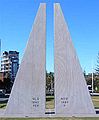
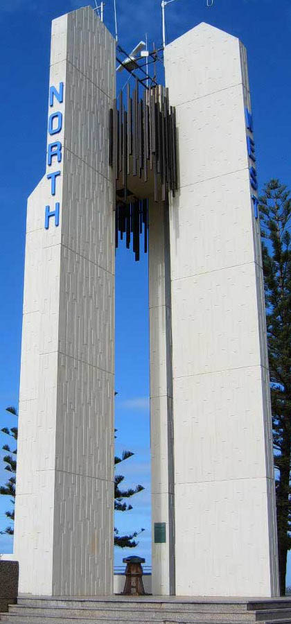
Border marker between two states, dividing the "Twin Towns"
-

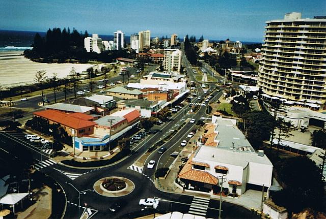
Coolangatta in 2003
-

Hull planking from Coolangatta wreck
-

Anchor from Coolangatta wreck site memorial; creek at right
References
- ^ Australian Bureau of Statistics (25 October 2007). "Coolangatta (Gold Coast City) (State Suburb)". 2006 Census QuickStats. http://www.censusdata.abs.gov.au/ABSNavigation/prenav/LocationSearch?collection=Census&period=2006&areacode=SSC32071&producttype=QuickStats&breadcrumb=PL&action=401. Retrieved 2008-03-24.
- ^ "Coolangatta AWS". Climate statistics for Australian locations. Bureau of Meteorology. http://www.bom.gov.au/climate/averages/tables/cw_040717.shtml. Retrieved 2009-05-09.
External links
- University of Queensland: Queensland Places: Coolangatta
- Coolangatta: that's the place for me - music score, digitised and held by the State Library of Queensland
- Heritage Tour — Coolangatta
- "Coolangatta". Gazetteer of Australia online. Geoscience Australia, Australian Government. http://www.ga.gov.au/bin/gazd01?rec=162991.
- Very GC — Coolangatta
- Coolangatta/Tugun Catholic Parish
- Tweed Heads Bowls Club
Gold Coast, Queensland Suburbs: Arundel · Ashmore · Benowa · Biggera Waters · Bilinga · Broadbeach · Broadbeach Waters · Bundall · Burleigh Heads · Burleigh Waters · Carrara · Clear Island Waters · Coolangatta · Coombabah · Coomera · Currumbin · Currumbin Waters · Elanora · Gaven · Helensvale · Highland Park · Hollywell · Hope Island · Labrador · Main Beach · Mermaid Beach · Mermaid Waters · Merrimac · Miami · Molendinar · Nerang · Oxenford · Pacific Pines · Palm Beach · Paradise Point · Parkwood · Robina · Runaway Bay · Southport · Surfers Paradise · Tugun · Upper Coomera · Varsity LakesWestern localities: Northern localities: Categories:- Suburbs of the Gold Coast, Queensland


Wikimedia Foundation. 2010.