- Aboriginal Shire of Doomadgee
-
Aboriginal Shire of Doomadgee
Queensland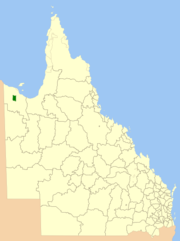
Location within QueenslandPopulation: 1,285(2010)[1] Established: 1987 Area: 1863.2 km² (719.4 sq mi) Mayor: Fredrick O'Keefe Council Seat: Doomadgee, Queensland Region: North West Queensland State District: Mount Isa Federal Division: Kennedy The Aboriginal Shire of Doomadgee is a special Local Government Area in North West Queensland, Queensland, Australia. It is managed under a Deed of Grant in Trust under the Local Government (Community Government Areas) Act 2004.
Contents
History
The area originally was set up as a Mission in 1931 by the Christian Brethren to house primarily Gangalidda Aboriginal people who had ended up living on the fringes of the Burketown township. Originally on the coast, a cyclone in 1936 destroyed the settlement, and the decision was made to move the settlement to Nicholson River.
In 1987, under the Community Services (Aborigines) Act 1984, a Deed of Grant in Trust was given to the Doomadgee community over both the former and current mission. Like other DOGIT communities of the time, Doomadgee had a Community Council elected by Aboriginal people living in the community.
Responsibilities
As the Shire is not operated under the Local Government Act and operates the land on behalf of the community, the Shire Council's responsibilities are quite different from a typical local government body. This includes responsibility for fisheries, alcohol management and employment initiatives.
See also
References
- ^ Australian Bureau of Statistics (31 March 2011). "Regional Population Growth, Australia, 2009–10". http://www.abs.gov.au/ausstats/abs@.nsf/Products/3218.0~2009-10~Main+Features~Queensland?OpenDocument. Retrieved 11 June 2011.
Local Government Areas of Queensland South East Brisbane · Gold Coast · Ipswich · Lockyer Valley · Logan · Moreton Bay · Redland · Scenic Rim · Somerset · Sunshine CoastWide Bay-Burnett Darling Downs Central Central Highlands · Gladstone · Isaac · Mackay · Rockhampton · WoorabindaNorth Far North Aurukun · Cairns · Cassowary Coast · Cook · Hopevale · Kowanyama · Lockhart River · Mapoon · Napranum · Northern Peninsula Area · Pormpuraaw · Tablelands · Torres · Torres Strait Islands · Weipa · Wujal Wujal · YarrabahNorth West Burke · Carpentaria · Cloncurry · Croydon · Doomadgee · Etheridge · Flinders · McKinlay · Mornington · Mount Isa · RichmondCentral West South West Coordinates: 17°55′58.02″S 138°49′08.38″E / 17.9327833°S 138.8189944°E
Categories:- Populated places established in 1987
- 1987 establishments in Australia
- Local Government Areas of Queensland
- Indigenous Australian communities
- North West Queensland

Wikimedia Foundation. 2010.