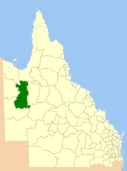
- Shire of Cloncurry
-
Shire of Cloncurry
Queensland
Location within QueenslandPopulation: 3,384(2010)[1] Established: 1884 Area: 48113.3 km² (18,576.6 sq mi) Mayor: Andrew Daniels Council Seat: Cloncurry Region: North West Queensland State District: Mount Isa Federal Division: Kennedy LGAs around Shire of Cloncurry: Burke Carpentaria Carpentaria Mount Isa Shire of Cloncurry McKinlay Boulia Boulia Winton The Shire of Cloncurry is a Local Government Area located in North West Queensland. It covers an area of 48,113.3 square kilometres (18,576.6 sq mi), and has existed as a local government entity since 1884. The major town and administrative centre of the shire is Cloncurry.
Prior to European settlement the area was home to the Mitakoodi, Kalkadoon and Pitta Pitta Aboriginal people.
The ghost town of Mary Kathleen, a town servicing a uranium mine since closed, is in the shire.
Towns and localities
Population
Year Population 1933 6,184 1947 6,267 1954 3,052 1961 4,869 1966 3,348 1971 3,623 1976 4,036 1981 3,651 1986 3,194 1991 3,382 1996 3,878 2001 4,795 2006 3,970 References
- ^ Australian Bureau of Statistics (31 March 2011). "Regional Population Growth, Australia, 2009–10". http://www.abs.gov.au/ausstats/abs@.nsf/Products/3218.0~2009-10~Main+Features~Queensland?OpenDocument. Retrieved 11 June 2011.
Local Government Areas of Queensland South East Brisbane · Gold Coast · Ipswich · Lockyer Valley · Logan · Moreton Bay · Redland · Scenic Rim · Somerset · Sunshine CoastWide Bay-Burnett Darling Downs Central Central Highlands · Gladstone · Isaac · Mackay · Rockhampton · WoorabindaNorth Far North Aurukun · Cairns · Cassowary Coast · Cook · Hopevale · Kowanyama · Lockhart River · Mapoon · Napranum · Northern Peninsula Area · Pormpuraaw · Tablelands · Torres · Torres Strait Islands · Weipa · Wujal Wujal · YarrabahNorth West Burke · Carpentaria · Cloncurry · Croydon · Doomadgee · Etheridge · Flinders · McKinlay · Mornington · Mount Isa · RichmondCentral West South West Coordinates: 20°42′15.60″S 140°30′20.21″E / 20.704333°S 140.5056139°E
Categories:- Populated places established in 1884
- 1884 establishments in Australia
- Local Government Areas of Queensland
Wikimedia Foundation. 2010.
