- Shire of Duaringa
-
Shire of Duaringa
Queensland
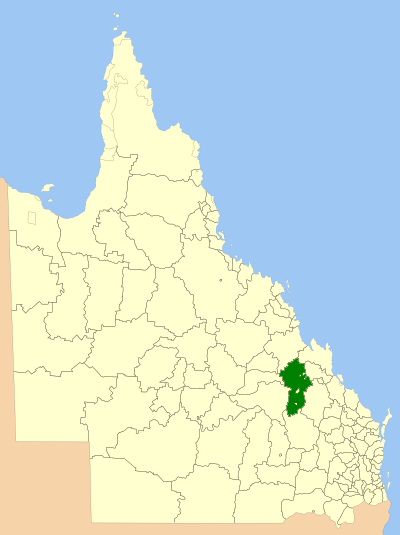
Location within QueenslandPopulation: 7,757 (2001 census) Area: 18201 km² (7,027.4 sq mi) Council Seat: Duaringa Region: Capricornia 
LGAs around Shire of Duaringa: Broadsound Broadsound Livingstone Emerald Shire of Duaringa Fitzroy Bauhinia Taroom Banana The Shire of Duaringa is a Local Government Area in the Capricornia region of Queensland, Australia. Duaringa Shire covers an area of 18,201 square kilometres and boasts a population of approximately 11,000. The Shire incorporates four main towns - Duaringa, Dingo, Blackwater and Bluff - and the township of Bauhinia. Woorabinda Aboriginal Shire is located in five separate locations inside Duaringa - three of them wholly surrounded by Duaringa, and two on the border with Fitzroy Shire.
Duaringa is a local centre for the region's farmers, who cultivate sorghum and wheat, and graze beef cattle. Mining is another major industry within the Shire, due to the vast coal deposits around Blackwater.
External links
Local Government Areas of Queensland South East Brisbane · Gold Coast · Ipswich · Lockyer Valley · Logan · Moreton Bay · Redland · Scenic Rim · Somerset · Sunshine CoastWide Bay-Burnett Darling Downs Central Central Highlands · Gladstone · Isaac · Mackay · Rockhampton · WoorabindaNorth Far North Aurukun · Cairns · Cassowary Coast · Cook · Hopevale · Kowanyama · Lockhart River · Mapoon · Napranum · Northern Peninsula Area · Pormpuraaw · Tablelands · Torres · Torres Strait Islands · Weipa · Wujal Wujal · YarrabahNorth West Central West South West Coordinates: 23°43′03.64″S 149°40′11″E / 23.7176778°S 149.66972°E
Categories:- Former Local Government Areas of Queensland
- Queensland geography stubs
Wikimedia Foundation. 2010.