- Darling Downs
-
"Southern Downs" redirects here. For the Queensland electoral division, see Electoral district of Southern Downs.This article is about the region of Queensland, Australia. For the suburb of Perth, Australia, see Darling Downs, Western Australia.
Darling Downs
Queensland
Population: 241,537 Established: 1840 Area: 77388.7 km² (29,879.9 sq mi) State District: Condamine, Nanango, Southern Downs, Toowoomba North, Toowoomba South, Warrego Federal Division: Groom, Maranoa The Darling Downs is a farming region on the western slopes of the Great Dividing Range in southern Queensland, Australia. The Downs are to the west of South East Queensland and are one of eleven major regions of Queensland.
The region was named after the then Governor of New South Wales, Ralph Darling by Allan Cunningham, an early Australian explorer.[1]
The landscape is dominated by rolling hills covered by pastures of many different vegetables, legumes and other crops including cotton, wheat, barley and sorghum. Between the farmlands there are long stretches of crisscrossing roads, bushy ridges, winding creeks and herds of cattle. There are farms with beef and dairy cattle, pigs, sheep and lamb stock. Other typical sights include irrigation systems, windmills serving as water well pumps to get water from the Great Artesian Basin, light planes crop-dusting, rusty old woolsheds and other scattered remnants from a bygone era of early exploration and settlement.
Contents
Geography
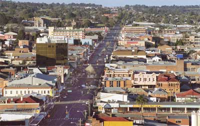
 The central business district of the region's largest city, Toowoomba
The largest city and commercial centre of the Darling Downs is Toowoomba[2] about 132 km west of Brisbane.
Other towns situated on what is now called the Downs include Dalby, Warwick, Roma, Oakey, Mitchell, Pittsworth, Allora, Clifton, Cecil Plains, Drayton, Millmerran, Nobby, and Chinchilla in the west.
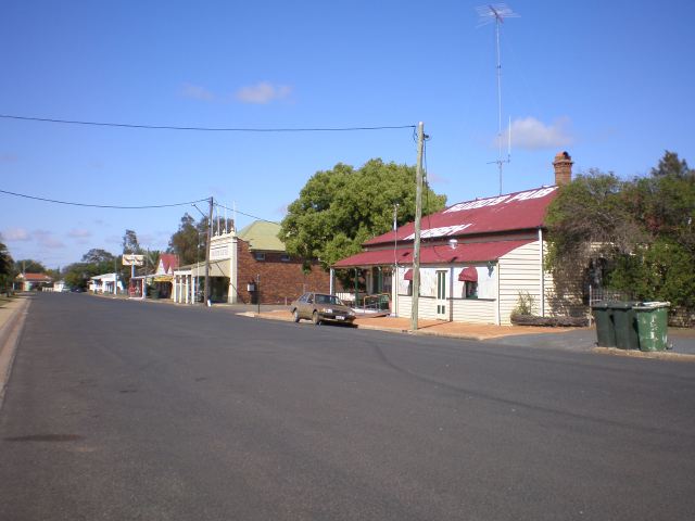
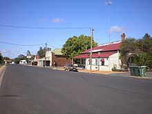 A wide street in the small town of Nobby
The Darling Down is situated in the drainage basins of the Condamine River and Maranoa River and tributaries. On the northern boundaries of the Downs are the Bunya Mountains and the Bunya Mountains National Park. The region to the north is the South Burnett and the Maranoa lies to the west. A section of the western downs lies over coal deposits of the Surat Basin. Towards the coast, the mountains of the Scenic Rim form the headwaters of the westward flowing Condamine.
Southern Downs
Part of the Darling Downs, which includes the towns of Allora, Clifton, Warwick, Killarney and the rocky district in the south known as the Granite Belt, is known as the Southern Downs. The Southern Downs is classed as a region of the Interim Biogeographic Regionalisation for Australia. The phrase is also used to define political boundaries and in the promotion of tourism in the area. The Dumaresq and the MacIntyre are found in this part of the region.
History
Originally the Darling Downs was covered with a wealth of indigenous grasses, this created an ideal verdure for stock eight months of the year. The Darling Downs Aborigines had an annual burning season at the time when the indigenous grasses were ripe and dry. The annual fires gave the local Aborigines of the Darling Downs a name "Goonneeburra" or "Fire Blacks" - "goonnee" being a name for fire and "burra" a generic word for the whole race. This is what the Downs tribes were known as to the coast blacks who inhabited the Moreton Bay area. Murri is wider spread genic word meaning the whole race but in the Kamabroi dialect. The Downs tribes spoke one common dialect, called Waccah and so to all other surrounding tribes were known as the Wacca-burra. The Goonnee-burra were once situated where Warwick stands today.
 Windmill on the Darling Downs, Queensland
Cunninghams Gap and the Darling Downs were first explored by Allan Cunningham and Charles Fraser in 1827.[2] Cunningham returned in 1828 to further research the area and try to find a way through to the coast which was still off limits being a penal colony. Cunningham climbed to the top of Mount Dumareque (near what is now Maryvale) and after wrote in his diary that this lush area was ideal for settlement. The original Darling Downs as quoted by Allan Cunningham was named after Governor Darling and stretched for 100 miles or as far as the eye could see from Mt Dumaresque. Ludwig Leichhardt in 1844 saw the remains of a camp showing the signs of white men through ridge polls and steel axes.
News of the lush pastures quickly spread resulting in a land grab that authorities in the distant New South Wales colony found difficult to stop.[3] Patrick Leslie was the first person to settle on the Darling Downs in 1840, establishing a sheep property at Canning Downs on the Condamine River in 1846. Other well-established residences on the southern downs include Glengallan Homestead, Talgai Homestead, Pringle Cottage and Rosenthal Homestead.
In 1854 Charles Douglas Eastaughffe settled in the area. Spicers Gap Road opened up the area in the 1850s. Later the expansion of Queensland Rail's train networks and Cobb and Co's stagecoach transport greatly assisted access to the region. Gold was found in the district around this time, however it was agricultural activity that provided for the boom times ahead.
The 1891 Australian shearers' strike started at Jondaryan. The Darling Downs experienced a water crisis as the Condamine River dried up during the severe drought of 1994/1995.[4]
Development
The New England Highway, Gore Highway and the Warrego Highway traverse the region. The Leslie Dam, Storm King Dam and the Glenlyon Dam are some of the major water storage facilities in the area.
The Queensland Gas Pipeline oil pipeline and the Roma to Brisbane Pipeline, Australia's first natural gas pipeline both cross the region from west to east. There are a few coal mines and a number of power stations situated on the Downs, including the Millmerran Power Station, Oakey Power Station, Darling Downs Power Station]] and the Kogan Creek Power Station.
Before European settlement many areas on the Darling Downs were fertile wilderness. For example around Ma Ma Creek, rich swampy wetlands provided a haven for many animal species not currently found on the downs. The Hopping mouse and Paradise Parrot have both become extinct since cattle farming begun.
The Dingo Fence starts at the town of Jimbour across the country to the Great Australian Bight.
Attractions
The region is popular with tourists because of its many natural and heritage attractions, including the Goomburra State Forest, Cunninghams Gap, Spicers Gap and the Queen Mary Falls near Killarney in the Main Range National Park. Lake Broadwater is the only natural lake on the tablelands.
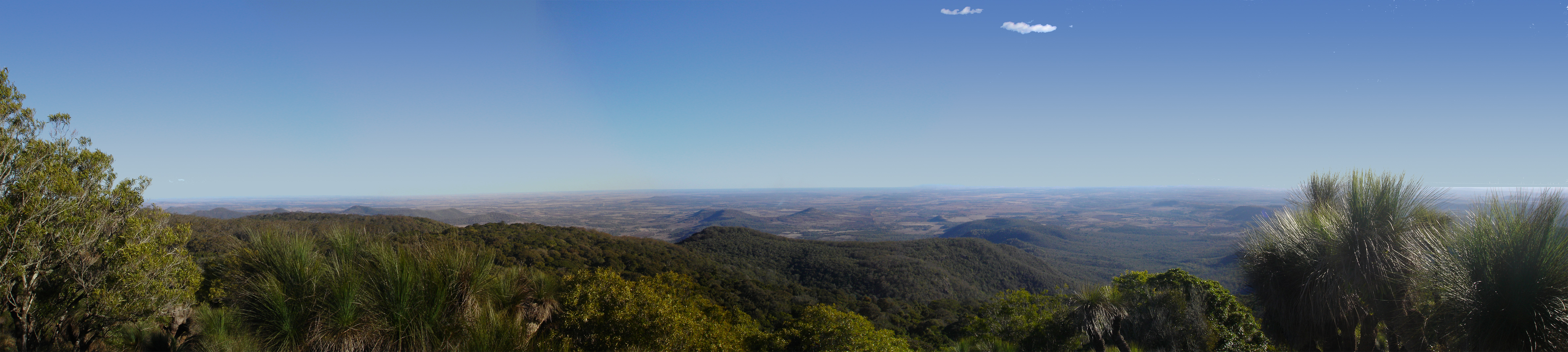
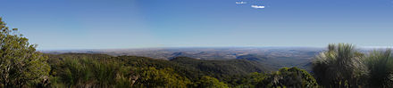 Darling Downs viewed from the Bunya Mountains.
The town of Jandowae gained fame after offering vacant block of land for just $1. This was done to encourage resident to settle in the small town with less than 1000 people in 2001.
The Cobb & Co Museum has displays of horse drawn vehicles and material on the history of the Darling Downs. The region has also a small zoo, Darling Downs Zoo near Clifton.
The region has uncovered important megafauna fossil finds.[5] The rich discoveries have lent weight to the theory that humans were not a factor in the extinction of the ancient megafauna species.[6]
In fiction
Steele Rudd (Arthur Davis) wrote a series of comic novels on rural life, starting with On Our Selection (1899), about Dad, Mother and Dave Rudd of Snake Gully. The Rudds had four (or six) acres adjoining a sheep run in Darling Downs. They were made into films and a radio series.
See also
References
- ^ Naming the Highways - Cunningham Highway No. 17. p. 2. Accessed on 20 August 2007.
- ^ a b "Darling Downs". Encyclopædia Britannica. http://www.britannica.com/EBchecked/topic/151740/Darling-Downs. Retrieved 6 November 2010.
- ^ Evans, Raymond (2007). A History of Queensland. Port Melbourne, Victoria: Cambridge University Press. pp. 51–52. ISBN 9780521876926.
- ^ Collie, Gordon. Water crisis threatens towns. The Courier Mail p. 3. 3 June 1995.
- ^ "Australia's fossil past". http://www.cultureandrecreation.gov.au/articles/fossils/. Retrieved 2008-06-23.
- ^ "Study clears humans over megafauna extinction". ABC News. 2005-05-30. http://www.abc.net.au/news/newsitems/200505/s1379450.htm. Retrieved 2008-06-24.
External links
Darling Downs, Queensland Cities: Toowoomba · WarwickTownships: Acland · Allora · Amiens · Applethorpe · Ballandean · Bell · Brigalow · Bungunya · Cambooya · Cecil Plains · Chinchilla · Clifton · Condamine · Cooyar · Crows Nest · Dalby · Dalveen · Daymar · Drillham · Dulacca · Goombungee · Goondiwindi · Gowrie Junction · Greenmount · Haden · Hampton · Highfields · Inglewood · Jandowae · Jimbour · Karara · Kaimkillenbun · Killarney · Kingsthorpe · Kogan · Kulpi · Leyburn · Macalister · Maclagan · Maryvale · Meandarra · Meringandan · Messines · Miles · Millmerran · Moonie · Nobby · Oakey · Passchendaele · Peranga · Pittsworth · Pozieres · Quinalow · Stanthorpe · Southbrook · Talwood · Texas · Tara · The Gums · Thulimbah · Toobeah · Wallangarra · Wandoan · Warra · Weengallon · Wyberba · Wyreema · Yangan · Yarraman · YelarbonLocal Government Areas: Goondiwindi Region · Southern Downs Region · Toowoomba Region · Western Downs RegionNational Parks: Bunya Mountains · Girraween · Main Range · Mount Binga · Southwood · Sundown · The Palms · Wondul RangeCoordinates: 27°49′14.45″S 151°38′08.51″E / 27.8206806°S 151.6356972°E
Categories:

Wikimedia Foundation. 2010.