- Meandarra
-
Meandarra
Queensland
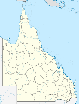
Meandarra ANZAC Memorial MuseumPopulation: 341[1] Postcode: 4422 Coordinates: 27°19′S 149°53′E / 27.317°S 149.883°ECoordinates: 27°19′S 149°53′E / 27.317°S 149.883°E Location: LGA: Western Downs Region State District: Warrego Federal Division: Maranoa Meandarra is a town in the Australian state of Queensland. The town is located on Brigalow Creek and in the Western Downs Region local government area, 361 kilometres (224 mi) west of the state capital, Brisbane. At the 2006 census, Meandarra and the surrounding area had a population of 341.[1] First surveyed in 1912, the town derived its name from a pastoral run.[2]
The Meandarra ANZAC Memorial Museum was opened in 2009. The museum contains a large collection of ANZAC memorabilia including a Canberra bomber and a German U-boat.[3]
References
- ^ a b Australian Bureau of Statistics (25 October 2007). "Meandarra (Tara Shire) (State Suburb)". 2006 Census QuickStats. http://www.censusdata.abs.gov.au/ABSNavigation/prenav/LocationSearch?collection=Census&period=2006&areacode=SSC36671&producttype=QuickStats&breadcrumb=PL&action=401. Retrieved 2010-11-07.
- ^ "Meandarra". Place name details. Department of Environment and Resource Management (Queensland). http://www.derm.qld.gov.au/property/placenames/detail.php?id=21484. Retrieved 7 November 2010.
- ^ Casey, Scott (24 July 2009). "Little Meandarra's big bang in world of war craft". Brisbane Times. http://www.brisbanetimes.com.au/travel/travel-news/little-meandarras-big-bang-in-world-of-war-craft-20090724-dvp6.html. Retrieved 7 November 2010.
Towns in the Western Downs Region | Darling Downs | Queensland Main Article: Local Government Areas of QueenslandDarling Downs, Queensland Cities: Toowoomba · WarwickTownships: Acland · Allora · Amiens · Applethorpe · Ballandean · Bell · Brigalow · Bungunya · Cambooya · Cecil Plains · Chinchilla · Clifton · Condamine · Cooyar · Crows Nest · Dalby · Dalveen · Daymar · Drillham · Dulacca · Goombungee · Goondiwindi · Gowrie Junction · Greenmount · Haden · Hampton · Highfields · Inglewood · Jandowae · Jimbour · Karara · Kaimkillenbun · Killarney · Kingsthorpe · Kogan · Kulpi · Leyburn · Macalister · Maclagan · Maryvale · Meandarra · Meringandan · Messines · Miles · Millmerran · Moonie · Nobby · Oakey · Passchendaele · Peranga · Pittsworth · Pozieres · Quinalow · Stanthorpe · Southbrook · Talwood · Texas · Tara · The Gums · Thulimbah · Toobeah · Wallangarra · Wandoan · Warra · Weengallon · Wyberba · Wyreema · Yangan · Yarraman · YelarbonLocal Government Areas: Goondiwindi Region · Southern Downs Region · Toowoomba Region · Western Downs RegionNational Parks: Bunya Mountains · Girraween · Main Range · Mount Binga · Southwood · Sundown · The Palms · Wondul RangeCategories:- Towns in Queensland
- Queensland geography stubs
Wikimedia Foundation. 2010.

