- Moonie, Queensland
-
Moonie
Queensland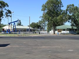
The playground, craft and information centre at Moonie.
 Moonie
Postcode: 4406 Coordinates: 27°43′01″S 150°22′16″E / 27.717°S 150.371°ECoordinates: 27°43′01″S 150°22′16″E / 27.717°S 150.371°E Location: - 331 km (206 mi) W of Brisbane
- 204 km (127 mi) W of Toowoomba
- 122 km (76 mi) SW of Dalby
- 112 km (70 mi) N of Goondiwindi
- 65 km (40 mi) S of Tara
LGA: Western Downs Region State District: Warrego Federal Division: Maranoa Moonie is a town in the Darling Downs region of Queensland, Australia. The town is located in the Western Downs Region Local Government Area at the intersection of the Leichhardt and Moonie Highways, 331 kilometres (206 mi) west of the state capital, Brisbane, and is the Official Oil Capital of Australia.
The town's name is derived from Moonie River, which was first recorded as Mooni by Sir Thomas Mitchell in November 1846 when he passed through the region.[1]
The town is very small and consists of a public school, service station, a few houses, Moonie Sports Club and a motel. In December 1961 Moonie was the site of Australia's first commercial oil field, a very small field consisting of less than one percent of Australia's oil and gas reserves.[2] The oil field is still operational and pumps out 35 kilolitres (7,700 gallons) every day.[3]
The region is also an agricultural area that produces grain, beef cattle and prime lambs.
References
- ^ "MOONIE, QUEENSLAND". http://www.australiaforeveryone.com.au/places_moonie.htm. Retrieved 30 May 2011.
- ^ "Moonie". Walkabout - Australian Travel Guide. Fairfax. http://walkabout.com.au/locations/QLDMoonie.shtml. Retrieved 2007-09-23.
- ^ "Places to Visit - Western Downs - Moonie". Queensland Holidays. Tourism Queensland. http://www.queenslandholidays.com.au/destinations/western-downs/places-to-visit/moonie/. Retrieved 2007-09-23.
Towns in the Western Downs Region | Darling Downs | Queensland Main Article: Local Government Areas of QueenslandDarling Downs, Queensland Cities: Toowoomba · WarwickTownships: Acland · Allora · Amiens · Applethorpe · Ballandean · Bell · Brigalow · Bungunya · Cambooya · Cecil Plains · Chinchilla · Clifton · Condamine · Cooyar · Crows Nest · Dalby · Dalveen · Daymar · Drillham · Dulacca · Goombungee · Goondiwindi · Gowrie Junction · Greenmount · Haden · Hampton · Highfields · Inglewood · Jandowae · Jimbour · Karara · Kaimkillenbun · Killarney · Kingsthorpe · Kogan · Kulpi · Leyburn · Macalister · Maclagan · Maryvale · Meandarra · Meringandan · Messines · Miles · Millmerran · Moonie · Nobby · Oakey · Passchendaele · Peranga · Pittsworth · Pozieres · Quinalow · Stanthorpe · Southbrook · Talwood · Texas · Tara · The Gums · Thulimbah · Toobeah · Wallangarra · Wandoan · Warra · Weengallon · Wyberba · Wyreema · Yangan · Yarraman · YelarbonLocal Government Areas: Goondiwindi Region · Southern Downs Region · Toowoomba Region · Western Downs RegionNational Parks: Bunya Mountains · Girraween · Main Range · Mount Binga · Southwood · Sundown · The Palms · Wondul RangeCategories:- Towns in Queensland
- Towns in the Darling Downs
- Queensland geography stubs


Wikimedia Foundation. 2010.