- Crows Nest, Queensland
-
Crows Nest
Queensland
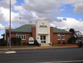
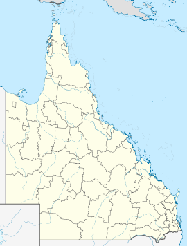
Former Council chambers, now an art galleryPopulation: 1,443[1] Postcode: 4355 Coordinates: 27°15′45″S 152°03′27″E / 27.2625°S 152.0574°ECoordinates: 27°15′45″S 152°03′27″E / 27.2625°S 152.0574°E Location: LGA: Toowoomba Region County: Cavendish Parish: Crows Nest State District: Nanango Federal Division: Maranoa Crows Nest is a town in the Darling Downs region of Queensland, Australia. The town is located 158 kilometres (98 mi) on the New England Highway from the state capital, Brisbane and 43 kilometres (27 mi) from the nearby city of Toowoomba within the Toowoomba Region local government area. At the 2006 census, Crows Nest had a population of 1,443.[1]
Town facilities include a large pavilion for sports activities and other functions, showgrounds and a 25 m heated pool.[2] 6 km east of the town is the Crows Nest National Park.
History
Crows Nest was declared a town in 1876.[3] A branch railway line from Toowoomba, which serviced a number of sawmills and a dairying district, was finished in 1886.[3]
The town was named after an Aboriginal, Jimmy Crow, who gave directions to early European settlers. He lived in a hollow tree known as Crows Nest. A statue of Crow stands in the centre of the village green.[4][dubious ]
In the 1950s and 60s the town's population declined together with the local industries.[3]
References
- ^ a b Australian Bureau of Statistics (25 October 2007). "Crows Nest (Urban Centre/Locality)". 2006 Census QuickStats. http://www.censusdata.abs.gov.au/ABSNavigation/prenav/LocationSearch?collection=Census&period=2006&areacode=UCL316000&producttype=QuickStats&breadcrumb=PL&action=401. Retrieved 2008-03-30.
- ^ "Crows Nest facilities". Toowoomba Regional Council. http://www.toowoombarc.qld.gov.au/index.php?option=com_content&task=view&id=462&Itemid=85. Retrieved 16 July 2010.
- ^ a b c Environmental Protection Agency (Queensland) (2000). Heritage Trails of the Great South East. State of Queensland. pp. 51. ISBN 0-7345-1008-X.
- ^ "Crows Nest". Travel (Melbourne: The Age). 2004-02-08. http://www.theage.com.au/news/Queensland/Crows-Nest/2005/02/17/1108500202278.html. Retrieved 2008-03-30.
External links
Darling Downs, Queensland Cities: Toowoomba · WarwickTownships: Acland · Allora · Amiens · Applethorpe · Ballandean · Bell · Brigalow · Bungunya · Cambooya · Cecil Plains · Chinchilla · Clifton · Condamine · Cooyar · Crows Nest · Dalby · Dalveen · Daymar · Drillham · Dulacca · Goombungee · Goondiwindi · Gowrie Junction · Greenmount · Haden · Hampton · Highfields · Inglewood · Jandowae · Jimbour · Karara · Kaimkillenbun · Killarney · Kingsthorpe · Kogan · Kulpi · Leyburn · Macalister · Maclagan · Maryvale · Meandarra · Meringandan · Messines · Miles · Millmerran · Moonie · Nobby · Oakey · Passchendaele · Peranga · Pittsworth · Pozieres · Quinalow · Stanthorpe · Southbrook · Talwood · Texas · Tara · The Gums · Thulimbah · Toobeah · Wallangarra · Wandoan · Warra · Weengallon · Wyberba · Wyreema · Yangan · Yarraman · YelarbonLocal Government Areas: Goondiwindi Region · Southern Downs Region · Toowoomba Region · Western Downs RegionNational Parks: Bunya Mountains · Girraween · Main Range · Mount Binga · Southwood · Sundown · The Palms · Wondul RangeCategories:- Towns in Queensland
- Towns in the Darling Downs
- Queensland geography stubs
Wikimedia Foundation. 2010.

