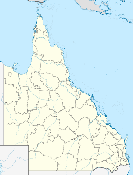
- Millmerran, Queensland
-
Millmerran
QueenslandPopulation: 1,223[1] Established: 1881 Postcode: 4357 Coordinates: 27°52′S 151°16′E / 27.867°S 151.267°ECoordinates: 27°52′S 151°16′E / 27.867°S 151.267°E Location: - 208 km (129 mi) west of Brisbane
- 84 km (52 mi) south west of Toowoomba
- 140 km (87 mi) north east of Goondiwindi
LGA: Toowoomba Region County: Derby Parish: Domville State District: Southern Downs Federal Division: Maranoa Millmerran (pronounced /mɪlˈmɛrən/) is a town in the Darling Downs region of Queensland, Australia. The town is situated on the Gore Highway, 208 kilometres west of the state capital, Brisbane. At the 2006 census, Millmerran had a population of 1,223.[1]
History
Millmerran is located near a lookout commonly used by the local Aboriginal population prior to European settlement and the town's name is believed to be derived from two words - "meel" meaning "eye" and "merran" meaning "to look out".[2] European settlement in the Millmerran area began in 1841 when the Gore brothers established the vast Yandilla station. Yandilla station covered an estimated 1,780 square kilometres and hosted its own school with 20 to 30 students, telegraph station and store. Closer settlement began after the passing of the Crown Lands Alienation Act in 1876, which allowed Edward Walpole to select a portion of Yandilla station. In 1881, Walpole established a general store on the site of what was known at the time as Back Creek, and a receiving office was opened with that name on 8 July 1883.[3] It was elevated to the status of a post office, and the name changed to Domville, on 1 June 1889.[3] The name was again changed to Millmerran on 16 November 1894.[3]
References
- ^ a b Australian Bureau of Statistics (25 October 2007). "Community Profile Series : Millmerran (Urban Centre/Locality)". 2006 Census of Population and Housing. http://www.censusdata.abs.gov.au/ABSNavigation/prenav/ProductSelect?newproducttype=Community+Profiles&collection=Census&period=2006&areacode=UCL338400&breadcrumb=LP¤taction=201&action=401. Retrieved 2007-10-28.
- ^ "Millmerran". Walkabout. Fairfax. http://walkabout.com.au/locations/QLDMillmerran.shtml. Retrieved 2007-06-07.
- ^ a b c Frew, Joan (1981) Queensland Post Offices 1842-1980 and Receiving Offices 1869-1927, p. 346. Fortitude Valley, Queensland: published by the author, ISBN 0 9593973 0 2
External links
Darling Downs, Queensland Cities: Toowoomba · WarwickTownships: Acland · Allora · Amiens · Applethorpe · Ballandean · Bell · Brigalow · Bungunya · Cambooya · Cecil Plains · Chinchilla · Clifton · Condamine · Cooyar · Crows Nest · Dalby · Dalveen · Daymar · Drillham · Dulacca · Goombungee · Goondiwindi · Gowrie Junction · Greenmount · Haden · Hampton · Highfields · Inglewood · Jandowae · Jimbour · Karara · Kaimkillenbun · Killarney · Kingsthorpe · Kogan · Kulpi · Leyburn · Macalister · Maclagan · Maryvale · Meandarra · Meringandan · Messines · Miles · Millmerran · Moonie · Nobby · Oakey · Passchendaele · Peranga · Pittsworth · Pozieres · Quinalow · Stanthorpe · Southbrook · Talwood · Texas · Tara · The Gums · Thulimbah · Toobeah · Wallangarra · Wandoan · Warra · Weengallon · Wyberba · Wyreema · Yangan · Yarraman · YelarbonLocal Government Areas: Goondiwindi Region · Southern Downs Region · Toowoomba Region · Western Downs RegionNational Parks: Bunya Mountains · Girraween · Main Range · Mount Binga · Southwood · Sundown · The Palms · Wondul RangeCategories:- Towns in Queensland
- Towns in the Darling Downs
- Australian Aboriginal placenames
- Queensland geography stubs
Wikimedia Foundation. 2010.

