- Nadi International Airport
-
Nadi International Airport 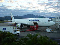
IATA: NAN – ICAO: NFFN Location of airport in Fiji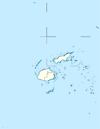
 NAN
NANSummary Airport type Public Operator Airports Fiji Limited (AFL) Serves Nadi Location Nadi, Viti Levu, Fiji Hub for Air Pacific Elevation AMSL 18 m / 59 ft Coordinates 17°45′19″S 177°26′36″E / 17.75528°S 177.44333°E Website Runways Direction Length Surface m ft 02/20 3,273 10,739 Asphalt 09/27 2,136 7,007 Asphalt Nadi International Airport (IATA: NAN, ICAO: NFFN) is the main international gateway for the islands of Fiji. It serves about 1.2 million people per year, and is the main hub of Air Pacific. The airport is 10km from the city of Nadi. In 2009 it handled 1,220,000 passengers on international and domestic flights.[1]
Contents
History
The original airstrips at Nadi were built by New Zealand in 1939. They were paid for by the British colonial authorities and were used by the United States Army Air Forces when the Pacific War began in 1941, as USAAF Nandi [sic]. Early in the war, the Americans flew B-17 Flying Fortresses from Nadi against Japanese targets in the Philippines and Solomon Islands. Later in 1943, the 42nd Bombardment Group flew B-25 Mitchells from Nadi.
Following the end of the war, control of Nadi Airport was handed over to New Zealand on 20 December 1946, and the Civil Aviation Authority of New Zealand began operations from Nadi in 1947. At independence in 1970, the Fijian government began participating in the organization of Nadi Airport, and full control was handed over in 1979.
The first tarmac runway was constructed in 1946 at a cost of £46,500; length 7000 ft x 150 ft - 2133m x 46m.
Then, as now, Fiji was the crossroads of the Pacific - and in those days was even more important as a refuelling stop. Back then, the apron was shaded by palms and crotons and hibiscus trees, with whitewashed stone paths connecting it to the terminal. These have now been lost under concrete as the apron has expanded over the years, as aeroplanes larger in both number and size land at Nadi. In those days (1940s, 1950s), the airport's official name was Colony of Fiji: Nadi Airport; although foreign timetables continued to spell the name incorrectly as Nandi.
Nadi was selected as the major airport for Fiji mainly due to its location on the drier west coast of Viti Levu.
During the first half of the 1960s, Nadi served as a key airport for transfer of passengers from Auckland's Whenuapai airport which could only take turboprop and piston aeroplanes, onto the new DC-8s and Boeing 707s bound for North America and Europe. At one time, New Zealand controlled the world's largest Flight Information Service (FIS), which at its largest stretched to 10,360,000 square kilometres. All of this was controlled from Nadi.
Operations
Arrivals and departures are much preferred to be to the south, due to the close proximity of the Sabeto Range to the immediate north of the airport. A large turn around area, suitable for Boeing 747s, is located to the left of the threshold of Runway 02, in case meteorological factors make departure to the north necessary.
In 2008, a Qantas Airbus A380 had to make an emergency landing to disembark a sick passenger, showing that whilst not certified, the facilities at Nadi are sufficient to cater for the largest civilian aeroplane in the world.
Today, the largest concentration of hotels in Fiji has grown up in and around Nadi, and as tourism took off in the 1960s, the nearby resorts under construction in the nearby Mamanuca Islands cemented Nadi as the centre of Fiji's tourism industry.
Nadi is also the operational base for Air Pacific, which services six airports throughout the southwest Pacific, and many more on the Pacific Rim. Remnants of the largest FIS in the world remain as, for example, Nadi Tower provides an FIS service for Fua'amotu Airport in Tonga when Fua'amotu Tower is off watch.
Airlines and destinations
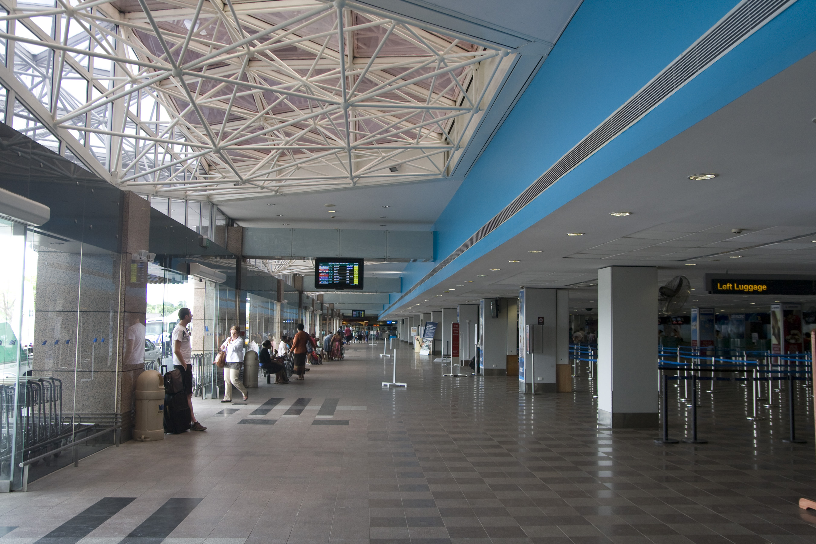
 International Departures
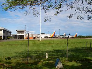 Side view of the airport
Airlines Destinations Aircalin Nouméa, Wallis Island Air Kiribati operated by Our Airline Tarawa Air New Zealand Auckland, Christchurch
Seasonal: WellingtonAir Niugini Honiara, Port Moresby Air Pacific Apia, Auckland, Brisbane, Christchurch, Funafuti, Hong Kong, Honiara, Honolulu, Kiritimati, Los Angeles, Melbourne, Nuku'alofa, Port Vila, Sydney, Tarawa Air Pacific operated by Pacific Sun Kadavu, Labasa, Malololailai, Mana, Pacific Harbour, Savusavu, Suva, Taveuni Jetstar Sydney Korean Air Seoul-Incheon Our Airline Nauru, Tarawa Virgin Australia operated by Pacific Blue Brisbane, Melbourne, Sydney[2] See also
- USAAF in the South Pacific
References
 This article incorporates public domain material from websites or documents of the Air Force Historical Research Agency.
- Maurer, Maurer (1983). Air Force Combat Units Of World War II. Maxwell AFB, Alabama: Office of Air Force History. ISBN 0-89201-092-4.
- Mauer, Mauer (1969), Combat Squadrons of the Air Force, World War II, Air Force Historical Studies Office, Maxwell AFB, Alabama. ISBN 0-89201-097-5
External links
- Nadi International Airport (official site)
 USAAF Thirteenth Air Force in World War II
Airfields Pacific USAAF in the South Pacific · USAAF in the Southwest Pacific
Units Commands XIII Bomber · XIII FighterGroups Fighter 18th Fighter · 347th Fighter · 414th FighterBomber Reconnaissance Troop Carrier 403d Troop CarrierSquadrons Bombardment 100th Bombardment · 868th BombardmentNight Fighter 418th Night Fighter · 419th Night Fighter · 550th Night FighterReconnaissance 4th Photographic Charting · 17th Photographic Reconnaissance · 36th Photographic Reconnaissance · 38th Photographic ReconnaissanceTroop Carrier 13th Troop CarrierUnited States Army Air Forces
First · Second · Third · Fourth · Fifth · Sixth · Seventh · Eighth · Ninth · Tenth · Eleventh · Twelfth · Thirteenth · Fourteenth · Fifteenth · TwentiethCategories:- USAAF Air Transport Command Airfields - Pacific
- Airfields of the United States Army Air Forces in the Pacific Ocean theatre of World War II
- Airports in Fiji
- Airports established in 1939


Wikimedia Foundation. 2010.