- Viti Levu
Infobox Islands
name = Viti Levu

image caption = Map of Viti Levu
image size =
locator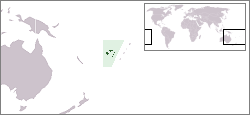
map_custom = no
native name =
native name link =
nickname =
location =Pacific Ocean
coordinates = coord|17|48|S|178|0|E|display=inline
archipelago =Viti Levu Group
total islands =
major islands =
area = convert|10388|km2|sqmi|abbr=on
rank = 75th
length = convert|146|km|mi|abbr=on
width = convert|106|km|mi|abbr=on
highest mount =Tomanivi
elevation = convert|1394|m|ft|abbr=on
country = Fiji
country admin divisions title = Division
country admin divisions = Western Division and Central Division
country admin divisions title 1 =
country admin divisions 1 =
country admin divisions title 2 =
country admin divisions 2 =
country largest city =Suva
country largest city population = 77,366
population = 580,000
population as of =
density = 55.83
ethnic groups = native Fijians, who areMelanesia ns (54.3%), although a few also havePolynesia n ancestry, andIndo-Fijians (38.1%)
additional info =Viti Levu (pronounced|ˈβiti ˈleβu) is the largest island in the Republic of Fiji, the site of the nation's capital,
Suva , and home to a large majority of Fiji's population.Geography and economy
Viti Levu covers an area of 10,388 km² and is about 106 km from north to south and 146 km east to west. It is the sixth-largest island in
Oceania , afterTasmania , the two major islands ofNew Zealand ,Hawaii Island , andNew Caledonia .Geologist s believe that Viti Levu has been submerged a number of times, and has been covered bylava and other volcanic materials. Earthquakes and volcanic eruptions account for the somewhat rugged terrain of the island, which is divided into roughly equal halves by a north-south mountain range. The eastern side of the island experiences heavy rainfall, while the western side is noticeably drier. Accordingly,sugar cane production thrives in the west, while adairy industry is being built in the east. Fiji's biggest cattle ranch, with 7000 head of cattle in its 70 square kilometres, is atYaqara , halfway betweenTavua andRakiraki .The centre of the island is forested and includes the nation's highest peak
Tomanivi (otherwise Mt. Victoria) rising to 1,324 meters.The island is the only known home of one of the world's largest insects, the
Giant Fijian Long-Horned Beetle .Localities
Viti Levu hosts the capital city of Suva, and is home to nearly three quarters of the population of the Republic (about 580,000). Other important towns, all around the coast, include Ba,
Lautoka ,Nadi ,Nausori , Rakiraki, andSigatoka . One major road has been built around the perimeter of Viti Levu.Well-known localities include
Natadola Beach ,Pacific Harbour (a resort center about 50 kilometers from Suva).Politics
Eight of Fiji's fourteen Provinces are in Viti Levu. The Provinces of Ba,
Nadroga-Navosa , and Ra comprise the Western Division, whileNaitasiri ,Namosi , Rewa,Serua , andTailevu form the Central Division. In part because of its high concentration ofIndo-Fijian s, whose ancestors came mostly as indentured workers fromIndia between 1879 and 1916, the political dynamics of western Viti Levu are somewhat different from those of eastern Viti Levu, where, apart from the multi-racial urban areas, indigenous Fijians are more heavily concentrated.History
Viti Levu is believed to have been inhabited longer than the northern island of
Vanua Levu . According to oral traditions, the firstMelanesia n settlers landed atVuda Point and establishedViseisei , believed to be Fiji's oldest settlement, nearby.External links
*Wikitravel|Viti Levu
Wikimedia Foundation. 2010.