- Zambia
-
Republic of Zambia

Flag Coat of arms Motto: One Zambia, One Nation Anthem: "Stand and Sing of Zambia, Proud and Free" 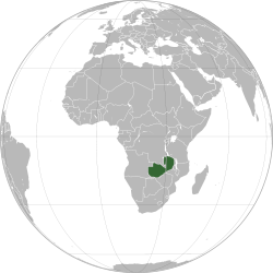
Capital
(and largest city)Lusaka
15°25′S 28°17′E / 15.417°S 28.283°EOfficial language(s) English Recognised regional languages Chewa, Bemba, Lunda, Tonga, Lozi, Luvale, Kaonde Demonym Zambian Government Republic - President Michael Sata - Vice President Guy Scott Independence - from the United Kingdom 24 October 1964 Area - Total 752,618 km2 [1](39th)
290,587 sq mi- Water (%) 1 Population - 2009 estimate 12,935,000[2] (71st) - 2000 census 9,885,591[3] - Density 17.2/km2 (191st)
44.5/sq miGDP (PPP) 2009 estimate - Total $18.454 billion[4] - Per capita $1,541[4] GDP (nominal) 2009 estimate - Total $13.000 billion[4] - Per capita $1,086[4] Gini (2002–03) 42.1 (medium) HDI (2010)  0.395 (low) (150th)
Currency Zambian kwacha ( ZMK)Time zone CAT (UTC+2) - Summer (DST) not observed (UTC+2) Drives on the left ISO 3166 code ZM Internet TLD .zm Calling code 260 Zambia (
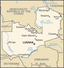
 /ˈzæmbiə/), officially the Republic of Zambia, is a landlocked country in Southern Africa. The neighbouring countries are the Democratic Republic of the Congo to the north, Tanzania to the north-east, Malawi to the east, Mozambique, Zimbabwe, Botswana and Namibia to the south, and Angola to the west. The capital city is Lusaka, located in the south-central part of the country. The population is concentrated mainly around the capital Lusaka in the south and the Copperbelt to the northwest.
Originally inhabited by Khoisan peoples, the region of what is now Zambia was reached by the Bantu expansion by ca. the 12th century. After visits by European explorers starting in the 18th century, Zambia became the British colony of Northern Rhodesia towards the end of the nineteenth century. For most of the colonial period, the country was governed by an administration appointed from London with the advice of the British South Africa Company.
On 24 October 1964, the country declared independence from the United Kingdom and prime minister Kenneth Kaunda became the first head of state. Zambia was governed by Kenneth Kaunda of the socialist United National Independence Party (UNIP) from 1964 until 1991. From 1972 to 1991 Zambia was a one-party state with UNIP the sole legal political party. From 1991 to 2002, Zambia was governed by president Frederick Chiluba of the social-democratic Movement for Multi-Party Democracy during which the country saw a rise in social-economic growth and increased decentralisation of government. Levy Mwanawasa was the third President of Zambia. He presided over the country from January 2002 until his death in August 2008. He is credited with having initiated a campaign to rid the country of corruption, and increasing standards of living from the levels left by Frederick T.J. Chiluba. Rupiah Banda became president in 2008. Michael Sata defeated Banda's re-election bid in 2011 and was set to become president in 2012.
The World Bank in 2010 named Zambia as one of the world's fastest economically reforming countries. The Common Market for Eastern and Southern Africa (COMESA) has its headquarters in the capital Lusaka.
Contents
Etymology
Further information: Rhodesia (name)The territory of what is now Zambia was known as Northern Rhodesia from 1911. It was renamed to Zambia on the occasion of its independence, in 1964. The new name of Zambia was derived from the Zambezi river (Zambezi may mean "God's river")[citation needed] which flows through the western region of the country and forms its southern border.
History
The area of modern Zambia was inhabited by Khoisan hunter-gatherers until around AD 300, when more technologically advanced migrating ethnic groups[clarification needed] began to displace or absorb them.[5] In the 12th century, major waves of Bantu-speaking immigrants arrived during the Bantu expansion. Among them, the Tonga people (also called Ba-Tonga, "Ba-" meaning "woman") were the first to settle in Zambia and are believed to have come from the east near the "big sea".
The Nkoya people also arrived early in the expansion[6][7], coming from the Luba–Lunda kingdoms located in the southern parts of the modern Democratic Republic of the Congo and northern Angola, followed by a much larger influx, especially between the late 12th and early 13th centuries. In the early 19th century, the Nsokolo people settled in the Mbala district of Northern Province. During the 19th century, the Ngoni and Sotho peoples arrived from the south. By the late 19th century, most of the various peoples of Zambia were established in the areas they currently occupy. The arrival of Europeans was just yet another such influx.
The earliest account of a European visiting the area was Francisco de Lacerda in the late 18th century, followed by other European visitors in the 19th century. The most prominent of these was David Livingstone, who had a vision of ending the slave trade through the "3 Cs" (Christianity, Commerce and Civilization).
He was the first European to see the magnificent waterfall on the Zambezi River in 1855, naming them "Victoria Falls" after Queen Victoria - he described them thus: "Scenes so loovely must have been gazed upon by angels in their flight". Locally the falls are known as "Mosi-o-Tunya" or "(the) thundering smoke" (in the Lozi or Kololo dialect). The town of Livingstone, near the Falls, is named after him. Highly publicised accounts of his journeys motivated a wave of European visitors, missionaries and traders after his death in 1873.[8][9]
In 1888, the British South Africa Company (BSA Company), led by Cecil Rhodes, obtained mineral rights from the Litunga, the Paramount Chief of the Lozi or Ba-rotse for the area which later became North-Western Rhodesia.[10] To the east, in December 1897 a section of the Angoni or Ngoni (originally from Zululand) under Tsinco, the son of King Mpezeni, rebelled, but the rebellion was put down,[11] and Mpezeni accepted the Pax Britannica. That part of the country then came to be known as North-Eastern Rhodesia. In 1895, Rhodes asked his American scout Frederick Russell Burnham to look for minerals and ways to improve river navigation in the region, and it was during this trek that Burnham discovered major copper deposits along the Kafue River.[12]
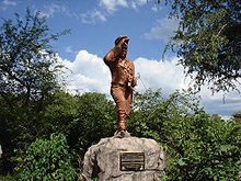
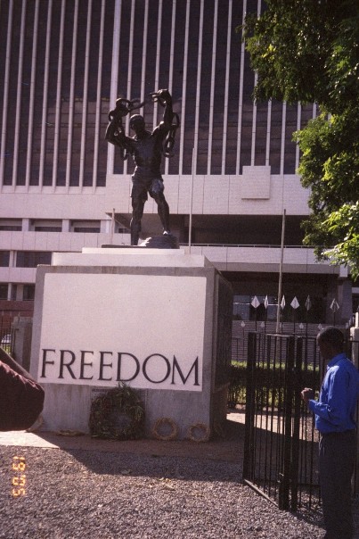
 Liberation statue in front of a government building
North-Eastern Rhodesia and North-Western Rhodesia were administered as separate units until 1911 when they were merged to form the British Colony of Northern Rhodesia. In 1923, the BSA Company ceded control of Northern Rhodesia to the British Government after the government decided not to renew the Company's charter.
That same year, Southern Rhodesia (now Zimbabwe), a conquered territory which was also administered by the BSA Company, became a self-governing British Dominion. In 1924, after negotiations, administration of Northern Rhodesia transferred to the British Colonial Office. In 1953, the creation of the Federation of Rhodesia and Nyasaland grouped together Northern Rhodesia, Southern Rhodesia and Nyasaland (now Malawi) as a single semi-autonomous region. This was undertaken despite opposition from a sizeable minority of the population, who demonstrated against it in 1960–61.[13] Northern Rhodesia was the centre of much of the turmoil and crisis characterizing the federation in its last years. Initially, Harry Nkumbula's African National Congress (ANC) led the campaign that Kenneth Kaunda's United National Independence Party (UNIP) subsequently took up.
A two-stage election held in October and December 1962 resulted in an African majority in the legislative council and an uneasy coalition between the two African nationalist parties. The council passed resolutions calling for Northern Rhodesia's secession from the federation and demanding full internal self-government under a new constitution and a new National Assembly based on a broader, more democratic franchise. The federation was dissolved on 31 December 1963, and in January 1964, Kaunda won the first and only election for Prime Minister of Northern Rhodesia. The Colonial Governor, Sir Evelyn Hone, was very close to Kaunda and urged him to stand for the post. Soon after, there was an uprising in the north of the country known as the Lumpa Uprising led by Alice Lenshina – Kaunda's first internal conflict as leader of the nation.
Northern Rhodesia became the Republic of Zambia on 24 October 1964, with Kaunda as the first president.
At independence, despite its considerable mineral wealth, Zambia faced major challenges. Domestically, there were few trained and educated Zambians capable of running the government, and the economy was largely dependent on foreign expertise.[citation needed] There were over 70,000 British in Zambia in 1964, who were of great economic importance.[14] During the next decade, Kaunda's regime supported movements such as UNITA in Angola; the Zimbabwe African People's Union (ZAPU); the African National Congress (ANC) in South Africa; and the South West Africa People's Organization (SWAPO).[citation needed] Kaunda developed close relations with communist regimes in the Soviet Union and the People's Republic of China. Kaunda also developed a close friendship with Iraqi dictator Saddam Hussein.[15][dubious ]
Kaunda's support for the terrorists/freedom-fighters attacking neighbouring Rhodesia, and the setting up of training camps for them in Zambia resulted in cross-border raids in both directions, leading to the closure of the border with Rhodesia in 1973 and severe problems with international transport and power supply. However, the Kariba hydroelectric station on the Zambezi River provided sufficient capacity to satisfy the country's requirements for electricity (despite the fact that the control centre was on the Rhodesian side of the border). A railway to the Tanzanian port of Dar es Salaam, built with Chinese assistance, reduced Zambian dependence on railway lines south to South Africa and west through an increasingly troubled Angola. Until the completion of the railway, however, Zambia's major artery for imports and the critical export of copper was along the TanZam Road, running from Zambia to the port cities in Tanzania. The Tazama oil pipeline was also built from Dar-es-Salaam to Ndola in Zambia.
By the late 1970s, Mozambique and Angola had attained independence from Portugal. Zimbabwe achieved independence in 1980 in accordance with the 1979 Lancaster House Agreement. Zambia's problems, however, were not solved. Civil war in the former Portuguese colonies created an influx of refugees and caused continuing transportation problems. The Benguela railway, which extended west through Angola, was essentially closed to traffic from Zambia by the late 1970s. Zambia's strong support for the ANC (despite both the Zambian ANC and the SA ANC being banned within Zambia), which had its external headquarters in Lusaka, created security problems as South Africa raided South African ANC military training camps in Zambia.
In the mid-1970s, the price of copper, Zambia's principal export, suffered a severe decline worldwide. In Zambia's situation, the cost of transporting the copper great distances to market was an additional strain. Zambia turned to foreign and international lenders for relief, but, as copper prices remained depressed, it became increasingly difficult to service its growing debt, particularly as much aid was syphoned off into Swiss bank accounts. By the mid-1990s, despite limited debt relief, Zambia's per capita foreign debt remained among the highest in the world.
In June 1990 riots against Kaunda accelerated. Many protesters were killed by the regime in breakthrough June 1990 protests. In 1990 Kaunda survived an attempted coup, and in 1991 he agreed to re-instate multiparty democracy (having instituted one party rule under the Chona Commission of 1972) and following multiparty elections Kaunda was removed from office (see below).
In the 2000s, the economy stabilized, attaining single-digit inflation in 2006–2007, real GDP growth, decreasing interest rates, and increasing levels of trade. Much of its growth is due to foreign investment in Zambia's mining sector and higher copper prices on the world market. All this led to Zambia being courted enthusiastically by aid donors, and saw a surge in investor confidence in the country.
Politics
Zambian politics take place in a framework of a presidential representative democratic republic, whereby the President of Zambia is both head of state and head of government in a pluriform multi-party system. The government exercises executive power, while legislative power is vested in both the government and parliament. Zambia became a republic immediately upon attaining independence in October 1964. Zambia's current president is H.E. Michael Sata
Subdivisions
Main article: Subdivisions of ZambiaZambia is divided into nine provinces, each administered by an appointed deputy minister. Each province is subdivided into several districts with a grand total of 72 districts. The provinces are:
A clickable map of Zambia exhibiting its nine provinces.

Geography
Map of Zambia 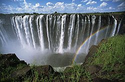 Victoria Falls is by some measures the largest waterfall in the world, being twice as wide and one and a half times as high as the Niagara FallsSee also: List of settlements in Zambia
Zambia is a landlocked country in southern Africa, with a tropical climate and consists mostly of high plateau, with some hills and mountains, dissected by river valleys. At 752,614 km2 (290,586 sq mi) it is the 39th-largest country in the world (after Chile) and slightly larger than the US state of Texas. The country lies mostly between latitudes 8° and 18°S, and longitudes 22° and 34°E.
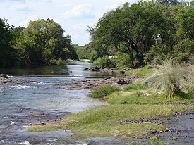
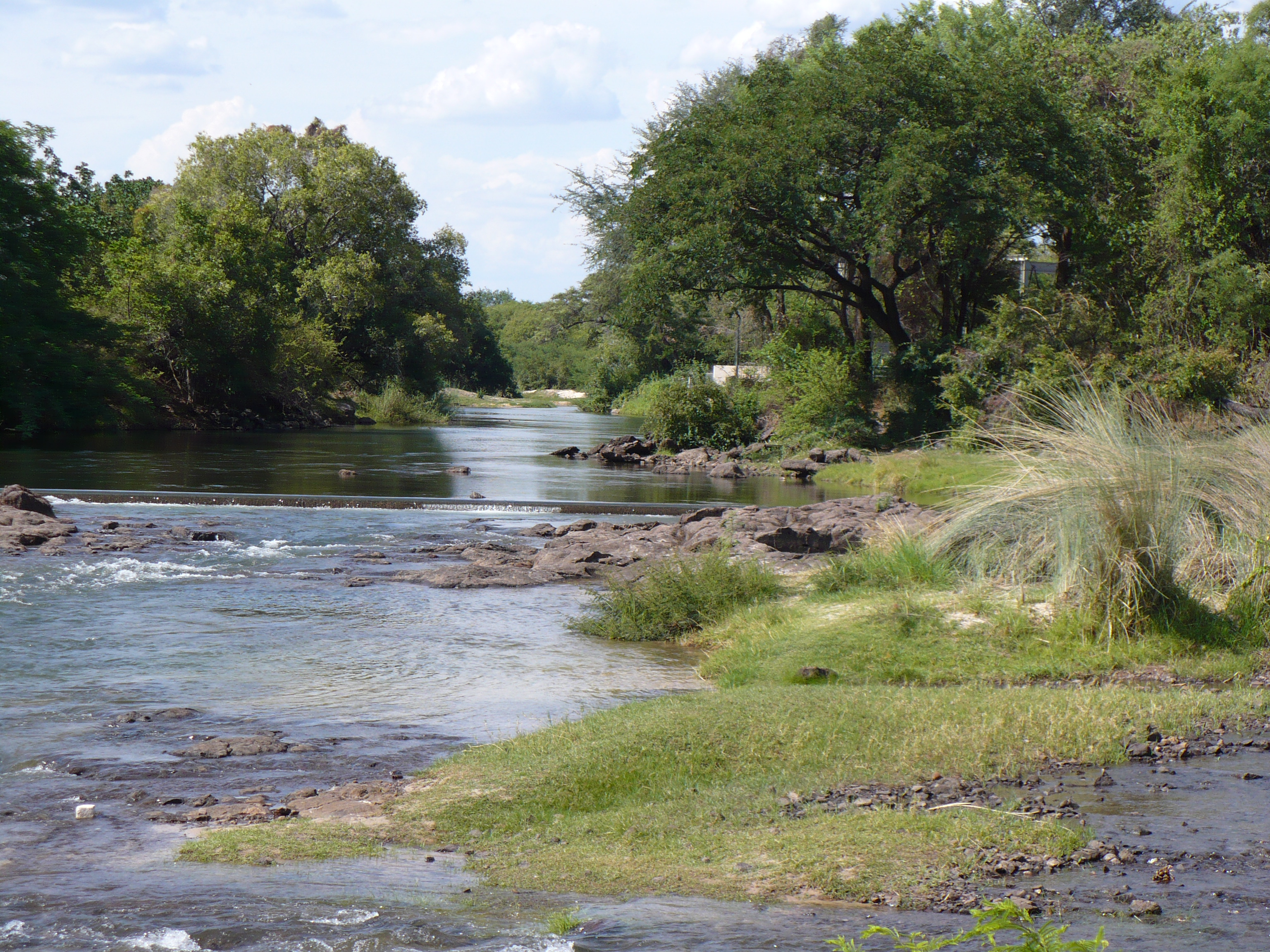
Zambia is drained by two major river basins: the Zambezi/Kafue basin in the centre, west and south covering about three-quarters of the country; and the Congo basin in the north covering about one-quarter of the country. A very small area in the northeast forms part of the internal drainage basin of Lake Rukwa in Tanzania.
In the Zambezi basin, there are a number of major rivers flowing wholly or partially through Zambia: the Kabompo, Lungwebungu, Kafue, Luangwa, and the Zambezi itself, which flows through the country in the west and then forms its southern border with Namibia, Botswana and Zimbabwe. Its source is in Zambia but it diverts into Angola, and a number of its tributaries rise in Angola's central highlands. The edge of the Cuando River floodplain (not its main channel) forms Zambia's southwestern border, and via the Chobe River that river contributes very little water to the Zambezi because most is lost by evaporation.[16]
Two of the Zambezi's longest and largest tributaries, the Kafue and the Luangwa, flow mainly in Zambia. Their confluences with the Zambezi are on the border with Zimbabwe at Chirundu and Luangwa town respectively. Before its confluence, the Luangwa River forms part of Zambia's border with Mozambique. From Luangwa town, the Zambezi leaves Zambia and flows into Mozambique, and eventually into the Mozambique Channel.
The Zambezi falls about 100 metres (328 ft) over the 1.6 km (0.99 mi) wide Victoria Falls, located in the south-west corner of the country, subsequently flowing into Lake Kariba. The Zambezi valley, running along the southern border, is both deep and wide. From Lake Kariba going east it is formed by grabens and like the Luangwa, Mweru-Luapula, Mweru-wa-Ntipa and Lake Tanganyika valleys, is a rift valley.
A type of landscape in Zambia The north of Zambia is very flat with broad plains. In the west the most notable being the Barotse Floodplain on the Zambezi, which floods from December to June, lagging behind the annual rainy season (typically November to April). The flood dominates the natural environment and the lives, society and culture of the inhabitants and those of other smaller, floodplains throughout the country.
In Eastern Zambia the plateau which extends between the Zambezi and Lake Tanganyika valleys is tilted upwards to the north, and so rises imperceptibly from about 900 m (2,953 ft) in the south to 1,200 m (3,937 ft) in the centre, reaching 1,800 m (5,906 ft) in the north near Mbala. These plateau areas of northern Zambia have been categorised by the World Wildlife Fund as a large section of the Central Zambezian Miombo woodlands ecoregion.
Eastern Zambia shows great diversity. The Luangwa Valley splits the plateau in a curve north east to south west, extended west into the heart of the plateau by the deep valley of the Lunsemfwa River. Hills and mountains are found by the side of some sections of the valley, notably in its north-east the Nyika Plateau (2,200 m/7,218 ft) on the Malawi border, which extend into Zambia as the Mafinga Hills, containing the country's highest point, Kongera (2,187 m/7,175 ft). The Muchinga Mountains, the watershed between the Zambezi and Congo drainage basins, run parallel to the deep valley of the Luangwa River and form a sharp backdrop to its northern edge, although they are almost everywhere below 1,700 m (5,577 ft). Their culminating peak Mumpu is at the western end and at 1,892 m (6,207 ft) is the highest point in Zambia away from the eastern border region. The border of the Congo Pedicle was drawn around this mountain.
The southernmost headstream of the Congo River rises in Zambia and flows west through its northern area firstly as the Chambeshi and then, after the Bangweulu Swamps as the Luapula, which forms part of the border with the Democratic Republic of the Congo. The Luapula flows south then west before it turns north until it enters Lake Mweru. The lake's other major tributary is the Kalungwishi River, which flows into it from the east. The Luvua River drains Lake Mweru, flowing out of the northern end to the Lualaba River (Upper Congo River).
Lake Tanganyika is the other major hydrographic feature that belongs to the Congo basin. Its south-eastern end receives water from the Kalambo River, which forms part of Zambia's border with Tanzania. This river has Africa's second highest uninterrupted waterfall, the Kalambo Falls.
Climate
The climate of Zambia is tropical modified by elevation. In the Köppen climate classification, most of the country is classified as humid subtropical or tropical wet and dry, with small stretches of semi-arid steppe climate in the south-west and along the Zambezi valley.
There are two main seasons, the rainy season (November to April) corresponding to summer, and the dry season (May/June to October/November), corresponding to winter. The dry season is subdivided into the cool dry season (May/June to August), and the hot dry season (September to October/November). The modifying influence of altitude gives the country pleasant subtropical weather rather than tropical conditions during the cool season of May to August.[17] However, average monthly temperatures remain above 20 °C (68 °F) over most of the country for eight or more months of the year.
Demographics
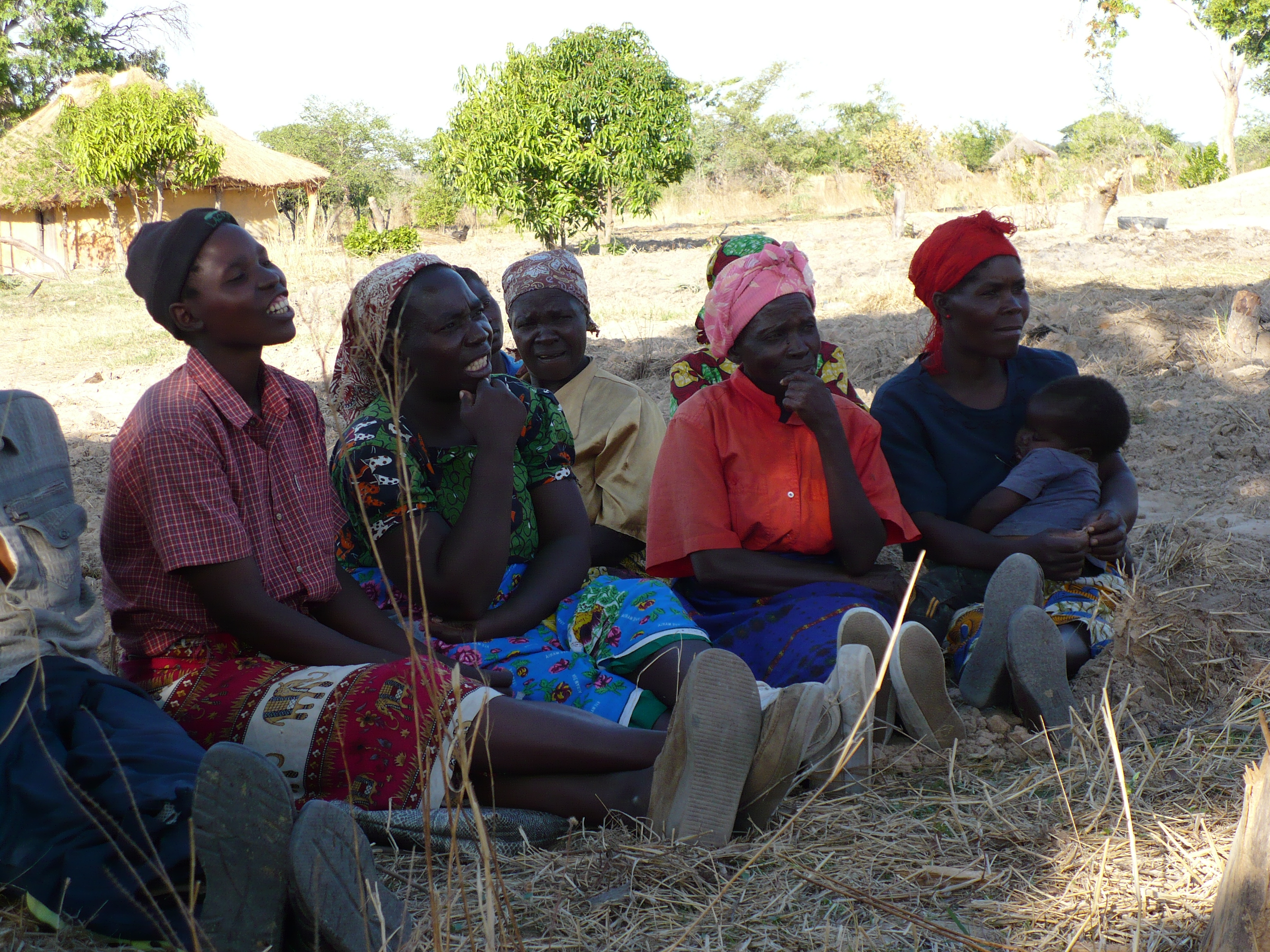
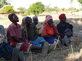 Village in Zambia. Women with baby.
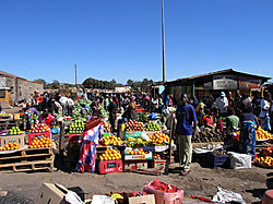
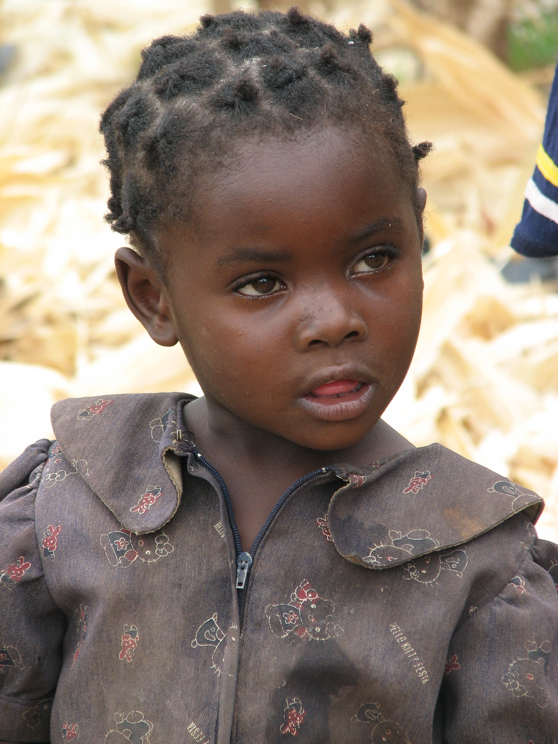
Zambia is one of the most highly urbanized countries in sub-Saharan Africa with 44% of the population concentrated in a few urban areas along the major transport corridors, while rural areas are sparsely populated. Unemployment and underemployment in urban areas are serious problems, while most rural Zambians are subsistence farmers. The population comprises approximately 72 ethnic groups, most of which are Bantu-speaking.
Almost 90% of Zambians belong to the nine main ethnolinguistic groups: the Nyanja-Chewa, Bemba, Tonga, Tumbuka, Lunda, Luvale, Kaonde, Nkoya and Lozi. In the rural areas, each ethnic group is concentrated in a particular geographic region of the country and many groups are very small and not as well known. However, all the ethnic groups can be found in significant numbers in Lusaka and the Copperbelt.
Expatriates, mostly British or South African, as well as some white Zambian citizens, live mainly in Lusaka and in the Copperbelt in northern Zambia, where they are either employed in mines, financial and related activities or retired. There were 70,000 Europeans in Zambia in 1964, but many have since left the country.[14] Zambia also has a small but economically important Asian population, most of whom are Indians and Chinese. An estimated 80,000 Chinese are resident in Zambia.[18] In recent years, several hundred dispossessed white farmers have left Zimbabwe at the invitation of the Zambian government, to take up farming in the Southern province.[19][20]
According to the World Refugee Survey 2008 published by the U.S. Committee for Refugees and Immigrants, Zambia has a population of refugees and asylum seekers numbering approximately 113,200. The majority of refugees in the country came from the Democratic Republic of Congo (55,400 refugees from the DRC living in Zambia in 2007), Angola (40,800; see Angolans in Zambia) and Rwanda (4,000).[21]
Beginning in May 2008, the number of Zimbabweans in Zambia also began to increase significantly; the influx consisted largely of Zimbabweans formerly living in South Africa who were fleeing xenophobic violence there.[22] Nearly 60,000 refugees live in camps in Zambia, while 50,000 are mixed in with the local populations. Refugees who wish to work in Zambia must apply for official permits which can cost up to $500 per year.[21]
- Population of major cities
City Pop. 2000[23] Pop. 2010[23] 1. Lusaka 1,084,703 1,460,566 2. Ndola 374,757 495,004 3. Kitwe 363,734 547,700 4. Kabwe, Broken Hill 176,758 215,015 5. Chingola 147,448 178,092 6. Mufulira 122,336 141,056 7. Luanshya 115,579 132 117 8. Livingstone 97,488 133,936 9. Kasama 74,243 111,588 10. Chipata, Ft. Jameson 73,110 109,344 The Europeans in the Colony numbered 14,000 at the 1931 census and the Africans 1,400,000, or just one hundred times as many. Of the Europeans, more than 10,000 had entered the country in the previous ten years, since the census in 1921[24][25] (mostly to work on the copper mines). In 1938 there were only eight doctors in the entire country.
Languages
The official language of Zambia is English, which is used to conduct official business and is the medium of instruction in schools. The main local language, especially in Lusaka, is Nyanja. However, Bemba and Nyanja are spoken in the urban areas in addition to other indigenous languages which are commonly spoken in Zambia. Estimates of the total number of languages spoken in Zambia add up to 72,[26] thirteen (13) dialects are counted as languages in their own right which brings this number to 85.
The process of urbanisation has had a dramatic effect on some of the indigenous languages, including the assimilation of words from other indigenous languages and English. Urban dwellers sometimes differentiate between urban and rural dialects of the same language by prefixing the rural languages with 'deep'.
Most will thus speak Bemba and Nyanja on the Copperbelt; Nyanja is dominantly spoken in Lusaka and Eastern Zambia. English is used in official communications and is the chosen language at home among - now common - intertribal families. If one does visit Zambia it becomes evident that language continuously evolves and has led to Zambian slang which can be heard in daily life throughout Lusaka and other major cities. As a member of the SADC, Portuguese was introduced into the primary school system, to cater for the increasing Angolan population in the country.[27]
Religion

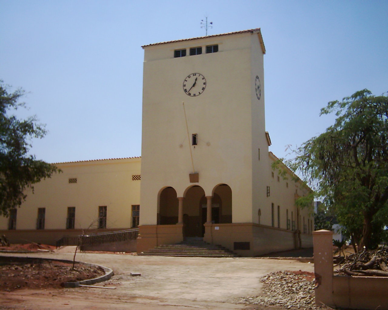
The Livingstone Museum, Zambia Zambia is officially a Christian nation according to the 1996 constitution,[28] but a wide variety of religious traditions exist. Traditional religious thoughts blend easily with Christian beliefs in many of the country's syncretic churches. Christian denominations include: Roman Catholic, Anglican, Pentecostal, New Apostolic Church, Lutheran, Seventh-day Adventist, The Church of Jesus Christ of Latter-day Saints, Jehovah's Witnesses and a variety of Evangelical denominations. These grew, adjusted and prospered from the original missionary settlements (Portuguese and Catholicism in the east from Mozambique) and Anglicanism (English and Scottish influences) from the south. Except for some technical positions (e.g. physicians), Western missionary roles have been assumed by native believers. After Frederick Chiluba (a Pentecostal Christian) became President in 1991, Pentecostal congregations expanded considerably around the country.[29]
Approximately 87% of the population are Christians. Approximately 1% of the population are Muslims with most living in urban areas.[30] There is also a small Jewish community, composed mostly of Ashkenazis. Notable Jewish Zambians include Simon Zukas, retired Minister, MP and a member of Forum for Democracy and Development and earlier on the Movement for Multiparty Democracy (MMD) and United National Independence Party. Additionally, the economist Stanley Fischer, currently the governor of the Bank of Israel and formerly Deputy Managing Director of the International Monetary Fund (IMF) was born and partially raised in Zambia's Jewish community. The Baha'i population of Zambia is over 160,000,[31] or 1.5% of the population. The William Mmutle Masetlha Foundation[32] run by the Baha'i community is particularly active in areas such as literacy and primary health care.
Economy
About 68% of Zambians live below the recognised national poverty line,[33] with rural poverty rates standing at about 78%[34] and urban rates of 53%.[35] Zambia ranked 117th out of 128 countries on the 2007 Global Competitiveness Index, which looks at factors that affect economic growth.[36] Per capita annual incomes are currently at about one-half their levels at independence and, at $395, place the country among the world's poorest nations.[citation needed] Social indicators continue to decline, particularly in measurements of life expectancy at birth (about 40.9 years) and maternal mortality (830 per 100,000 pregnancies).[37] The country's rate of economic growth cannot support rapid population growth or the strain which HIV/AIDS-related issues place on the economy.
During the decades of Kaunda's socialist policies, Zambia fell into poverty, especially after international copper prices declined in the 1970s. The socialist regime made up for falling revenue with several abortive attempts at International Monetary Fund structural adjustment programmes (SAPs). After the dictatorship ended, successive governments have begun limited reforms. The economy stagnated until late 1990s. In 2007 Zambia recorded its ninth consecutive year of economic growth. Inflation was 8.9%, down from 30% in 2000.[38]
Zambia is still dealing with economic reform issues such as the size of the public sector and improving Zambia's social sector delivery systems.[38] Economic regulations and red tape are extensive, and corruption is widespread. Zambia's total foreign debt exceeded $6 billion when the country qualified for Highly Indebted Poor Country Initiative (HIPC) debt relief in 2000, contingent upon meeting certain performance criteria. Initially, Zambia hoped to reach the HIPC completion point, and benefit from substantial debt forgiveness, in late 2003.
In January 2003, the Zambian government informed the International Monetary Fund and World Bank that it wished to renegotiate some of the agreed performance criteria calling for privatisation of the Zambia National Commercial Bank and the national telephone and electricity utilities. Although agreements were reached on these issues, subsequent overspending on civil service wages delayed Zambia's final HIPC debt forgiveness from late 2003 to early 2005, at the earliest. In an effort to reach HIPC completion in 2004, the government drafted an austerity budget for 2004, freezing civil service salaries and increasing a number of taxes. The tax hike and public sector wage freeze prohibited salary increases and new hires. This sparked a nationwide strike in February 2004.[39]
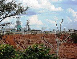
The Zambian economy has historically been based on the copper mining industry. Output of copper had fallen, however, to a low of 228,000 metric tons in 1998, after a 30 year decline in output due to lack of investment, low copper prices, and uncertainty over privatisation. In 2002, following privatisation of the industry, copper production rebounded to 337,000 metric tons. Improvements in the world copper market have magnified the effect of this volume increase on revenues and foreign exchange earnings.
The Zambian government is pursuing an economic diversification program to reduce the economy's reliance on the copper industry. This initiative seeks to exploit other components of Zambia's rich resource base by promoting agriculture, tourism, gemstone mining, and hydro-power.
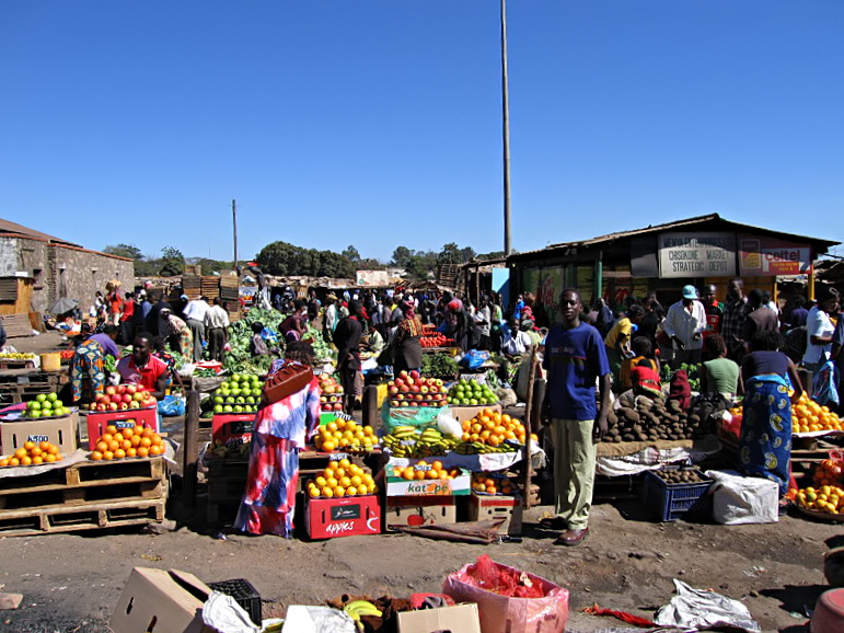
Agriculture plays a very important part in Zambia's economy providing many more jobs than the mining industry. Private local company Zambeef Products Ltd. is the leading agri-business in Zambia with over 4.000 employees, producing row crops (5.000 ha irrigated, 1.500 ha non-irrigated), cattle (Zambeef), pork (Master Pork), chicken (ZamChick), eggs (ZamChick Egg), dairy products, leather, fish, feedstock (Novatek) and edible oil (Zamanita). Zambeef operates eight abattoirs, four farms and numerous retail stores (also in cooperation with Shoprite) and a fast-food chain (ZamChick Inn) throughout the country.
In 2003, exports of nonmetals increased by 25% and accounted for 38% of all export earnings, previously 35%. The Zambian government has recently been granting licenses to international resource companies to prospect for minerals such as nickel, tin, copper and uranium.[40] It is hoped that nickel will take over from copper as the country's top metallic export. In 2009, Zambia has been badly hit by the world economic crisis.[41]
Zambia was ranked the 127th safest investment destination in the world in the March 2011 Euromoney Country Risk rankings.[42]
Social protection in Zambia
Zambia officially has extensive social protection targeted at low-capacity households, including social assistance (protection) and social insurance programmes (prevention), and programmes to improve economic productivity (promotion). However, these programmes face immense challenges and the actual coverage is very low and, in some cases, actually declining.[43] Some analysts describe the programmes' coverage as patchy and transitory and not especially coherent or logical.[43]
Public works, such as PUSH, and cash transfers are the main instruments used to protect consumption among low-capacity households by providing (1) seasonal safety nets to address cyclical poverty and vulnerability at times of need by offering employment and (2) community assets that are beneficial for productive activities.[43] In practice, however, the programme prioritises food transfers to areas affected by natural disasters where vulnerability is acute and infrastructure development has remained a secondary objective.[43] NGOs also have implemented short-term public works programmes implemented by NGOs, such as CARE’s agricultural inputs-for-assets (AICA) programme.[43]
Social insurance initiatives, such as micro-insurance, health insurance and other contributory schemes exist, but these are very limited in their membership. Formal sector workers are protected by well-resourced pension, sickness and disability benefits, but most low-capacity households, especially in rural areas, work outside the formal sector.[43]
The emphasis on protection of the expense of prevention and promotion means that households move out of poverty only very slowly because they are unable to invest in activities that have greater returns. They remain highly at risk of sliding back into poverty and applying negative coping strategies.[43] A balance between protection, prevention and promotion, however can only be achieved through more and consistent resources.[43] Further improvements might also include
- improved implementation of existing programmes; and
- better coordination between different implementers and programmes.
Education
In 2003, the literacy rate was estimated to be 80.6% (86.8% male and 74.8% female).[44] Education in Zambia is provided at two levels: basic education (years 1 to 9), and upper secondary (years 10 to 12). Some schools provide a "basic" education covering years 1 to 9, as year 9 is considered to be a decent level of education for the majority of children. However, tuition is only free up to year 7, and UNESCO estimated that 80% of children of primary school age in 2002 were enrolled.[45] Most children drop out after year 7 when fees must be paid.
Both government and private schools exist in Zambia. The private school system began largely as a result of Christian mission efforts during the late 19th and early 20th centuries.
Educational opportunities beyond secondary school are limited in Zambia. After secondary school, most students study at the various colleges, around the country. There are three main universities: the University of Zambia (UNZA), Mulungushi University (MU) and the Copperbelt University (CBU). Normally they all select students on the basis of ability; competition for places is intense. The introduction of fees in the late 1990s has made university level education inaccessible for some, although the government does provide state bursaries.
Copperbelt University opened in the late 1980s, taking over most of the former Zambia Institute of Technology site in Kitwe. Other centres of education include the Public Administration College (NIPA), the Northern Technical College (NORTEC), the National Resources Development College (NRDC), the Evelyn Hone College, and Northrise University. There are also several teacher training colleges offering two-year training programmes, whilst missionary hospitals around the country offer internationally acceptable training for nurses. Several Christian schools offer seminary-level training.
Health
HIV prevalence exceeds 10%. Public expenditure on health was at 3.4 of the GDP in 2004. Expenditure on health was at 2.9 % in the same year. Health expenditure was at US$ 63 (PPP) in 2004. Infant mortality was at 102 per 1,000 in 2005.
Maternal and Child Health Care
In June 2011, the United Nations Population Fund released a report on The State of the World's Midwifery. It contained new data on the midwifery workforce and policies relating to newborn and maternal mortality for 58 countries. The 2010 maternal mortality rate per 100,000 births for Zambia is 470. This is compared with 602.9 in 2008 and 594.2 in 1990. The under 5 mortality rate, per 1,000 births is 145 and the neonatal mortality as a percentage of under 5's mortality is 25. The aim of this report is to highlight ways in which the Millennium Development Goals can be achieved, particularly Goal 4 – Reduce child mortality and Goal 5 – improve maternal death. In Zambia the number of midwives per 1,000 live births is 5 and 1 in 38 shows us the lifetime risk of death for pregnant women. [46]
Culture
The culture of Zambia is mainly indigenous Bantu culture mixed with European influences. Prior to the establishment of modern Zambia, the natives lived in independent tribes, each with their own ways of life. One of the results of the colonial era was the growth of urbanization. Different ethnic groups started living together in towns and cities, influencing each other as well as adopting a lot of the European culture. The original cultures have largely survived in the rural areas. In the urban setting there is a continuous integration and evolution of these cultures to produce what is now called "Zambian culture".
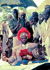
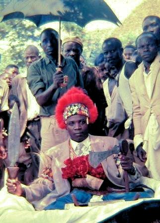
Traditional culture is very visible through colourful annual Zambian traditional ceremonies. Some of the more prominent are: Kuomboka and Kathanga (Western Province), Mutomboko (Luapula Province), Ncwala (Eastern Province), Lwiindi and Shimunenga (Southern Province), Lunda Lubanza (North Western), Likumbi Lyamize (North Western), Chibwela Kumushi (Central Province), Ukusefya Pa Ng’wena (Northern Province).
Popular traditional arts are mainly in pottery, basketry (such as Tonga baskets), stools, fabrics, mats, wooden carvings, ivory carvings, wire craft and copper crafts.[citation needed] Most Zambian traditional music is based on drums (and other percussion instruments) with a lot of singing and dancing.[citation needed] In the urban areas foreign genres of music are popular, in particular Congolese rumba, African-American music and Jamaican reggae. Several psychedelic rock artists emerged in the 1970s to create a genre known as "Zamrock," including The Witch, Musi-O-Tunya, Rikki Ililonga, Amanaz, the Peace, Chrissy Zebby Tembo, Blackfoot, and the Ngozi Family.[citation needed]
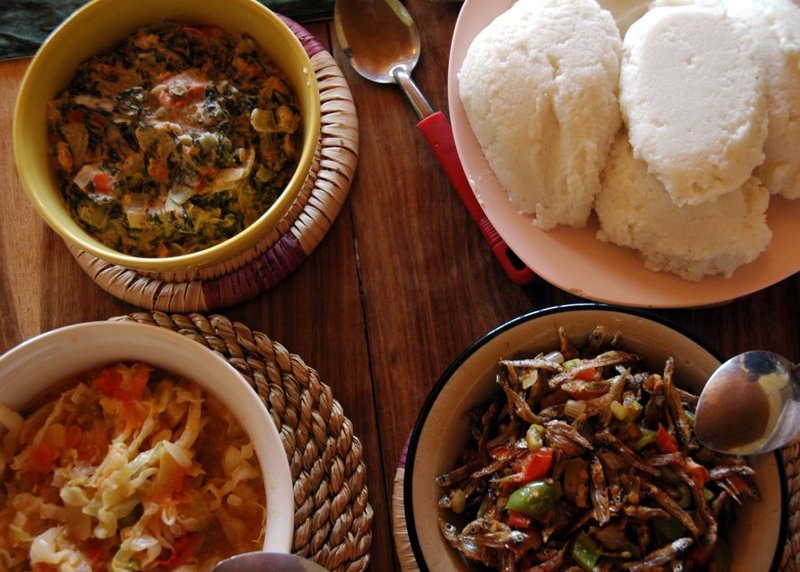
The Zambian staple diet is based on maize. It is normally eaten as a thick porridge, called Nshima (Nyanja Word), prepared from maize flour commonly known as mealie meal. This may be eaten with a variety of vegetables, beans, meat, fish or sour milk depending on geographical location/origin. Nshima is also prepared from cassava, a staple food in some parts of the country.
Sports
See also: Rugby union in Zambia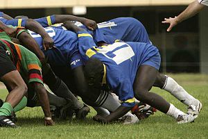 Zambia playing Senegal
Zambia declared its independence on the day of the closing ceremony of the 1964 Summer Olympics, thereby becoming the first country ever to have entered an Olympic games as one country, and left it as another.[citation needed]
Football is the most popular sport in Zambia, and the Zambia national football team has had its triumphant moments in football history. At the Seoul Olympics of 1988, the national team defeated the Italian national team by a score of 4–0. Kalusha Bwalya, Zambia's most celebrated football player and one of Africa's greatest football talents had a hat trick in that match. However, to this day, many pundits say the greatest team Zambia has ever assembled was the one that perished on 28 April 1993 in a plane crash at Libreville, Gabon. Despite this, in 1996, Zambia was ranked 15th on the official FIFA World Football Team rankings, the highest attained by any Southern African team. The national team is currently ranked 86th on the rankings. Zambia also produced the first black African (Madalitso Muthiya) to play in the United States Golf Open, one of the four major golf tournaments.
Rugby, boxing and cricket are also popular sports in Zambia. Notably, at one point in the early 2000s, the Australia and South Africa national rugby teams were captained by players born in the same Lusaka hospital, George Gregan and Corné Krige. Zambia boasts having the highest rugby poles in the world, located at Luanshya Sports Complex in Luanshya.[citation needed] Rugby union in Zambia is a minor but growing sport. They are currently ranked 73rd by the IRB and have 3,650 registered players and three formally organised clubs.[47] Zambia used to play cricket as part of Rhodesia. Zambia has also strangely provided a shinty international, Zambian-born Eddie Tembo representing Scotland in the compromise rules Shinty/Hurling game against Ireland in 2008.[48]
In 2011, Zambia was due to host the tenth All-Africa Games, for which three stadiums were to be built in Lusaka, Ndola, and Livingstone.[49] The Lusaka stadium will have a capacity of 70,000 spectators while the other two stadiums will hold 50,000 people each. The government is encouraging the private sector to get involved in the construction of the sports facilities because of a shortage of public funds for the project. Zambia has since revoked its bid to host the 2011 All-Africa Games, citing a lack of funds. Instead, Mozambique will be hosting.
Zambia took part in the 2008 Summer Olympics in Beijing.
See also
- Outline of Zambia
- Index of Zambia-related articles
- Commonwealth of Nations
- List of countries by copper mine production
References
- ^ United Nations Statistics Division. "Population by sex, rate of population increase, surface area and density" (PDF). http://unstats.un.org/unsd/demographic/products/dyb/DYB2004/Table03.pdf. Retrieved 2007-11-09.
- ^ Department of Economic and Social Affairs Population Division (2009) (PDF). World Population Prospects, Table A.1. 2008 revision. United Nations. http://www.un.org/esa/population/publications/wpp2008/wpp2008_text_tables.pdf. Retrieved 2009-03-12.
- ^ Central Statistical Office, Government of Zambia. "Population size, growth and composition" (PDF). http://www.zamstats.gov.zm/media/chapter_3_population_comp._size_and_growth-_final.pdf. Retrieved 2007-11-09.
- ^ a b c d "Zambia". International Monetary Fund. http://www.imf.org/external/pubs/ft/weo/2010/01/weodata/weorept.aspx?sy=2007&ey=2010&scsm=1&ssd=1&sort=country&ds=.&br=1&c=754&s=NGDPD%2CNGDPDPC%2CPPPGDP%2CPPPPC%2CLP&grp=0&a=&pr.x=47&pr.y=15. Retrieved 2010-04-21.
- ^ Holmes, Timothy (1998). Cultures of the World: Zambia. Tarrytown, New York: Times Books International. pp. 19–20. ISBN 0-7614-0694-8.
- ^ "History of the Mankoya District" by Gervas Clay
- ^ "Gervas Clay WebSite". http://www.spanglefish.com/gervasclay/documents.
- ^ "First to the Falls" by Gervas and Gill Clay
- ^ "Gervas Clay WebSite". http://www.spanglefish.com/gervasclay/documents.
- ^ Livingstone Tourism Association. "Destination:Zambia - History and Culture". Archived from the original on October 12, 2007. http://web.archive.org/web/20071012153527/http://livingstonetourism.com/pages/history.htm. Retrieved 2007-10-29.
- ^ Human Rights & Documentation Centre. "Zambia: Historical Background". Archived from the original on 2007-03-11. http://web.archive.org/web/20070311093653/http://www.hrdc.unam.na/zm_history.htm. Retrieved 2011-01-14.
- ^ Burnham, Frederick Russell (1899). "Northern Rhodesia". In Wills, Walter H.. Bulawayo Up-to-date; Being a General Sketch of Rhodesia. Simpkin, Marshall, Hamilton, Kent & Co.. pp. 177–180.
- ^ Pearson Education. "Rhodesia and Nyasaland, Federation of". http://www.infoplease.com/ce6/history/A0841738.html. Retrieved 2007-10-29.
- ^ a b 1964: President Kaunda takes power in Zambia. BBC On This Day.
- ^ Kaunda and Southern Africa by Stephen Chan
- ^ Richard Beilfuss & David dos Santos: Patterns of Hydrological Change in the Zambezi Delta, Mozambique. Working Paper No 2 Program for the Sustainable Management of Cahora Bassa Dam and The Lower Zambezi Valley (2001).
- ^ Camerapix: "Spectrum Guide to Zambia." Camerapix International Publishing, Nairobi, 1996.
- ^ Zambians wary of "exploitative" Chinese employers. Irinnews.org. November 23, 2006.
- ^ "Zim's Loss, Zam's gain: White Zimbabweans making good in Zambia". The Economist. June 2004. http://www.highbeam.com/doc/1G1-123518400.html. Retrieved 2009-08-28
- ^ Thielke, Thilo (2004-12-27). "Settling in Zambia: Zimbabwe's Displaced Farmers Find a New Home". Der Spiegel. http://www.spiegel.de/international/spiegel/0,1518,334756,00.html. Retrieved 2009-08-28
- ^ a b "World Refugee Survey 2008". U.S. Committee for Refugees and Immigrants. 2008-06-19. http://www.refugees.org/survey/.
- ^ "Zambia: Rising levels of resentment towards Zimbabweans". IRIN News. 2008-06-09. http://www.irinnews.org/Report.aspx?ReportId=78648. Retrieved 2009-08-28
- ^ a b http://world-gazetteer.com/wg.php?x=&men=gcis&lng=en&des=wg&geo=-246&srt=npan&col=abcdefghinoq&msz=1500&pt=c&va=&srt=pnan
- ^ "The Colour Bar in the Copper Belt" by Julius Lewin, SA IRR, 1941
- ^ "Gervas Clay WebSite". http://www.spanglefish.com/gervasclay/documents/Miscellaneous%20Printed%20Documents/Colour%20Bar%20and%20CopperBelt.doc.
- ^ "Zanglish". http://www.zanglish.com/. Retrieved 2008-10-03.
- ^ Zambia to introduce Portuguese into school curriculum.
- ^ http://www.scribd.com/doc/3713564/Constitution-of-Zambia-1991Amended-to-1996
- ^ Matthew Steel (2005). Pentecostalism in Zambia : Power, Authority and the Overcomers. MSc Dissertation. University of Wales.
- ^ International Religious Freedom Report 2010 - Zambia
- ^ Adherents.com. "The Largest Baha'i Communities". http://adherents.com/largecom/com_bahai.html. Retrieved 2007-10-29.
- ^ DL Publicaciones. "About DLP". http://www.devlp.com/dla.html#masetlha. Retrieved 2007-10-29.
- ^ Development Indicators Unit, Statistics Division, United Nations. "Population below national poverty line, total, percentage". http://mdgs.un.org/unsd/mdg/SeriesDetail.aspx?srid=581&crid=894. Retrieved 2007-10-30.
- ^ Development Indicators Unit, Statistics Division, United Nations. "Population below national poverty line, rural, percentage". http://mdgs.un.org/unsd/mdg/SeriesDetail.aspx?srid=583&crid=894. Retrieved 2007-10-30.
- ^ Development Indicators Unit, Statistics Division, United Nations. "Population below national poverty line, urban, percentage". http://mdgs.un.org/unsd/mdg/SeriesDetail.aspx?srid=582&crid=894. Retrieved 2007-10-30.
- ^ "Zambia Country Brochure". World Bank. http://siteresources.worldbank.org/INTZAMBIA/Resources/Zambia_Brochure_V_3.pdf.
- ^ [1][dead link]
- ^ a b "Background Note: Zambia". Department of State. http://www.state.gov/r/pa/ei/bgn/2359.htm.
- ^ The World Bank and IMF’s long shadow in Zambia’s copper mines
- ^ Pennysharesonline.com, City Equities Limited (2006-07-14). "Albidon signs agreement with Zambian government". http://www.pennysharesonline.com/News/Articles/735922.asp. Retrieved 2006-10-30.[dead link]
- ^ Chinese keep low profile to cash in on the slump in Zambia. The Times. January 24, 2009.
- ^ "Euromoney Country Risk". Euromoney Country Risk. Euromoney Institutional Investor PLC. http://www.euromoneycountryrisk.com/. Retrieved 15 August 2011.
- ^ a b c d e f g h Rebecca Holmes and Rachel Slater (2010) Social protection for low capacity households in Zambia Overseas Development Institute
- ^ https://www.cia.gov/library/publications/the-world-factbook/fields/2103.html
- ^ Abby Riddell, UNESCO (2003). "The introduction of free primary education in sub-Saharan Africa". http://unesdoc.unesco.org/images/0014/001469/146914e.pdf. Retrieved 2007-10-30.
- ^ "The State Of The World's Midwifery". United Nations Population Fund. Accessed August 2011. http://www.unfpa.org/sowmy/report/home.html.
- ^ IRB Zambia page. Retrieved 2009-07-05.
- ^ Tembo's return is boost for Glen.
- ^ "Zambia to build three stadia for 2011 All-Africa Games". People's Daily Online. http://english.peopledaily.com.cn/200602/22/eng20060222_244775.html. Retrieved 2007-11-06.
Further reading
- Burke, Mark, Glimmers of Hope : A Memoir of Zambia, (lulu.com, 2009)
- Ferguson, James (1999). Expectations of Modernity: Myths and Meanings of Urban Life in the Zambian Copperbelt. Berkeley: University of California Press. ISBN 0520217012
- Ihonvbere, Julius, Economic Crisis, Civil Society and Democratisation: The Case of Zambia, (Africa Research & Publications, 1996)
- LaMonica, Christopher, Local Government Matters: The Case of Zambia , (Lambert Academic Publishing, 2010)
- Mcintyre, Charles, Zambia (Bradt Travel Guides), (Bradt Travel Guides, 2008)
- Murphy, Alan and Luckham, Nana, Zambia and Malawi (Lonely Planet Multi Country Guide), (Lonely Planet Publications, 2010)
- Phiri, Bizeck Jube, A Political History of Zambia: From the Colonial Period to the 3rd Republic, (Africa Research & Publications, 2005)
- Roberts, Andrew, A History of Zambia, (Heinemann, 1976)
- Sardanis, Andrew, Africa: Another Side of the Coin: Northern Rhodesia's Final Years and Zambia's Nationhood, (I.B.Tauris, 2003)
- Various, One Zambia, Many Histories: Towards a History of Post-colonial Zambia, (Brill, 2008)
- Wotela, Kambidima (2010). Deriving Ethno-geographical Clusters for Comparing Ethnic Differentials in Zambia. University of California Irvine: World Cultures eJournal, 17(2). http://www.escholarship.org/uc/item/0j58j1nz?display=all.
External links
- Official website
- Zambia entry at The World Factbook
- Zambia at the Open Directory Project
- Wikimedia Atlas of Zambia
- Zambia travel guide from Wikitravel
- Template:Truly Zambian
International membership Member states of the African Union (AU) Algeria · Angola · Benin · Botswana · Burkina Faso · Burundi · Cameroon · Cape Verde · Central African Republic · Chad · Comoros · Democratic Republic of the Congo · Republic of the Congo · Côte d'Ivoire · Djibouti · Egypt · Equatorial Guinea · Eritrea · Ethiopia · Gabon · The Gambia · Ghana · Guinea · Guinea-Bissau · Kenya · Lesotho · Liberia · Libya · Madagascar · Malawi · Mali · Mauritania · Mauritius · Mozambique · Namibia · Niger · Nigeria · Rwanda · Sahrawi Arab Democratic Republic · São Tomé and Príncipe · Senegal · Seychelles · Sierra Leone · Somalia · South Africa · South Sudan · Sudan · Swaziland · Tanzania · Togo · Tunisia · Uganda · Zambia · Zimbabwe
Southern African Development Community Member states Angola · Botswana · Democratic Republic of the Congo · Lesotho · Madagascar · Malawi · Mauritius · Mozambique · Namibia · South Africa · Swaziland · Tanzania · Zambia · ZimbabweLeaders Chairpersons: Levy Mwanawasa · Kgalema Motlanthe
Secretaries-General: Kaire Mbuende · Prega Ramsamy · Tomaz SalomãoSee also Members of the Commonwealth of Nations Sovereign states - Antigua and Barbuda
- Australia
- Bahamas
- Bangladesh
- Barbados
- Belize
- Botswana
- Brunei
- Cameroon
- Canada
- Cyprus
- Dominica
- Fiji (suspended)
- The Gambia
- Ghana
- Grenada
- Guyana
- India
- Jamaica
- Kenya
- Kiribati
- Lesotho
- Malawi
- Malaysia
- Maldives
- Malta
- Mauritius
- Mozambique
- Namibia
- Nauru
- New Zealand
- Nigeria
- Pakistan
- Papua New Guinea
- Rwanda
- St. Kitts and Nevis
- St. Lucia
- St. Vincent and the Grenadines
- Samoa
- Seychelles
- Sierra Leone
- Singapore
- Solomon Islands
- South Africa
- Sri Lanka
- Swaziland
- Tanzania
- Tonga
- Trinidad and Tobago
- Tuvalu
- Uganda
- United Kingdom
- Vanuatu
- Zambia
Dependencies AustraliaNew ZealandUnited Kingdom- Akrotiri and Dhekelia
- Anguilla
- Bermuda
- British Antarctic Territory
- British Indian Ocean Territory
- British Virgin Islands
- Cayman Islands
- Falkland Islands
- Gibraltar
- Guernsey
- Isle of Man
- Jersey
- Montserrat
- Pitcairn Islands
- St. Helena, Ascension and Tristan da Cunha
- South Georgia and the South Sandwich Islands
- Turks and Caicos Islands
Source: Commonwealth Secretariat - Member States Zambia topics Politics and law History Geography and ecology Economy and infrastructure Culture and society List of Zambia-related topics · Portal:Zambia Categories:- Zambia
- African countries
- Member states of the African Union
- Landlocked countries
- English-speaking countries and territories
- Member states of the Commonwealth of Nations
- Least developed countries
- States and territories established in 1964
- Member states of the United Nations
- Bantu countries and territories


Wikimedia Foundation. 2010.