- Districts of Zambia
-
Zambia 
This article is part of the series:
Politics and government of
Zambia- President
- Vice President
- Cabinet
- National Assembly
- Speaker
- Amusaa Mwanamwambwa
- Speaker
- Political parties
- Elections
- Constituencies
- 2001, 2006, 2008, 2011
- Foreign relations
- Provinces
- Districts
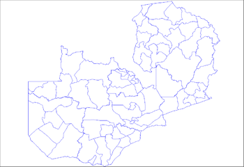 Districts of Zambia
The nine provinces of Zambia are divided into a total of 72 districts.
Article 109 in part VIII of the constitution of Zambia deals with local government. It states only that there should be some form of local government, and that this local government should be based on democratically elected councils on the basis of universal adult suffrage.[1]
The 72 districts are listed below, by province:
Contents
Central Province
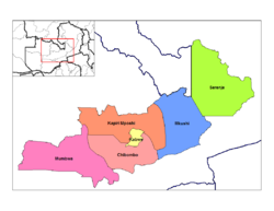 Districts of Central Zambia
- Chibombo District
- Kabwe District
- Kapiri Mposhi District
- Mkushi District
- Mumbwa District
- Serenje District
Copperbelt Province
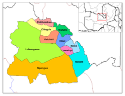 Districts of Copperbelt
- Chililabombwe District
- Chingola District
- Kalulushi District
- Kitwe District
- Luanshya District
- Lufwanyama District
- Masaiti District
- Mpongwe District
- Mufulira District
- Ndola District
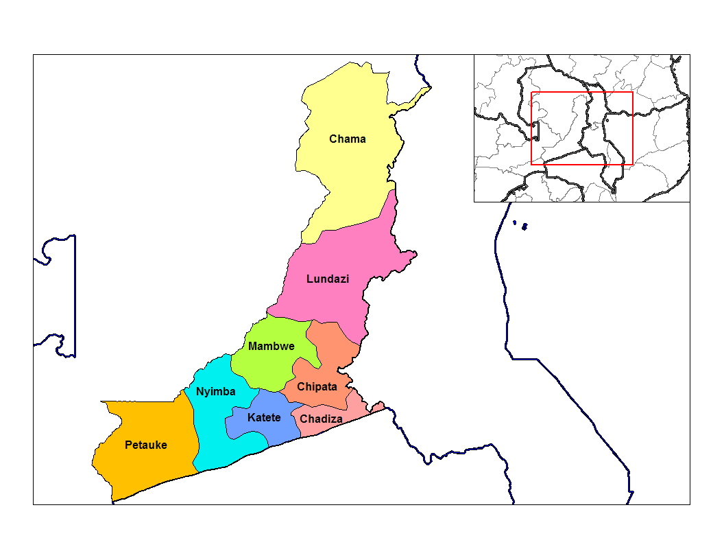
Eastern Province
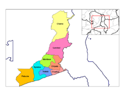 Districts of Eastern Zambia
- Chadiza District
- Chama District
- Chipata District
- Katete District
- Lundazi District
- Mambwe District
- Nyimba District
- Petauke District
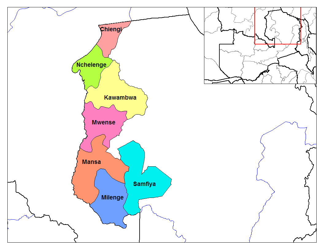
Luapula Province
 Districts of Luapula
- Chiengi District
- Kawambwa District
- Mansa District
- Milenge District
- Mwense District
- Nchelenge District
- Samfya District
Lusaka Province
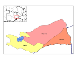 Districts of Lusaka
- Chongwe District
- Kafue District
- Luangwa District
- Lusaka District
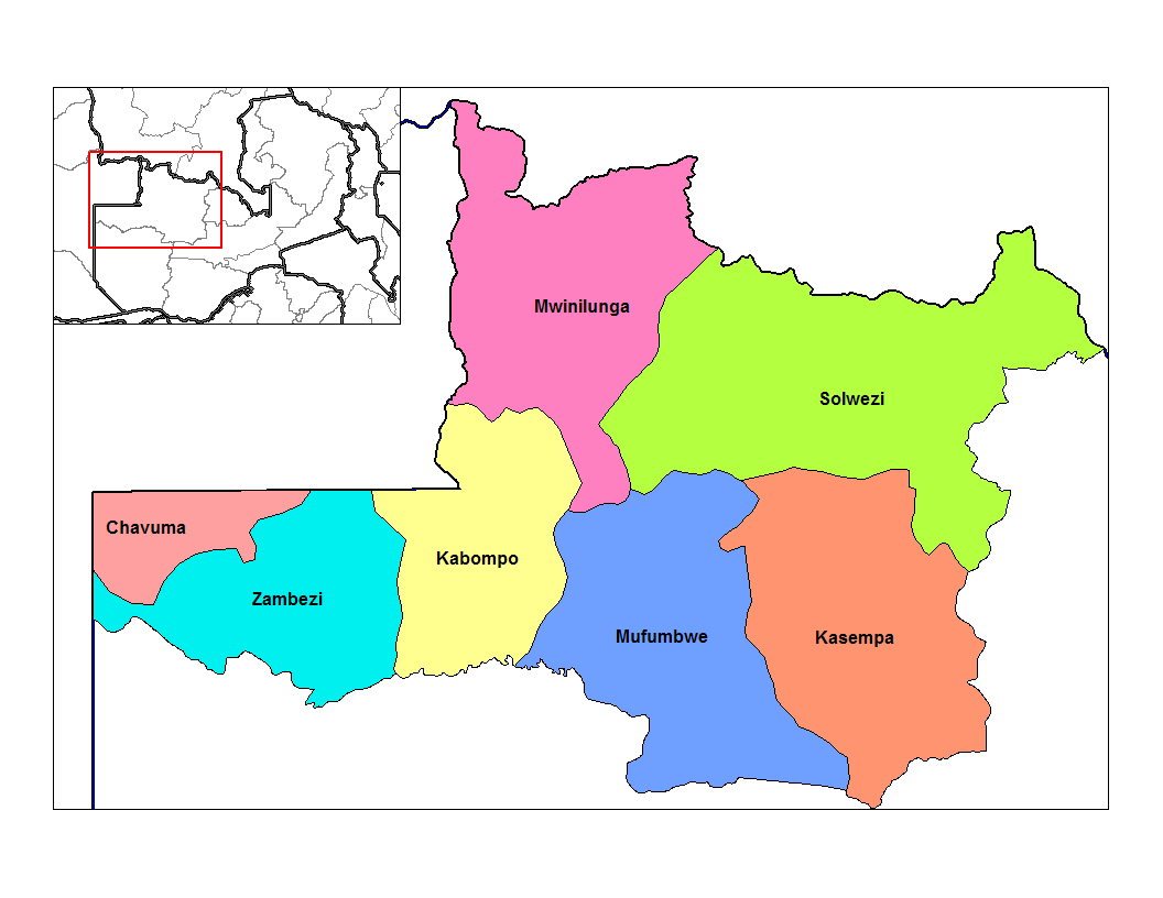
North-Western Province
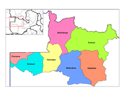 Districts of North-Western Zambia
- Chavuma District
- Kabompo District
- Kasempa District
- Mufumbwe District
- Mwinilunga District
- Solwezi District
- Zambezi District
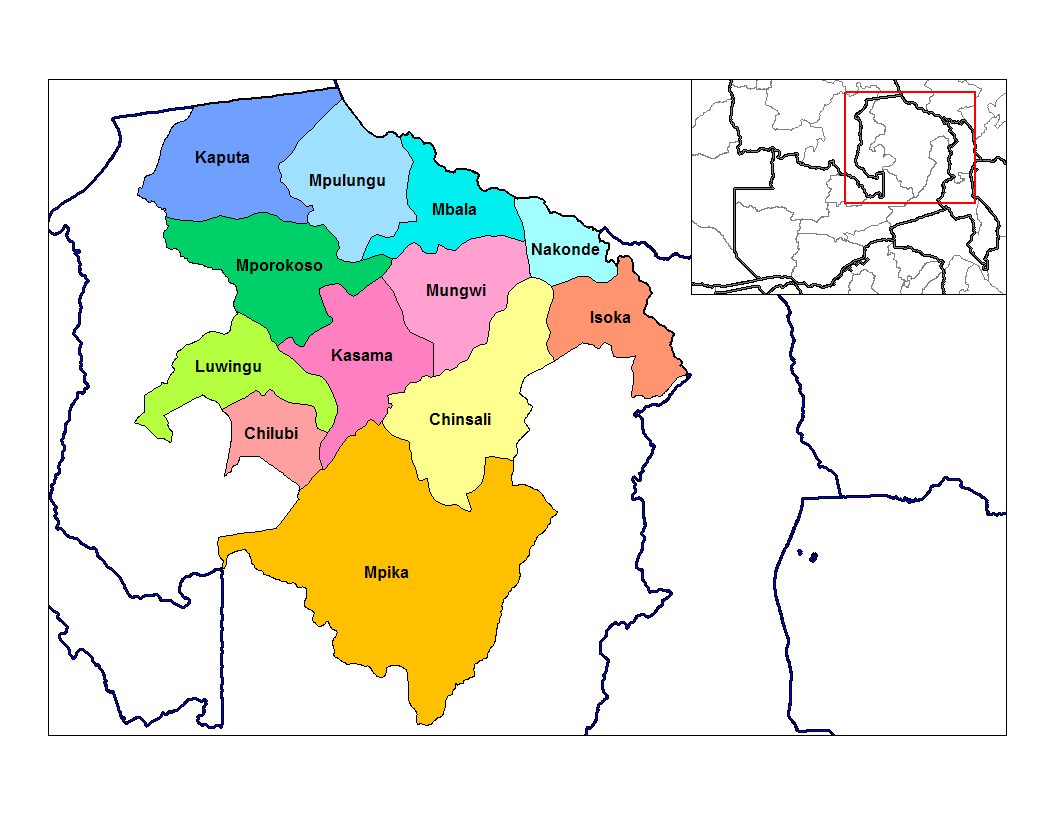
Northern Province
 Districts of Northern Zambia
- Chilubi District
- Chinsali District
- Isoka District
- Kaputa District
- Kasama District
- Luwingu District
- Mbala District
- Mpika District
- Mporokoso District
- Mpulungu District
- Mungwi District
- Nakonde District
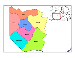
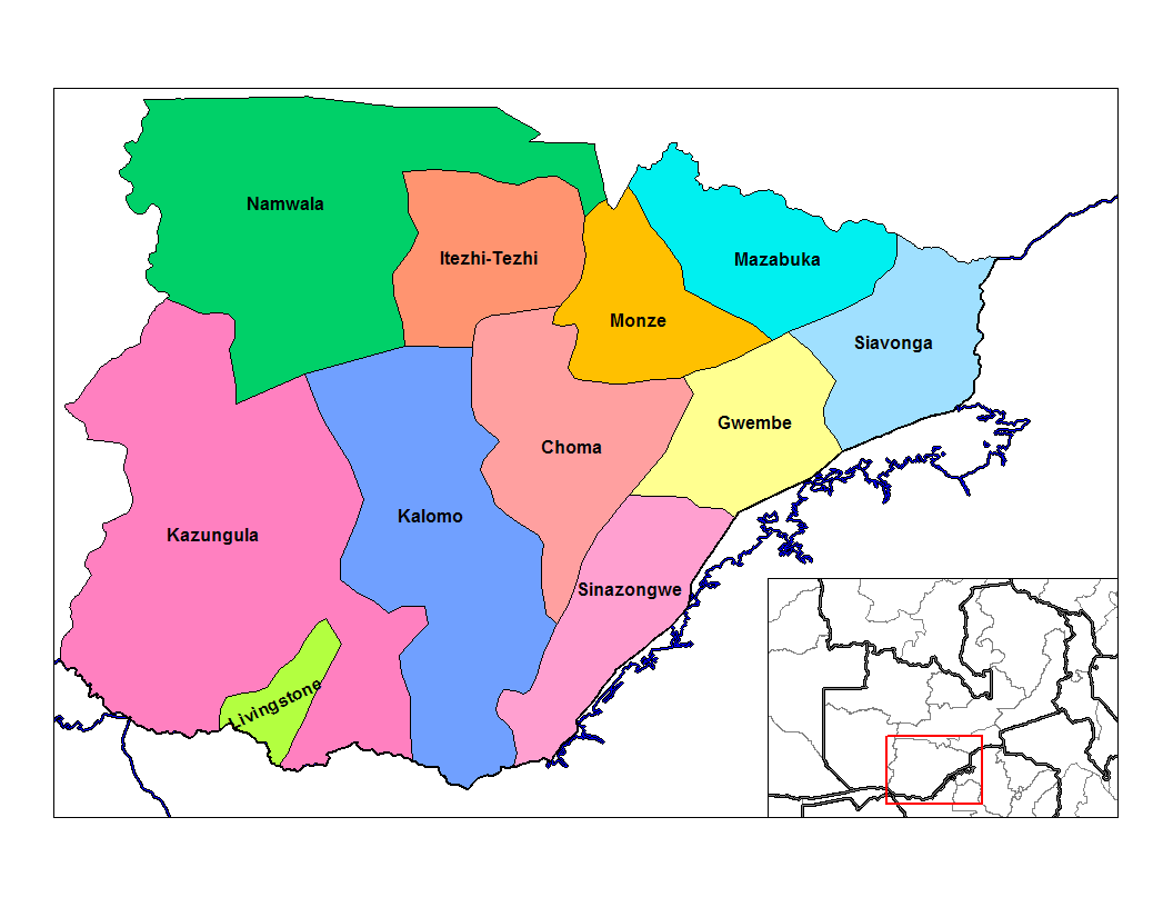
Southern Province
 Districts of Southern Zambia
- Choma District
- Gwembe District
- Itezhi-Tezhi
- Kalomo District
- Kazungula District
- Livingstone District
- Mazabuka District
- Monze District
- Namwala
- Siavonga District
- Sinazongwe District
Western Province
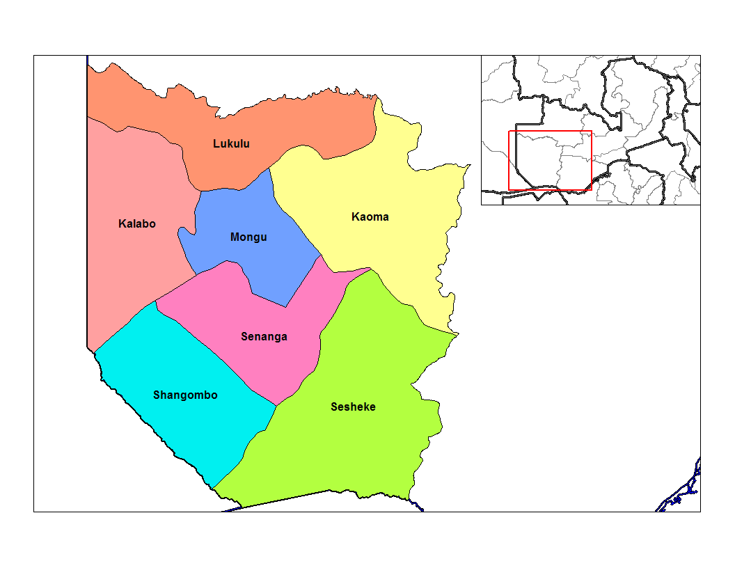
 Districts of Western Zambia
- Kalabo District
- Kaoma District
- Lukulu District
- Mongu District
- Senanga District
- Sesheke District
- Shangombo District
See also
References
- ^ "Constitution of Zambia (1996)". The Zambian - Gateway to Zambia. http://www.thezambian.com/Constitution/1996constitution.aspx. Retrieved 2006-10-22.
External links
- Zambia Desktop Mapping Tools for Microsoft Office by Andy Lyons.
 Districts of Zambia
Central Chibombo District · Kabwe District · Kapiri Mposhi District · Mkushi District · Mumbwa District · Serenje DistrictCopperbelt Chililabombwe District · Chingola District · Kalulushi District · Kitwe District · Luanshya District · Lufwanyama District · Masaiti District · Mpongwe District · Mufulira District · Ndola DistrictEastern Chadiza District · Chama District · Chipata District · Katete District · Lundazi District · Mambwe District · Nyimba District · Petauke DistrictLuapula Chiengi District · Kawambwa District · Mansa District · Milenge District · Mwense District · Nchelenge District · Samfya DistrictLusaka Northern Chilubi District · Chinsali District · Isoka District · Kaputa District · Kasama District · Luwingu District · Mafinga District · Mbala District · Mpika District · Mporokoso District · Mpulungu District · Mungwi District · Nakonde DistrictNorthwestern Chavuma District · Kabompo District · Kasempa District · Mufumbwe District · Mwinilunga District · Solwezi District · Zambezi DistrictSouthern Choma District · Gwembe District · Itezhi-Tezhi District · Kalomo District · Kazungula District · Livingstone · Mazabuka District · Monze District · Namwala District · Siavonga District · Sinazongwe DistrictWestern Kalabo District · Kaoma District · Lukulu District · Mongu District · Senanga District · Sesheke District · Shangombo DistrictArticles on second-level administrative divisions of African countries Algeria · Angola · Benin · Botswana · Burkina Faso · Burundi · Cameroon · Cape Verde · Central African Republic · Chad · Democratic Republic of the Congo · Republic of the Congo · Côte d'Ivoire (Ivory Coast) · Djibouti · Egypt · Eritrea · Ethiopia · Gabon · The Gambia · Ghana · Guinea · Guinea-Bissau · Kenya · Liberia · Libya · Madagascar · Mali · Mauritania · Morocco · Mozambique · Namibia · Niger · Nigeria · Rwanda · São Tomé and Príncipe · Senegal · Sierra Leone · Somalia · Somaliland · South Africa · South Sudan · Sudan · Tanzania · Togo · Tunisia · Uganda · Zambia · Zimbabwe
Table of administrative divisions by country Categories:- Districts of Zambia
- Subdivisions of Zambia
- Lists of country subdivisions
- Country subdivisions of Africa
- Second-level administrative country subdivisions
- Zambia-related lists


Wikimedia Foundation. 2010.