- Namwala District
-
Namwala District — District — District location in Zambia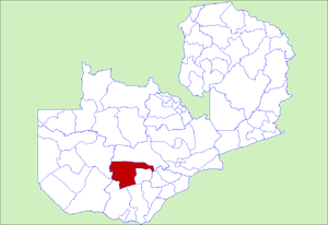
Country  Zambia
Province Southern Province Capital Namwala Population (2000) – Total 82,810 Time zone CAT (UTC+2) Namwala District is a district of Zambia, located in Southern Province. The capital lies at Namwala. As of the 2000 Zambian Census, the district had a population of 82,810 people.[1]
Contents
Geography
Namwala covers an area of approximately 10,000 square kilometers.[2] Namwala town has a population of over 5,000 people. It lies on the southern bank of the Kafue River at 996 metres above sea level. It houses the administrative offices of Namwala District and is the principal town of the Ila people who inhabit the district. They are famous for their large herds of cattle with livestock farming, not surprisingly, their main economic activity.[2] Other major settlement areas in the district are Kabulamwanda, Muchila, Maala, Mbeza and Chitongo.
Culture
The district is also well known for, its Shimunenga traditional ceremony.[2] This spectacular event that takes place around September/October of every year at Maala village. The Ila people, the traditional inhabitants of Namwala District, engage mostly in cattle herding, fishing, hunting and subsistence farming. As a symbol of prestige, the traditional Ila do not routinely eat their cattle.. However, drought and disease have affected the cattle population.[2]
The Ila are closely related in language and culture to their more numerous Tonga neighbours in Southern Province. The Ila speaking people of Zambia reside mainly in the administrative districts of Namwala, Itezhi-Tezhi and Mumbwa spread over seventeen chiefdoms.
References
- ^ "Districts of Zambia". Statoids. http://www.statoids.com/yzm.html. Retrieved February 12, 2010.
- ^ a b c d "All About Namwala". Namwala.com. http://www.namwala.com/visit_namwala.php. Retrieved March 6, 2010.
External links
 Districts of Zambia
Central Chibombo District · Kabwe District · Kapiri Mposhi District · Mkushi District · Mumbwa District · Serenje DistrictCopperbelt Chililabombwe District · Chingola District · Kalulushi District · Kitwe District · Luanshya District · Lufwanyama District · Masaiti District · Mpongwe District · Mufulira District · Ndola DistrictEastern Chadiza District · Chama District · Chipata District · Katete District · Lundazi District · Mambwe District · Nyimba District · Petauke DistrictLuapula Chiengi District · Kawambwa District · Mansa District · Milenge District · Mwense District · Nchelenge District · Samfya DistrictLusaka Northern Chilubi District · Chinsali District · Isoka District · Kaputa District · Kasama District · Luwingu District · Mafinga District · Mbala District · Mpika District · Mporokoso District · Mpulungu District · Mungwi District · Nakonde DistrictNorthwestern Chavuma District · Kabompo District · Kasempa District · Mufumbwe District · Mwinilunga District · Solwezi District · Zambezi DistrictSouthern Choma District · Gwembe District · Itezhi-Tezhi District · Kalomo District · Kazungula District · Livingstone · Mazabuka District · Monze District · Namwala District · Siavonga District · Sinazongwe DistrictWestern Kalabo District · Kaoma District · Lukulu District · Mongu District · Senanga District · Sesheke District · Shangombo DistrictCategories:

Wikimedia Foundation. 2010.