- Dunlap, Iowa
-
Dunlap, Iowa — City — Location of Dunlap, Iowa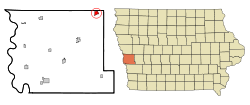
Coordinates: 41°51′14″N 95°36′0″W / 41.85389°N 95.6°WCoordinates: 41°51′14″N 95°36′0″W / 41.85389°N 95.6°W Country  United States
State  Iowa
IowaCounty Harrison Area – Total 1.1 sq mi (2.9 km2) – Land 1.1 sq mi (2.8 km2) – Water 0.0 sq mi (0.0 km2) Elevation 1,145 ft (349 m) Population (2000) – Total 1,139 – Density 1,043.9/sq mi (403.0/km2) Time zone Central (CST) (UTC-6) – Summer (DST) CDT (UTC-5) ZIP code 51529 Area code(s) 712 FIPS code 19-22890 GNIS feature ID 0456066 Dunlap is a city in Harrison County, Iowa, United States, along the Boyer River. The population was 1,139 at the 2000 census.
Contents
Geography
Dunlap is located at 41°51′14″N 95°36′0″W / 41.85389°N 95.6°W (41.853952, -95.599862).[1]
According to the United States Census Bureau, the city has a total area of 1.1 square miles (2.8 km2), of which, 1.1 square miles (2.8 km2) of it is land and 0.90% is water.
Demographics
As of the census[2] of 2000, there were 1,139 people, 483 households, and 282 families residing in the city. The population density was 1,043.9 people per square mile (403.5/km²). There were 524 housing units at an average density of 480.2 per square mile (185.6/km²). The racial makeup of the city was 98.33% White, 0.18% African American, 0.26% Native American, 0.09% Asian, and 1.14% from two or more races. Hispanic or Latino of any race were 0.26% of the population.
There were 483 households out of which 24.8% had children under the age of 18 living with them, 45.8% were married couples living together, 8.9% had a female householder with no husband present, and 41.6% were non-families. 37.3% of all households were made up of individuals and 23.8% had someone living alone who was 65 years of age or older. The average household size was 2.24 and the average family size was 2.97.
In the city the population was spread out with 22.4% under the age of 18, 6.8% from 18 to 24, 23.6% from 25 to 44, 20.4% from 45 to 64, and 26.9% who were 65 years of age or older. The median age was 43 years. For every 100 females there were 90.5 males. For every 100 females age 18 and over, there were 83.0 males.
The median income for a household in the city was $31,100, and the median income for a family was $39,762. Males had a median income of $26,094 versus $17,452 for females. The per capita income for the city was $17,936. About 6.8% of families and 10.5% of the population were below the poverty line, including 14.2% of those under age 18 and 9.2% of those age 65 or over.
Economy
Dunlap is home to a small number of shops, two gas stations, two bars, and a grocery store. Dunlap is also the home of a feed manufacturing plant. There is a steak house, and two restaurants to serve customers.
Dunlap's historic Independent Order of Odd Fellows Hall was added to the National Register of Historic Places in June 2011.
Education
Boyer Valley South is located in Dunlap. It is the high school for the Boyer Valley Community School system. The Dunlap public library along with the school's library joined together by a grant when the new school was built, which was finished in 2004.[citation needed]
References
- ^ "US Gazetteer files: 2010, 2000, and 1990". United States Census Bureau. 2011-02-12. http://www.census.gov/geo/www/gazetteer/gazette.html. Retrieved 2011-04-23.
- ^ "American FactFinder". United States Census Bureau. http://factfinder.census.gov. Retrieved 2008-01-31.
External links
- City-Data Comprehensive statistical data and more about Dunlap
Metropolitan area of Omaha-Council Bluffs Primary Cities NebraskaIowa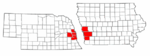
Cities over 10,000
(per 2000 Census)NebraskaCities of 5,000 to 10,000
(per 2000 Census)NebraskaIowaCities of 1,000 to 5,000
(per 2000 Census)NebraskaIowaCensus-designated places NebraskaCities and villages
of fewer than 1,000
(per 2000 Census)NebraskaAlvo · Avoca · Bennington · Boys Town · Cedar Bluffs · Cedar Creek · Ceresco · Colon · Elmwood · Fort Calhoun · Greenwood · Herman · Ithaca · Kennard · Leshara · Malmo · Manley · Mead · Memphis · Morse Bluff · Murdock · Murray · Nehawka · Prague · South Bend · Union · Valparaiso · Washington · Waterloo · WestonIowaCounties NebraskaIowaMunicipalities and communities of Harrison County, Iowa Cities Dunlap‡ | Little Sioux | Logan | Magnolia | Missouri Valley | Modale | Mondamin | Persia | Pisgah | Woodbine

Townships Allen | Boyer | Calhoun | Cass | Cincinnati | Clay | Douglas | Harrison | Jackson | Jefferson | La Grange | Lincoln | Little Sioux | Magnolia | Morgan | Raglan | St. John | Taylor | Union | Washington
Footnotes ‡This populated place also has portions in an adjacent county or counties
Categories:- Cities in Iowa
- Populated places in Harrison County, Iowa


Wikimedia Foundation. 2010.