- Walnut, Iowa
Infobox Settlement
official_name = Walnut, Iowa
settlement_type =City
nickname =
motto =
imagesize =
image_caption =
image_
imagesize =
image_caption =
image_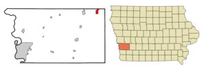
mapsize = 250x200px
map_caption = Location of Walnut, Iowa
mapsize1 =
map_caption1 =subdivision_type = Country
subdivision_name =
subdivision_type1 = State
subdivision_name1 =
subdivision_type2 = County
subdivision_name2 = Pottawattamie
government_footnotes =
government_type =
leader_title =
leader_name =
leader_title1 =
leader_name1 =
established_title =
established_date =unit_pref = Imperial
area_footnotes =area_magnitude =
area_total_km2 = 5.6
area_land_km2 = 5.6
area_water_km2 = 0.0
area_total_sq_mi = 2.1
area_land_sq_mi = 2.1
area_water_sq_mi = 0.0population_as_of = 2000
population_footnotes =
population_total = 778
population_density_km2 = 140.1
population_density_sq_mi = 362.8timezone = Central (CST)
utc_offset = -6
timezone_DST = CDT
utc_offset_DST = -5
elevation_footnotes =
elevation_m = 406
elevation_ft = 1332
latd = 41 |latm = 28 |lats = 52 |latNS = N
longd = 95 |longm = 13 |longs = 16 |longEW = Wpostal_code_type =
ZIP code
postal_code = 51577
area_code = 712
blank_name = FIPS code
blank_info = 19-82065
blank1_name = GNIS feature ID
blank1_info = 0462626
website =
footnotes =Walnut is a city in Pottawattamie County,
Iowa ,United States . The population was 778 at the 2000 census. Walnut is located onInterstate 80 and is famous for its many antique stores.Geography
Walnut is located at coor dms|41|28|52|N|95|13|16|W|city (41.480999, -95.221116)GR|1.
According to the
United States Census Bureau , the city has a total area of 2.1square mile s (5.5km² ), all of it land.Demographics
As of the
census GR|2 of 2000, there were 778 people, 326 households, and 231 families residing in the city. Thepopulation density was 362.8 people per square mile (140.4/km²). There were 350 housing units at an average density of 163.2/sq mi (63.1/km²). The racial makeup of the city was 97.56% White, 0.51% African American, 0.39% Asian, and 1.54% from two or more races. Hispanic or Latino of any race were 0.77% of the population.There were 326 households out of which 28.5% had children under the age of 18 living with them, 61.7% were married couples living together, 6.1% had a female householder with no husband present, and 29.1% were non-families. 27.3% of all households were made up of individuals and 15.3% had someone living alone who was 65 years of age or older. The average household size was 2.39 and the average family size was 2.88.
In the city the population was spread out with 25.2% under the age of 18, 6.4% from 18 to 24, 22.5% from 25 to 44, 26.0% from 45 to 64, and 19.9% who were 65 years of age or older. The median age was 42 years. For every 100 females there were 95.5 males. For every 100 females age 18 and over, there were 89.6 males.
The median income for a household in the city was $36,154, and the median income for a family was $44,500. Males had a median income of $29,464 versus $18,750 for females. The
per capita income for the city was $16,489. About 5.2% of families and 8.5% of the population were below thepoverty line , including 14.9% of those under age 18 and 2.6% of those age 65 or over.References
External links
* [http://www.walnutiowa.org Official City Website]
Wikimedia Foundation. 2010.