- Blair, Nebraska
Infobox Settlement
official_name = Blair, Nebraska
settlement_type =City
nickname =
motto =
imagesize =
image_caption =
image_
imagesize =
image_caption =
image_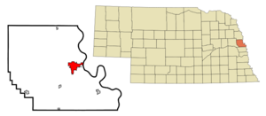
mapsize = 250px
map_caption = Location of Blair, Nebraska
mapsize1 =
map_caption1 =subdivision_type = Country
subdivision_name =United States
subdivision_type1 = State
subdivision_name1 =Nebraska
subdivision_type2 = County
subdivision_name2 = Washington
government_footnotes =
government_type =
leader_title =
leader_name =
leader_title1 =
leader_name1 =
established_title =
established_date =unit_pref = Imperial
area_footnotes =
area_magnitude =
area_total_km2 = 12.1
area_land_km2 = 12.0
area_water_km2 = 0.0
area_total_sq_mi = 4.7
area_land_sq_mi = 4.6
area_water_sq_mi = 0.0population_as_of = 2000
population_footnotes =
population_total = 7512
population_density_km2 = 624.4
population_density_sq_mi = 1617.3timezone = Central (CST)
utc_offset = -6
timezone_DST = CDT
utc_offset_DST = -5
elevation_footnotes =
elevation_m = 326
elevation_ft = 1070
latd = 41 |latm = 32 |lats = 44 |latNS = N
longd = 96 |longm = 8 |longs = 4 |longEW = Wpostal_code_type =
ZIP code s
postal_code = 68008-68009
area_code = 402
blank_name = FIPS code
blank_info = 31-05350GR|2
blank1_name = GNIS feature ID
blank1_info = 0827479GR|3
website =
footnotes =Blair is a city in and the
county seat of Washington County,Nebraska ,United States .GR|6 The population was 7,512 at the 2000 census.Geography
Blair is located at coor dms|41|32|44|N|96|8|4|W|city (41.545562, -96.134383)GR|1.
According to the
United States Census Bureau , the city has a total area of 4.7 square miles (12.1 km²), of which, 4.6 square miles (12.0 km²) of it is land and 0.04 square miles (0.1 km²) of it (0.43%) is water.Demographics
As of the
census GR|2 of 2000, there were 7,512 people, 2,871 households, and 1,891 families residing in the city. Thepopulation density was 1,617.3 people per square mile (625.1/km²). There were 3,033 housing units at an average density of 653.0/sq mi (252.4/km²). The racial makeup of the city was 97.43% White, 0.44% African American, 0.29% Native American, 0.33% Asian, 0.27% Pacific Islander, 0.33% from other races, and 0.91% from two or more races. Hispanic or Latino of any race were 1.34% of the population.There were 2,871 households out of which 33.9% had children under the age of 18 living with them, 52.8% were married couples living together, 10.1% had a female householder with no husband present, and 34.1% were non-families. 29.1% of all households were made up of individuals and 14.4% had someone living alone who was 65 years of age or older. The average household size was 2.43 and the average family size was 3.02.
In the city the population was spread out with 24.9% under the age of 18, 13.8% from 18 to 24, 25.6% from 25 to 44, 20.4% from 45 to 64, and 15.4% who were 65 years of age or older. The median age was 35 years. For every 100 females there were 90.9 males. For every 100 females age 18 and over, there were 88.2 males.
The median income for a household in the city was $41,214, and the median income for a family was $52,114. Males had a median income of $36,839 versus $25,452 for females. The
per capita income for the city was $19,240. About 6.2% of families and 8.4% of the population were below thepoverty line , including 11.4% of those under age 18 and 10.5% of those age 65 or over.History
Blair, county seat and largest city in Washington County, was not one of its earliest towns. It was established when the
Sioux City and Pacific Rail Road chose to cross the river at that location, going from Missouri Valley, Iowa, and up along "Carter Hollow" on the Nebraska side. Whether by chance or design, the route missed the existing river towns of DeSoto and Cuming City. An entirely new town was needed.A convert|1075|acre|km2|sing=on tract of land was purchased and platted, with lots to be sold at auction on May 10, 1869. The entire tract was purchased by
John I. Blair , an official of the railroad, who announced his plans for the city, which he named for himself.Front street quickly took shape. Many businesses and several churches were hauled overland from the former town sites to supplement those being built. In a short time there were hardware, implement, and dry goods stores, a hotel, a bank, and a newspaper. A town board was formed in August.
Before the end of the year, the town called for an election to relocate the county seat, which at that time was in
Fort Calhoun . Blair won, and a brick courthouse was erected at 19th and Grant.Construction was also progressing on the rail line. Before a railroad bridge was built across the Missouri, freight cars were pushed onto barges on one side of the river, then pulled off on the other. Since the engines did not cross the river, a roundhouse to service them was built north of town. When the bridge was completed in 1882, that facility was dismantled and servicing was done in Iowa.
Local brickyards turned out 1,500,000 bricks per year to meet the demands of the city's rapid development. In 1884 the community, predominantly Danish, raised $3,000 in matching funds and appropriated several acres of land on which to establish a "folk school." The forerunner of Dana College, Trinity Seminary was housed in a home until the impressive, four-story main building was dedicated in 1886.
By then a city water system was in place, and South Creek, dug out by men with hand shovels, had been straightened to improve the drainage on south side of town. A public high school was constructed before the turn of the century.
Industries that sprang up along the railroad include: a mill which produced Maintop flour and livestock feeds; a foundry manufacturing roller bearings; a laboratory which made patent medicines; a poultry incubator plant employing about 40 men; and a horse collar company which employed up to 125 men, until "horses left the drawbar scene."
A plant, built in 1889 to provide electricity for lights, was not dependable or profitable. In 1914 a new municipal power plant was built and later a city ice plant was added to supply Blair with "safe ice," replacing the system of cutting it from the river.
Over the years, other enterprises came and went: a plant manufacturing spark plugs used in Model T Fords; a canning company; a seed corn plant; and a church-publishing house. Currently, Kelly Ryan Equipment Company, established in the mid-1940s, employs up to 50 persons. The D.L.Blair Company, specializing in nation-wide promotion campaigns, was established in the 1970s. Mid America Computer Corp. was also established in the 1970s and employs 200+ employees and servers over 300 clients in the telecommunications industry.
The "Bee-Line" Highway, started in 1923, got little use until a bridge was built across the Missouri at Blair in 1929. Later designated as Highway 30, paving was completed as a Federal Works project in the 1930s. Highways U.S.75 and State 91 and 133 were completed later.
Dana, a fully accredited four-year liberal arts college, has 14 buildings on its convert|150|acre|km2|sing=on campus. The fire that destroyed "Old Main" in 1988 changed the skyline, but not the student population of around 600. The "Sights and Sounds of Christmas," held on campus each December, is a popular event.
Today, a progressive business district is flanked by a modern shopping center. There is a new grade school planned, as well as additions to the high school in the works, a golf course, a municipal airport, and a swimming pool. As many as 100 new homes have been added in a single year. Spacious parks, designed into the existing landscape of the state arboretum system, further enhance the natural beauty of Blair.
Points of interest
*Part of the
Nebraska Statewide Arboretum collection
*Blair is home toDana College
*From 1896-1954, Blair was home to Trinity Seminary, a school of theUnited Evangelical Lutheran Church
*Blair is located along the historicLincoln Highway Notable residents
*
Bill Dannenhauser (aka Dave Sullivan, The Equalizer) - Professional wrestler in the NWA and the WCW (coached football atDana College starting in 2003).
*Mick Mines - Nebraska state senator and Vice President of External Relations for HunTel Systems Inc.
*Tom Seaton - Early baseball star (born in Blair).
*Paul Simon - Democratic Congressman, Senator, and presidential candidate (attendedDana College ).
*Rod Whitaker (aka Trevanian, Nicholas Seare) - Novelist (Drama professor atDana College from 1963-1966Trivia
*This is one of two cities that have been the contact point for many consumer products contests, the other being Young America, Minnesota.
*Blair served as the headquarters of 2 Lutheran denominations - the Danish Evangelical Lutheran Church Association in America from 1884-1896; and theUnited Evangelical Lutheran Church from 1896-1960. Both denominations were informally known as "The Blair Church."References
External links
* [http://www.blairnebraska.org/ Official site]
* [http://www.blairhistory.com/ Local History site]
Wikimedia Foundation. 2010.