- Jackson County, Iowa
-
Jackson County, Iowa 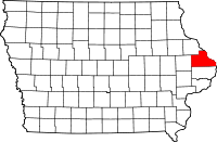
Location in the state of Iowa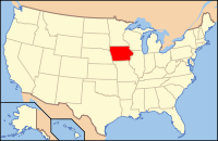
Iowa's location in the U.S.Founded 1837 Seat Maquoketa Largest city Maquoketa Area
- Total
- Land
- Water
649.75 sq mi (1,683 km²)
636.09 sq mi (1,647 km²)
13.66 sq mi (35 km²), 2.10%Population
- (2010)
- Density
19,848
31/sq mi (12/km²)Time zone Central: UTC-6/-5 Website www.co.jackson.ia.us Footnotes: Population [1] Jackson County is a county located in the U.S. state of Iowa. Its eastern border is formed by the Mississippi River. The population was 19,848 in the 2010 census, a decline from 20,296 in the 2000 census.[1][2] The county seat is Maquoketa. [3]
Contents
Geography
According to the 2000 census, the county has a total area of 649.75 square miles (1,682.8 km2), of which 636.09 square miles (1,647.5 km2) (or 97.90%) is land and 13.66 square miles (35.4 km2) (or 2.10%) is water.[4]
Major highways
 U.S. Highway 52
 U.S. Highway 61
 U.S. Highway 67
Adjacent counties
- Dubuque County (north)
- Jo Daviess County, Illinois (northeast), across the Mississippi River
- Carroll County, Illinois (east), across the Mississippi River
- Clinton County (south)
- Jones County (west)
National protected areas
- Driftless Area National Wildlife Refuge (part)
- Upper Mississippi River National Wildlife and Fish Refuge (part)
History
Jackson County was formed on December 21, 1837. It was named after US President Andrew Jackson.
Demographics
Historical populations Census Pop. %± 1850 7,210 — 1860 18,493 156.5% 1870 22,619 22.3% 1880 23,771 5.1% 1890 22,771 −4.2% 1900 23,615 3.7% 1910 21,258 −10.0% 1920 19,931 −6.2% 1930 18,481 −7.3% 1940 19,181 3.8% 1950 18,622 −2.9% 1960 20,754 11.4% 1970 20,839 0.4% 1980 22,503 8.0% 1990 19,950 −11.3% 2000 20,296 1.7% 2010 19,848 −2.2% Iowa Data Center [2] 2010 census
The 2010 census recorded a population of 19,848 in the county, with a population density of 31.2031/sq mi (12.0476/km2). There were 9,415 housing units, of which 8,289 were occupied.[1]
2000 census
 2000 Census Age Pyramid for Jackson County
As of the census[5] of 2000, there were 20,296 people, 8,078 households, and 5,589 families residing in the county. The population density was 32 people per square mile (12/km²). There were 8,949 housing units at an average density of 14 per square mile (5/km²). The racial makeup of the county was 98.96% White, 0.10% Black or African American, 0.12% Native American, 0.09% Asian, 0.11% Pacific Islander, 0.15% from other races, and 0.47% from two or more races. 0.60% of the population were Hispanic or Latino of any race.
There were 8,078 households out of which 32.00% had children under the age of 18 living with them, 58.20% were married couples living together, 7.70% had a female householder with no husband present, and 30.80% were non-families. 27.00% of all households were made up of individuals and 13.80% had someone living alone who was 65 years of age or older. The average household size was 2.47 and the average family size was 3.01.
In the county the population was spread out with 26.00% under the age of 18, 7.00% from 18 to 24, 26.50% from 25 to 44, 23.20% from 45 to 64, and 17.30% who were 65 years of age or older. The median age was 39 years. For every 100 females there were 97.10 males. For every 100 females age 18 and over, there were 93.90 males.
The median income for a household in the county was $34,529, and the median income for a family was $42,526. Males had a median income of $29,334 versus $20,577 for females. The per capita income for the county was $17,329. About 7.70% of families and 10.30% of the population were below the poverty line, including 13.90% of those under age 18 and 8.90% of those age 65 or over.
Government
The three-member board of supervisors that governs Jackson County is composed of Steve Flynn, Larry Koos, and Jack Willey, and the county sheriff is Russ Kettmann.[6]
Sheriff's office
See also: Jackson County, Iowa Law EnforcementThe Jackson County Sheriff's Office is the primary law enforcement agency located in the county. The headquarters for the Sheriff's Department are in Maquoketa, Iowa. The department is led by an elected Sheriff. The current[update] Sheriff is Russ Kettmann.
The Sheriff's Department provides law enforcement for unincorporated areas in the county, and performs various civil procedures. Like other departments, the department uses the Jeep Grand Cherokee and Chevy Impala as its primary patrol vehicles. A Chevy Silverado truck is also used for patrol.
The department consists of the sheriff, chief deputy, seven full-time deputies and one part-time deputy. Current employees of the department are:
- 49-1 - Sheriff Russ Kettmann
- 49-2 - Chief Deputy Ed Clark
- 49-3 - Deputy Steve Schroeder
- 49-4 - Deputy Randy Manning
- 49-5 - Civil Deputy Terry Roling
- 49-6 - Deputy Russ Long
- 49-7 - K-9 Deputy Mike Peters
- 49-8 - Deputy Brandon Beck
- 49-9 - Deputy Chad Gruver
- 49-10 - Deputy Chad Roeder
- Criminal Administrator - Karen Wells
- Civil Administrator - Kim Clark
- Jail Administrator - Mark Pape
County Attorney's office
The responsibilities of the County Attorney are prosecuting violations of the laws of the State of Iowa, and of County Ordinances. The County Attorney is also the legal advisor for the County of Jackson County. The position of County Attorney is an elected position in the state of Iowa. The current employees of the office are:
- County Attorney Chris Raker
- Assistant County Attorney Sarah Davenport
- Administrative Assistant/Paralegal Rosanne Schwager
Localities
Cities
Unincorporated communities
- Canton
- Green Island
Ghost towns
- Alma
- Amoy
- America
- Bridgeport
- Brookfield
- Buckhorn
- Canton
- Carrollport
- Centerville
- Charleston
- Charkstown
- Cobb
- Coloma
- Copper Creek
- Cottonville
- Crabb
- Crabb's Mill
- Crabbtown
- Deventersville
- Duggan
- Duke
- Emeline
- Fremont
- Fulton
- Garry Owen
- Gordon's Ferry
- Hickory Grove
- Higginsport
- Hugo
- Hurstville
- Fairfield
- Farmers Creek
- Franklin
- Iron Hill
- East Iron Hills
- Isabel
- Lainsville
- Lowell
- Millrock
- Mount Algor
- Nashville
- New Castle
- New Rochester
- North Maquoketa
- Otter Creek
- Ozark
- Pass
- Prairie Springs
- Rolley
- Silsbee
- Smiths Ferry
- Springfield
- Spruce Mills
- Sterling
- Sullivan
- Summer Hill
- Sylva
- Tetes des Morts
- Union Center
- Van Buren
- Wagonersburgh
- Waterford
- Wickliffe
Ref:[1]
Townships
Jackson County is divided into 18 townships:
- Bellevue
- Brandon
- Butler
- Fairfield
- Farmers Creek
- Iowa
- Jackson
- Maquoketa
- Monmouth
- Otter Creek
- Perry
- Prairie Springs
- Richland
- South Fork
- Tete Des Morts
- Union
- Van Buren
- Washington
State parks
See also
Bibliography
- Sorensen, Lucille. Holihan, Grace. Ghost Towns of Jackson County Iowa/History of Jackson County, Vol. 1, Jackson County Historical Society 1988 and 2000.
References
- ^ a b c "Population & Housing Occupancy Status 2010". United States Census Bureau American FactFinder. http://factfinder2.census.gov/faces/tableservices/jsf/pages/productview.xhtml?pid=DEC_10_PL_GCTPL2.ST05&prodType=table. Retrieved May 18, 2011.
- ^ a b "Data from the 2010 Census". State Data Center of Iowa. http://www.iowadatacenter.org/archive/2011/02/feb10. Retrieved May 18, 2011.
- ^ "Find a County". National Association of Counties. http://www.naco.org/Counties/Pages/FindACounty.aspx. Retrieved 2011-06-07.
- ^ "Census 2000 U.S. Gazetteer Files: Counties". United States Census. http://www.census.gov/tiger/tms/gazetteer/county2k.txt. Retrieved 2011-02-13.
- ^ "American FactFinder". United States Census Bureau. http://factfinder.census.gov. Retrieved 2008-01-31.
- ^ http://www.jacksoncountyiowa.com/boardofsupervisors.cfm
External links
- Official Jackson County Government Website
- Jackson County Economic Development Council's website
- Jackson County Government Overview Webpages
- Jackson County Historical Society

Dubuque County Jo Daviess County, Illinois Jones County 
Carroll County, Illinois  Jackson County, Iowa

Clinton County Municipalities and communities of Jackson County, Iowa Cities Andrew | Baldwin | Bellevue | La Motte | Maquoketa‡ | Miles | Monmouth | Preston | Sabula | St. Donatus | Spragueville | Springbrook | Zwingle‡

Townships Bellevue | Brandon | Butler | Fairfield | Farmers Creek | Iowa | Jackson | Maquoketa | Monmouth | Otter Creek | Perry | Prairie Springs | Richland | South Fork | Tete Des Morts | Union | Van Buren | Washington
Unincorporated
communitiesCanton | Green Island
Footnotes ‡This populated place also has portions in an adjacent county or counties
Categories:- Iowa counties
- Jackson County, Iowa
- 1837 establishments in the United States
- Populated places established in 1837
- Iowa counties on the Mississippi River


Wikimedia Foundation. 2010.