- Adair County, Iowa
Infobox U.S. County
county = Adair County
state = Iowa
seallink =
map size = 250
founded = 1851
seat = Greenfield
largest city =
area_total_sq_mi = 570
area_total_km2 = 1477
area_land_sq_mi = 569
area_land_km2 = 1474
area_water_sq_mi = 1
area_water_km2 = 3
area percentage = 0.18%
census yr = 2000
pop = 8243
density_sq_mi = 14
density_km2 = 6
time zone = Central
UTC offset = -6
DST offset= -5
footnotes =
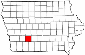
web = |Adair County is a
county located in theU.S. state ofIowa . As of 2000, the population is 8,243. Itscounty seat is Greenfield.GR|6Geography
According to the
U.S. Census Bureau , the county has a total area of 570square mile s (1,477km² ), of which, 569 square miles (1,474 km²) of it is land and 1 square miles (3 km²) of it (0.18%) is water.Major highways
*
*
*
*Adjacent counties
*Guthrie County (north)
*Madison County (east)
*Union County (southeast)
*Adams County (southwest)
*Cass County (west)History
Adair County was formed in 1851 from sections of Pottawattamie County. It was named for
John Adair , a general in theWar of 1812 , and the eighthGovernor of Kentucky .Demographics
USCensusPop
1900= 16192
1910= 14420
1920= 14259
1930= 13891
1940= 13196
1950= 12292
1960= 10893
1970= 9487
1980= 9509
1990= 8409
2000= 8243
footnote= [http://www.census.gov/population/cencounts/ia190090.txt IA Counties 1900-1990] As of thecensus GR|2 of 2000, there were 8,243 people, 3,398 households, and 2,324 families residing in the county. Thepopulation density was 14 people per square mile (6/km²). There were 3,690 housing units at an average density of 6 per square mile (2/km²). The racial makeup of the county was 98.91% White, 0.07% Black or African American, 0.07% Native American, 0.23% Asian, 0.23% from other races, and 0.49% from two or more races. 0.70% of the population were Hispanic or Latino of any race.There were 3,398 households out of which 29.20% had children under the age of 18 living with them, 59.50% were married couples living together, 5.70% had a female householder with no husband present, and 31.60% were non-families. 28.10% of all households were made up of individuals and 15.90% had someone living alone who was 65 years of age or older. The average household size was 2.37 and the average family size was 2.89.
In the county the population was spread out with 23.90% under the age of 18, 6.90% from 18 to 24, 24.40% from 25 to 44, 22.70% from 45 to 64, and 22.10% who were 65 years of age or older. The median age was 42 years. For every 100 females there were 95.90 males. For every 100 females age 18 and over, there were 93.00 males.
The median income for a household in the county was $35,179, and the median income for a family was $42,884. Males had a median income of $29,008 versus $21,680 for females. The
per capita income for the county was $17,262. About 4.90% of families and 7.60% of the population were below thepoverty line , including 9.40% of those under age 18 and 8.70% of those age 65 or over.Cities and towns
Townships
Adair County is divided into seventeen townships:
External links
*http://www.visitadaircounty.com
Wikimedia Foundation. 2010.