- Cherokee County, Iowa
-
Cherokee County, Iowa 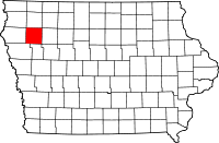
Location in the state of Iowa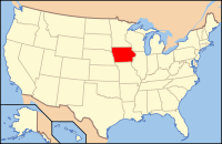
Iowa's location in the U.S.Founded 1851 Seat Cherokee Area
- Total
- Land
- Water
577.34 sq mi (1,495 km²)
577.15 sq mi (1,495 km²)
0.18 sq mi (0 km²), 0.03%Population
- (2010)
- Density
12,072
21.2/sq mi (8.2/km²)Time zone Central: UTC-6/-5 Website www.cherokeecountyiowa.com Footnotes: Population [1] Cherokee County is a county located in the U.S. state of Iowa. The population was 12,072 in the 2010 census, a decline from 13,035 in 2000.[1][2] The county seat is the city of Cherokee.[3]
Contents
Geography
According to the 2000 census, the county has a total area of 577.34 square miles (1,495.3 km2), of which 577.15 square miles (1,494.8 km2) (or 99.97%) is land and 0.18 square miles (0.47 km2) (or 0.03%) is water.[4]
Major highways
 U.S. Highway 59
 Iowa Highway 3
 Iowa Highway 7
 Iowa Highway 31
 Iowa Highway 143
Adjacent counties
- O'Brien County (north)
- Buena Vista County (east)
- Ida County (south)
- Woodbury County (southwest)
- Plymouth County (west)
History
Cherokee County was formed on January 15, 1851 from open territory. It was named after the Cherokee Indians.
Demographics
Historical populations Census Pop. %± 1860 58 — 1870 1,967 3,291.4% 1880 8,240 318.9% 1890 15,659 90.0% 1900 16,570 5.8% 1910 16,741 1.0% 1920 17,760 6.1% 1930 18,737 5.5% 1940 19,258 2.8% 1950 19,052 −1.1% 1960 18,598 −2.4% 1970 17,269 −7.1% 1980 16,238 −6.0% 1990 14,098 −13.2% 2000 13,035 −7.5% 2010 12,072 −7.4% Iowa Data Center [2] 2010 census
The 2010 census recorded a population of 12,072 in the county, with a population density of 21.254/sq mi (8.206/km2). There were 5,777 housing units, of which 5,207 were occupied.[1]
2000 census
 2000 Census Age Pyramid for Cherokee County.
As of the census[5] of 2000, there were 13,035 people, 5,378 households, and 3,597 families residing in the county. The population density was 23 people per square mile (9/km²). There were 5,850 housing units at an average density of 10 per square mile (4/km²). The racial makeup of the county was 98.33% White, 0.31% Black or African American, 0.16% Native American, 0.43% Asian, 0.37% from other races, and 0.40% from two or more races. 0.95% of the population were Hispanic or Latino of any race.
There were 5,378 households out of which 29.10% had children under the age of 18 living with them, 57.30% were married couples living together, 6.50% had a female householder with no husband present, and 33.10% were non-families. 29.50% of all households were made up of individuals and 15.30% had someone living alone who was 65 years of age or older. The average household size was 2.35 and the average family size was 2.91.
In the county the population was spread out with 24.60% under the age of 18, 6.80% from 18 to 24, 24.00% from 25 to 44, 24.30% from 45 to 64, and 20.40% who were 65 years of age or older. The median age was 42 years. For every 100 females there were 97.40 males. For every 100 females age 18 and over, there were 92.70 males.
The median income for a household in the county was $35,142, and the median income for a family was $42,897. Males had a median income of $29,612 versus $21,181 for females. The per capita income for the county was $17,934. About 5.50% of families and 7.30% of the population were below the poverty line, including 9.70% of those under age 18 and 5.70% of those age 65 or over.
Cities and towns
Townships
Cherokee County is divided into sixteen townships:
See also
References
- ^ a b c "Population and Housing Occupancy Status: 2010 - State -- County". United States Census Bureau American FactFinder. http://factfinder2.census.gov/faces/tableservices/jsf/pages/productview.xhtml?pid=DEC_10_PL_GCTPL2.ST05&prodType=table. Retrieved March 9, 2011.
- ^ a b "Data from the 2010 Census". State Data Center of Iowa. http://www.iowadatacenter.org/archive/2011/02/feb10. Retrieved March 9, 2011.
- ^ "Find a County". National Association of Counties. http://www.naco.org/Counties/Pages/FindACounty.aspx. Retrieved 2011-06-07.
- ^ "Census 2000 U.S. Gazetteer Files: Counties". United States Census. http://www.census.gov/tiger/tms/gazetteer/county2k.txt. Retrieved 2011-02-13.
- ^ "American FactFinder". United States Census Bureau. http://factfinder.census.gov. Retrieved 2008-01-31.

O'Brien County Plymouth County 
Buena Vista County  Cherokee County, Iowa

Woodbury County Ida County Municipalities and communities of Cherokee County, Iowa Cities 
Townships Coordinates: 42°44′05″N 95°37′27″W / 42.73472°N 95.62417°W
Categories:- Iowa counties
- Cherokee County, Iowa
- 1851 establishments in the United States


Wikimedia Foundation. 2010.