- Buchanan County, Iowa
Infobox U.S. County
county = Buchanan County
state = Iowa
seallink =
map size = 250
founded = 1837
seat = Independence
largest city =
area_total_sq_mi = 573
area_total_km2 = 1485
area_land_sq_mi = 571
area_land_km2 = 1480
area_water_sq_mi = 2
area_water_km2 = 5
area percentage = 0.36%
census yr = 2000
pop = 21093
density_sq_mi = 37
density_km2 = 14
time zone = Central
UTC offset = -6
DST offset= -5
footnotes =
web = www.buchanancounty.com|Buchanan County is a
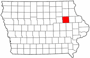
county located in theU.S. state ofIowa . It was created in 1837 and was named in honor of SenatorJames Buchanan , who became the 15th President of the United States. As of 2000, the population was 21,093. Itscounty seat is Independence.GR|6Geography
According to the
U.S. Census Bureau , the county has a total area of 573square mile s (1,485km² ), of which, 571 square miles (1,480 km²) of it is land and 2 square miles (5 km²) of it (0.36%) is water.Major highways
A number of historic communities in Buchanan County once appeared on state maps, but no longer exist. Hamerville was located east of Brandon at the intersection of Highway 150. Today, the site is the location of three farmhouses. Vista, once located between Brandon and Independence, appeared on maps frequently until the 1950s. This site is not even accessed by paved road. Kier, between Fairbank and Littleton, appeared on many maps in the 1800s and early 1900s. The area is now settled by
Amish . Several towns named Middlefield existed southeast of Winthrop, but none are populated today. Newtonville was located a few miles south of Monti. The houses at Castleville were later moved to Aurora. Wise, once located between Independence and Jesup just north of Highway 939, was a train-stop between the 1920s and the 1950s. Little remains at the site. Kiene was founded in 1911 between Quasqueton and Monti, but was empty by 1955. Few or even no houses remain at any of these sites.Townships
Buchanan County is divided into sixteen townships:
External links
* [http://www.buchanancounty.com/ Buchanan County Economic Development Commission's website]
Wikimedia Foundation. 2010.