- Ida Grove, Iowa
Infobox Settlement
official_name = Ida Grove, Iowa
settlement_type =City
nickname = The Grove
motto =
imagesize =
image_caption =
image_
imagesize =
image_caption =
image_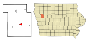
mapsize = 250x200px
map_caption = Location of Ida Grove, Iowa
mapsize1 =
map_caption1 =subdivision_type = Country
subdivision_name =
subdivision_type1 = State
subdivision_name1 =
subdivision_type2 = County
subdivision_name2 = Ida
government_footnotes =
government_type =
leader_title =
leader_name =
leader_title1 =
leader_name1 =
established_title =
established_date =unit_pref = Imperial
area_footnotes =area_magnitude =
area_total_km2 = 5.4
area_land_km2 = 5.4
area_water_km2 = 0.0
area_total_sq_mi = 2.1
area_land_sq_mi = 2.1
area_water_sq_mi = 0.0population_as_of = 2000
population_footnotes =
population_total = 2350
population_density_km2 = 436.2
population_density_sq_mi = 1129.7timezone = Central (CST)
utc_offset = -6
timezone_DST = CDT
utc_offset_DST = -5
elevation_footnotes =
elevation_m = 376
elevation_ft = 1234
latd = 42 |latm = 20 |lats = 40 |latNS = N
longd = 95 |longm = 28 |longs = 14 |longEW = Wpostal_code_type =
ZIP code
postal_code = 51445
area_code = 712
blank_name = FIPS code
blank_info = 19-38010
blank1_name = GNIS feature ID
blank1_info = 0457744
website =
footnotes =Ida Grove is a city in Ida County,
Iowa ,United States . The population was 2,350 at the 2000 census. It is thecounty seat of Ida CountyGR|6.Geography
Ida Grove is located at coor dms|42|20|40|N|95|28|14|W|city (42.344394, -95.470540)GR|1. It is situated on the Maple River.
According to the
United States Census Bureau , the city has a total area of 2.1square mile s (5.4km² ), of which, 2.1 square miles (5.4 km²) of it is land and 0.48% is water.Demographics
As of the
census GR|2 of 2000, there were 2,350 people, 1,017 households, and 639 families residing in the city. Thepopulation density was 1,129.7 people per square mile (436.2/km²). There were 1,127 housing units at an average density of 541.8/sq mi (209.2/km²). The racial makeup of the city was 98.94% White, 0.09% African American, 0.04% Native American, 0.17% Asian, 0.21% from other races, and 0.55% from two or more races. Hispanic or Latino of any race were 0.64% of the population.There were 1,017 households out of which 26.8% had children under the age of 18 living with them, 52.7% were married couples living together, 7.9% had a female householder with no husband present, and 37.1% were non-families. 34.5% of all households were made up of individuals and 18.3% had someone living alone who was 65 years of age or older. The average household size was 2.25 and the average family size was 2.88.
In the city the population was spread out with 23.9% under the age of 18, 6.1% from 18 to 24, 23.6% from 25 to 44, 23.3% from 45 to 64, and 23.1% who were 65 years of age or older. The median age was 43 years. For every 100 females there were 87.8 males. For every 100 females age 18 and over, there were 82.6 males.
The median income for a household in the city was $35,341, and the median income for a family was $46,213. Males had a median income of $31,185 versus $19,135 for females. The
per capita income for the city was $20,698. About 4.6% of families and 7.7% of the population were below thepoverty line , including 9.6% of those under age 18 and 6.5% of those age 65 or over.Notable natives
*
Mildred Lillie , California Court of Appeal Presiding Justice and Richard Nixon's choice for the first woman to serve on theU.S. Supreme Court (nomination withdrawn)
*Harold Hughes , Governor of Iowa (1963-1969), U.S. Senator (1969-1975), and 1972 Presidential candidate.References
External links
Wikimedia Foundation. 2010.