- Ladora, Iowa
Infobox Settlement
official_name = Ladora, Iowa
settlement_type =City
nickname =
motto =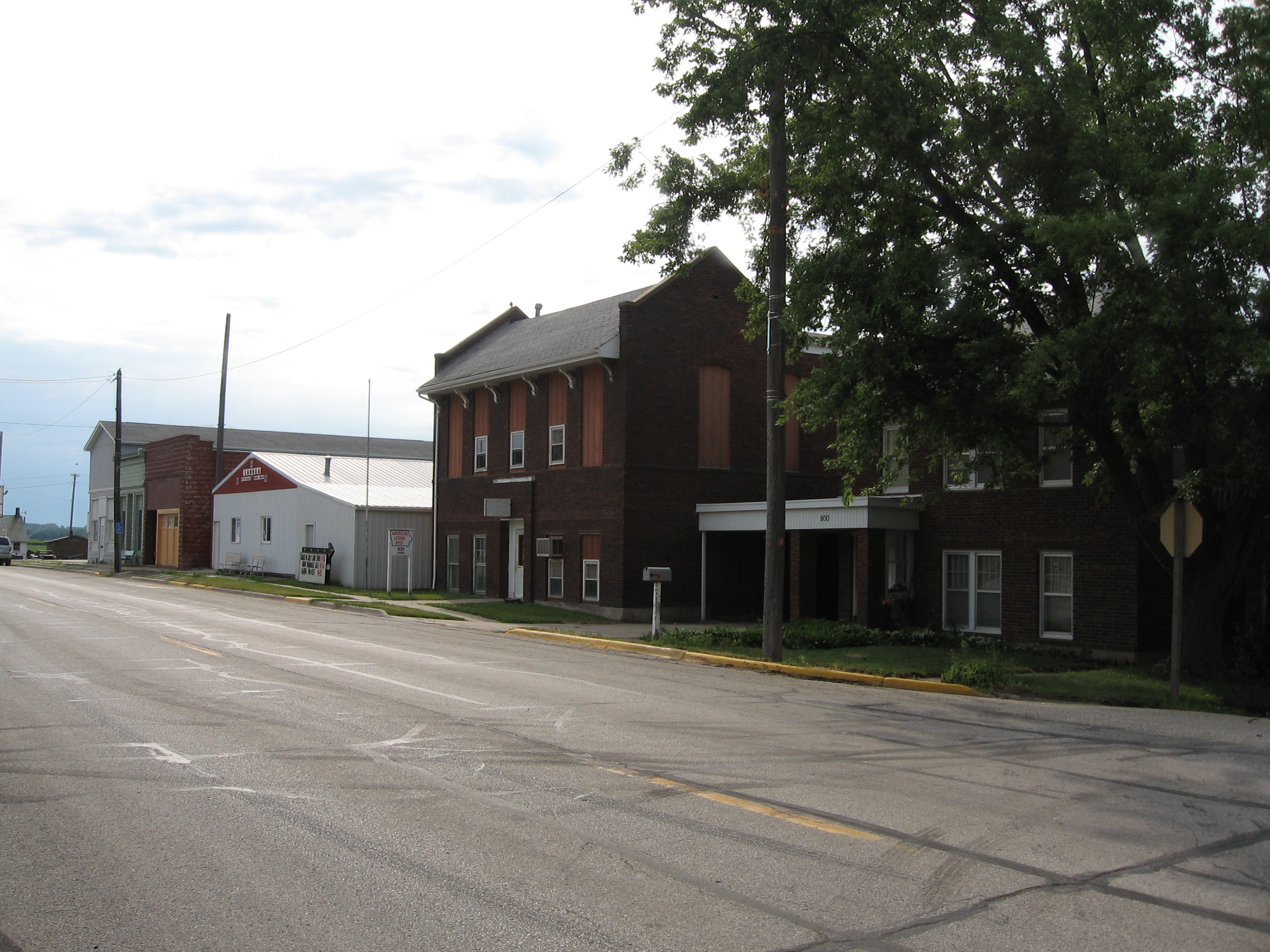
imagesize =
image_caption = Downtown Ladora, 2007
image_
image_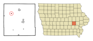
mapsize = 250x200px
map_caption = Location of Ladora, Iowa
mapsize1 =
map_caption1 =subdivision_type = Country
subdivision_name =
subdivision_type1 = State
subdivision_name1 =
subdivision_type2 = County
subdivision_name2 = Iowa
government_footnotes =
government_type =
leader_title =
leader_name =
leader_title1 =
leader_name1 =
established_title =
established_date =unit_pref = Imperial
area_footnotes =area_magnitude =
area_total_km2 = 0.8
area_land_km2 = 0.8
area_water_km2 = 0.0
area_total_sq_mi = 0.3
area_land_sq_mi = 0.3
area_water_sq_mi = 0.0population_as_of = 2000
population_footnotes =
population_total = 287
population_density_km2 = 362.1
population_density_sq_mi = 937.8timezone = Central (CST)
utc_offset = -6
timezone_DST = CDT
utc_offset_DST = -5
elevation_footnotes =
elevation_m = 238
elevation_ft = 781
latd = 41 |latm = 45 |lats = 18 |latNS = N
longd = 92 |longm = 11 |longs = 2 |longEW = Wpostal_code_type =
ZIP code
postal_code = 52251
area_code = 319
blank_name = FIPS code
blank_info = 19-42330
blank1_name = GNIS feature ID
blank1_info = 0458168
website =
footnotes =Ladora is a city in Iowa County,
Iowa ,United States . The population was 287 at the 2000 census.Geography
Ladora is located at coor dms|41|45|18|N|92|11|2|W|city (41.754903, -92.183925)GR|1.
According to the
United States Census Bureau , the city has a total area of 0.3square mile s (0.8km² ), all of it land. Ladora also was [http://iowaprogress.com/2007/01/23/ladora-iowa-stronghold-of-socialism/| the strongest precinct] forSocialist Workers Party congressional candidateHelen Meyers in 2006 Congressional Election.Demographics
As of the
census GR|2 of 2000, there were 287 people, 121 households, and 75 families residing in the city. Thepopulation density was 937.8 people per square mile (357.5/km²). There were 129 housing units at an average density of 421.5/sq mi (160.7/km²). The racial makeup of the city was 99.65% White, 0.35% from other races. Hispanic or Latino of any race were 1.39% of the population.There were 121 households out of which 31.4% had children under the age of 18 living with them, 52.9% were married couples living together, 5.8% had a female householder with no husband present, and 38.0% were non-families. 32.2% of all households were made up of individuals and 15.7% had someone living alone who was 65 years of age or older. The average household size was 2.37 and the average family size was 3.05.
In the city the population was spread out with 26.1% under the age of 18, 8.7% from 18 to 24, 32.4% from 25 to 44, 18.5% from 45 to 64, and 14.3% who were 65 years of age or older. The median age was 36 years. For every 100 females there were 120.8 males. For every 100 females age 18 and over, there were 107.8 males.
The median income for a household in the city was $36,875, and the median income for a family was $48,333. Males had a median income of $30,156 versus $21,528 for females. The
per capita income for the city was $15,888. About 7.4% of families and 8.5% of the population were below thepoverty line , including 5.0% of those under the age of eighteen and 8.6% of those sixty five or over.Notable natives
*
Mildred Wirt Benson , American author.References
External links
Wikimedia Foundation. 2010.