- County Road 105 (Iowa)
-
County Road 105
Route information Length: 34 mi (55 km) History: Iowa Highway 105 (1920–1992)[1] Major junctions West end:  US 69 in Lake Mills
 I-35 near Northwood
East end:  US 218 in St. Ansgar
Highway system Iowa Primary Highway System
Interstates • U.S. Highways • State Highways←  Iowa 102
Iowa 107  →
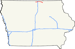
→County Road 105 (CR 105) is an east–west route which runs 34 miles (55 km) from Lake Mills to St. Ansgar in northern Iowa. Prior to December 31, 1992, CR 105 was known as Iowa Highway 105 (Iowa 105). County Road 105 was the first county road in Iowa to not follow the standard alphanumeric route numbering system.
Contents
Route description
County Road 105 begins in Winnebago County at the intersection of Lake Street and Main Street in Lake Mills. Northbound U.S. Route 69 (US 69) traffic approaches the intersection on Main Street and turns north at Lake Street; CR 105 begins eastbound on Main Street.[2] At the intersection, Interstate 35 (I-35) is signed using CR 105 as a connector route.[3] Just outside of Lake Mills, CR 105 enters Worth County. CR 105 meets I-35 at exit 214, the northernmost exit in Iowa. Located at this exit is an Iowa welcome center and a Diamond Jo Casino.[4] Seven miles (11 km) east of the I-35 interchange, CR 105 enters Northwood along Central Avenue. At Eighth Street, CR 105 intersects southbound U.S. Route 65. US 65 and CR 105 overlap each other for two blocks, ending at Sixth Street, when US 65 turns south again.[5]
 Eastern terminus at St. Ansgar.
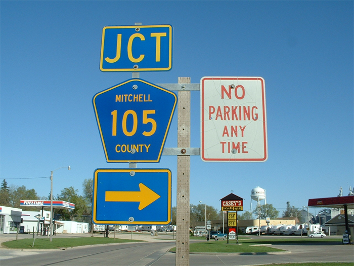
County Road 105 continues eastward towards Carpenter. Just west of Carpenter, CR 105 enters Mitchell County. One mile (1.6 km) east of Carpenter, CR 105 intersects Mitchell County Road S70, which travels 6 miles (9.7 km) north and connects to Minnesota State Highway 105.[6] East of the intersection with CR S70, CR 105 travels southeast towards St. Ansgar. CR 105 enters St. Ansgar along Main Street, before turning east on Fourth Street. CR 105 crosses a Canadian National Railway line before ending at U.S. Route 218 just 100 yards (91 m) later.[7]
History
Iowa Highway 105 was an original state highway designated in 1920.[8] During its 72-year-long existence, Iowa 105's route changed very little.[1][6]. On 31 December 1992, most of Iowa 105 was turned over to Worth and Mitchell Counties. All of Iowa 105 in Winnebago County became Iowa Highway 971. Sections of Iowa 105 in Northwood and St. Ansgar became Iowa 972 and Iowa 973, respectively.[9] The rest of Iowa 105 was designated County Road 105 by Worth and Mitchell Counties. CR 105 was the first numeric county route designation since Iowa began giving county routes an alphanumeric designation, e.g. County Road E41.[10]
Major intersections
County Location Mile[11] Destinations Notes Winnebago Lake Mills 0.0 US 69Worth Hartland Township 10.4 I-35Northwood 16.8  US 65 north
West end of US 65 overlap 17.0 US 65 southEast end of US 65 overlap Mitchell St. Ansgar 34.1 US 2181.000 mi = 1.609 km; 1.000 km = 0.621 mi
Concurrency terminus • Closed/Former • Incomplete access • UnopenedReferences
- ^ a b Rand McNally & Company (1947). Road and Reference Atlas (Map). 1:1,077,120, (1947 ed.). pp. 42–43.
- ^ Iowa Department of Transportation (29 June 2006). Highway and Street Map of Lake Mills, Iowa (Map). http://www.iowadotmaps.com/msp/citypdf/Lake%20Mills_ci.pdf. Retrieved 27 December 2009.
- ^ Morrison, Jeff (1 January 2007). "End of Iowa 105". Iowa Highway Ends. http://www.angelfire.com/ia3/roadgeek/ia105.html. Retrieved 27 December 2009.
- ^ Diamond Jo Casino (2009). "Contact". http://diamondjoworth.com/Contact.aspx. Retrieved 27 December 2009.
- ^ Iowa Department of Transportation (2 April 2009). Highway and Street Map of Northwood, Iowa (Map). http://www.iowadotmaps.com/msp/citypdf/Northwood_ci.pdf. Retrieved 27 December 2009.
- ^ a b Iowa Department of Transportation (2009). Transportation Map (Map). http://www.iowadotmaps.com/msp/pdf/current/stmapmain.pdf. Retrieved 27 December 2009.
- ^ Iowa Department of Transportation (20 August 2008). Highway and Street Map of Saint Ansgar, Iowa (Map). http://www.iowadotmaps.com/msp/citypdf/Saint%20Ansgar_ci.pdf. Retrieved 27 December 2009.
- ^ Hancock, Jason (21 February 2007). "Iowa Highways: 100 to 119". The Iowa Highways Page. http://iowahighways.home.mchsi.com/highways/iowa100-119.html#105. Retrieved 27 December 2009.
- ^ Morrison, Jeff. "A Comprehensive(?) Listing of the 900s - Page 4". Iowa Highway Ends. http://homepage.mac.com/jeffmorrison/900s4.html. Retrieved 27 December 2009.
- ^ Hancock, Jason (16 February 2009). "County Roads of Iowa". The Iowa Highways Page. http://iowahighways.home.mchsi.com/highways/countyrd.html. Retrieved 27 December 2009.
- ^ Google, Inc. Google Maps – County Road 105 (Iowa) (Map). Cartography by Google, Inc. http://maps.google.com/maps?f=d&source=s_d&saddr=Co+Rd+R74%2FE+Main+St&daddr=Route+105+to:Central+Ave+to:Central+Ave+to:W+4th+St&hl=en&geocode=FaSGlgId3s5s-g%3BFWTolgIdUJlv-g%3BFSDnlgIdyI9x-g%3BFRbnlgId5plx-g%3BFTrnlQIdtjB2-g&mra=mi&mrcr=2,3&mrsp=3&sz=16&sll=43.443182,-93.219252&sspn=0.007977,0.013797&ie=UTF8&ll=43.447934,-93.264313&spn=0.510468,0.883026&t=h&z=10. Retrieved September 7, 2010.
Categories:- Former state highways in Iowa


Wikimedia Foundation. 2010.