National Register of Historic Places listings in Davis County, Iowa
- National Register of Historic Places listings in Davis County, Iowa
-

Location of Davis County in Iowa
This is a list of the National Register of Historic Places listings in Davis County, Iowa.
This is intended to be a complete list of the properties and districts on the National Register of Historic Places in Davis County, Iowa, United States. Latitude and longitude coordinates are provided for many National Register properties and districts; these locations may be seen together in a Google map.[1]
There are 11 properties and districts listed on the National Register in the county, including one National Historic Landmark.
-
- This National Park Service list is complete through NPS recent listings posted November 10, 2011.[2]
| [3] |
Landmark name [4] |
Image |
Date listed |
Location |
City or town |
Summary |
| 1 |
Bloomfield Square |
|
01976-11-07November 7, 1976 |
Madison, Jefferson, Franklin, and Washington Sts.
40°45′05″N 92°24′52″W / 40.751389°N 92.414444°W / 40.751389; -92.414444 (Bloomfield Square) |
Bloomfield |
|
| 2 |
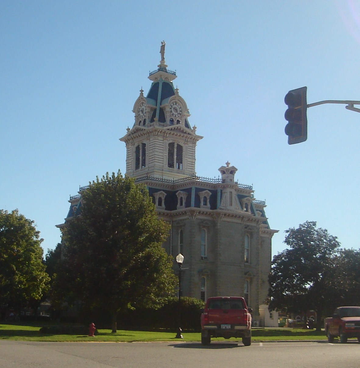
Davis County Courthouse |
|
01974-05-03May 3, 1974 |
Bloomfield Town Sq.
40°45′10″N 92°25′01″W / 40.752778°N 92.416944°W / 40.752778; -92.416944 (Davis County Courthouse) |
Bloomfield |
|
| 3 |
William Findley House |
|
01978-06-09June 9, 1978 |
302 E. Franklin St.
40°45′01″N 92°24′43″W / 40.750278°N 92.411944°W / 40.750278; -92.411944 (William Findley House) |
Bloomfield |
|
| 4 |
"Lockkeeper's" House |
|
02009-10-14October 14, 2009 |
Whitefish Trail
40°53′35″N 92°12′26″W / 40.893014°N 92.207117°W / 40.893014; -92.207117 ("Lockkeeper's" House) |
Eldon |
|
| 5 |
Stringtown House |
|
01974-04-16April 16, 1974 |
East of Centerville on Iowa Highway 2
40°45′34″N 92°24′10″W / 40.759444°N 92.402778°W / 40.759444; -92.402778 (Stringtown House) |
Centerville |
|
| 6 |
Trimble-Parker Historic Farmstead District |
|
02003-03-21March 21, 2003 |
23981 240th St.
40°43′01″N 92°22′12″W / 40.716944°N 92.37°W / 40.716944; -92.37 (Trimble-Parker Historic Farmstead District) |
Bloomfield |
|
| 7 |
Troy Academy |
|
01976-06-23June 23, 1976 |
Off Iowa Highway 2
40°44′47″N 92°12′03″W / 40.746389°N 92.200833°W / 40.746389; -92.200833 (Troy Academy) |
Troy |
|
| 8 |
James B. Weaver House |
|
01975-05-15May 15, 1975 |
Weaver Park Rd. (U.S. Route 63)
40°45′18″N 92°24′44″W / 40.755°N 92.412222°W / 40.755; -92.412222 (James B. Weaver House) |
Bloomfield |
|
| 9 |
West Grove United Methodist Church |
|
02004-05-26May 26, 2004 |
21944 Echo Ave.,
40°43′32″N 92°33′23″W / 40.725556°N 92.556389°W / 40.725556; -92.556389 (West Grove United Methodist Church) |
West Grove |
|
| 10 |
Asa Wilson House |
|
01982-12-10December 10, 1982 |
207 S. Washington
40°45′00″N 92°24′46″W / 40.75°N 92.412778°W / 40.75; -92.412778 (Asa Wilson House) |
Bloomfield |
|
| 11 |
Henry Wishard House |
|
02004-12-15December 15, 2004 |
406 W. Jefferson St.
40°45′05″N 92°25′11″W / 40.751389°N 92.419722°W / 40.751389; -92.419722 (Henry Wishard House) |
Bloomfield |
|
See also
References
- ^ The latitude and longitude information provided in this table was derived originally from the National Register Information System, which has been found to be fairly accurate for about 99% of listings. For about 1% of NRIS original coordinates, experience has shown that one or both coordinates are typos or otherwise extremely far off; some corrections may have been made. A more subtle problem causes many locations to be off by up to 150 yards, depending on location in the country: most NRIS coordinates were derived from tracing out latitude and longitudes off of USGS topographical quadrant maps created under the North American Datum of 1927, which differs from the current, highly accurate WGS84 GPS system used by Google maps. Chicago is about right, but NRIS longitudes in Washington are higher by about 4.5 seconds, and are lower by about 2.0 seconds in Maine. Latitudes differ by about 1.0 second in Florida. Some locations in this table may have been corrected to current GPS standards.
- ^ "National Register of Historic Places: Weekly List Actions". National Park Service, United States Department of the Interior. Retrieved on November 10, 2011.
- ^ Numbers represent an ordering by significant words. Various colorings, defined here, differentiate National Historic Landmark sites and National Register of Historic Places Districts from other NRHP buildings, structures, sites or objects.
- ^ "National Register Information System". National Register of Historic Places. National Park Service. . http://nrhp.focus.nps.gov/natreg/docs/All_Data.html.
Categories: - National Register of Historic Places in Iowa by county
- Davis County, Iowa
- Buildings and structures in Davis County, Iowa
Wikimedia Foundation.
2010.
Look at other dictionaries:
National Register of Historic Places listings in Johnson County, Iowa — Location of Johnson County in Iowa This is a list of the National Register of Historic Places listings in Johnson County, Iowa. This is intended to be a complete list of the properties and districts on the National Register of Historic Places in… … Wikipedia
National Register of Historic Places listings in Clayton County, Iowa — Location of Clayton County in Iowa This is a list of the National Register of Historic Places listings in Clayton County, Iowa. This is intended to be a complete list of the properties and districts on the National Register of Historic Places in… … Wikipedia
National Register of Historic Places listings in Dubuque County, Iowa — Location of Dubuque County in Iowa This is a list of the National Register of Historic Places listings in Dubuque County, Iowa. This is intended to be a complete list of the properties and districts on the National Register of Historic Places in… … Wikipedia
National Register of Historic Places listings in Hardin County, Iowa — Location of Hardin County in Iowa This is a list of the National Register of Historic Places listings in Hardin County, Iowa. This is intended to be a complete list of the properties and districts on the National Register of Historic Places in… … Wikipedia
National Register of Historic Places listings in Polk County, Iowa — Location of Polk County in Iowa This is a list of the National Register of Historic Places listings in Polk County, Iowa. This is intended to be a complete list of the properties and districts on the National Register of Historic Places in Polk… … Wikipedia
National Register of Historic Places listings in Buchanan County, Iowa — Location of Buchanan County in Iowa This is a list of the National Register of Historic Places listings in Buchanan County, Iowa. This is intended to be a complete list of the properties and districts on the National Register of Historic Places… … Wikipedia
National Register of Historic Places listings in Cedar County, Iowa — Location of Cedar County in Iowa This is a list of the National Register of Historic Places listings in Cedar County, Iowa. This is intended to be a complete list of the properties and districts on the National Register of Historic Places in… … Wikipedia
National Register of Historic Places listings in Delaware County, Iowa — Location of Delaware County in Iowa This is a list of the National Register of Historic Places listings in Delaware County, Iowa. This is intended to be a complete list of the properties and districts on the National Register of Historic Places… … Wikipedia
National Register of Historic Places listings in Henry County, Iowa — Location of Henry County in Iowa This is a list of the National Register of Historic Places listings in Henry County, Iowa. This is intended to be a complete list of the properties and districts on the National Register of Historic Places in… … Wikipedia
National Register of Historic Places listings in Jackson County, Iowa — Location of Jackson County in Iowa This is a list of the National Register of Historic Places listings in Jackson County, Iowa. This is intended to be a complete list of the properties and districts on the National Register of Historic Places in… … Wikipedia