- National Register of Historic Places listings in Woodbury County, Iowa
-
 Location of Woodbury County in Iowa
This is a list of the National Register of Historic Places listings in Woodbury County, Iowa.
This is intended to be a complete list of the properties and districts on the National Register of Historic Places in Woodbury County, Iowa, United States. Latitude and longitude coordinates are provided for many National Register properties and districts; these locations may be seen together in a Google map.[1]
There are 53 properties and districts listed on the National Register in the county, including three National Historic Landmarks.
-
- This National Park Service list is complete through NPS recent listings posted November 10, 2011.[2]
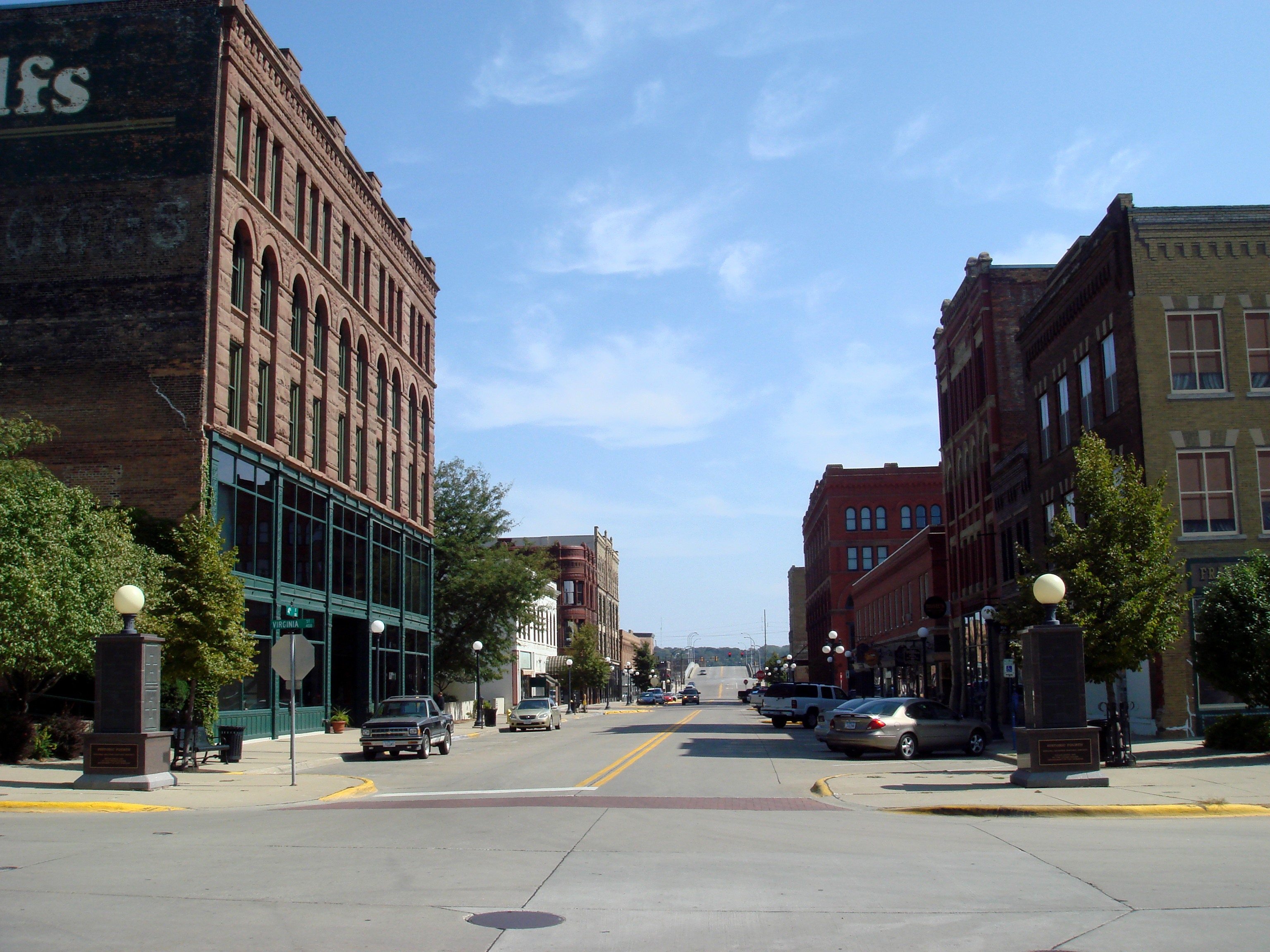
[3] Landmark name [4] Image Date listed Location City or town Summary 1 Alhambra Apartments September 25, 1998 October 12, 2001 801 8th St.
42°29′54″N 96°23′17″W / 42.49833°N 96.38806°WSioux City 2 Atchison A. Ashby House September 25, 1998 1807 Summit St.
42°30′34″N 96°24′34″W / 42.509444°N 96.409444°WSioux City 3 Badgerow Building March 24, 1982 622 4th St.
42°29′38″N 96°24′07″W / 42.493889°N 96.401944°WSioux City 4 George A. and Mary Tinkel Bailey House August 5, 1998 423 10th St.
42°28′53″N 95°47′03″W / 42.481389°N 95.784167°WCorrectionville 5 Benson Archeological Site (13WD50) April 24, 1984 Address Restricted Smithland 6 Boston Block January 3, 1985 1005-1013 E. 4th St.
42°30′12″N 96°23′47″W / 42.503333°N 96.396389°WSioux City 7 Theophile Bruguier Cabin August 14, 2000 Riverside Park
42°29′49″N 96°28′32″W / 42.496944°N 96.475556°WSioux City 8 Elzy G. Burkam House July 15, 1998 1525 Douglas St.
42°30′23″N 96°24′22″W / 42.506389°N 96.406111°WSioux City 9 Charles City College Hall January 21, 1983 1501 Morningside Ave.
42°28′29″N 96°21′33″W / 42.474722°N 96.359167°WSioux City 10 Chicago, Milwaukee, St. Paul & Pacific Combination Depot-Hornick September 6, 1990 Main St. south of Railway St.
42°13′51″N 96°05′51″W / 42.230833°N 96.0975°WHornick 11 Davidson Building June 25, 1999 505 6th St.
42°29′49″N 96°24′16″W / 42.496944°N 96.404444°WSioux City 12 Mary Elizabeth Day Nursery October 30, 1997 814 Court St.
42°30′31″N 96°23′43″W / 42.508611°N 96.395278°WSioux City 13 Evans Block January 3, 1985 1126-28 4th St.
42°29′39″N 96°23′41″W / 42.494167°N 96.394722°WSioux City 14 H.H. Everist House September 29, 1983 37 McDonald Dr.
42°31′08″N 96°24′38″W / 42.518889°N 96.410556°WSioux City 15 Florence Crittenton Home and Maternity Hospital March 31, 2000 1105-1111 28th St.
42°31′12″N 96°24′21″W / 42.52°N 96.405833°WSioux City 16 Fourth Street Historic District 
August 15, 1995 1002-1128 4th St.
42°29′39″N 96°23′46″W / 42.494167°N 96.396111°WSioux City 17 Grandview Park Music Pavilion February 28, 2011 Sits to the east of McDonald St. -- Entrance in 2600 block of McDonald St.
42°31′02″N 96°24′38″W / 42.517222°N 96.410556°WSioux City 18 Great Northern Railway Steam Locomotive No. 1355 and Tender 1451 December 15, 2004 3400 Sioux River Rd.
42°31′45″N 96°28′36″W / 42.529167°N 96.476667°WSioux City 19 Holy Trinity Greek Orthodox Church 
May 1, 1998 900 6th St.
42°29′46″N 96°23′55″W / 42.496111°N 96.398611°WSioux City 20 Dr. Van Buren Knott House September 8, 1999 2323 Nebraska St.
42°30′50″N 96°24′12″W / 42.513889°N 96.403333°WSioux City 21 Leeds Junior High School October 24, 2002 3919 Jefferson St.
42°32′15″N 96°22′04″W / 42.5375°N 96.367778°WSioux City 22 Martin Hotel 
January 27, 1983 410 Pierce St.
42°29′40″N 96°24′15″W / 42.494444°N 96.404167°WSioux City 23 T.S. Martin and Company July 15, 1998 Junction of 4th St. and Nebraska St.
42°29′40″N 96°24′12″W / 42.494444°N 96.403333°WSioux City 24 Midland Packing Company January 25, 1979 2001 Leech Ave.
42°29′19″N 96°22′59″W / 42.488611°N 96.383056°WSioux City 25 Morningside College Historic District May 14, 1997 Roughly bounded by Vine, Morningside, Garretson, Peters, and S. Paxton Aves. and Sioux Trail
42°28′28″N 96°21′42″W / 42.474444°N 96.361667°WSioux City 26 Motor Mart Building April 22, 1993 520 Nebraska St.
42°29′45″N 96°23′25″W / 42.495833°N 96.390278°WSioux City 27 Mount Sinai Temple 
October 21, 1999 1320 Nebraska St.
42°30′18″N 96°24′10″W / 42.505°N 96.402778°WSioux City 28 Municipal Auditorium 
July 27, 2006 500 Gordon Dr.
42°29′34″N 96°24′24″W / 42.492778°N 96.406667°WSioux City 29 Mylius-Eaton House January 13, 2004 2900 Jackson St.
42°31′15″N 96°24′07″W / 42.520833°N 96.401944°WSioux City 30 New Orpheum Theatre 
August 25, 2000 520-28 Pierce St.
42°29′44″N 96°24′17″W / 42.49556°N 96.40472°WSioux City Restored theatre complex that was built in 1927 31 James P. Newton House and Maid Cottage March 3, 2000 2312 Nebraska St.
42°30′53″N 96°24′10″W / 42.514722°N 96.402778°WSioux City 32 Julius and Anine Oversen House March 28, 2007 2037 S. Lemon St.
42°28′08″N 96°20′33″W / 42.468889°N 96.3425°WSioux City 33 John Peirce House 
December 12, 1978 2901 Jackson St.
42°31′15″N 96°24′08″W / 42.520833°N 96.402222°WSioux City 34 Rose Hill Historic District September 12, 2002 1400-1700 blocks of Douglas St., Grandview Boulevard, and Summit St.
42°30′08″N 96°24′48″W / 42.502222°N 96.413333°WSioux City 35 St. Boniface Historic District 
November 5, 1998 703 W. 5th St., 515 Cook St., and 700 W. 6th St.
42°30′04″N 96°25′03″W / 42.501111°N 96.4175°WSioux City 36 St. Thomas Episcopal Church 
September 27, 1984 1200 Douglas St.
42°30′11″N 96°24′23″W / 42.503056°N 96.406389°WSioux City 37 Arthur and Stella Sanford House May 9, 2003 1925 Summit
42°30′39″N 96°24′33″W / 42.510833°N 96.409167°WSioux City 38 Ben and Harriet Schulein House October 30, 1997 2604 Jackson St.
42°31′02″N 96°24′05″W / 42.517222°N 96.401389°WSioux City 39 SERGEANT FLOYD 
May 5, 1989 Missouri River Mile Marker 730
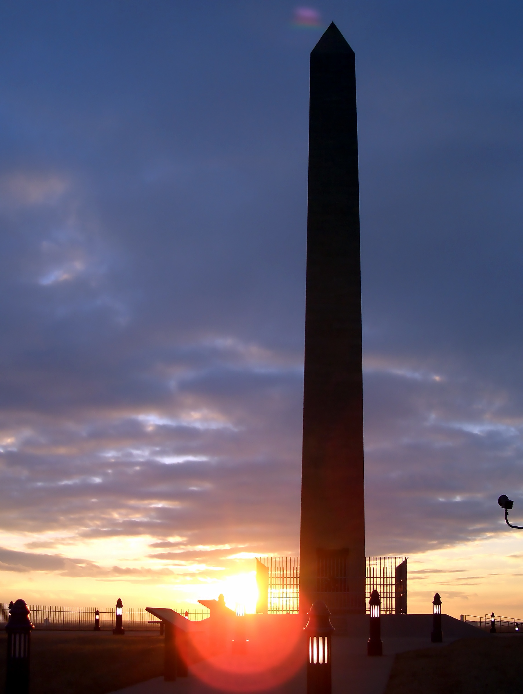
42°30′04″N 96°28′21″W / 42.501111°N 96.4725°WSioux City 40 Sergeant Floyd Monument 
October 15, 1966 Glenn Ave. and Lewis Rd.
42°27′45″N 96°22′39″W / 42.4625°N 96.3775°WSioux City 41 Simmons Hardware Company Warehouse April 25, 2008 323 Water St.
42°29′36″N 96°24′34″W / 42.4933°N 96.40932°WSioux City 42 Sioux City Baptist Church October 22, 1979 1301 Nebraska Ave.
42°30′47″N 96°24′12″W / 42.513056°N 96.403333°WSioux City 43 Sioux City Central High School July 23, 1974 1212 Nebraska St.
42°30′13″N 96°24′09″W / 42.503611°N 96.4025°WSioux City 44 Sioux City Fire Station Number 3 May 21, 2008 1211 5th St.
42°29′43″N 96°23′41″W / 42.49532°N 96.39473°WSioux City 45 Sioux City Free Public Library June 2, 1997 705 6th St.
42°30′08″N 96°24′27″W / 42.502222°N 96.4075°WSioux City 46 Sioux City Linseed Oil Works January 10, 2008 210 Court St.
42°29′33″N 96°23′43″W / 42.4925°N 96.395278°WSioux City 47 Sioux City Masonic Temple 
January 14, 2004 820 Nebraska St.
42°29′58″N 96°24′05″W / 42.499444°N 96.401389°WSioux City 48 Sioux City Public Library (Smith Villa Branch) May 23, 1983 1509 George Ave.
42°30′23″N 96°25′37″W / 42.506389°N 96.426944°WSioux City 49 Sioux City Public Library-North Side Branch December 7, 2000 810 29th St.
42°31′15″N 96°23′59″W / 42.520833°N 96.399722°WSioux City 50 Swedish Evangelical Lutheran Augustana Church May 30, 2006 600 Court St.
42°29′48″N 96°23′45″W / 42.496667°N 96.395833°WSioux City 51 Warrior Hotel June 27, 1985 6th and Nebraska Sts.
42°29′48″N 96°24′12″W / 42.496667°N 96.403333°WSioux City 52 Williges Building August 31, 2007 613-615 Pierce St.
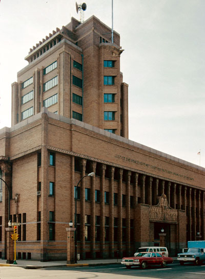
42°29′49″N 96°24′17″W / 42.496944°N 96.404722°WSioux City 53 Woodbury County Courthouse 
December 18, 1973 7th and Douglas Sts.
42°29′50″N 96°24′20″W / 42.497222°N 96.405556°WSioux City See also
References
- ^ The latitude and longitude information provided in this table was derived originally from the National Register Information System, which has been found to be fairly accurate for about 99% of listings. For about 1% of NRIS original coordinates, experience has shown that one or both coordinates are typos or otherwise extremely far off; some corrections may have been made. A more subtle problem causes many locations to be off by up to 150 yards, depending on location in the country: most NRIS coordinates were derived from tracing out latitude and longitudes off of USGS topographical quadrant maps created under North American Datum of 1927, which differs from the current, highly accurate GPS system used by Google maps. Chicago is about right, but NRIS longitudes in Washington are higher by about 4.5 seconds, and are lower by about 2.0 seconds in Maine. Latitudes differ by about 1.0 second in Florida. Some locations in this table may have been corrected to current GPS standards.
- ^ "National Register of Historic Places: Weekly List Actions". National Park Service, United States Department of the Interior. Retrieved on November 10, 2011.
- ^ Numbers represent an ordering by significant words. Various colorings, defined here, differentiate National Historic Landmark sites and National Register of Historic Places Districts from other NRHP buildings, structures, sites or objects.
- ^ "National Register Information System". National Register of Historic Places. National Park Service. . http://nrhp.focus.nps.gov/natreg/docs/All_Data.html.
U.S. National Register of Historic Places Topics Lists by states Alabama • Alaska • Arizona • Arkansas • California • Colorado • Connecticut • Delaware • Florida • Georgia • Hawaii • Idaho • Illinois • Indiana • Iowa • Kansas • Kentucky • Louisiana • Maine • Maryland • Massachusetts • Michigan • Minnesota • Mississippi • Missouri • Montana • Nebraska • Nevada • New Hampshire • New Jersey • New Mexico • New York • North Carolina • North Dakota • Ohio • Oklahoma • Oregon • Pennsylvania • Rhode Island • South Carolina • South Dakota • Tennessee • Texas • Utah • Vermont • Virginia • Washington • West Virginia • Wisconsin • WyomingLists by territories Lists by associated states Other  Category:National Register of Historic Places •
  Portal:National Register of Historic Places
Municipalities and communities of Woodbury County, Iowa County seat: Sioux City Cities Anthon | Bronson | Correctionville | Cushing | Danbury | Hornick | Lawton | Moville | Oto | Pierson | Salix | Sergeant Bluff | Sioux City‡ | Sloan | Smithland

Unincorporated
communityIndian reservations Winnebago Reservation‡
Footnotes ‡This populated place also has portions in an adjacent county or counties
Categories:- National Register of Historic Places in Iowa by county
- Woodbury County, Iowa
- Buildings and structures in Woodbury County, Iowa
-


Wikimedia Foundation. 2010.