- Smithland, Iowa
Infobox Settlement
official_name = Smithland, Iowa
settlement_type =City
nickname =
motto =
imagesize =
image_caption =
image_
imagesize =
image_caption =
image_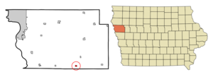
mapsize = 250x200px
map_caption = Location of Smithland, Iowa
mapsize1 =
map_caption1 =subdivision_type = Country
subdivision_name =
subdivision_type1 = State
subdivision_name1 =
subdivision_type2 = County
subdivision_name2 = Woodbury
government_footnotes =
government_type =
leader_title =
leader_name =
leader_title1 =
leader_name1 =
established_title =
established_date =unit_pref = Imperial
area_footnotes =area_magnitude =
area_total_km2 = 0.9
area_land_km2 = 0.9
area_water_km2 = 0.0
area_total_sq_mi = 0.4
area_land_sq_mi = 0.4
area_water_sq_mi = 0.0population_as_of = 2000
population_footnotes =
population_total = 221
population_density_km2 = 236.7
population_density_sq_mi = 613.0timezone = Central (CST)
utc_offset = -6
timezone_DST = CDT
utc_offset_DST = -5
elevation_footnotes =
elevation_m = 331
elevation_ft = 1086
latd = 42 |latm = 13 |lats = 45 |latNS = N
longd = 95 |longm = 55 |longs = 55 |longEW = Wpostal_code_type =
ZIP code
postal_code = 51056
area_code = 712
blank_name = FIPS code
blank_info = 19-73650
blank1_name = GNIS feature ID
blank1_info = 0461707
website =
footnotes =Smithland is a city in Woodbury County,
Iowa ,United States . It is part of the Sioux City/Iowa/Nebraska /South Dakota Metropolitan Statistical Area . The population was 221 at the 2000 census.Geography
Smithland is located at coor dms|42|13|45|N|95|55|55|W|city (42.229078, -95.931875)GR|1.The town is situated near the
Little Sioux River , where the river valley courses through theLoess Hills on its way to thefloodplain of theMissouri River .According to the
United States Census Bureau , the city has a total area of 0.4square mile s (0.9km² ), all of it land.Demographics
As of the
census GR|2 of 2000, there were 221 people, 101 households, and 72 families residing in the city. Thepopulation density was 613.0 people per square mile (237.0/km²). There were 114 housing units at an average density of 316.2/sq mi (122.3/km²). The racial makeup of the city was 99.10% White, 0.45% Native American, and 0.45% from two or more races. Hispanic or Latino of any race were 0.45% of the population.There were 101 households out of which 19.8% had children under the age of 18 living with them, 56.4% were married couples living together, 8.9% had a female householder with no husband present, and 28.7% were non-families. 27.7% of all households were made up of individuals and 15.8% had someone living alone who was 65 years of age or older. The average household size was 2.19 and the average family size was 2.60.
In the city the population was spread out with 19.0% under the age of 18, 7.2% from 18 to 24, 17.2% from 25 to 44, 29.4% from 45 to 64, and 27.1% who were 65 years of age or older. The median age was 49 years. For every 100 females there were 100.9 males. For every 100 females age 18 and over, there were 90.4 males.
The median income for a household in the city was $31,406, and the median income for a family was $33,750. Males had a median income of $31,250 versus $17,188 for females. The
per capita income for the city was $14,722. About 4.0% of families and 6.4% of the population were below thepoverty line , including 7.0% of those under the age of eighteen and none of those sixty five or over.References
External links
Wikimedia Foundation. 2010.