- National Register of Historic Places listings in Keokuk County, Iowa
-
 Location of Keokuk County in Iowa
This is a list of the National Register of Historic Places listings in Keokuk County, Iowa.
This is intended to be a complete list of the properties and districts on the National Register of Historic Places in Keokuk County, Iowa, United States. Latitude and longitude coordinates are provided for many National Register properties and districts; these locations may be seen together in a Google map.[1]
There are 10 properties and districts listed on the National Register in the county.
-
- This National Park Service list is complete through NPS recent listings posted November 10, 2011.[2]
[3] Landmark name [4] Image Date listed Location City or town Summary 1 Bruce Goldfish Fisheries September 20, 1982 East of Thornburg off Iowa Highway 22
41°27′16″N 92°18′42″W / 41.454444°N 92.311667°WThornburg 2 Hayesville Independent School August 3, 1990 231 Washington St.
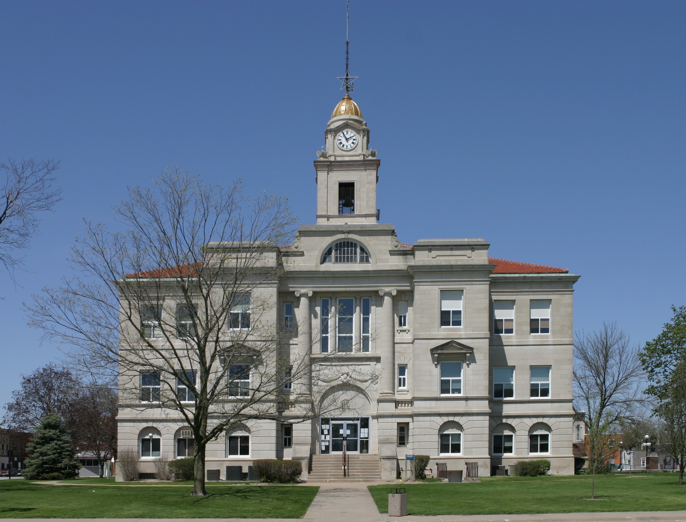
41°15′52″N 92°14′59″W / 41.264444°N 92.249722°WHayesville 3 Keokuk County Courthouse 
July 2, 1981 Main St.
41°20′00″N 92°12′16″W / 41.333333°N 92.204444°WSigourney 4 Lancaster School October 4, 1984 Southeast of Sigourney
41°16′31″N 92°10′01″W / 41.275278°N 92.166944°WSigourney 5 Masonic Opera House June 4, 1973 201 Barnes St.
41°24′05″N 92°21′17″W / 41.401389°N 92.354722°WWhat Cheer 6 Public Square Historic District April 29, 1999 Roughly around the Keokuk County Courthouse
41°20′00″N 92°12′16″W / 41.333333°N 92.204444°WSigourney 7 Saints Peter and Paul Roman Catholic Church August 6, 1986 Southeast of Harper
41°18′19″N 92°00′20″W / 41.305278°N 92.005556°WHarper 8 Sigourney Public Library May 23, 1983 203 N. Jefferson St.
41°20′06″N 92°12′12″W / 41.335°N 92.203333°WSigourney 9 C.F. and Mary Singmaster House January 16, 1998 32263 190th St.
41°22′53″N 91°58′49″W / 41.381389°N 91.980278°WKeota 10 Theodore White House July 14, 1983 Broadway St.
41°27′31″N 92°05′22″W / 41.458611°N 92.089444°WSouth English See also
References
- ^ The latitude and longitude information provided in this table was derived originally from the National Register Information System, which has been found to be fairly accurate for about 99% of listings. For about 1% of NRIS original coordinates, experience has shown that one or both coordinates are typos or otherwise extremely far off; some corrections may have been made. A more subtle problem causes many locations to be off by up to 150 yards, depending on location in the country: most NRIS coordinates were derived from tracing out latitude and longitudes off of USGS topographical quadrant maps created under the North American Datum of 1927, which differs from the current, highly accurate WGS84 GPS system used by Google maps. Chicago is about right, but NRIS longitudes in Washington are higher by about 4.5 seconds, and are lower by about 2.0 seconds in Maine. Latitudes differ by about 1.0 second in Florida. Some locations in this table may have been corrected to current GPS standards.
- ^ "National Register of Historic Places: Weekly List Actions". National Park Service, United States Department of the Interior. Retrieved on November 10, 2011.
- ^ Numbers represent an ordering by significant words. Various colorings, defined here, differentiate National Historic Landmark sites and National Register of Historic Places Districts from other NRHP buildings, structures, sites or objects.
- ^ "National Register Information System". National Register of Historic Places. National Park Service. . http://nrhp.focus.nps.gov/natreg/docs/All_Data.html.
U.S. National Register of Historic Places Topics Lists by states Alabama • Alaska • Arizona • Arkansas • California • Colorado • Connecticut • Delaware • Florida • Georgia • Hawaii • Idaho • Illinois • Indiana • Iowa • Kansas • Kentucky • Louisiana • Maine • Maryland • Massachusetts • Michigan • Minnesota • Mississippi • Missouri • Montana • Nebraska • Nevada • New Hampshire • New Jersey • New Mexico • New York • North Carolina • North Dakota • Ohio • Oklahoma • Oregon • Pennsylvania • Rhode Island • South Carolina • South Dakota • Tennessee • Texas • Utah • Vermont • Virginia • Washington • West Virginia • Wisconsin • WyomingLists by territories Lists by associated states Other Municipalities and communities of Keokuk County, Iowa Cities Delta | Gibson | Harper | Hayesville | Hedrick | Keota | Keswick | Kinross | Martinsburg | North English‡ | Ollie | Richland | Sigourney | South English | Thornburg | Webster | What Cheer

Footnotes ‡This populated place also has portions in an adjacent county or counties
Categories:- National Register of Historic Places in Iowa by county
- Keokuk County, Iowa
- Buildings and structures in Keokuk County, Iowa
-


Wikimedia Foundation. 2010.