- National Register of Historic Places listings in Cerro Gordo County, Iowa
-
 Location of Cerro Gordo County in Iowa
This is a list of the National Register of Historic Places listings in Cerro Gordo County, Iowa.
This is intended to be a complete list of the properties and districts on the National Register of Historic Places in Cerro Gordo County, Iowa, United States. Latitude and longitude coordinates are provided for many National Register properties and districts; these locations may be seen together in a Google map.[1]
There are 40 properties and districts listed on the National Register in the county.
-
- This National Park Service list is complete through NPS recent listings posted November 10, 2011.[2]
[3] Landmark name [4] Image Date listed Location City or town Summary 1 A.J. Andrus Duplex January 29, 1980 687-691 E. State St.
43°09′06″N 93°12′00″W / 43.151667°N 93.2°WMason City 2 Amaziah and Cornelia (Wait) Cannon House August 25, 2004 1581 N. Eisenhower Ave.
43°10′10″N 93°15′36″W / 43.169444°N 93.26°WMason City 3 City National Bank Building 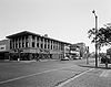
September 14, 1972 4 S. Federal Ave.
43°09′05″N 93°22′04″W / 43.151389°N 93.367778°WMason City 4 East Park Band Shell October 14, 2009 E. State St. between N. Carolina Ave. and N. Kentucky Ave.
43°09′09″N 93°11′01″W / 43.152425°N 93.183586°WMason City 5 Elks-Rogers Hotel June 21, 1982 223 Main Ave.
43°08′08″N 93°22′54″W / 43.135556°N 93.381667°WClear Lake 6 John L. Etzel House January 27, 1983 214 N. 3rd St.
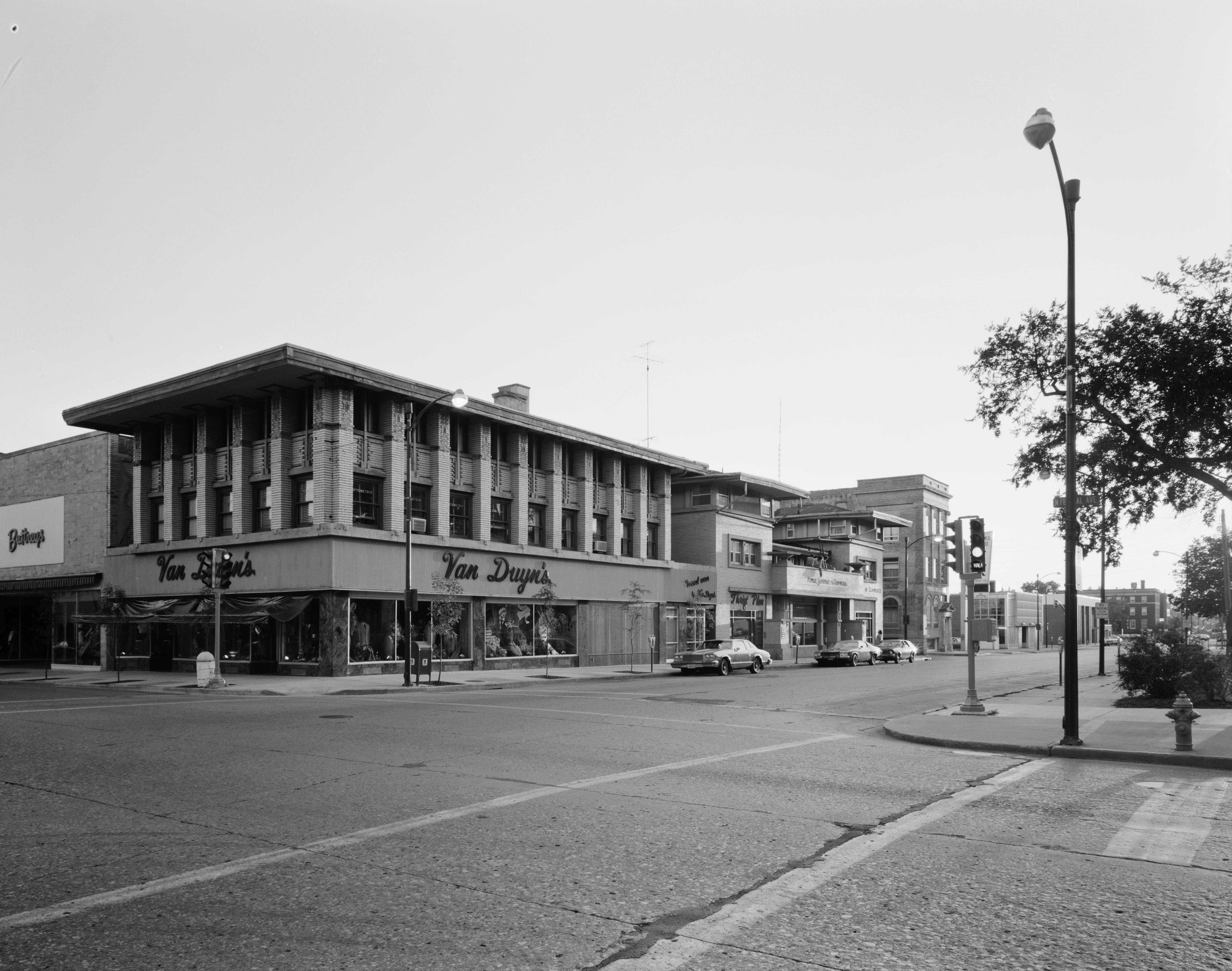
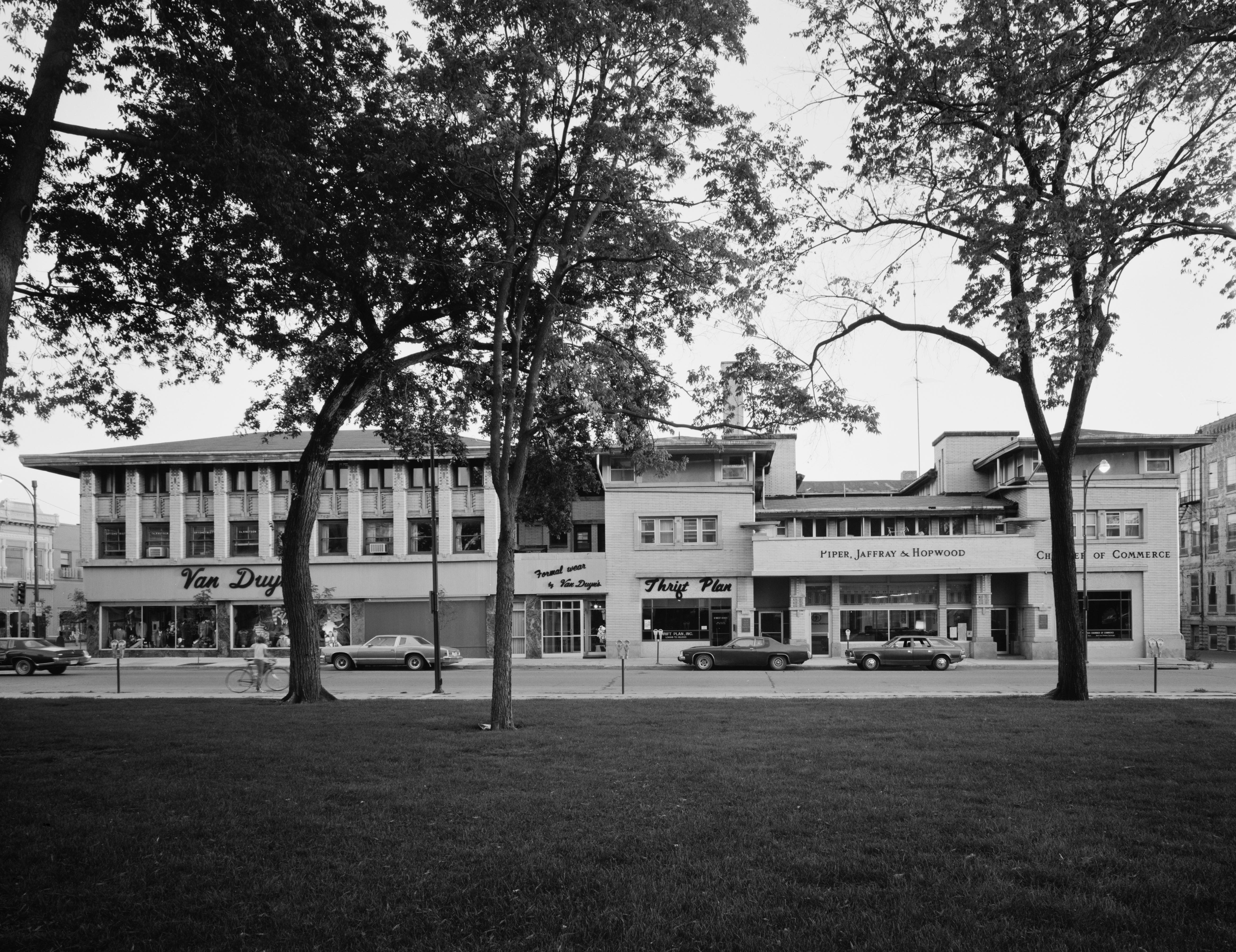
43°08′15″N 93°22′58″W / 43.1375°N 93.382778°WClear Lake 7 First Church of Christ Scientist October 30, 1997 23 3rd St., NW.
43°09′18″N 93°04′16″W / 43.155°N 93.071111°WMason City 8 First National Bank of Mason City May 2, 1997 5-7 N. Federal Ave.
43°09′40″N 93°12′00″W / 43.161111°N 93.2°WMason City 9 C.F. Franke House January 29, 1980 320 1st St., SE.
43°09′04″N 93°12′25″W / 43.151111°N 93.206944°WMason City 10 E.R. Gibson House January 29, 1980 114 4th St., NW.
43°09′20″N 93°12′55″W / 43.155556°N 93.215278°WMason City 11 Hotel Lester-Lester Cafe December 20, 2002 408-410 2nd St., NW.
43°09′14″N 93°12′30″W / 43.153889°N 93.208333°WMason City 12 Jewell Apartments January 29, 1980 404-412 1st St., NW.
43°09′10″N 93°13′11″W / 43.152778°N 93.219722°WMason City 13 Keerl-Decker House December 20, 2002 119 2nd St., SE.
43°09′00″N 93°11′54″W / 43.15°N 93.198333°WMason City 14 The Kirk April 12, 1982 206 N. Federal Ave.
43°09′13″N 93°12′06″W / 43.153611°N 93.201667°WMason City 15 Lippert House January 29, 1980 122-124 N. Madison Ave.
43°09′12″N 93°13′11″W / 43.153333°N 93.219722°WMason City 16 Mason City Downtown Historic District September 8, 2005 Roughly bounded by N. 46th St., Georgia Ave., Washington Ave., and S. 2nd St.
43°09′25″N 93°12′00″W / 43.156944°N 93.2°WMason City 17 Mason City Public Library May 25, 1989 208 E. State St.
43°09′07″N 93°03′01″W / 43.151944°N 93.050278°WMason City 18 Mason City YMCA May 2, 2002 15 N. Pennsylvania
43°09′09″N 93°11′50″W / 43.1525°N 93.197222°WMason City 19 MBA (Modern Brotherhood of America) Building September 12, 2002 103 E. State St.
43°09′06″N 93°11′56″W / 43.151667°N 93.198889°WMason City 20 F.M. Norris House January 29, 1980 108 4th St., NE.
43°09′20″N 93°12′41″W / 43.155556°N 93.211389°WMason City 21 Park Inn Hotel 
September 14, 1972 15 W. State St.
43°09′05″N 93°22′04″W / 43.151389°N 93.367778°WMason City 22 Parker's Opera House November 20, 1998 23 N. Federal Ave.
43°09′10″N 93°12′02″W / 43.152778°N 93.200556°WMason City 23 Rock Crest-Rock Glen Historic District December 28, 1979 Off U.S. Route 18
43°09′02″N 93°11′32″W / 43.150556°N 93.192222°WMason City 24 Rock Falls Bridge June 25, 1998 Spring St. over the Shell Rock River
43°12′24″N 93°05′04″W / 43.206667°N 93.084444°WRock Falls 25 Rogers-Knutson House September 9, 1982 315 N. 3rd St.
43°08′19″N 93°23′06″W / 43.138611°N 93.385°WClear Lake 26 George Romey House January 29, 1980 428 1st St., SE.
43°09′04″N 93°12′20″W / 43.151111°N 93.205556°WMason City 27 Duncan Rule House October 16, 1979 321 2nd St., SE.
43°08′59″N 93°11′44″W / 43.149722°N 93.195556°WMason City 28 Chris Rye House January 29, 1980 630 E. State St.
43°09′08″N 93°12′05″W / 43.152222°N 93.201389°WMason City 29 St. John Baptist Church January 24, 2002 715 6th St., SW.
43°07′55″N 93°12′42″W / 43.131944°N 93.211667°WMason City 30 Charles Seney House January 29, 1980 109 7th St., NW. and 622 N. Washington St.
43°09′29″N 93°12′54″W / 43.158056°N 93.215°WMason City 31 C.P. Shipley House January 29, 1980 114 3rd St., NW.
43°09′17″N 93°12′55″W / 43.154722°N 93.215278°WMason City 32 State Street Bridge June 25, 1998 E. State St. over Willow Creek
43°09′07″N 93°11′29″W / 43.151944°N 93.191389°WMason City 33 Stewart Avenue Bridge June 25, 1998 North Carolina Ave. over the Winnebago River
43°09′24″N 93°11′25″W / 43.156667°N 93.190278°WMason City 34 Dr. G.C. Stockman House 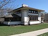
September 17, 1992 311 1st St., SE.
43°09′10″N 93°11′31″W / 43.15265°N 93.191981°WMason City 35 Surf Ballroom 
September 6, 2011 460 N Shore Dr
43°08′24″N 93°23′22″W / 43.14°N 93.389444°WClear Lake 36 Wagner-Mozart Music Hall November 16, 1978 1st St., NE. and Delaware Ave.
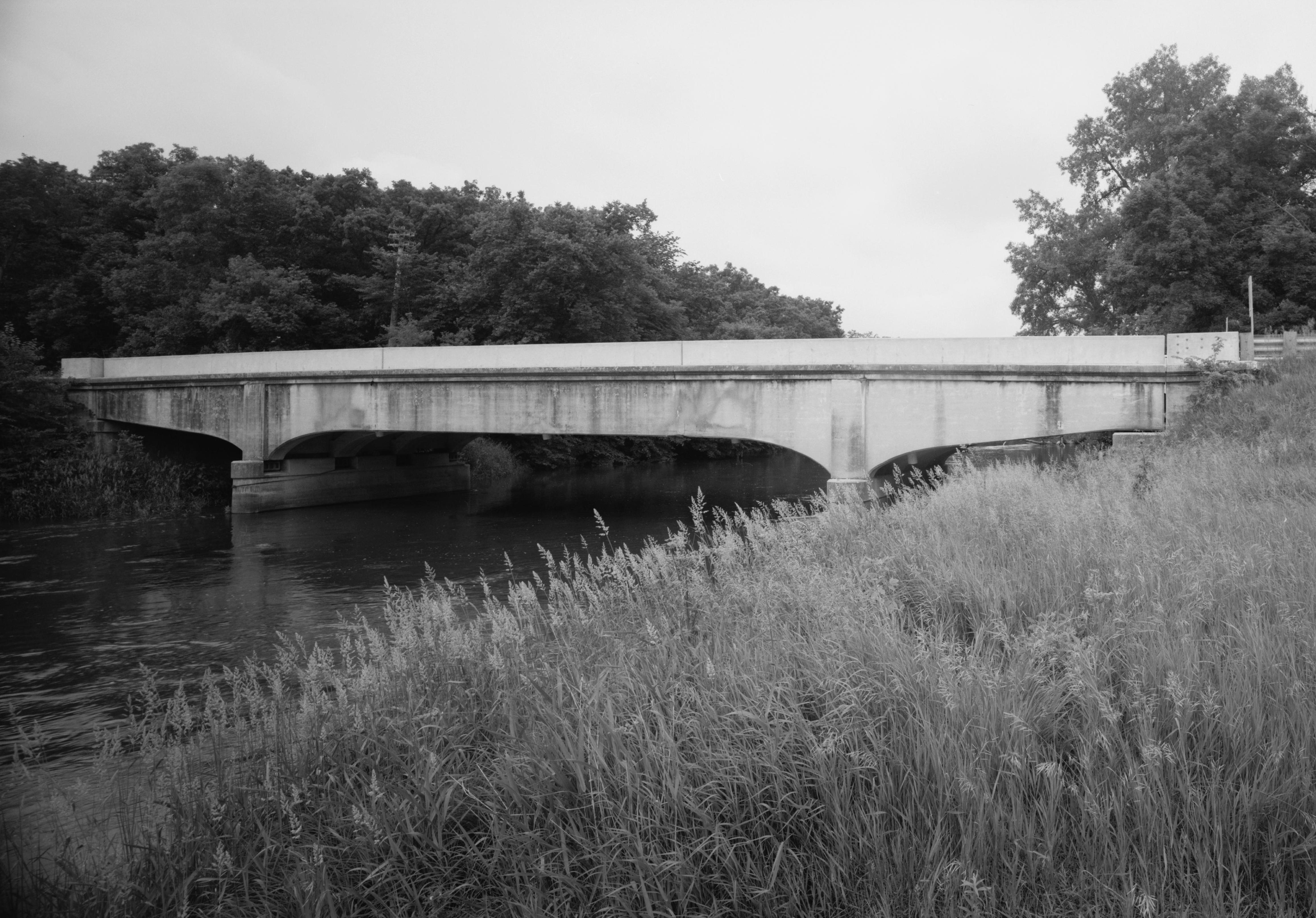
43°09′09″N 93°11′56″W / 43.1525°N 93.198889°WMason City 37 Winnebago River Bridge 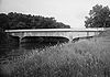
June 25, 1998 U.S. Route 65 over the Winnebago River
43°11′35″N 93°12′37″W / 43.193056°N 93.210278°WMason City 38 Mier Wolf House January 29, 1980 811 N. Adams St.
43°09′34″N 93°12′58″W / 43.159444°N 93.216111°WMason City 39 Curtis Yelland House January 29, 1980 37 River Heights Dr.
43°08′55″N 93°12′22″W / 43.148611°N 93.206111°WMason City 40 Tessa Youngblood House January 29, 1980 36 Oak Dr.
43°09′05″N 93°13′32″W / 43.151389°N 93.225556°WMason City See also
References
- ^ The latitude and longitude information provided in this table was derived originally from the National Register Information System, which has been found to be fairly accurate for about 99% of listings. For about 1% of NRIS original coordinates, experience has shown that one or both coordinates are typos or otherwise extremely far off; some corrections may have been made. A more subtle problem causes many locations to be off by up to 150 yards, depending on location in the country: most NRIS coordinates were derived from tracing out latitude and longitudes off of USGS topographical quadrant maps created under the North American Datum of 1927, which differs from the current, highly accurate WGS84 GPS system used by Google maps. Chicago is about right, but NRIS longitudes in Washington are higher by about 4.5 seconds, and are lower by about 2.0 seconds in Maine. Latitudes differ by about 1.0 second in Florida. Some locations in this table may have been corrected to current GPS standards.
- ^ "National Register of Historic Places: Weekly List Actions". National Park Service, United States Department of the Interior. Retrieved on November 10, 2011.
- ^ Numbers represent an ordering by significant words. Various colorings, defined here, differentiate National Historic Landmark sites and National Register of Historic Places Districts from other NRHP buildings, structures, sites or objects.
- ^ "National Register Information System". National Register of Historic Places. National Park Service. . http://nrhp.focus.nps.gov/natreg/docs/All_Data.html.
U.S. National Register of Historic Places Topics Lists by states Alabama • Alaska • Arizona • Arkansas • California • Colorado • Connecticut • Delaware • Florida • Georgia • Hawaii • Idaho • Illinois • Indiana • Iowa • Kansas • Kentucky • Louisiana • Maine • Maryland • Massachusetts • Michigan • Minnesota • Mississippi • Missouri • Montana • Nebraska • Nevada • New Hampshire • New Jersey • New Mexico • New York • North Carolina • North Dakota • Ohio • Oklahoma • Oregon • Pennsylvania • Rhode Island • South Carolina • South Dakota • Tennessee • Texas • Utah • Vermont • Virginia • Washington • West Virginia • Wisconsin • WyomingLists by territories Lists by associated states Other Municipalities and communities of Cerro Gordo County, Iowa Cities Clear Lake | Dougherty | Mason City | Meservey | Nora Springs‡ | Plymouth | Rock Falls | Rockwell | Swaledale | Thornton | Ventura

Townships Bath | Clear Lake | Dougherty | Falls | Geneseo | Grant | Grimes | Lake | Lime Creek | Lincoln | Mason | Mount Vernon | Owen | Pleasant Valley | Portland | Union
Footnotes ‡This populated place also has portions in an adjacent county or counties
Categories:- National Register of Historic Places in Iowa by county
- Cerro Gordo County, Iowa
- Buildings and structures in Cerro Gordo County, Iowa
-


Wikimedia Foundation. 2010.