There are 62 properties and districts listed on the National Register in the county. Another 2 properties were once listed but have been removed.
| [3] |
Landmark name |
Image |
Date listed |
Location |
City or town |
Summary |
| 1 |
Aaronsburg Historic District |
|
01980-09-02September 2, 1980 |
Pennsylvania Route 45 in Aaronsburg
40°54′02″N 77°27′10″W / 40.900556°N 77.452778°W / 40.900556; -77.452778 (Aaronsburg Historic District) |
Haines Township |
|
| 2 |
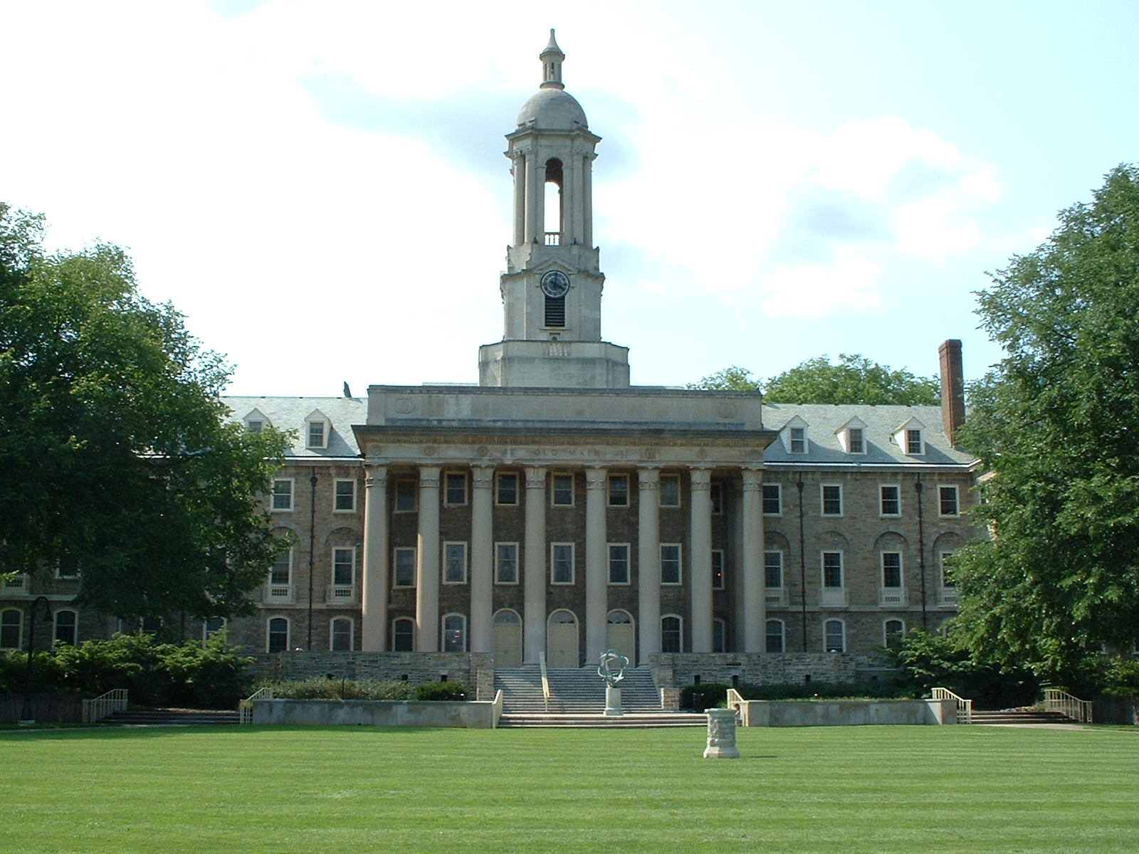
Ag Hill Complex |
|
01979-01-22January 22, 1979 |
Penn State University campus
40°47′59″N 77°51′54″W / 40.799722°N 77.865°W / 40.799722; -77.865 (Ag Hill Complex) |
State College |
|
| 3 |
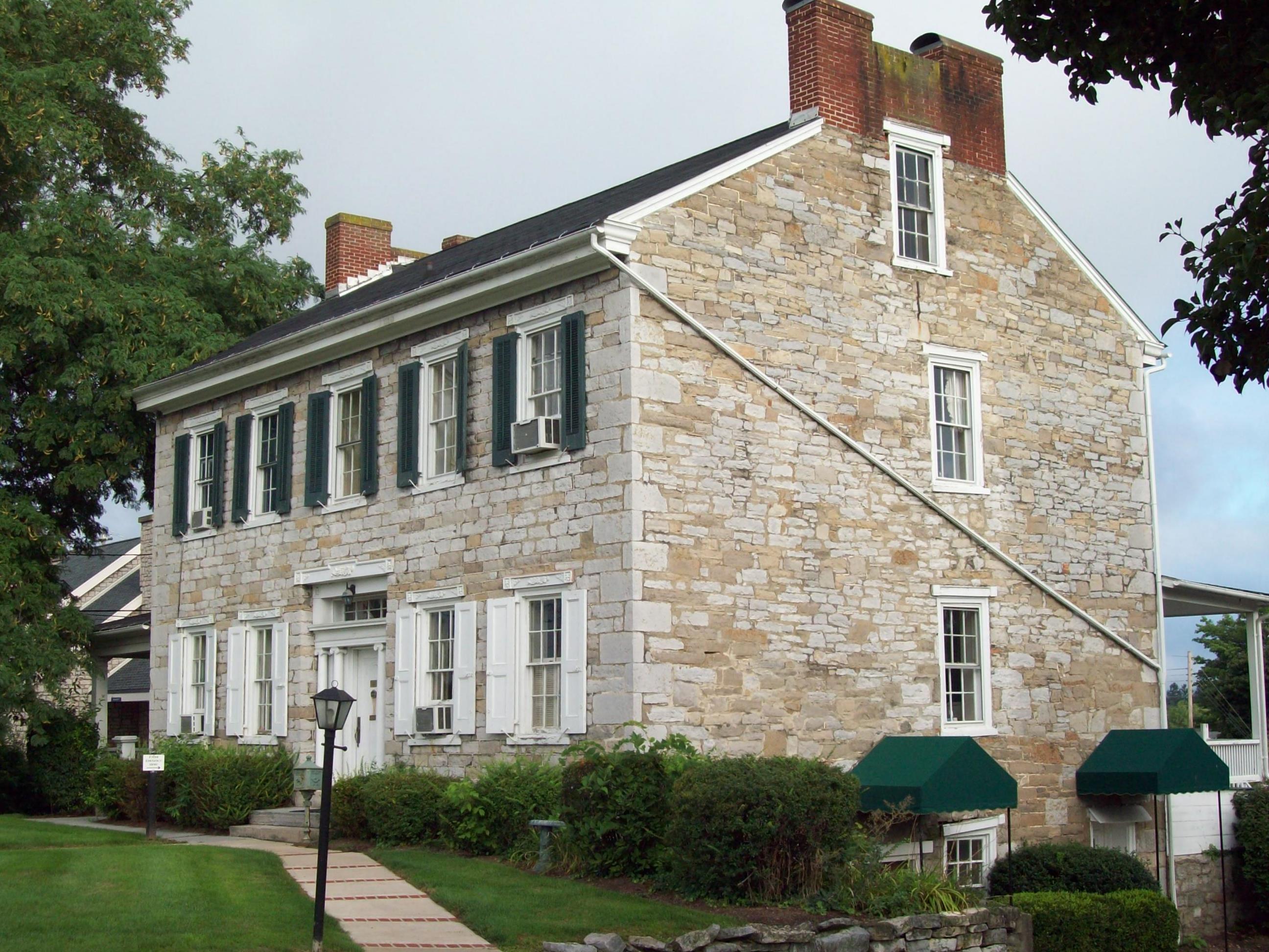
William Allison House |
|
01977-04-18April 18, 1977 |
1 mile (1.6 km) west of Spring Mills on Pennsylvania Route 45
40°51′05″N 77°34′55″W / 40.851389°N 77.581944°W / 40.851389; -77.581944 (William Allison House) |
Gregg Township |
|
| 4 |
Bucher Ayres Farm |
|
01980-12-01December 1, 1980 |
Southwest of Pine Grove Mills on Whitehall Road, Pennsylvania Furnace
40°43′21″N 77°57′54″W / 40.7225°N 77.965°W / 40.7225; -77.965 (Bucher Ayres Farm) |
Ferguson Township |
|
| 5 |
Christian Bechdel II House |
|
01982-03-01March 1, 1982 |
South of Blanchard on Liberty Road
41°03′31″N 77°36′16″W / 41.058611°N 77.604444°W / 41.058611; -77.604444 (Christian Bechdel II House) |
Liberty Township |
|
| 6 |
Bellefonte Armory |
|
01989-12-22December 22, 1989 |
East Bishop Street
40°54′55″N 77°45′25″W / 40.915278°N 77.756944°W / 40.915278; -77.756944 (Bellefonte Armory) |
Bellefonte |
|
| 7 |
Bellefonte Forge House |
|
01999-08-20August 20, 1999 |
4098 Axemann Road
40°54′21″N 77°46′41″W / 40.905833°N 77.778056°W / 40.905833; -77.778056 (Bellefonte Forge House) |
Spring Township |
|
| 8 |
Bellefonte Historic District |
|
01977-08-12August 12, 1977 |
Roughly bounded by Stony Batter, Ardell Alley, Thomas, Armor, Penn, Ridge and Logan Streets
40°54′48″N 77°46′43″W / 40.913333°N 77.778611°W / 40.913333; -77.778611 (Bellefonte Historic District) |
Bellefonte |
|
| 9 |
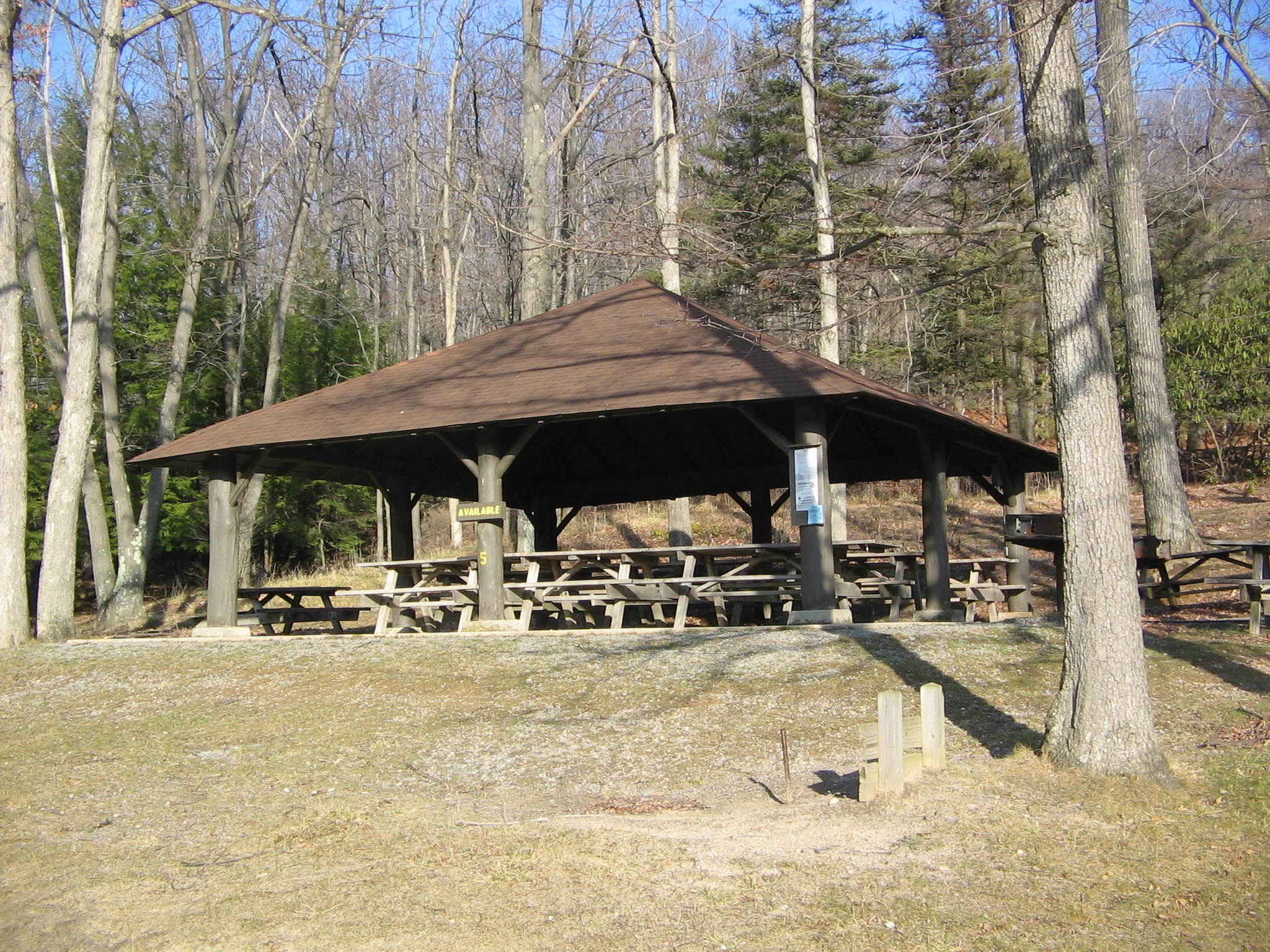
Black Moshannon State Park Day Use District |
|
01987-02-12February 12, 1987 |
9 miles (14 km) east of Philipsburg on Pennsylvania Route 504
40°54′57″N 78°03′46″W / 40.915833°N 78.062778°W / 40.915833; -78.062778 (Black Moshannon State Park Day Use District) |
Rush Township |
|
| 10 |
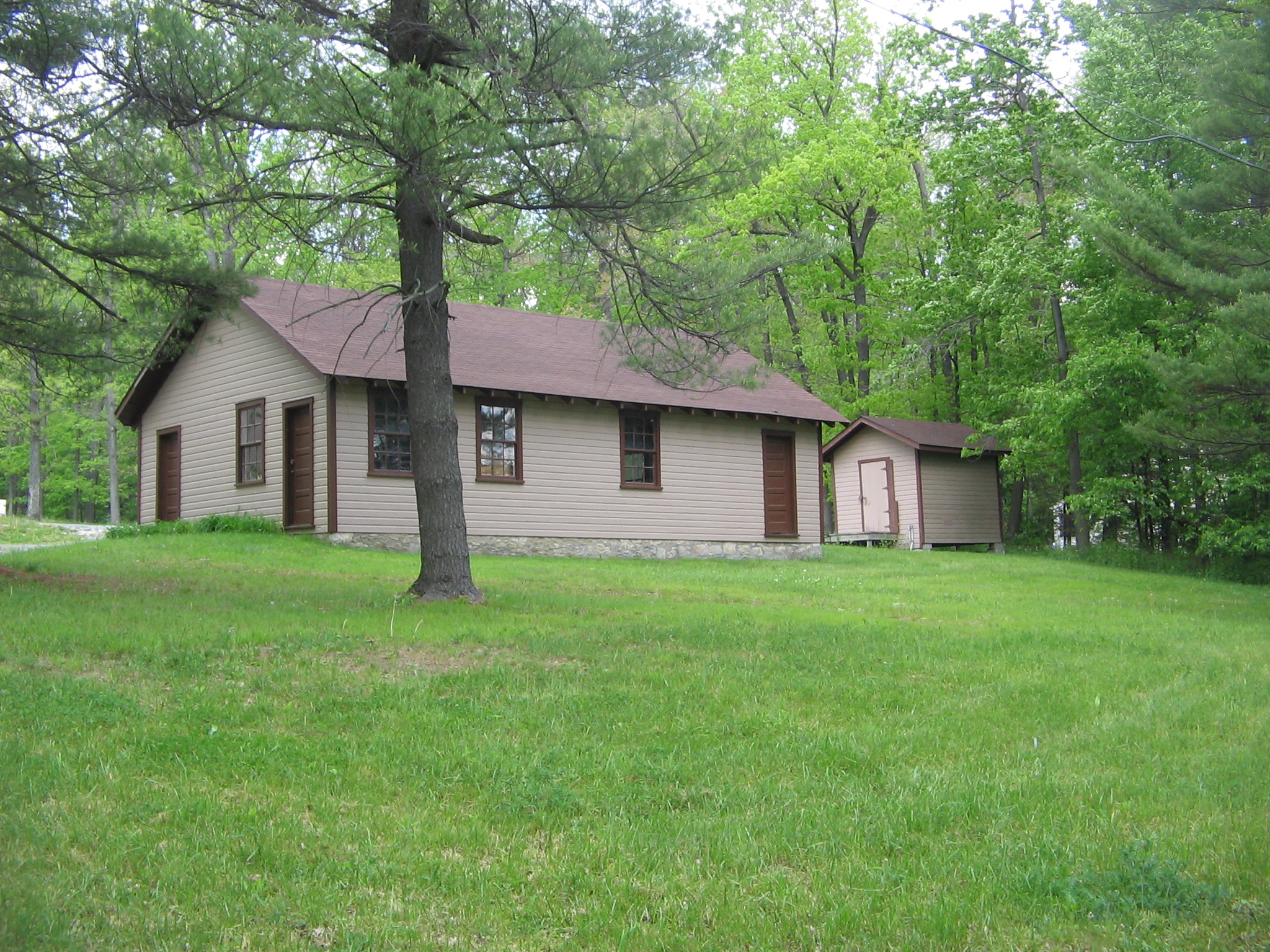
Black Moshannon State Park Family Cabin District |
|
01987-02-12February 12, 1987 |
9 miles (14 km) east of Philipsburg on Pennsylvania Route 504
40°54′48″N 78°03′45″W / 40.913333°N 78.0625°W / 40.913333; -78.0625 (Black Moshannon State Park Family Cabin District) |
Rush Township |
|
| 11 |
Black Moshannon State Park Maintenance District |
|
01987-02-12February 12, 1987 |
9 miles (14 km) east of Philipsburg on Pennsylvania Route 504
40°55′15″N 78°04′24″W / 40.920833°N 78.073333°W / 40.920833; -78.073333 (Black Moshannon State Park Maintenance District) |
Rush Township |
|
| 12 |
Boal Mansion |
|
01978-12-04December 4, 1978 |
U.S. Route 322 and Pennsylvania Route 45 in Boalsburg
40°46′44″N 77°48′01″W / 40.778889°N 77.800278°W / 40.778889; -77.800278 (Boal Mansion) |
Harris Township |
|
| 13 |
Boalsburg Historic District |
|
01977-12-12December 12, 1977 |
U.S. Route 322 in Boalsburg
40°46′34″N 77°47′38″W / 40.776111°N 77.793889°W / 40.776111; -77.793889 (Boalsburg Historic District) |
Harris Township |
|
| 14 |
Brockerhoff Hotel |
|
01977-04-11April 11, 1977 |
High and Allegheny Streets
40°54′42″N 77°46′42″W / 40.911667°N 77.778333°W / 40.911667; -77.778333 (Brockerhoff Hotel) |
Bellefonte |
|
| 15 |
Brockerhoff Mill |
|
01979-05-01May 1, 1979 |
Southwest of Bellefonte on Pennsylvania Route 550
40°54′01″N 77°47′58″W / 40.900278°N 77.799444°W / 40.900278; -77.799444 (Brockerhoff Mill) |
Benner Township |
|
| 16 |
Camelot |
|
01979-04-26April 26, 1979 |
520 South Fraser Street
40°47′20″N 77°51′29″W / 40.788889°N 77.858056°W / 40.788889; -77.858056 (Camelot) |
State College |
|
| 17 |
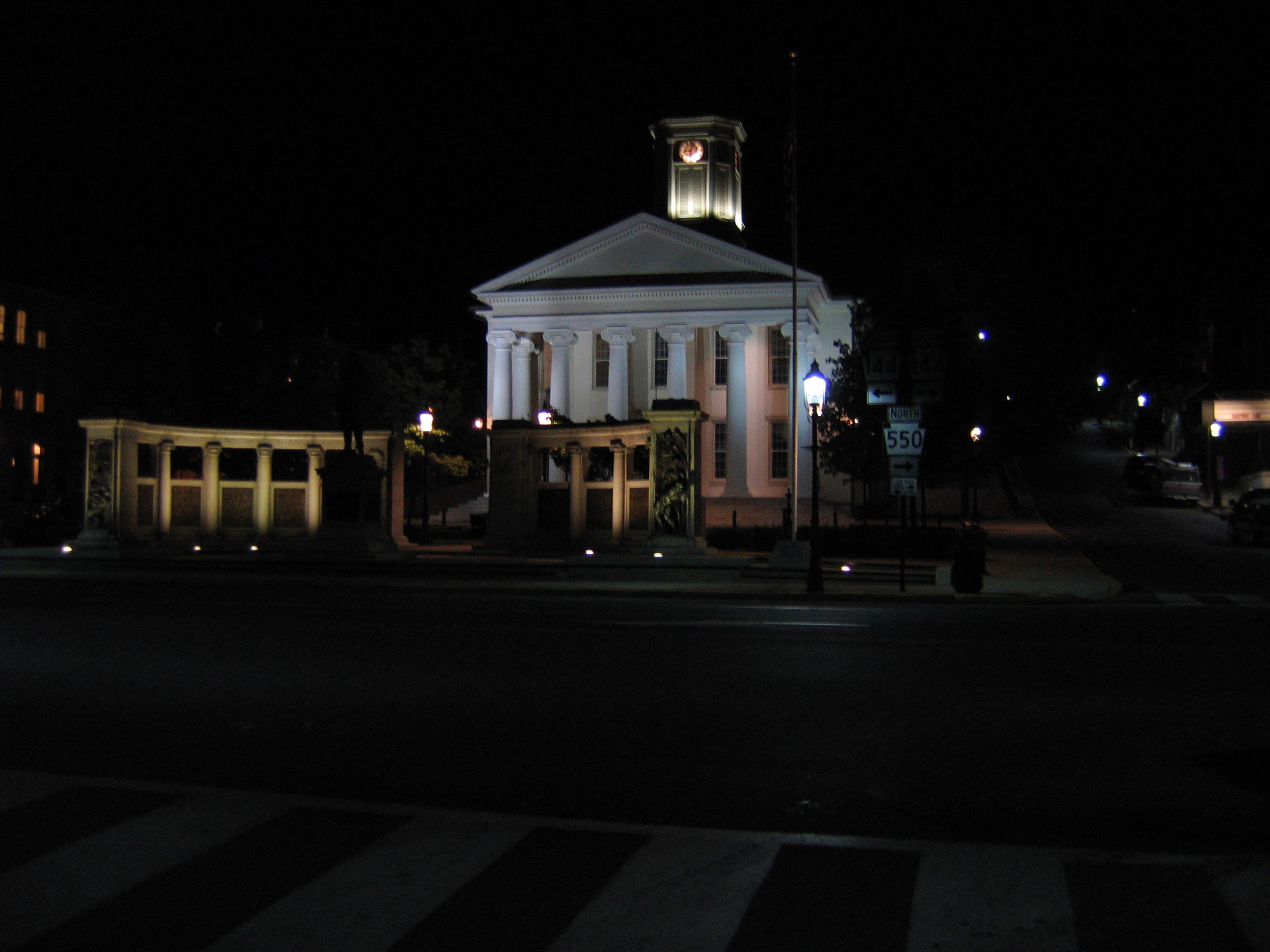
Centre County Courthouse |
|
01976-11-07November 7, 1976 |
High Street
40°54′43″N 77°46′40″W / 40.912083°N 77.777778°W / 40.912083; -77.777778 (Centre County Courthouse) |
Bellefonte |
|
| 18 |
Centre Furnace Mansion House |
|
01979-12-27December 27, 1979 |
1001 East College Avenue
40°48′23″N 77°50′33″W / 40.806389°N 77.8425°W / 40.806389; -77.8425 (Centre Furnace Mansion House) |
State College |
|
| 19 |
Centre Mills |
|
01976-12-12December 12, 1976 |
Southwest of Rebersburg off Pennsylvania Route 445
40°55′32″N 77°28′21″W / 40.925556°N 77.4725°W / 40.925556; -77.4725 (Centre Mills) |
Miles Township |
|
| 20 |
College Heights Historic District |
|
01995-04-27April 27, 1995 |
Roughly bounded by Holmes Street, Park Avenue, Ridge Avenuie, Sunset Road, Hillcrest Avenue, Woodland Drive and Mitchell Avenue
40°47′57″N 77°52′28″W / 40.799167°N 77.874444°W / 40.799167; -77.874444 (College Heights Historic District) |
State College |
|
| 21 |
Curtin Village |
|
01971-03-11March 11, 1971 |
Off U.S. Route 220
40°58′26″N 77°44′33″W / 40.973889°N 77.7425°W / 40.973889; -77.7425 (Curtin Village) |
Boggs Township |
|
| 22 |
Felix Dale Stone House |
|
01982-04-20April 20, 1982 |
Pennsylvania Route 871, south of Lemont
40°48′11″N 77°48′49″W / 40.803056°N 77.813611°W / 40.803056; -77.813611 (Felix Dale Stone House) |
College Township |
|
| 23 |
Egg Hill Church |
|
01979-06-04June 4, 1979 |
Southwest of Spring Mills on Egg Hill Road
40°49′42″N 77°37′32″W / 40.828333°N 77.625556°W / 40.828333; -77.625556 (Egg Hill Church) |
Potter Township |
|
| 24 |
Abraham Elder Stone House |
|
01977-04-13April 13, 1977 |
Pennsylvania Route 550 at Stormstown
40°47′43″N 78°00′46″W / 40.795278°N 78.012778°W / 40.795278; -78.012778 (Abraham Elder Stone House) |
Halfmoon Township |
|
| 25 |
Farmers' High School |
|
01981-09-11September 11, 1981 |
College Avenue and Atherton Street
40°47′39″N 77°51′55″W / 40.794167°N 77.865278°W / 40.794167; -77.865278 (Farmers' High School) |
State College |
|
| 26 |
Fisher Farm Site |
|
01982-03-03March 3, 1982 |
Along U.S. Route 220, straddling a rail line
40°54′15.6″N 77°52′40″W / 40.904333°N 77.87778°W / 40.904333; -77.87778 (Fisher Farm Site)[4]
|
Unionville |
|
| 27 |
Maj. Jared B. Fisher House |
|
01977-09-14September 14, 1977 |
Northeast of Spring Mills on Pennsylvania Route 45
40°51′42″N 77°33′22″W / 40.861667°N 77.556111°W / 40.861667; -77.556111 (Maj. Jared B. Fisher House) |
Gregg Township |
|
| 28 |
Gamble Mill |
|
01975-08-01August 1, 1975 |
Dunlap and Lamb Streets
40°54′50″N 77°47′01″W / 40.913889°N 77.783611°W / 40.913889; -77.783611 (Gamble Mill) |
Bellefonte |
|
| 29 |
John Gray House |
|
01975-04-03April 3, 1975 |
East of Port Matilda off Pennsylvania Route 550, south of U.S. Route 220
40°49′28″N 77°58′29″W / 40.824444°N 77.974722°W / 40.824444; -77.974722 (John Gray House) |
Patton Township |
|
| 30 |
Andrew Gregg Homestead |
|
01977-07-28July 28, 1977 |
2 miles (3.2 km) east of Centre Hall off Pennsylvania Route 192
40°51′53″N 77°38′22″W / 40.864722°N 77.639444°W / 40.864722; -77.639444 (Andrew Gregg Homestead) |
Potter Township |
|
| 31 |
Harmony Forge Mansion |
|
01979-10-16October 16, 1979 |
South of Milesburg on Pennsylvania Route 144
40°56′05″N 77°47′12″W / 40.934722°N 77.786667°W / 40.934722; -77.786667 (Harmony Forge Mansion) |
Boggs Township |
|
| 32 |
Hill House |
|
01977-03-28March 28, 1977 |
Tennis Street in Boalsburg
40°46′22″N 77°47′43″W / 40.772778°N 77.795278°W / 40.772778; -77.795278 (Hill House) |
Harris Township |
|
| 33 |
Holmes-Foster-Highlands Historic District |
|
01995-04-27April 27, 1995 |
Roughly bounded by Buckhout Street, Railroad and Highland Avenues, High and Keller Streets, and Irvin and Prospect Avenues
40°47′31″N 77°51′39″W / 40.791944°N 77.860833°W / 40.791944; -77.860833 (Holmes-Foster-Highlands Historic District) |
State College |
|
| 34 |
Houserville Site (36CE65) |
|
01986-03-06March 6, 1986 |
1300 block of East College Avenue, east of State College
40°48′42″N 77°50′4″W / 40.81167°N 77.83444°W / 40.81167; -77.83444 (Houserville Site (36CE65))[5]
|
College Township |
|
| 35 |
Iddings-Baldridge House |
|
01977-07-29July 29, 1977 |
Railroad Street
40°56′34″N 77°47′47″W / 40.942778°N 77.796389°W / 40.942778; -77.796389 (Iddings-Baldridge House) |
Milesburg |
|
| 36 |
Lemont Historic District |
|
01979-06-06June 6, 1979 |
Off Pennsylvania Route 26 in Lemont
40°48′37″N 77°49′08″W / 40.810278°N 77.818889°W / 40.810278; -77.818889 (Lemont Historic District) |
College Township |
|
| 37 |
Linden Hall Historic District |
|
01990-09-05September 5, 1990 |
Rock Hill Road between Linden Hall and Brush Valley Roads in Linden Hall
40°47′52″N 77°45′45″W / 40.797778°N 77.7625°W / 40.797778; -77.7625 (Linden Hall Historic District) |
Harris Township |
|
| 38 |
Logan Furnace Mansion |
|
01977-04-11April 11, 1977 |
3 miles (4.8 km) south of Bellefonte on Pennsylvania Route 144
40°52′38″N 77°45′51″W / 40.877222°N 77.764167°W / 40.877222; -77.764167 (Logan Furnace Mansion) |
Spring Township |
|
| 39 |
McAllister-Beaver House |
|
01982-02-24February 24, 1982 |
817 East Bishop Street
40°54′49″N 77°45′52″W / 40.913611°N 77.764444°W / 40.913611; -77.764444 (McAllister-Beaver House) |
Bellefonte |
|
| 40 |
Miles-Humes House |
|
01976-10-21October 21, 1976 |
203 North Allegheny Street
40°54′48″N 77°46′45″W / 40.913333°N 77.779167°W / 40.913333; -77.779167 (Miles-Humes House) |
Bellefonte |
|
| 41 |
Millheim Historic District |
|
01986-03-25March 25, 1986 |
Pennsylvania Routes 45 and 445
40°53′34″N 77°28′38″W / 40.892778°N 77.477222°W / 40.892778; -77.477222 (Millheim Historic District) |
Millheim |
|
| 42 |
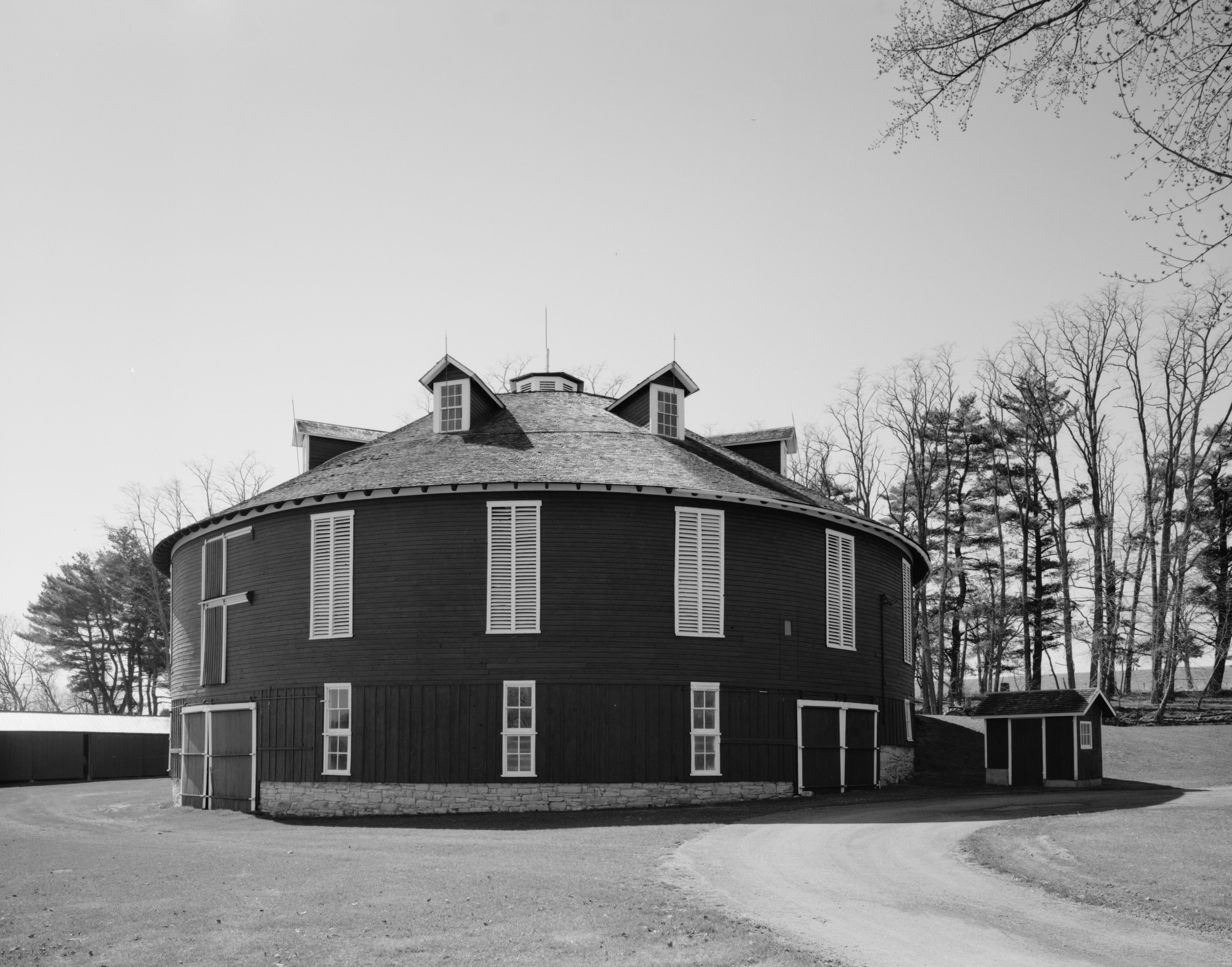
Neff Round Barn |
|
01979-05-02May 2, 1979 |
South of Centre Hall off Pennsylvania Route 45
40°49′03″N 77°42′06″W / 40.8175°N 77.701667°W / 40.8175; -77.701667 (Neff Round Barn) |
Potter Township |
|
| 43 |
Maj. John Neff Homestead |
|
01977-04-11April 11, 1977 |
Southwest of Centre Hall
40°49′17″N 77°43′38″W / 40.821389°N 77.727222°W / 40.821389; -77.727222 (Maj. John Neff Homestead) |
Potter Township |
|
| 44 |
Oak Hall Historic District |
|
01979-10-25October 25, 1979 |
Pennsylvania Route 871 in Oak Hall
40°47′37″N 77°48′18″W / 40.793611°N 77.805°W / 40.793611; -77.805 (Oak Hall Historic District) |
College Township |
|
| 45 |
Penn's Cave and Hotel |
|
01978-04-14April 14, 1978 |
5 miles (8.0 km) east of Centre Hall off Pennsylvania Route 192
40°52′58″N 77°36′36″W / 40.882778°N 77.61°W / 40.882778; -77.61 (Penn's Cave and Hotel) |
Gregg Township |
|
| 46 |
Pennsylvania Match Company |
|
02001-09-07September 7, 2001 |
367 Phoenix Avenue
40°54′31″N 77°46′59″W / 40.908653°N 77.783125°W / 40.908653; -77.783125 (Pennsylvania Match Company) |
Bellefonte |
|
| 47 |
Hardman Philips House |
|
01978-09-18September 18, 1978 |
Presquisle and 4th Streets
40°53′48″N 78°13′11″W / 40.89675°N 78.219667°W / 40.89675; -78.219667 (Hardman Philips House) |
Philipsburg |
|
| 48 |
Philipsburg Historic District |
|
01999-07-22July 22, 1999 |
Roughly bounded by East Presqueisle Street, Hillcrest Drive, Oak, Railroad, Spruce and Laurel Streets
40°54′00″N 78°13′00″W / 40.9°N 78.216667°W / 40.9; -78.216667 (Philipsburg Historic District) |
Philipsburg |
|
| 49 |
Simon Pickle Stone House |
|
01977-04-18April 18, 1977 |
Junction of Pennsylvania Routes 192 and 445 at Madisonburg
40°55′24″N 77°30′54″W / 40.923333°N 77.515°W / 40.923333; -77.515 (Simon Pickle Stone House) |
Miles Township |
|
| 50 |
Potter-Allison Farm |
|
01977-12-06December 6, 1977 |
Southeast of Centre Hall on Pennsylvania Route 144
40°48′06″N 77°37′51″W / 40.801667°N 77.630833°W / 40.801667; -77.630833 (Potter-Allison Farm) |
Potter Township |
|
| 51 |
Rebersburg Historic District |
|
01979-12-07December 7, 1979 |
Pennsylvania Route 192 in Rebersburg
40°56′40″N 77°26′35″W / 40.944444°N 77.443056°W / 40.944444; -77.443056 (Rebersburg Historic District) |
Miles Township |
|
| 52 |
Leonard Rhone House |
|
01985-10-31October 31, 1985 |
Off Pennsylvania Route 45
40°48′32″N 77°43′16″W / 40.808889°N 77.721111°W / 40.808889; -77.721111 (Leonard Rhone House) |
Potter Township |
|
| 53 |
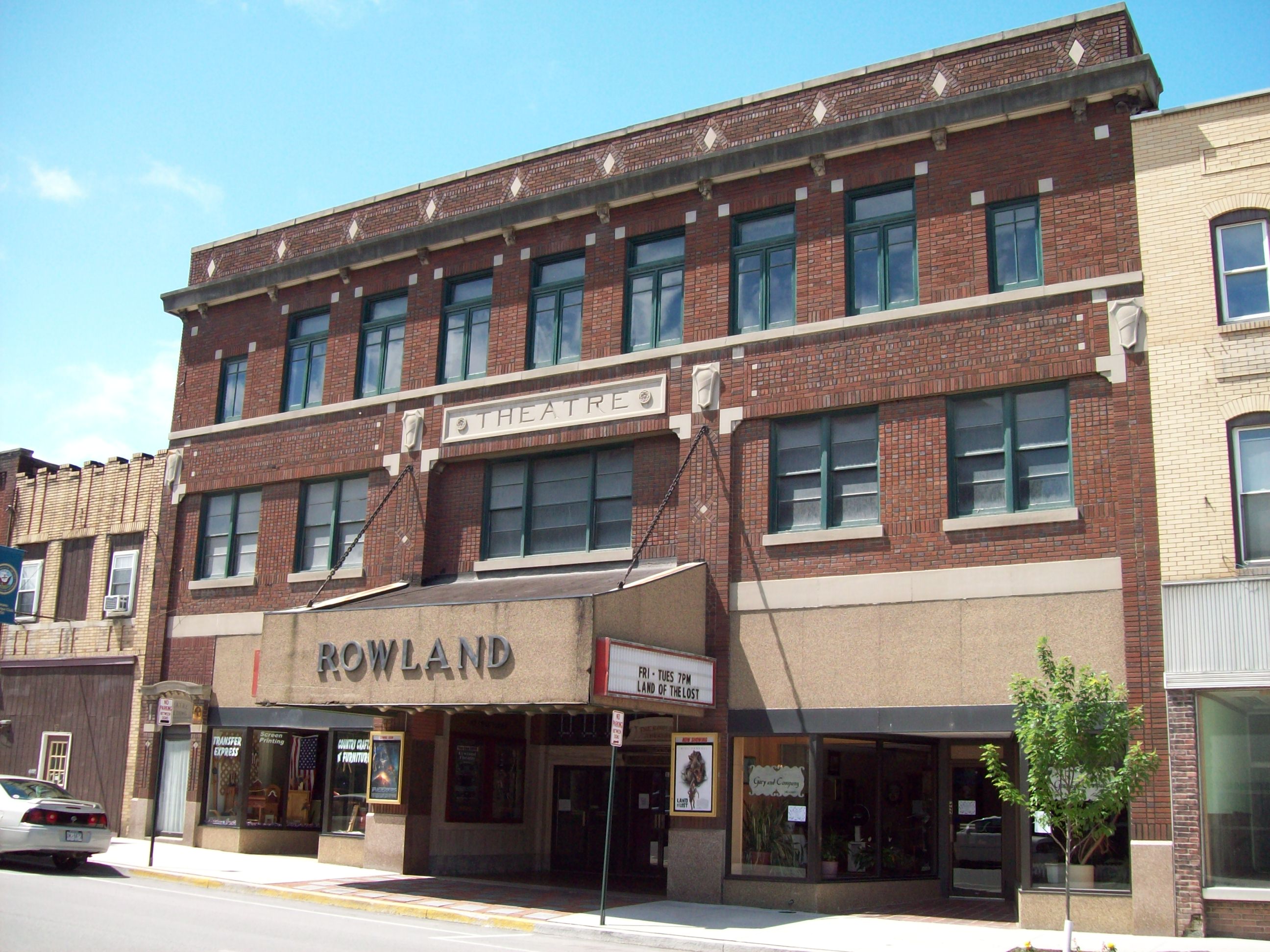
Rowland Theater |
|
01979-10-18October 18, 1979 |
Front Street
40°53′47″N 78°13′25″W / 40.896389°N 78.223611°W / 40.896389; -78.223611 (Rowland Theater) |
Philipsburg |
|
| 54 |
South Ward School |
|
01978-02-23February 23, 1978 |
Bishop Street
40°54′40″N 77°46′23″W / 40.911111°N 77.773056°W / 40.911111; -77.773056 (South Ward School) |
Bellefonte |
|
| 55 |
William Thomas House |
|
01976-11-13November 13, 1976 |
266 North Thomas Street
40°54′54″N 77°47′09″W / 40.915°N 77.785833°W / 40.915; -77.785833 (William Thomas House) |
Bellefonte |
|
| 56 |
Gen. John Thompson House |
|
01978-03-29March 29, 1978 |
East Branch Road, east of State College
40°47′25″N 77°49′56″W / 40.790278°N 77.832222°W / 40.790278; -77.832222 (Gen. John Thompson House) |
College Township |
|
| 57 |
Tudek Site |
|
01982-02-12February 12, 1982 |
Along Orchard Road, northeast of State College
40°49′1″N 77°51′3″W / 40.81694°N 77.85083°W / 40.81694; -77.85083 (Tudek Site)[6]
|
College Township |
|
| 58 |
Union Church and Burial Ground |
|
01978-05-23May 23, 1978 |
East Presqueisle Street
40°53′53″N 78°13′04″W / 40.898056°N 78.217778°W / 40.898056; -78.217778 (Union Church and Burial Ground) |
Philipsburg |
|
| 59 |
Unionville Historic District |
|
01979-05-30May 30, 1979 |
U.S. Route 220 and Pennsylvania Route 504
40°54′22″N 77°52′34″W / 40.906111°N 77.876111°W / 40.906111; -77.876111 (Unionville Historic District) |
Unionville |
|
| 60 |
Daniel Waggoner Log House and Barn |
|
01979-04-18April 18, 1979 |
Southwest of Spring Mills
40°49′52″N 77°37′11″W / 40.831111°N 77.619722°W / 40.831111; -77.619722 (Daniel Waggoner Log House and Barn) |
Potter Township |
|
| 61 |
George Wilson Homestead |
|
01982-02-24February 24, 1982 |
Southwest of Centennial on Pennsylvania Route 550
40°45′19″N 78°04′05″W / 40.755278°N 78.068056°W / 40.755278; -78.068056 (George Wilson Homestead) |
Halfmoon Township |
|
| 62 |
Woodward Inn |
|
01978-12-18December 18, 1978 |
Pennsylvania Route 45 at Woodward
40°53′55″N 77°21′25″W / 40.898611°N 77.356944°W / 40.898611; -77.356944 (Woodward Inn) |
Haines Township |
|
 Location of Centre County in Pennsylvania