- National Register of Historic Places listings in Venango County, Pennsylvania
-
 Location of Venango County in Pennsylvania
This is a list of the National Register of Historic Places listings in Venango County, Pennsylvania.
This is intended to be a complete list of the properties and districts on the National Register of Historic Places in Venango County, Pennsylvania, United States. The locations of National Register properties and districts for which the latitude and longitude coordinates are included below, may be seen in a Google map.[1]
There are 19 properties and districts listed on the National Register in the county, including 1 National Historic Landmark. Another property was once listed but has been removed.
-
- This National Park Service list is complete through NPS recent listings posted November 10, 2011.[2]
Current listings
[3] Landmark name[4] Image Date listed Location City or Town Summary 1 Allegheny Baptist Church December 15, 1978 Pennsylvania Route 27 and Main Street
41°35′50″N 79°34′51″W / 41.59722°N 79.58083°WPleasantville 2 Bridge in Cherrytree Township 
June 22, 1988 State Route 1011 over Oil Creek, southeast of Titusville
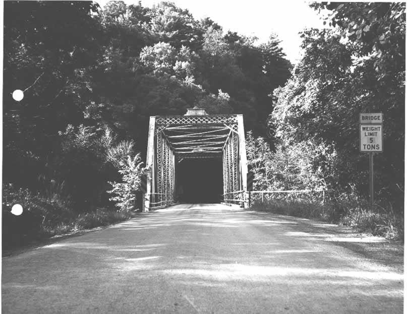
41°36′55″N 79°39′27″W / 41.61528°N 79.6575°WCherrytree Township 3 Bridge in Clinton Township 
June 22, 1988 State Route 3005 over Scrubgrass Creek, south of Kennerdell
41°14′17″N 79°51′16″W / 41.23806°N 79.85444°WClinton Township 4 Connely-Holeman House October 11, 2007 317 Chestnut Street
41°35′43.25″N 79°35′4.35″W / 41.5953472°N 79.5845417°WPleasantville 5 Samuel F. Dale House December 4, 1975 1409 Elk Street
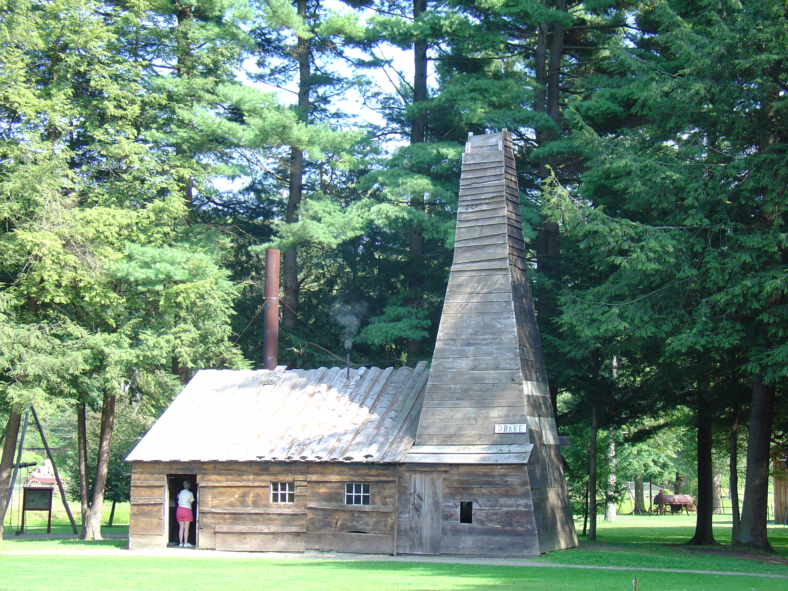
41°23′55″N 79°50′4″W / 41.39861°N 79.83444°WFranklin 6 Drake Oil Well 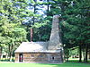
November 13, 1966 3 miles (4.8 km) southeast of Titusville on Pennsylvania Route 36, in Drake Well Memorial Park
41°36′38″N 79°39′28″W / 41.61056°N 79.65778°WCherrytree Township 7 Emlenton Historic District November 10, 1997 Roughly bounded by the Allegheny River, the borough limits, Kerr Avenue, and Hickory and Center Streets
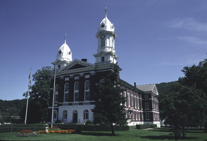
41°10′47″N 79°42′43″W / 41.17972°N 79.71194°WEmlenton 8 Franklin Historic District 
January 26, 1984 Roughly bounded by Miller Avenue and Otter, 8th, Buffalo, and 16th Streets
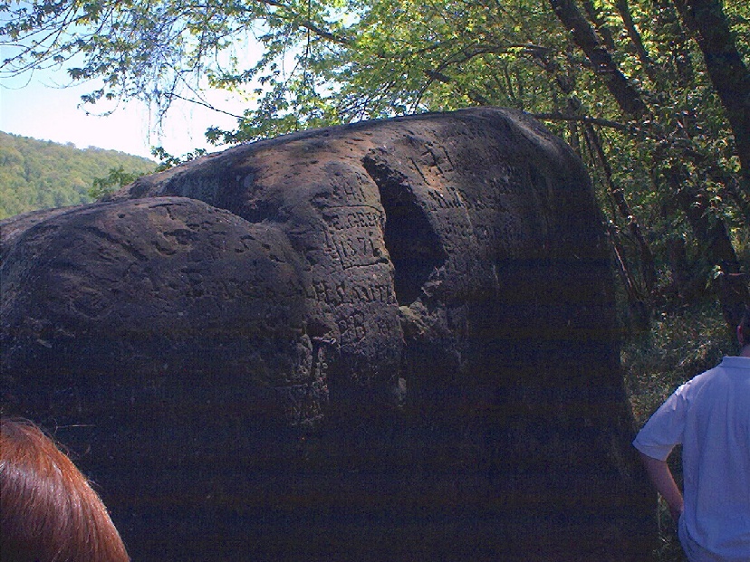
41°23′36″N 79°49′52″W / 41.39333°N 79.83111°WFranklin 9 Indian God Rock Petroglyphs Site (36VE26) 
May 14, 1984 On the eastern bank of the Allegheny River above Brandon
41°19′48″N 79°49′27″W / 41.33°N 79.82417°W[5]Rockland Township 10 National Transit Building September 13, 1978 206 Seneca Street
41°26′6″N 79°42′32″W / 41.435°N 79.70889°WOil City 11 Oil City Armory May 9, 1991 Junction of East 2nd and State Streets
41°25′38″N 79°42′33″W / 41.42722°N 79.70917°WOil City 12 Oil City Downtown Commercial Historic District October 24, 1997 Generally along Seneca, Center, Elm, Sycamore, Duncomb, and Main Streets
41°26′8″N 79°42′31″W / 41.43556°N 79.70861°WOil City 13 Oil City North Side Historic District November 12, 1999 Roughly bounded by Conrail railroad, Manning Street, Park Road, Deer Street, and Linden, Hasson, Bishop, Carroll and East Bissell Avenue
41°26′6″N 79°42′45″W / 41.435°N 79.7125°WOil City 14 Oil City South Side Historic District November 10, 1997 Roughly bounded by Allegheny River, Wilson Avenue, Lee's Lane, West Third, and West Fifth Streets, and Reservoir Street
41°25′18″N 79°43′12″W / 41.42167°N 79.72°WOil City 15 Pithole Stone Arch 
June 22, 1988 State Route 1004 over Pithole Creek
41°29′13″N 79°35′43″W / 41.48694°N 79.59528°WCornplanter and President Townships 16 Rockland Furnace September 6, 1991 On Shull Run north of the Allegheny River, northwest of Emlenton
41°14′3″N 79°44′57″W / 41.23417°N 79.74917°WRockland Township 17 Site of Pithole City 
March 20, 1973 10 miles (16 km) southeast of Titusville
41°31′16″N 79°35′14″W / 41.52111°N 79.58722°WCornplanter Township 18 U.S. Post Office September 15, 1977 270 Seneca Street
41°26′9″N 79°42′33″W / 41.43583°N 79.70917°WOil City 19 Witherup Bridge 
June 22, 1988 State Route 3007 over Scrubgrass Creek, south of Kennerdell
41°15′18″N 79°50′27″W / 41.255°N 79.84083°WClinton Township Former listing
[3] Landmark name[4] Image Date listed Location City or Town Summary 1 Plumer Block June 27, 1986 1205 Liberty Street Franklin See also
- List of National Historic Landmarks in Pennsylvania
- National Register of Historic Places listings in Pennsylvania
- List of Pennsylvania state historical markers in Venango County
References
- ^ The latitude and longitude information provided in this table was derived originally from the National Register Information System, which has been found to be fairly accurate for about 99% of listings. For about 1% of NRIS original coordinates, experience has shown that one or both coordinates are typos or otherwise extremely far off; some corrections may have been made. A more subtle problem causes many locations to be off by up to 150 yards, depending on location in the country: most NRIS coordinates were derived from tracing out latitude and longitudes off of USGS topographical quadrant maps created under North American Datum of 1927, which differs from the current, highly accurate GPS system used by Google maps. Chicago is about right, but NRIS longitudes in Washington are higher by about 4.5 seconds, and are lower by about 2.0 seconds in Maine. Latitudes differ by about 1.0 second in Florida. Some locations in this table may have been corrected to current GPS standards.
- ^ "National Register of Historic Places: Weekly List Actions". National Park Service, United States Department of the Interior. Retrieved on November 10, 2011.
- ^ a b Numbers represent an ordering by significant words. Various colorings, defined here, differentiate National Historic Landmark sites and National Register of Historic Places Districts from other NRHP buildings, structures, sites or objects.
- ^ a b "NPS Focus". National Register of Historic Places. National Park Service. http://nrhp.focus.nps.gov. Retrieved November 20, 2009.
- ^ Location derived from its GNIS feature record; the NRIS lists the site as "Address Restricted"
Municipalities and communities of Venango County, Pennsylvania County seat: Franklin Cities 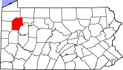
Boroughs Barkeyville | Clintonville | Cooperstown | Emlenton‡ | Pleasantville | Polk | Rouseville | Sugarcreek | Utica
Townships CDPs Unincorporated
communityGhost town Footnotes ‡This populated place also has portions in an adjacent county or counties
Categories:- Venango County, Pennsylvania
- National Register of Historic Places in Pennsylvania by county
-


Wikimedia Foundation. 2010.