- National Register of Historic Places listings in Columbia County, Pennsylvania
-
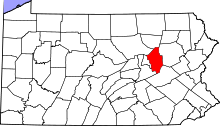 Location of Columbia County in Pennsylvania
This is a list of the National Register of Historic Places listings in Columbia County, Pennsylvania.
This is intended to be a complete list of the properties and districts on the National Register of Historic Places in Columbia County, Pennsylvania, United States. The locations of National Register properties and districts for which the latitude and longitude coordinates are included below, may be seen in a Google map.[1]
There are 31 properties and districts listed on the National Register in the county. Another property was once listed but has been removed.
-
- This National Park Service list is complete through NPS recent listings posted November 10, 2011.[2]
Current listings
[3] Landmark name Image Date listed Location City or town Summary 1 Berwick Armory 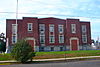
November 14, 1991 201 Pine Street
41°03′28″N 76°14′01″W / 41.057778°N 76.233611°WBerwick 2 Bloomsburg Historic District 
September 8, 1983 Roughly bounded by Penn, 5th, West, Willow, Millville and Light Streets
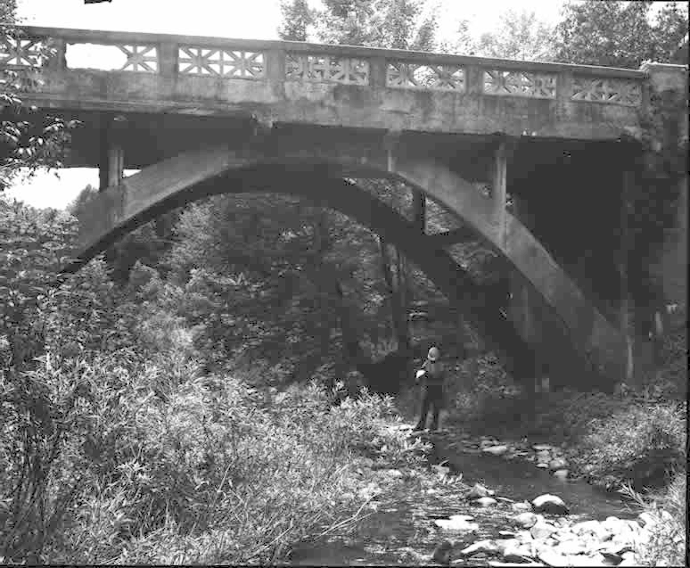
41°00′09″N 76°27′13″W / 41.0025°N 76.453611°WBloomsburg 3 Bridge in Fishing Creek Township 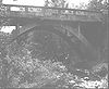
June 22, 1988 Legislative Route 19078 over Little Pine Creek, east of Bendertown
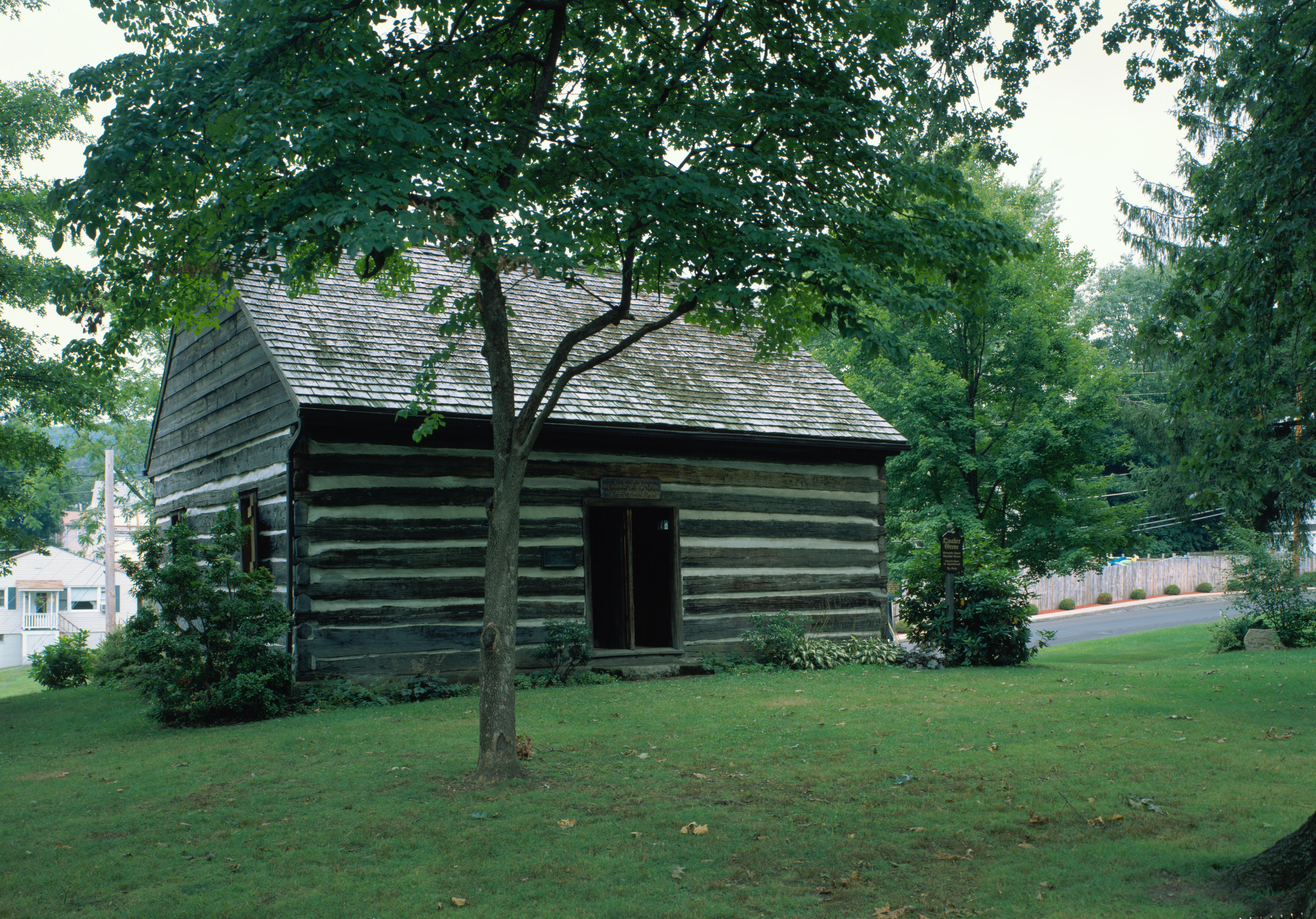
41°09′05″N 76°17′45″W / 41.151389°N 76.295833°WFishing Creek Township 4 Catawissa Friends Meetinghouse 
June 9, 1978 South and 3rd Streets
40°57′12″N 76°27′41″W / 40.953333°N 76.461389°WCatawissa 5 Jud Christie Covered Bridge No. 95 November 29, 1979 Pennsylvania Route 685, northeast of Millville
41°11′45″N 76°28′24″W / 41.195833°N 76.473333°WJackson and Pine Townships 6 Creasyville Covered Bridge November 29, 1979 Pennsylvania Route 683, northeast of Millville
41°12′43″N 76°27′42″W / 41.211944°N 76.461667°WJackson and Pine Townships 7 Davis Covered Bridge November 29, 1979 Pennsylvania Route 371, south of Catawissa
40°54′40″N 76°26′24″W / 40.911111°N 76.44°WCleveland Township 8 Sam Eckman Covered Bridge No. 92 November 29, 1979 Pennsylvania Route 548, northeast of Millville
41°10′39″N 76°29′26″W / 41.1775°N 76.490556°WGreenwood and Pine Townships 9 Fowlersville Covered Bridge November 29, 1979 Legislative Route 19039, south of Fowlersville
41°03′19″N 76°19′39″W / 41.055278°N 76.3275°WNorth Centre Township 10 Furnace Covered Bridge No. 11 November 29, 1979 Pennsylvania Route 373
40°54′24″N 76°27′37″W / 40.906667°N 76.460278°WCleveland Township 11 Josiah Hess Covered Bridge No. 122 November 29, 1979 Pennsylvania Route 563, east of Forks
41°06′53″N 76°20′23″W / 41.114722°N 76.339722°WFishing Creek Township 12 Hollingshead Covered Bridge No. 40 November 29, 1979 Pennsylvania Route 405, east of Catawissa
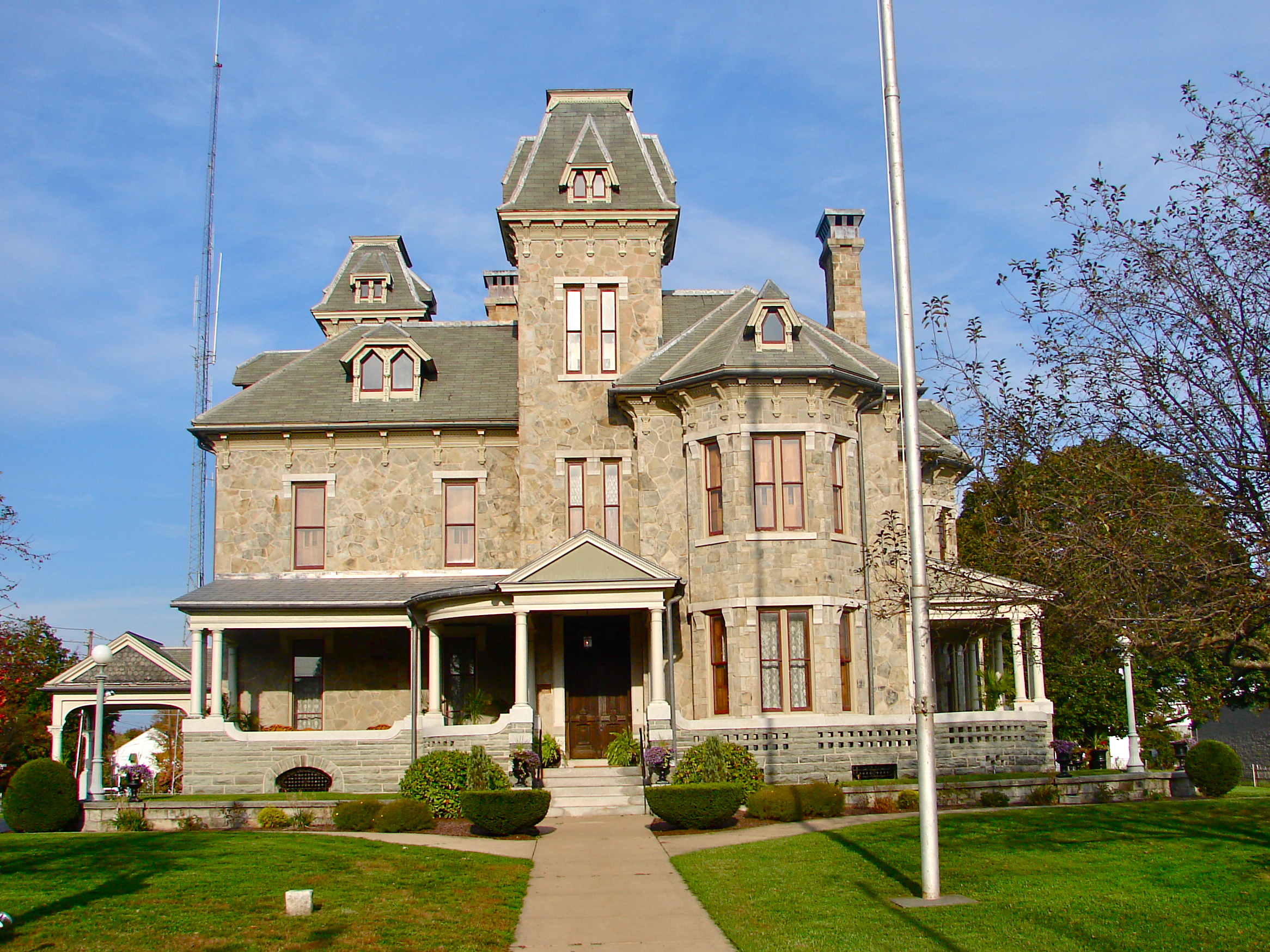
40°57′06″N 76°26′52″W / 40.951667°N 76.447778°WCatawissa Township 13 Jackson Mansion and Carriage House 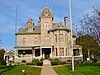
September 5, 1985 344 Market Street
41°03′27″N 76°14′07″W / 41.0575°N 76.235278°WBerwick 14 Johnson Covered Bridge No. 28 November 29, 1979 Pennsylvania Route 320, south of Catawissa
40°52′40″N 76°29′02″W / 40.877778°N 76.483889°WCleveland Township 15 Lawrence L. Knoebel Covered Bridge August 8, 1979 Knoebel's Grove
40°52′38″N 76°30′21″W / 40.877222°N 76.505833°WCleveland Township Extends into Ralpho Township in Northumberland County 16 Kramer Covered Bridge No. 113 November 29, 1979 Pennsylvania Route 572, southwest of Rohrsburg
41°07′16″N 76°25′56″W / 41.121111°N 76.432222°WGreenwood Township 17 Kreigbaum Covered Bridge August 8, 1979 East of Elysburg on Township 459
40°50′51″N 76°30′29″W / 40.8475°N 76.508056°WCleveland Township Extends into Ralpho Township in Northumberland County 18 Parr's Mill Covered Bridge No. 10 November 29, 1979 Pennsylvania Route 371 at Parr's Mill
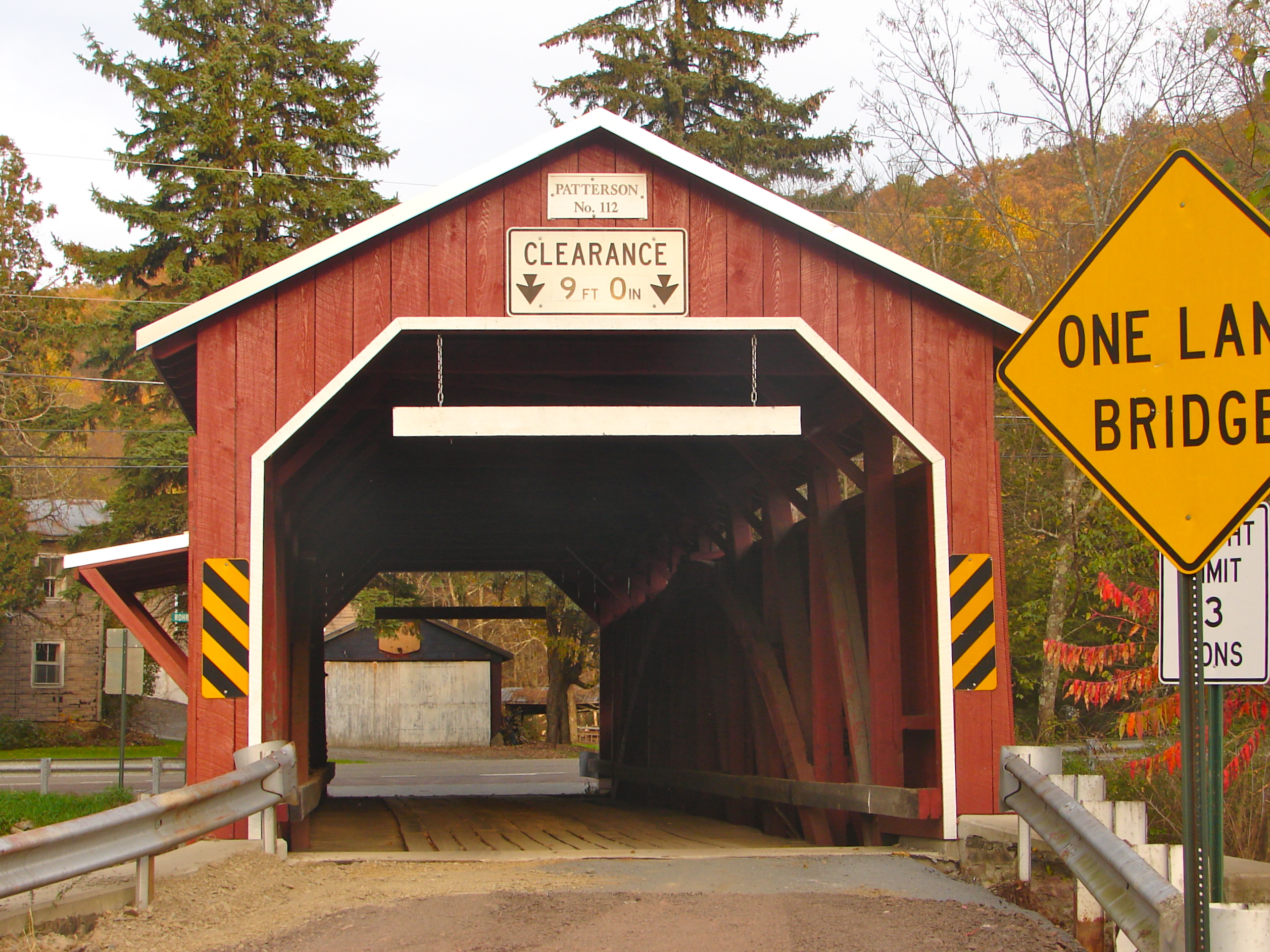
40°54′23″N 76°28′23″W / 40.906389°N 76.473056°WFranklin Township 19 Patterson Covered Bridge No. 112 
November 29, 1979 Pennsylvania Route 575, north of Orangeville
41°06′34″N 76°25′03″W / 41.109444°N 76.4175°WOrange Township 20 Richards Covered Bridge August 8, 1979 East of Elysburg on Township 804
40°52′03″N 76°30′29″W / 40.867444°N 76.508°WCleveland Township Extends into Ralpho Township in Northumberland County 21 Riegel Covered Bridge No. 6 November 29, 1979 Pennsylvania Route 312, southwest of Catawissa
40°54′44″N 76°30′49″W / 40.912222°N 76.513611°WFranklin Township 22 Rohrbach Covered Bridge No. 24 November 29, 1979 Pennsylvania Route 369, southwest of Catawissa
40°54′00″N 76°30′43″W / 40.9°N 76.511944°WFranklin Township 23 Rupert Covered Bridge No. 56 November 29, 1979 Pennsylvania Route 449 at Rupert
40°58′53″N 76°28′23″W / 40.981389°N 76.473056°WBloomsburg and Montour Township 24 Shoemaker Covered Bridge November 29, 1979 Legislative Route 19053, north of Iola
41°09′05″N 76°32′11″W / 41.151389°N 76.536389°WPine Township 25 Snyder Covered Bridge No. 17 November 29, 1979 Pennsylvania Route 361, southeast of Slabtown
40°54′05″N 76°23′41″W / 40.901389°N 76.394722°WLocust Township 26 Stillwater Covered Bridge No. 134 
November 29, 1979 Pennsylvania Route 629
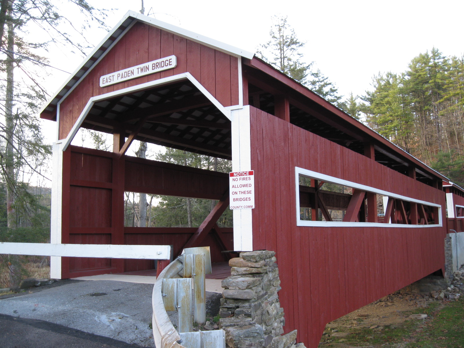
41°09′07″N 76°21′39″W / 41.151944°N 76.360833°WStillwater 27 Twin Bridges-East Paden Covered Bridge No. 120 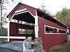
November 29, 1979 Off Pennsylvania Route 487, east of Forks
41°06′25″N 76°21′25″W / 41.106944°N 76.356944°WFishing Creek Township 28 Twin Bridges-West Paden Covered Bridge No. 121 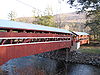
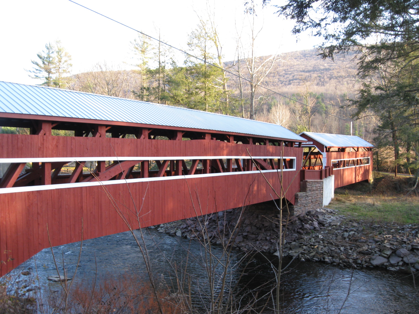
November 29, 1979 Off Pennsylvania Route 487, east of Forks
41°06′25″N 76°21′25″W / 41.106944°N 76.356944°WFishing Creek Township 29 Wagner Covered Bridge No. 19 November 29, 1979 Pennsylvania Route 468
40°53′32″N 76°22′28″W / 40.892222°N 76.374444°WLocust Township 30 Wanich Covered Bridge No. 69 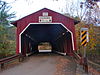
November 29, 1979 Off Pennsylvania Route 42, north of Fernville
41°02′23″N 76°29′01″W / 41.039722°N 76.483611°WHemlock and Mount Pleasant Townships 31 Y Covered Bridge No. 156 November 29, 1979 Pennsylvania Route 757, southeast of Central
41°17′23″N 76°21′52″W / 41.289722°N 76.364444°WSugarloaf Township Former listing
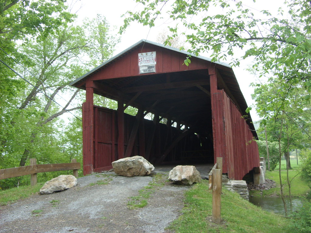
[3] Landmark name Image Date listed Location City or town Summary 1 Welle Hess Covered Bridge No. S1 June 27, 1986 South of Grassmere Park Grassmere Park Listed on November 29, 1979 See also
- List of National Historic Landmarks in Pennsylvania
- National Register of Historic Places listings in Pennsylvania
- List of Pennsylvania state historical markers in Columbia County
References
- ^ The latitude and longitude information provided in this table was derived originally from the National Register Information System, which has been found to be fairly accurate for about 99% of listings. For about 1% of NRIS original coordinates, experience has shown that one or both coordinates are typos or otherwise extremely far off; some corrections may have been made. A more subtle problem causes many locations to be off by up to 150 yards, depending on location in the country: most NRIS coordinates were derived from tracing out latitude and longitudes off of USGS topographical quadrant maps created under the North American Datum of 1927, which differs from the current, highly accurate WGS84 GPS system used by Google maps. Chicago is about right, but NRIS longitudes in Washington are higher by about 4.5 seconds, and are lower by about 2.0 seconds in Maine. Latitudes differ by about 1.0 second in Florida. Some locations in this table may have been corrected to current GPS standards.
- ^ "National Register of Historic Places: Weekly List Actions". National Park Service, United States Department of the Interior. Retrieved on November 10, 2011.
- ^ Numbers represent an ordering by significant words. Various colorings, defined here, differentiate National Historic Landmark sites and National Register of Historic Places Districts from other NRHP buildings, structures, sites or objects.
Municipalities and communities of Columbia County, Pennsylvania Town 
Boroughs Ashland‡ | Benton | Berwick | Briar Creek | Catawissa | Centralia | Millville | Orangeville | Stillwater
Townships CDPs Almedia | Aristes | Buckhorn | Espy | Eyers Grove | Fernville | Foundryville | Iola | Jamison City | Jerseytown | Jonestown | Lightstreet | Lime Ridge | Locustdale | Mainville | Mifflinville | Numidia | Rohrsburg | Rupert | Slabtown | Waller | Wilburton Number One | Wilburton Number Two
Footnotes ‡This populated place also has portions in an adjacent county or counties
Categories:- National Register of Historic Places in Pennsylvania by county
- Columbia County, Pennsylvania
-


Wikimedia Foundation. 2010.