- National Register of Historic Places listings in Potter County, Pennsylvania
-
 Location of Potter County in Pennsylvania
This is a list of the National Register of Historic Places listings in Potter County, Pennsylvania.
This is intended to be a complete list of the properties and districts on the National Register of Historic Places in Potter County, Pennsylvania, United States. The locations of National Register properties and districts for which the latitude and longitude coordinates are included below, may be seen in a Google map.[1]
There are 5 properties and districts listed on the National Register in the county.
-
- This National Park Service list is complete through NPS recent listings posted November 10, 2011.[2]
Current listings
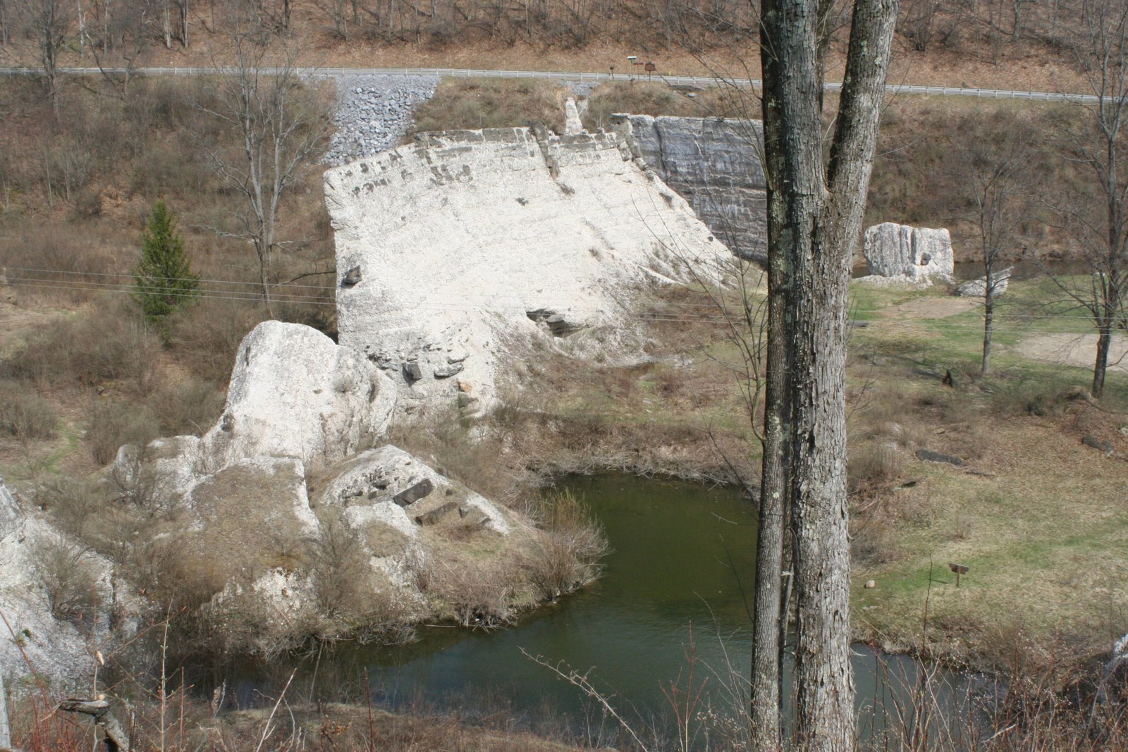
[3] Landmark name[4] Image Date listed Location City or Town Summary 1 Austin Dam 
January 15, 1987 Pennsylvania Route 872
41°38′26″N 78°5′18″W / 41.64056°N 78.08833°WAustin 2 Cherry Springs Picnic Pavilion 
May 11, 1987 8 miles (13 km) north of Carter Camp off Pennsylvania Route 44
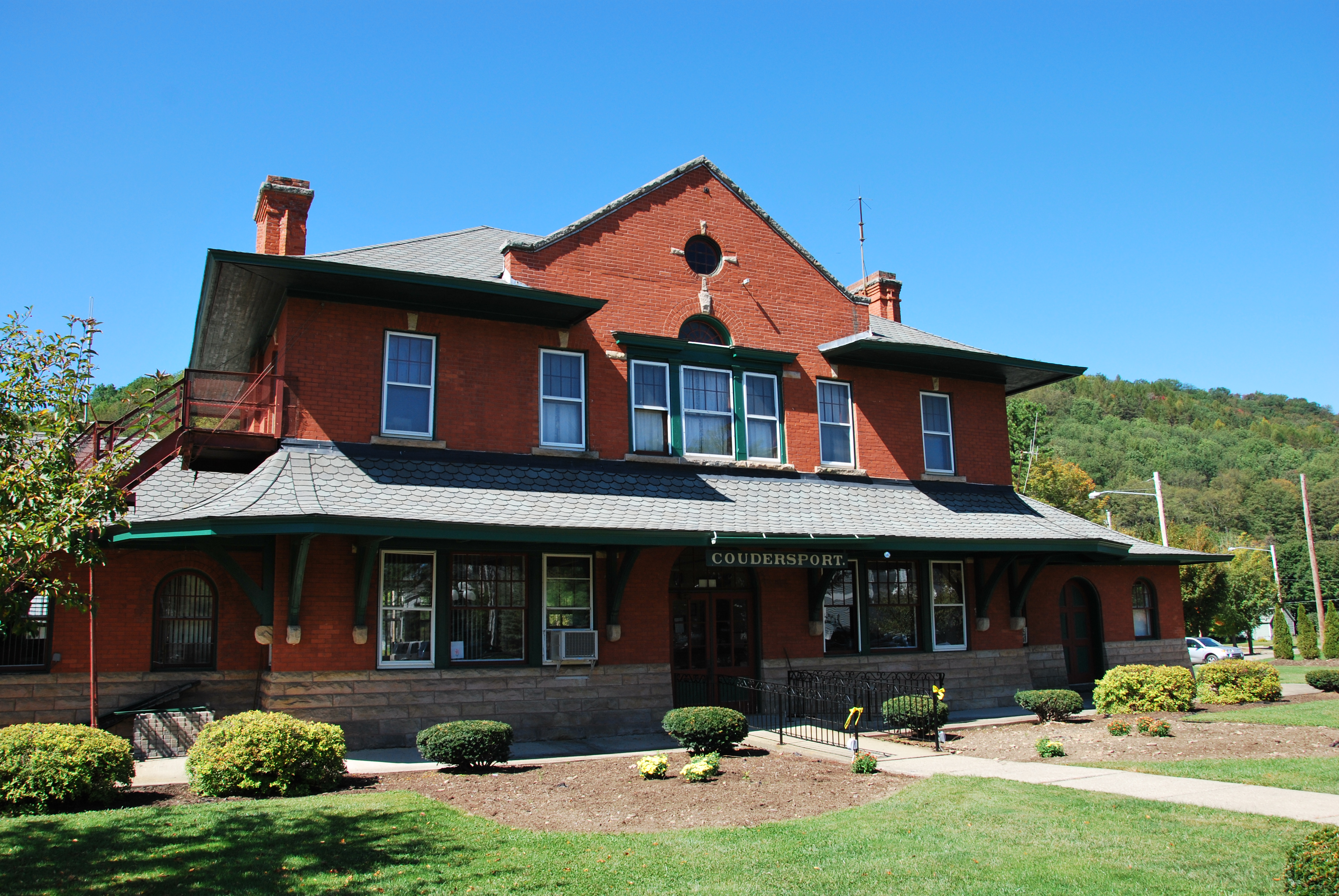
41°39′41″N 77°49′23″W / 41.66139°N 77.82306°WWest Branch Township 3 Coudersport and Port Allegany Railroad Station 
November 21, 1976 201 South West Street
41°46′15″N 78°1′19″W / 41.77083°N 78.02194°WCoudersport 4 Coudersport Historic District 
May 9, 1985 Roughly bounded by Seventh, East, Water, and Main Streets
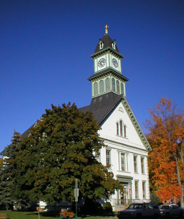
41°46′32″N 78°1′22″W / 41.77556°N 78.02278°WCoudersport 5 Potter County Courthouse 
February 24, 1975 East 2nd Street
41°46′28″N 78°1′14″W / 41.77444°N 78.02056°WCoudersport See also
- List of National Historic Landmarks in Pennsylvania
- National Register of Historic Places listings in Pennsylvania
- List of Pennsylvania state historical markers in Potter County
References
- ^ The latitude and longitude information provided in this table was derived originally from the National Register Information System, which has been found to be fairly accurate for about 99% of listings. For about 1% of NRIS original coordinates, experience has shown that one or both coordinates are typos or otherwise extremely far off; some corrections may have been made. A more subtle problem causes many locations to be off by up to 150 yards, depending on location in the country: most NRIS coordinates were derived from tracing out latitude and longitudes off of USGS topographical quadrant maps created under the North American Datum of 1927, which differs from the current, highly accurate WGS84 GPS system used by Google maps. Chicago is about right, but NRIS longitudes in Washington are higher by about 4.5 seconds, and are lower by about 2.0 seconds in Maine. Latitudes differ by about 1.0 second in Florida. Some locations in this table may have been corrected to current GPS standards.
- ^ "National Register of Historic Places: Weekly List Actions". National Park Service, United States Department of the Interior. Retrieved on November 10, 2011.
- ^ Numbers represent an ordering by significant words. Various colorings, defined here, differentiate National Historic Landmark sites and National Register of Historic Places Districts from other NRHP buildings, structures, sites or objects.
- ^ "NPS Focus". National Register of Historic Places. National Park Service. http://nrhp.focus.nps.gov. Retrieved November 20, 2009.
National Register of Historic Places in Potter County, Pennsylvania Historic district 
Other properties Cherry Springs Picnic Pavilion | Coudersport and Port Allegany Railroad Station | Potter County Courthouse
See also: National Register of Historic Places listings in Potter County, Pennsylvania and List of National Historic Landmarks in PennsylvaniaMunicipalities and communities of Potter County, Pennsylvania Boroughs Austin | Coudersport | Galeton | Oswayo | Shinglehouse | Ulysses

Townships Unincorporated
communityCategories:- Potter County, Pennsylvania
- National Register of Historic Places in Pennsylvania by county
-


Wikimedia Foundation. 2010.