- National Register of Historic Places listings in Luzerne County, Pennsylvania
-
 Location of Luzerne County in Pennsylvania
This is a list of the National Register of Historic Places listings in Luzerne County, Pennsylvania.
This is intended to be a complete list of the properties and districts on the National Register of Historic Places in Luzerne County, Pennsylvania, United States. The locations of National Register properties and districts for which the latitude and longitude coordinates are included below, may be seen in a Google map.[1]
There are 32 properties and districts listed on the National Register in the county.
-
- This National Park Service list is complete through NPS recent listings posted November 4, 2011.[2]
Current listings
[3] Landmark name[4] Image Date listed Location City or Town Summary 1 Ashley Planes January 25, 1980 Off Pennsylvania Route 309
41°11′26″N 75°54′37″W / 41.19056°N 75.91028°WFairview and Hanover Townships 2 Bear Creek Village Historic District October 28, 1999 Pennsylvania Route 115 at Bear Creek Dam
41°11′0″N 75°45′20″W / 41.183333°N 75.75556°WBear Creek Village 3 Bittenbender Covered Bridge December 1, 1980 South of Huntington Mills off Legislative Route 40076
41°10′51″N 76°13′30″W / 41.18083°N 76.225°WHuntington Township 4 Bridge in City of Wilkes-Barre 
June 22, 1988 Legislative Route 5 over Mill Creek
41°15′36″N 75°52′2″W / 41.26°N 75.86722°WWilkes-Barre 5 Catlin Hall, Wilkes College 
March 16, 1972 92 South River Street
41°14′48″N 75°53′12″W / 41.24667°N 75.88667°WWilkes-Barre 6 Central Railroad of New Jersey Station 
May 12, 1975 31–35 South Baltimore Street
41°14′31″N 75°52′47″W / 41.24194°N 75.87972°WWilkes-Barre 7 Comerford Theater 
December 3, 1980 71 Public Square
41°14′41″N 75°52′55″W / 41.24472°N 75.88194°WWilkes-Barre 8 Denison House 
December 2, 1970 35 Denison Street
41°17′57″N 75°51′46″W / 41.29917°N 75.86278°WForty Fort 9 Eckley Historic District October 26, 1971 Both sides of Main Street through Eckley
40°59′36″N 75°51′45″W / 40.99333°N 75.8625°WFoster Township 10 Benjamin Evans House August 25, 1983 Off Pennsylvania Route 93 south of Nescopeck
41°2′36″N 76°13′19″W / 41.04333°N 76.22194°WNescopeck Township 11 Forty Fort Meetinghouse 
November 3, 1988 River Street and Wyoming Avenue
41°17′4″N 75°52′18″W / 41.28444°N 75.87167°WForty Fort 12 George W. Guthrie School June 27, 1980 643 North Washington Street
41°15′22″N 75°51′47″W / 41.25611°N 75.86306°WWilkes-Barre 13 Kingston Armory December 21, 1989 280 Market Street
41°15′10″N 75°53′31″W / 41.25278°N 75.89194°WKingston 14 Luzerne County Courthouse 
September 4, 1980 North River Street
41°15′5″N 75°52′46″W / 41.25139°N 75.87944°WWilkes-Barre 15 Luzerne County Fresh Air Camp February 20, 2004 Middle Road, approximately 0.25 miles (0.40 km) northeast of the junction of Middle Road and Pennsylvania Route 3021
41°0′44″N 75°59′44″W / 41.01222°N 75.99556°WButler Township 16 Luzerne Presbyterial Institute 
September 7, 1979 Institute Street
41°18′39″N 75°50′29″W / 41.31083°N 75.84139°WWyoming 17 Market Street Bridge 
June 22, 1988 Market Street/Legislative Route 11 over the Susquehanna River
41°14′55″N 75°53′7″W / 41.24861°N 75.88528°WKingston and Wilkes-Barre 18 Markle Banking & Trust Company Building March 28, 1996 8 West Broad Street
40°57′14″N 75°58′29″W / 40.95389°N 75.97472°WHazleton 19 McClintock Hall 
March 16, 1972 44 South River Street
41°14′52″N 75°53′5″W / 41.24778°N 75.88472°WWilkes-Barre 20 Israel Platt Pardee Mansion January 12, 1984 235 North Laurel Street and 28 Aspen Street
40°57′36″N 75°58′22″W / 40.96°N 75.97278°WHazleton Designed by architect George Franklin Barber 21 River Street Historic District September 10, 1985 Franklin, River, West River, West Jackson, West Union, West Market, West Northampton, West South and West Ross Streets and Barnum Place
41°14′49″N 75°53′9″W / 41.24694°N 75.88583°WWilkes-Barre 22 St. Gabriel's Catholic Parish Complex August 22, 2002 122–142 South Wyoming Street
40°56′55″N 75°58′20″W / 40.94861°N 75.97222°WHazleton 23 St. John the Evangelist Roman Catholic Church and School Building July 30, 2003 419 North Main Street
41°15′29″N 75°52′3″W / 41.25806°N 75.8675°WWilkes-Barre 24 St. Stanislaus Institute December 30, 2008 141 Old Newport Street
41°11′32″N 76°1′3″W / 41.19222°N 76.0175°WNewport Township 25 George W. Search House July 10, 2009 56 South Main Street
41°9′3″N 76°9′3″W / 41.15083°N 76.15083°WShickshinny 26 Stegmaier Brewery 
May 30, 1979 Roughly bounded by Coal, Welles, Market, Lincoln and Baltimore Streets
41°14′32″N 75°52′36″W / 41.24222°N 75.87667°WWilkes-Barre 27 Stoddartsville Historic District November 12, 1998 South side of Pennsylvania Route 115 at the Lehigh River in Stoddartsville
41°7′47.3″N 75°37′42″W / 41.129806°N 75.62833°WBuck Township 28 Swetland Homestead 
December 13, 1978 855 Wyoming Avenue
41°18′6″N 75°51′10″W / 41.30167°N 75.85278°WWyoming 29 Weiss Hall 
November 27, 1972 98 South River Street
41°14′47″N 75°53′12″W / 41.24639°N 75.88667°WWilkes-Barre 30 West End Wheelmen's Club May 30, 1997 439 South Franklin Street
41°14′24″N 75°53′47″W / 41.24°N 75.89639°WWilkes-Barre 31 Wyoming Monument May 13, 2002 U.S. Route 11, Wyoming Avenue and Susquehanna Street
41°18′13″N 75°50′45″W / 41.30361°N 75.84583°WWyoming 32 Wyoming Seminary August 6, 1979 Sprague Avenue
41°15′48″N 75°53′54″W / 41.26333°N 75.89833°WKingston See also
- List of National Historic Landmarks in Pennsylvania
- National Register of Historic Places listings in Pennsylvania
- List of Pennsylvania state historical markers in Luzerne County
References
- ^ The latitude and longitude information provided in this table was derived originally from the National Register Information System, which has been found to be fairly accurate for about 99% of listings. For about 1% of NRIS original coordinates, experience has shown that one or both coordinates are typos or otherwise extremely far off; some corrections may have been made. A more subtle problem causes many locations to be off by up to 150 yards, depending on location in the country: most NRIS coordinates were derived from tracing out latitude and longitudes off of USGS topographical quadrant maps created under North American Datum of 1927, which differs from the current, highly accurate GPS system used by Google maps. Chicago is about right, but NRIS longitudes in Washington are higher by about 4.5 seconds, and are lower by about 2.0 seconds in Maine. Latitudes differ by about 1.0 second in Florida. Some locations in this table may have been corrected to current GPS standards.
- ^ "National Register of Historic Places: Weekly List Actions". National Park Service, United States Department of the Interior. Retrieved on November 4, 2011.
- ^ Numbers represent an ordering by significant words. Various colorings, defined here, differentiate National Historic Landmark sites and National Register of Historic Places Districts from other NRHP buildings, structures, sites or objects.
- ^ "NPS Focus". National Register of Historic Places. National Park Service. http://nrhp.focus.nps.gov. Retrieved November 20, 2009.
Municipalities and communities of Luzerne County, Pennsylvania County seat: Wilkes-Barre Cities 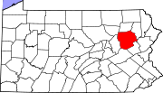
Boroughs Ashley | Avoca | Bear Creek Village | Conyngham | Courtdale | Dallas | Dupont | Duryea | Edwardsville | Exeter | Forty Fort | Freeland | Harveys Lake | Hughestown | Jeddo | Kingston | Laflin | Larksville | Laurel Run | Luzerne | Nescopeck | New Columbus | Nuangola | Penn Lake Park | Plymouth | Pringle | Shickshinny | Sugar Notch | Swoyersville | Warrior Run | West Hazleton | West Pittston | West Wyoming | White Haven | Wyoming | Yatesville
Townships Bear Creek | Black Creek | Buck | Butler | Conyngham | Dallas | Dennison | Dorrance | Exeter | Fairmount | Fairview | Foster | Franklin | Hanover | Hazle | Hollenback | Hunlock | Huntington | Jackson | Jenkins | Kingston | Lake | Lehman | Nescopeck | Newport | Pittston | Plains | Plymouth | Rice | Ross | Salem | Slocum | Sugarloaf | Union | Wilkes-Barre | Wright
CDPs Unincorporated
communitiesBreslau | Drifton | Drums | Ebervale | Harleigh | Huntington Hills | Japan | Koonsville | Korn Krest | Lattimer Mines | Milnesville | Pardeesville | Port Griffith | Shavertown | Suscon | Sybertsville | Tomhicken | Trucksville | Wapwallopen | Waterton
Categories:- Luzerne County, Pennsylvania
- National Register of Historic Places in Pennsylvania by county
-


Wikimedia Foundation. 2010.